Your browser is out-of-date!
For a richer surfing experience on our website, please update your browser. Update my browser now!
For a richer surfing experience on our website, please update your browser. Update my browser now!
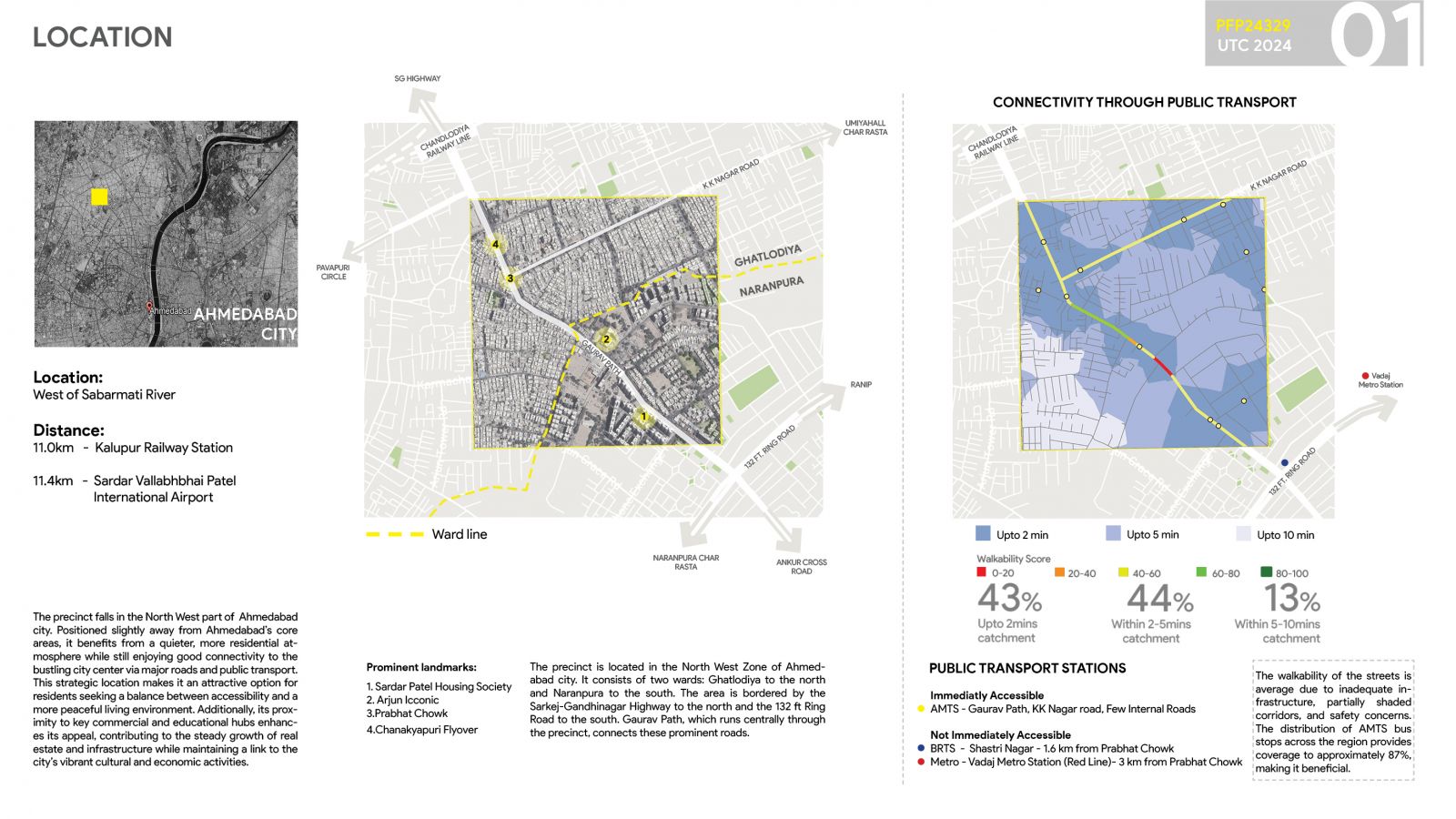
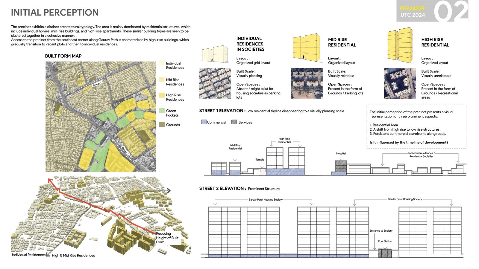
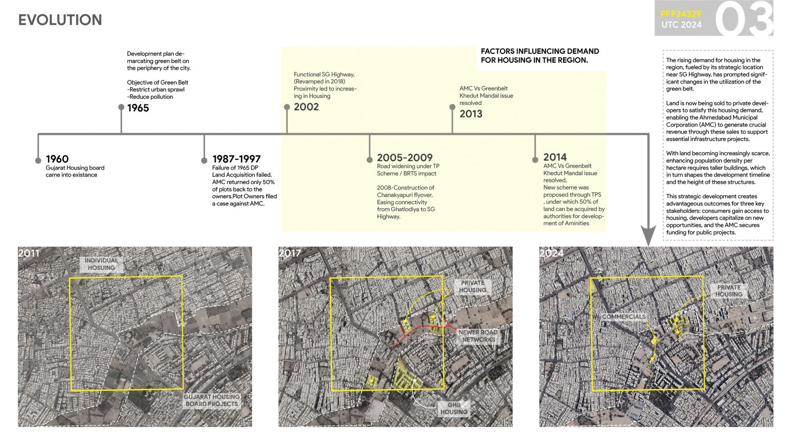
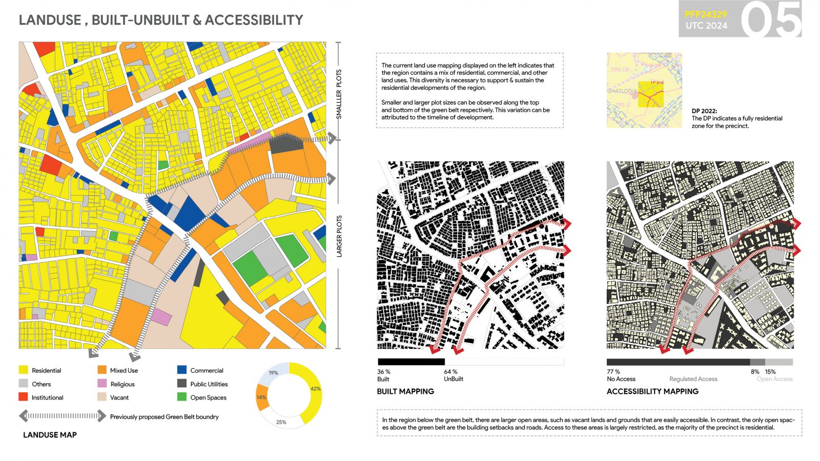
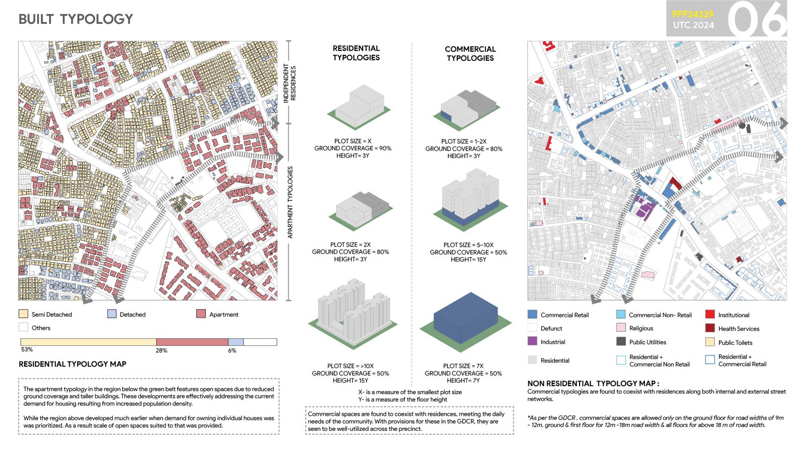
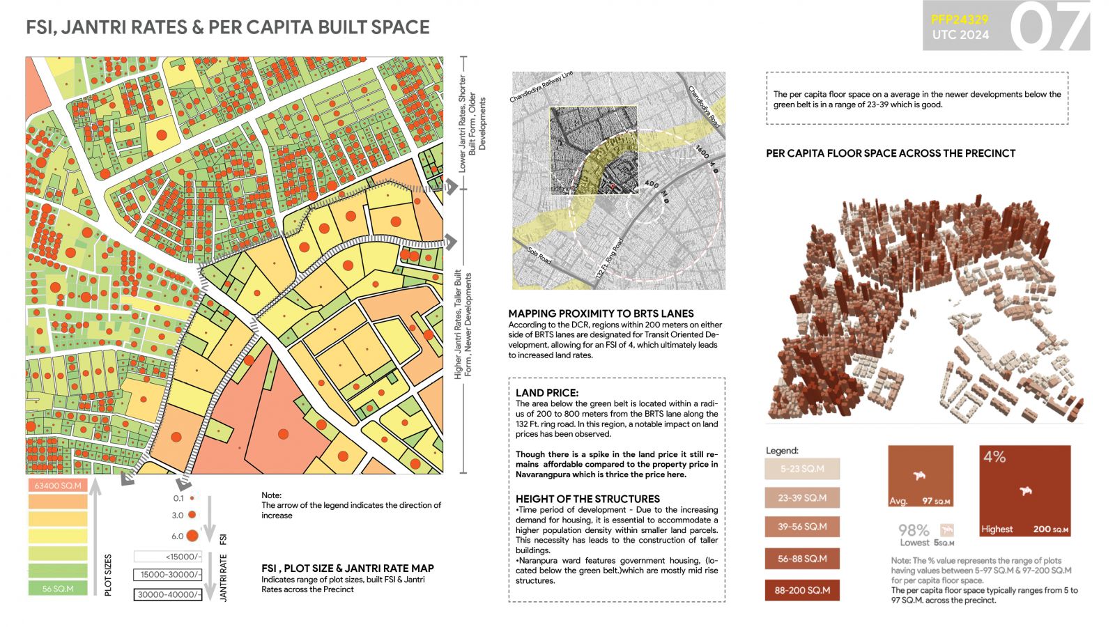
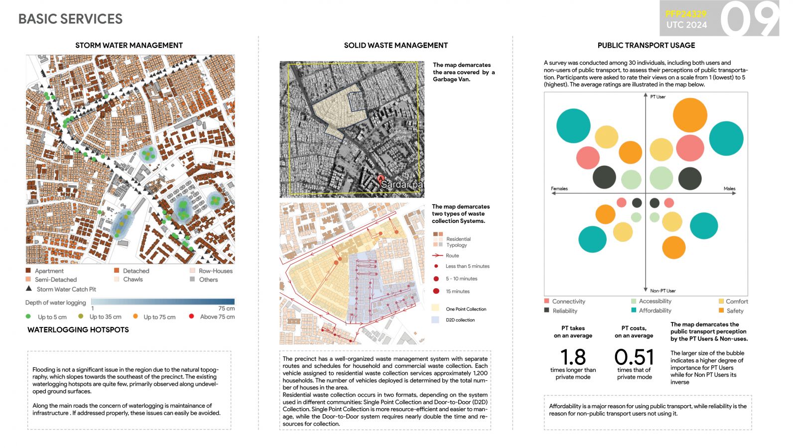
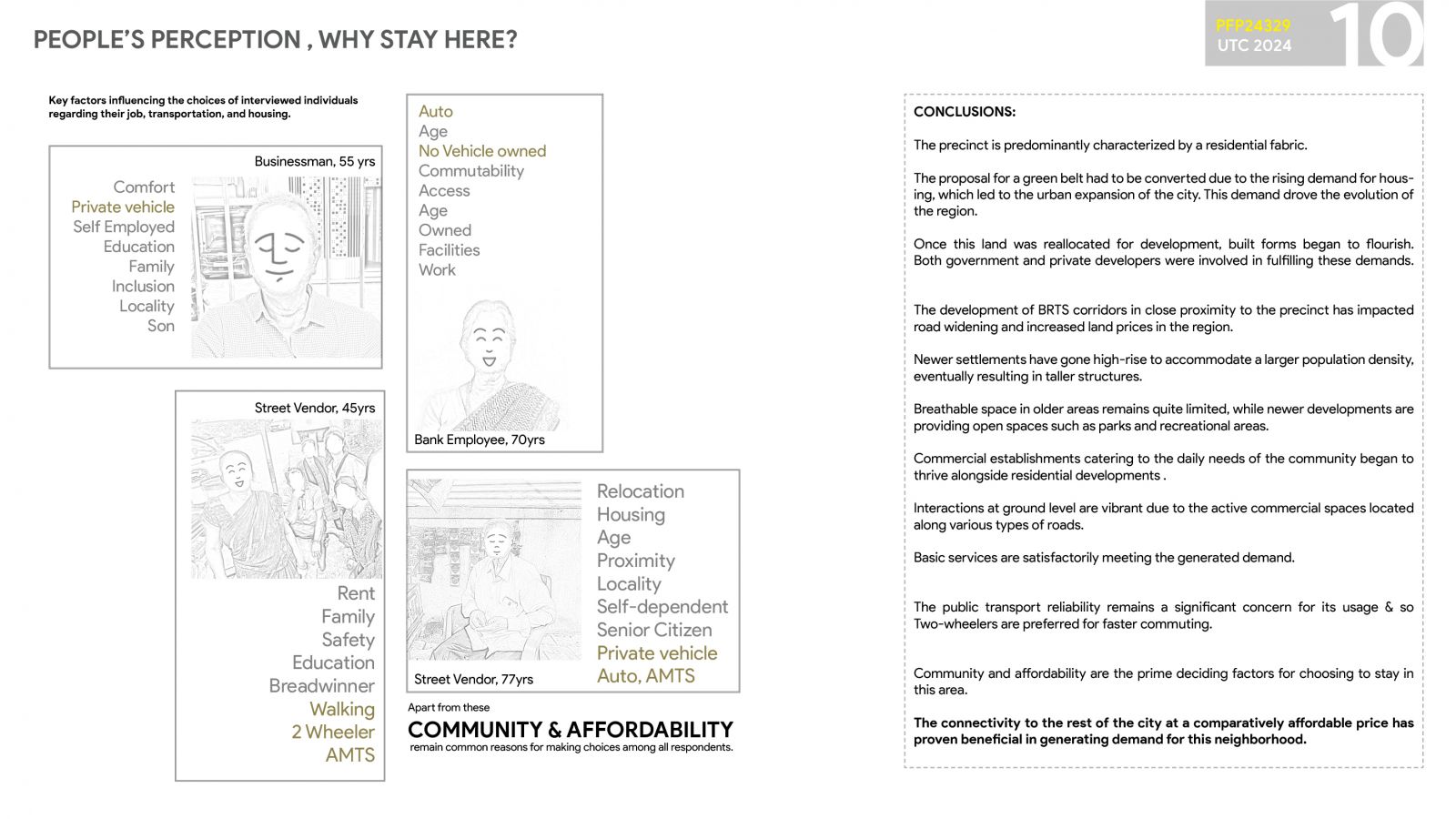
The precinct is located in the North West Zone of Ahmedabad city. It consists of two wards: Ghatlodiya to the north and Naranpura to the south. These are split by the previously proposed green belt. The evolution of the precinct reflects a dynamic shift from its initial designation as a green belt in the 1960s to a thriving urban area driven by rising housing demand and strategic infrastructural development. The failure of the 1965 land acquisition plan led to disputes, with only partial land being returned to owners, but subsequent resolutions in 2014 allowed the Ahmedabad Municipal Corporation (AMC) to reallocate land for development. The introduction of the SG Highway, road widening projects, and the BRTS corridor significantly improved connectivity, increasing land prices and making the area attractive for both residential and commercial developments. Over time, the region transitioned from low-rise individual housing to high-rise structures, accommodating the growing population while integrating green spaces and commercial hubs. Despite limited open spaces in older neighborhood's, newer developments prioritize parks and recreational areas, enhancing liability. The region’s connectivity, affordability, and balanced mix of housing and commercial spaces have made it a desirable location, shaping its urban fabric over the decades.
