Your browser is out-of-date!
For a richer surfing experience on our website, please update your browser. Update my browser now!
For a richer surfing experience on our website, please update your browser. Update my browser now!
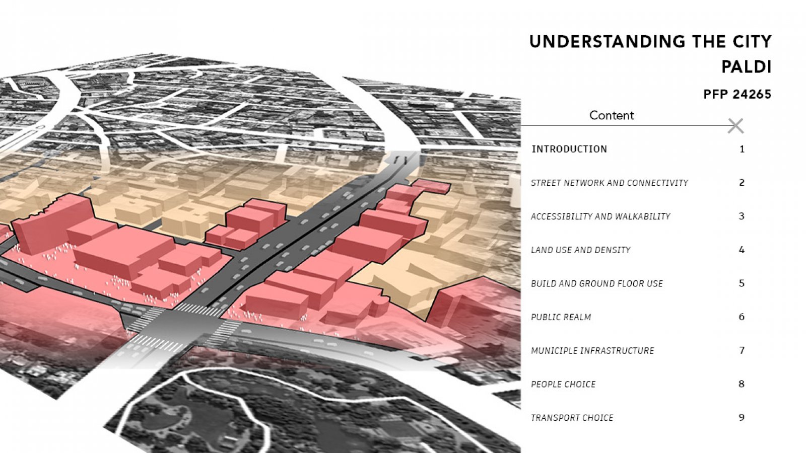
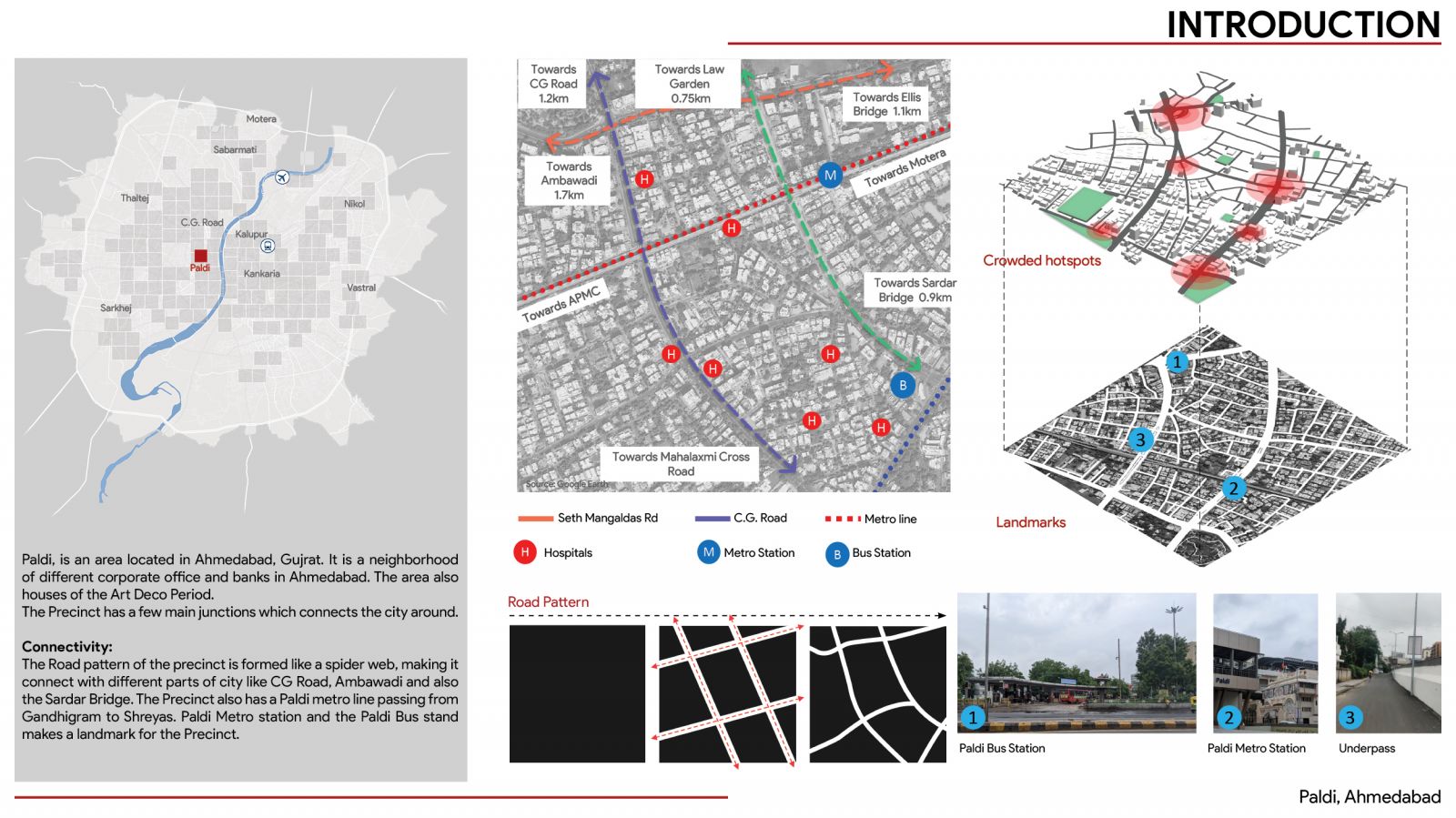
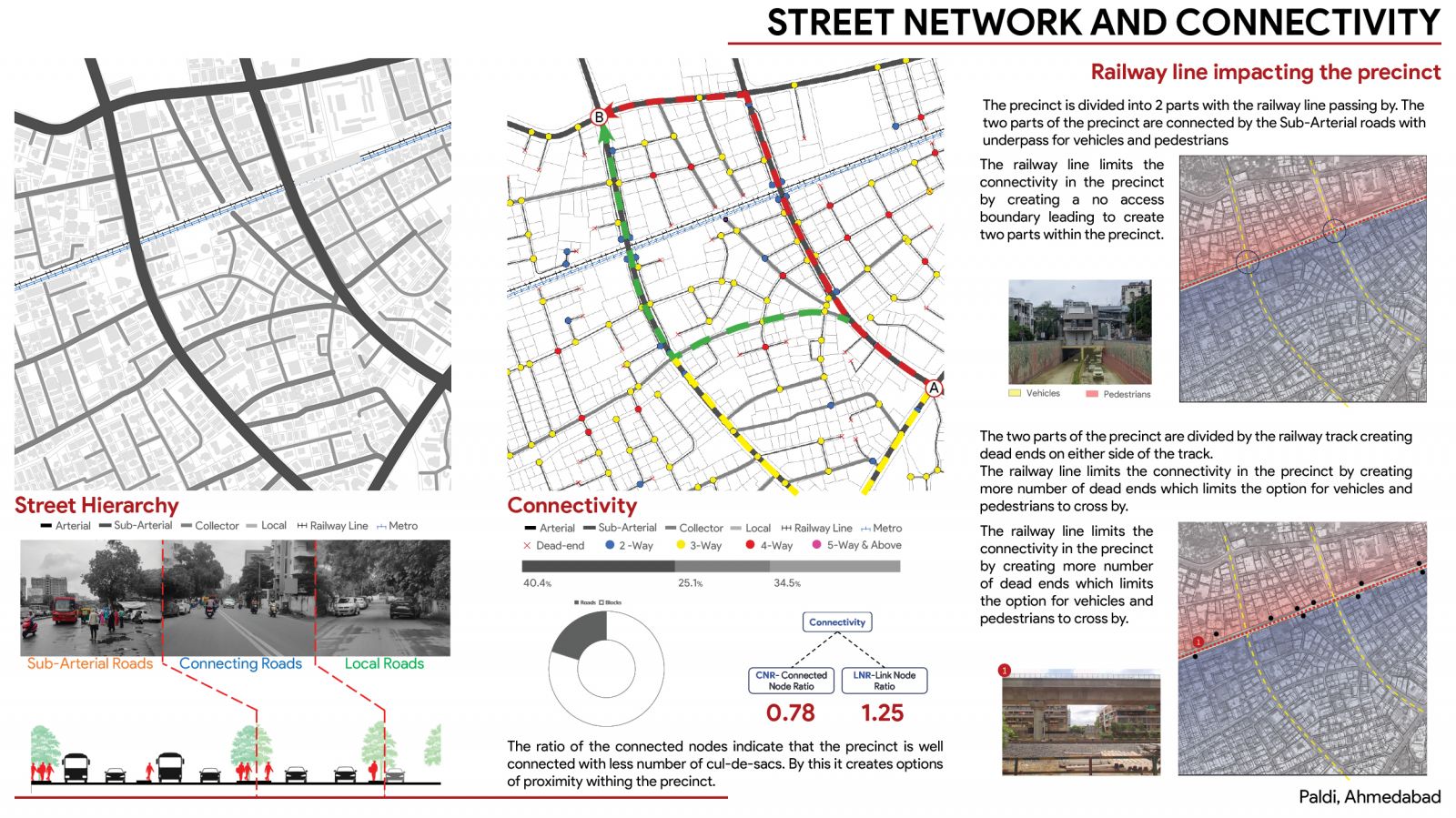
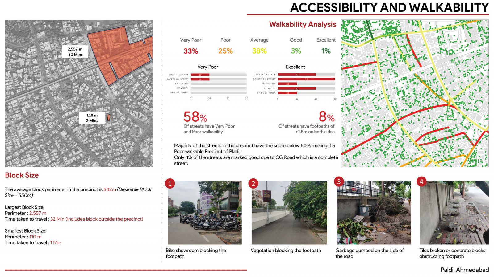
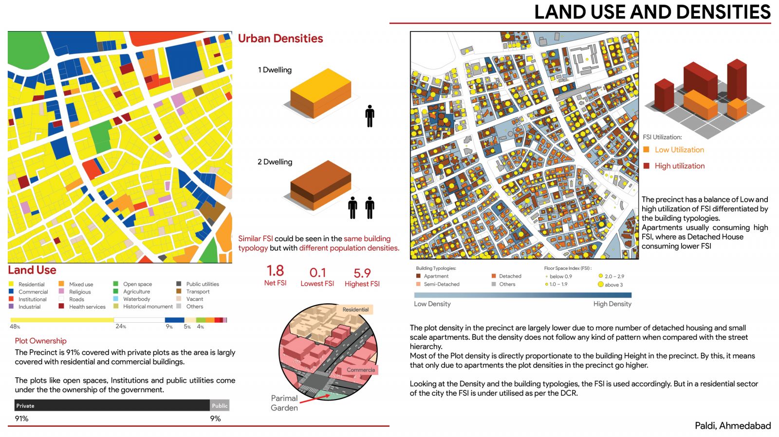
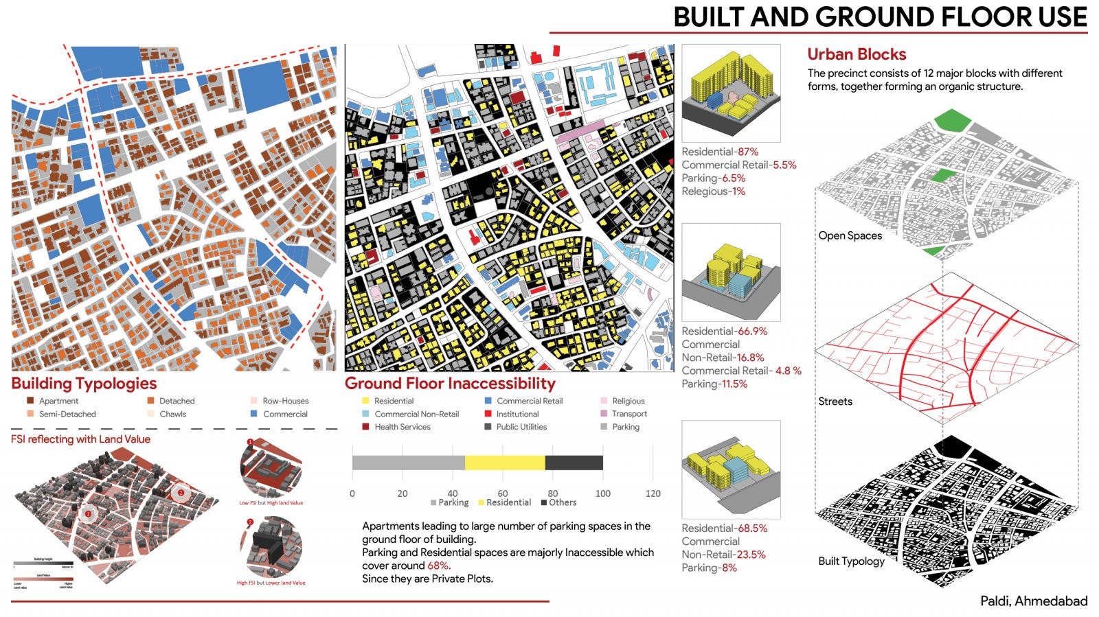
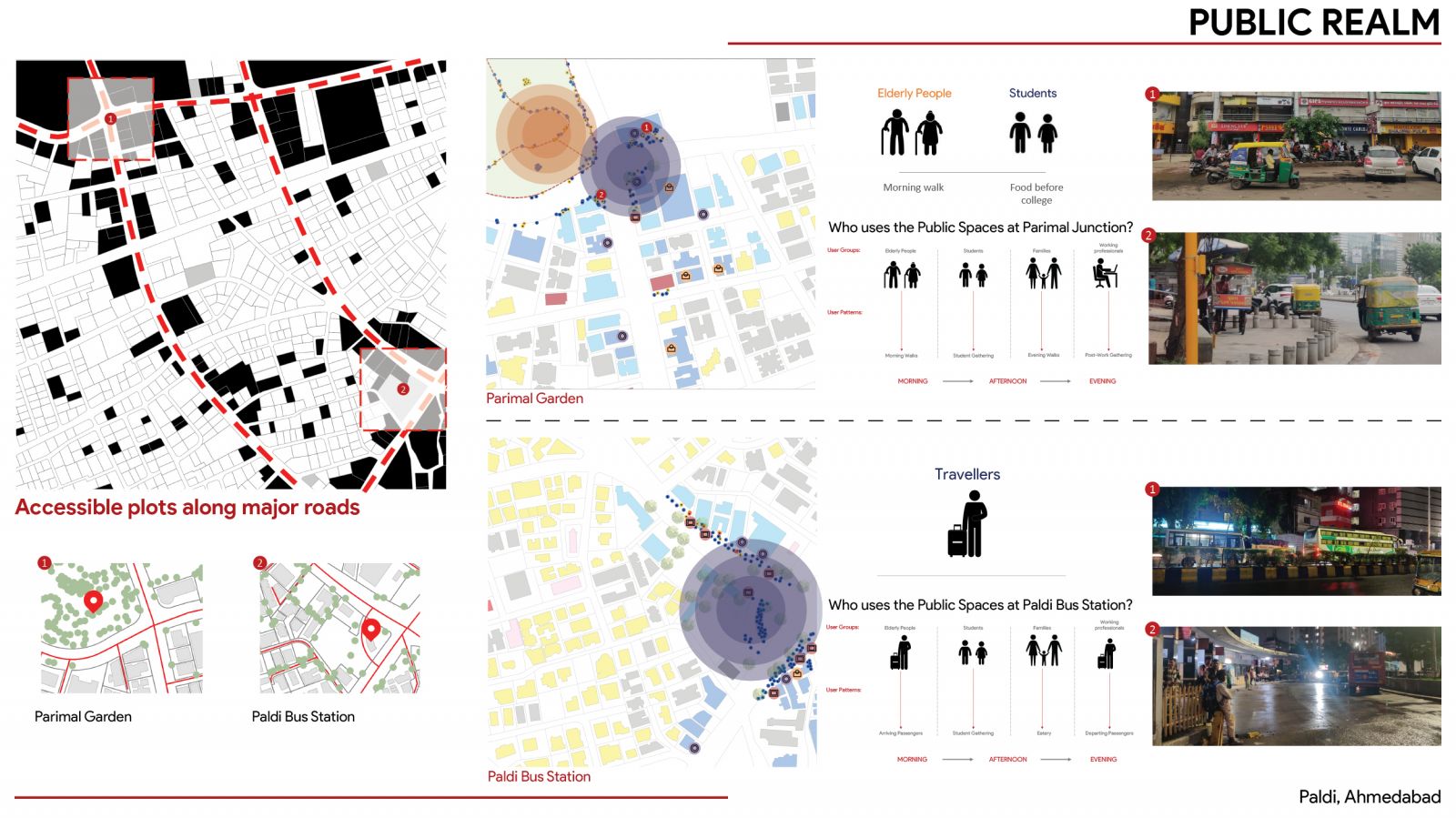
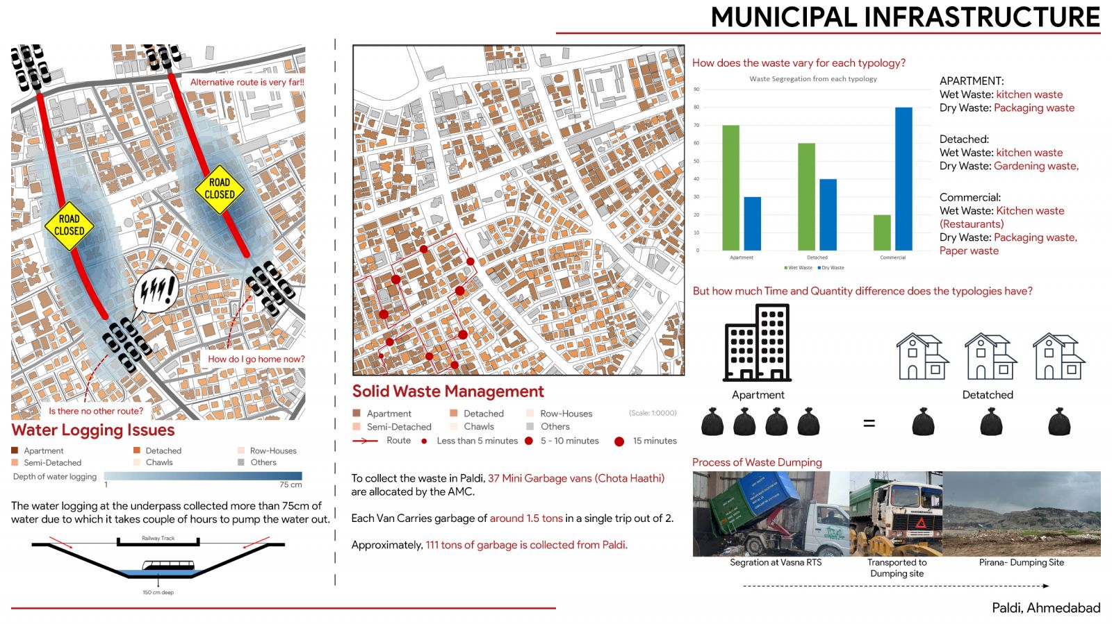
This project involves a comprehensive analysis of a 1 sq. km precinct to explore its spatial, functional, and statistical dimensions. The study will cover streets and networks, connectivity, land use, mixed-use patterns, built environment characteristics, public spaces, and urban services. Emphasis will be placed on conducting a detailed statistical study to identify trends, correlations, and anomalies within the precinct. The project will utilize mapping and visualization techniques to represent physical and functional aspects while integrating demographic, economic, and social data for a holistic understanding. Through systematic data collection and community engagement, it will incorporate lived experiences alongside empirical analysis. The final output will include analytical narratives, descriptive texts, and visual documentation, providing a multi-faceted insight into the precinct’s urban structure, challenges, and opportunities for future planning and development.
