Your browser is out-of-date!
For a richer surfing experience on our website, please update your browser. Update my browser now!
For a richer surfing experience on our website, please update your browser. Update my browser now!
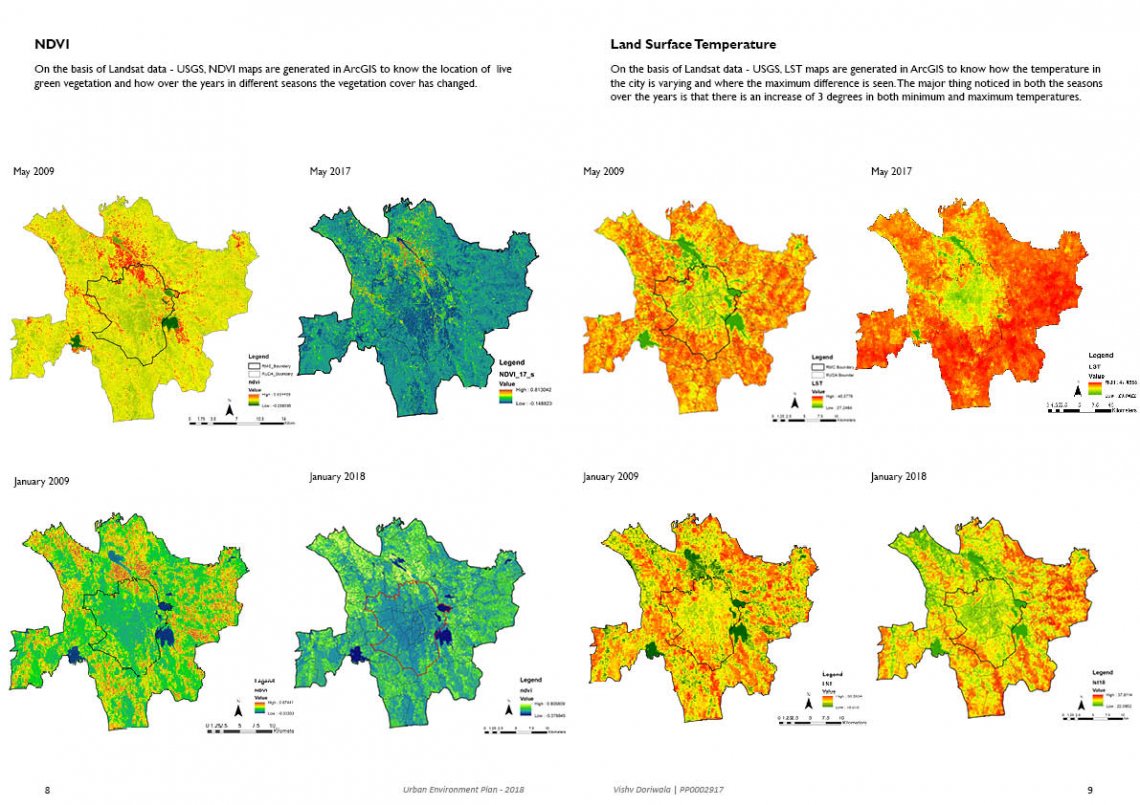
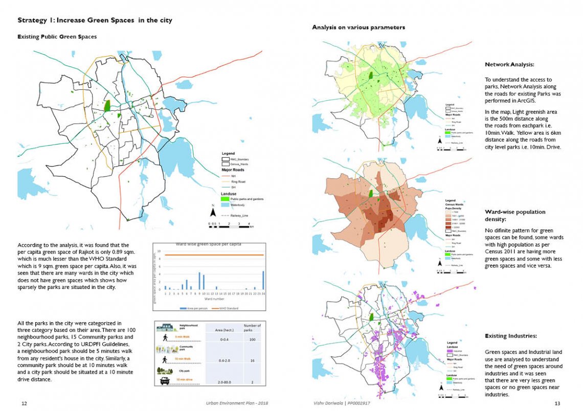
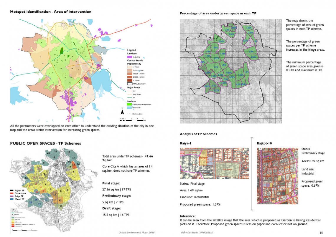
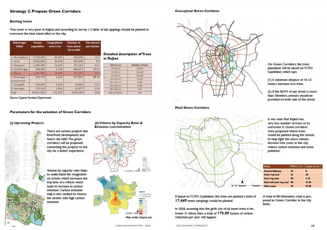
In the project, firstly on the basis of USGS data, NDVI and LST maps were generated to understand the change in the city over a decade. Later, on the basis of the primary and secondary analysis, it was found the city has very less greens for which some strategies are recommended and some calculations and envisioned scenario is shown.
