Your browser is out-of-date!
For a richer surfing experience on our website, please update your browser. Update my browser now!
For a richer surfing experience on our website, please update your browser. Update my browser now!
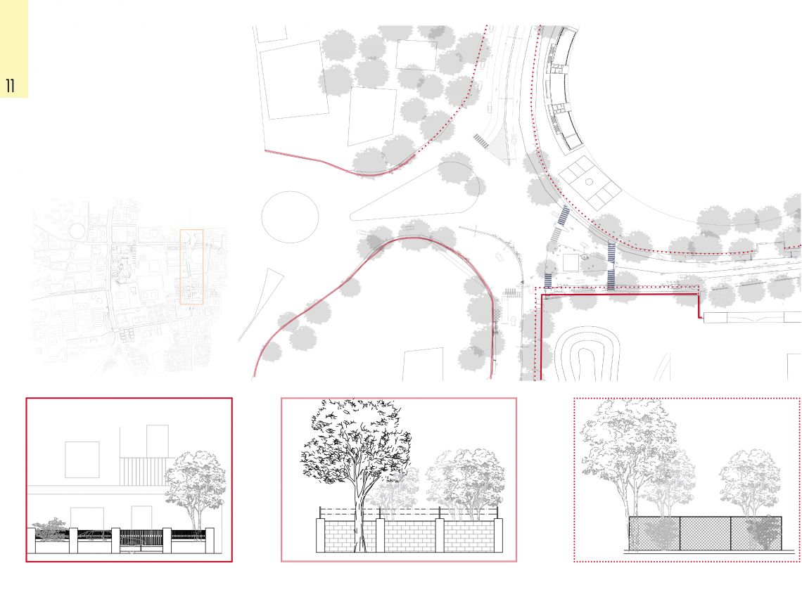
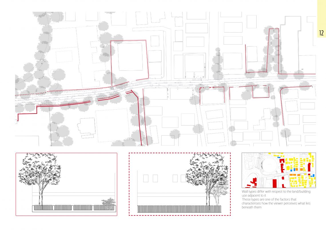
The University area is occupied by known intituitions of Ahmedabad. As some of the campuses have arrangement for accomodation, few others do not. Some have these arrangements inside their campuses while others have collaborated with each other and arranged it in proximity to their campuses. Even after such proximity to the campuses students prefer vehicular transit to their campuses. One of the major reasons of renting a pg or flat or a hostel in proximity to the campus is to cut down mode cost but the students prefer vehicular movement over walking.The reasons behind when inquired appeared to be as such: unwelcoming street edges. safety perception of a street, unsuitable footpath infrastructure, vehicular dominance, Ahmedabad's climate and a lot of other factors. The project is based on redefining the street sections so that the University area promote walkabiility. Zoning in Indian context has always been a complex process and understanding since the stakeholders are many. Hence in this case, sharing of spaces from the campuses to the street and vice versa can be strategised to optimise the usage of spaces. The campuses have large open spaces which are currently used for parking or are just barren land which have the potential to turn into green public spaces while restoring the private spaces of the campuses. The wall, currently defines a hard edge between the street and the campuses which can be softened inorder to carve out spaces and also create a welcoming environment for pedastrians. The following sections are a proposal to what and how is to be intervened inorder to achieve the goal of WALKABILITY. There are different conditions of the street which needs to be approached in different ways. The sections explain how with minimal changes with respect to the existing context, the perception of the area of being a vehicular dominated street can be turned into a pedastrian friendlly street.