Your browser is out-of-date!
For a richer surfing experience on our website, please update your browser. Update my browser now!
For a richer surfing experience on our website, please update your browser. Update my browser now!
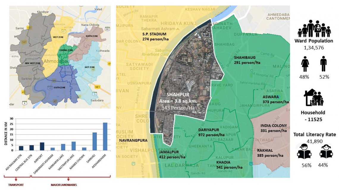
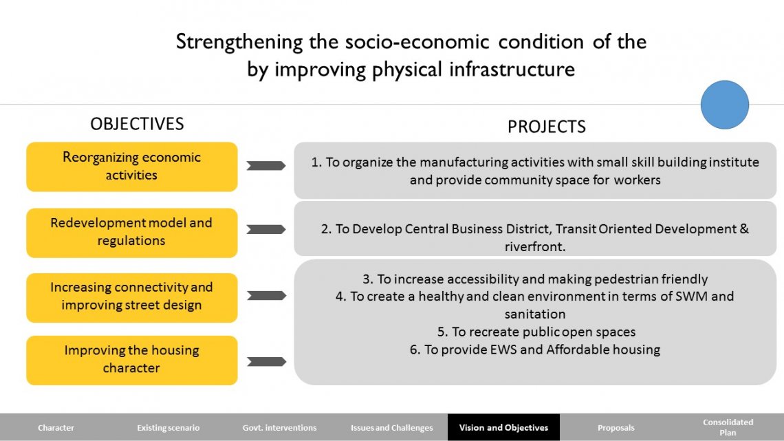
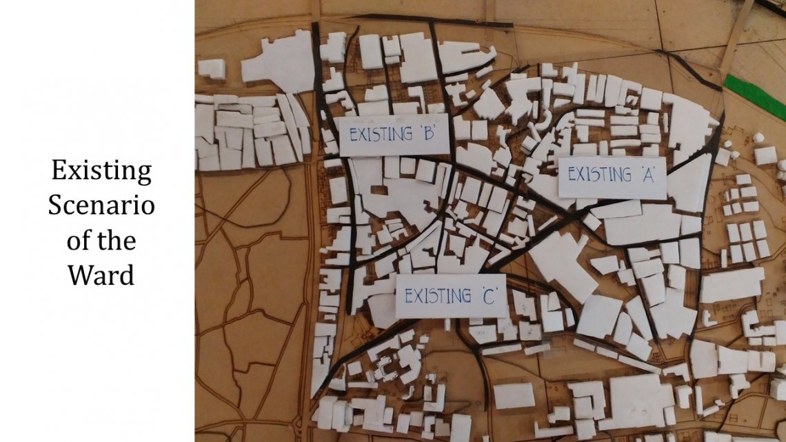
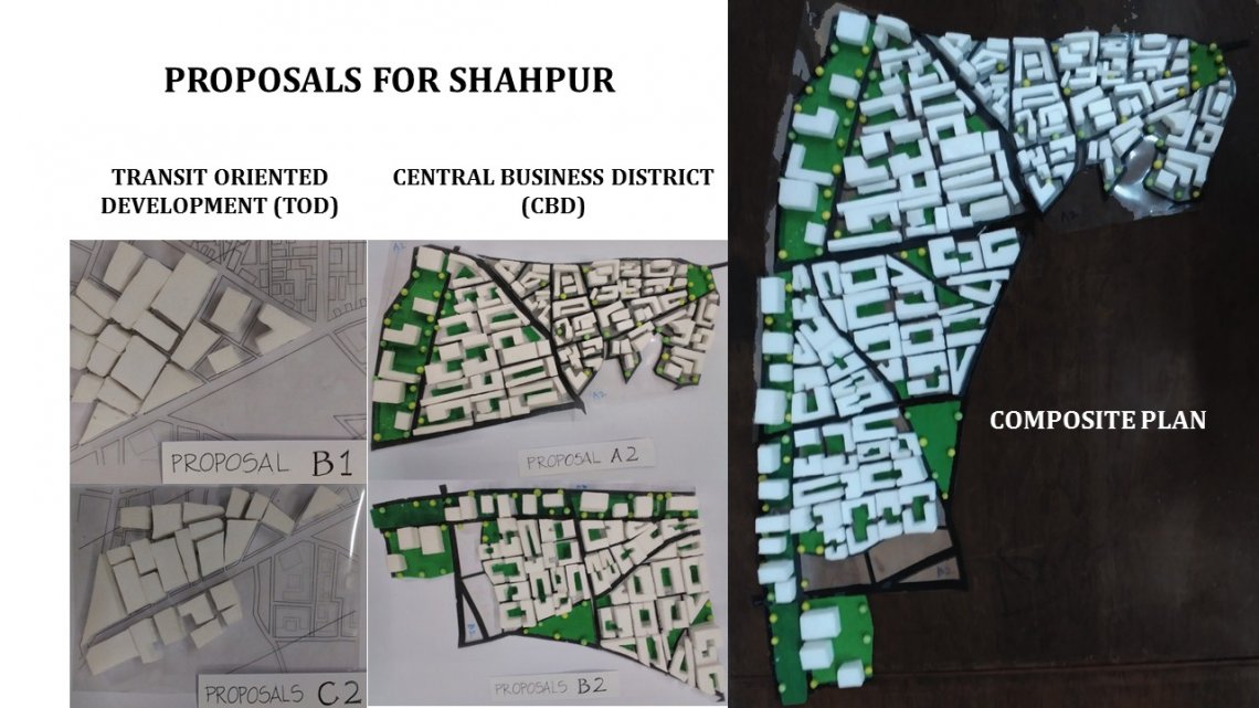
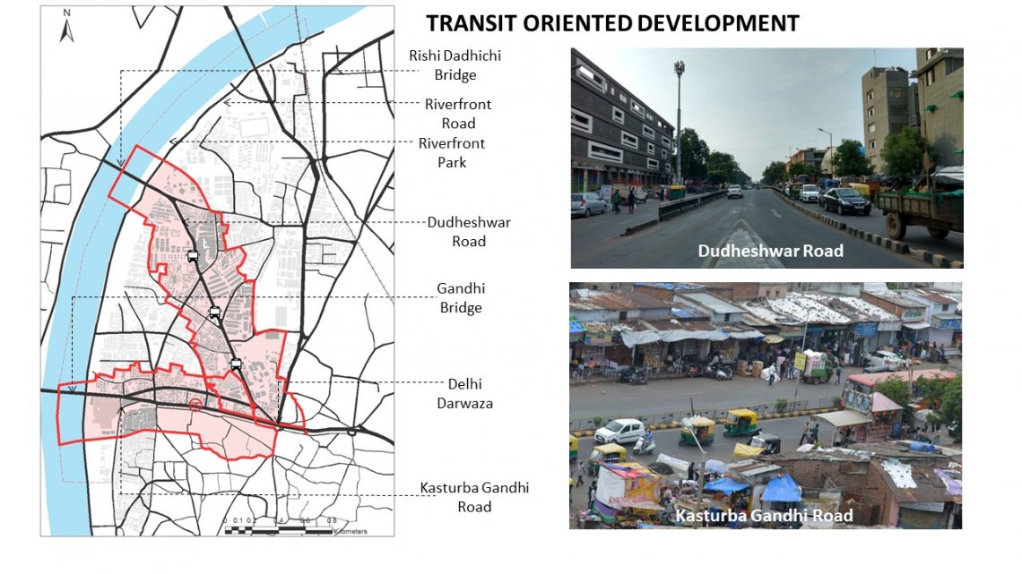
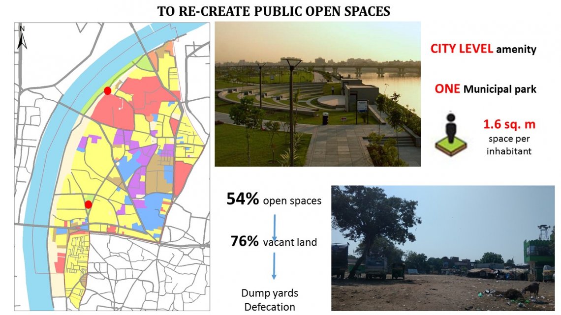
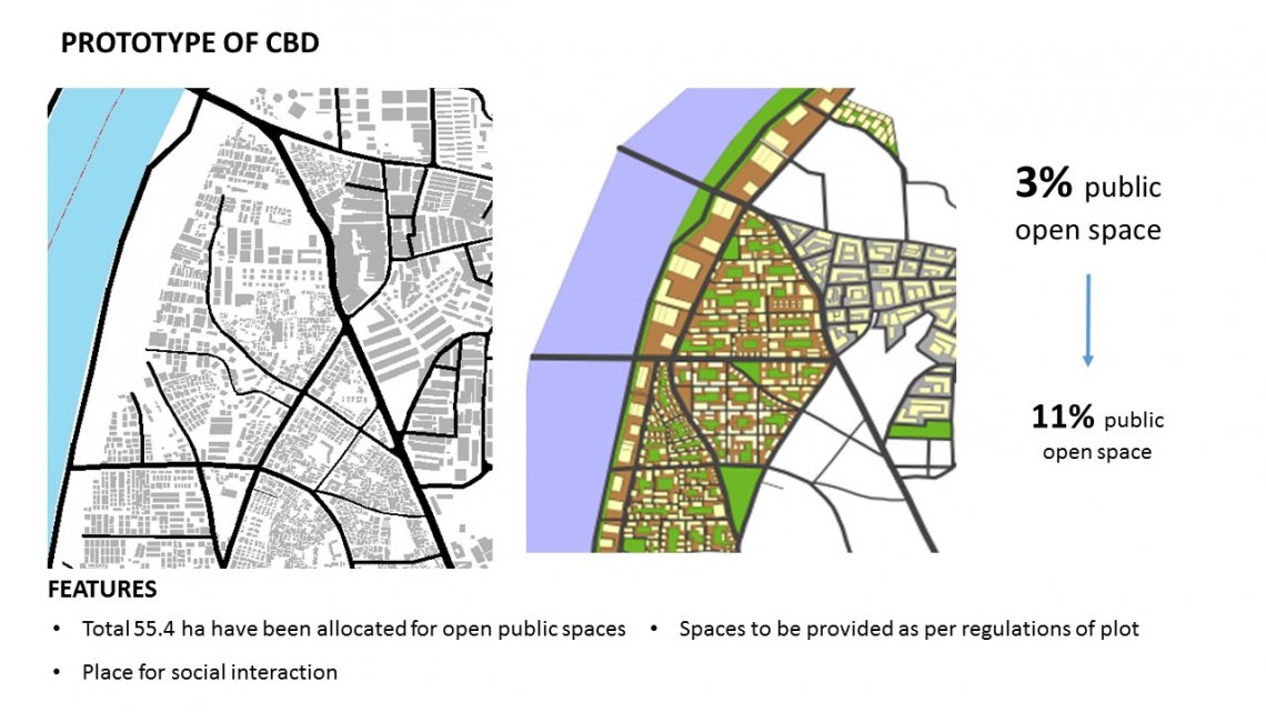
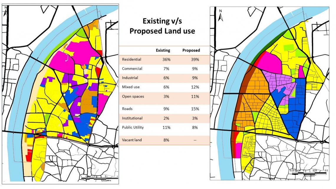
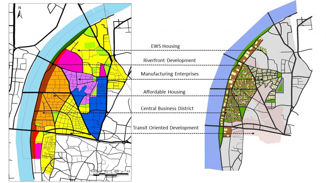
Shahpur ward is situated at the central zone of Ahmedabad with a population of 1.34 lakhs and has an area of 3.92 sq km, the average density of Shahpur is 343 person/hectare. It has a diversified identity with different kind of people living and working together. To understand better we have done mid-term mapping and different surveys. In Shahpur there are less public open spaces, for that we proposed green avenues as a part in Central Business District (CBD). We also proposed Transit Oriented Development (TOD) in two major roads of Shahpur i.e. Dudheshwar Road and Kasturba Gandhi Road. Keeping in mind about all the factors we try to put the Map of Shahpur on a Model, i.e. Existing Scenario with the Proposals.