Your browser is out-of-date!
For a richer surfing experience on our website, please update your browser. Update my browser now!
For a richer surfing experience on our website, please update your browser. Update my browser now!
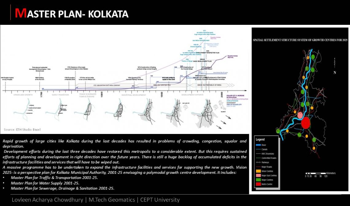
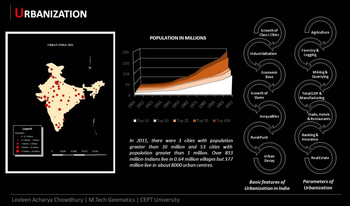
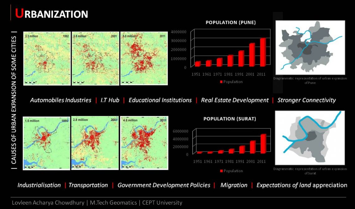
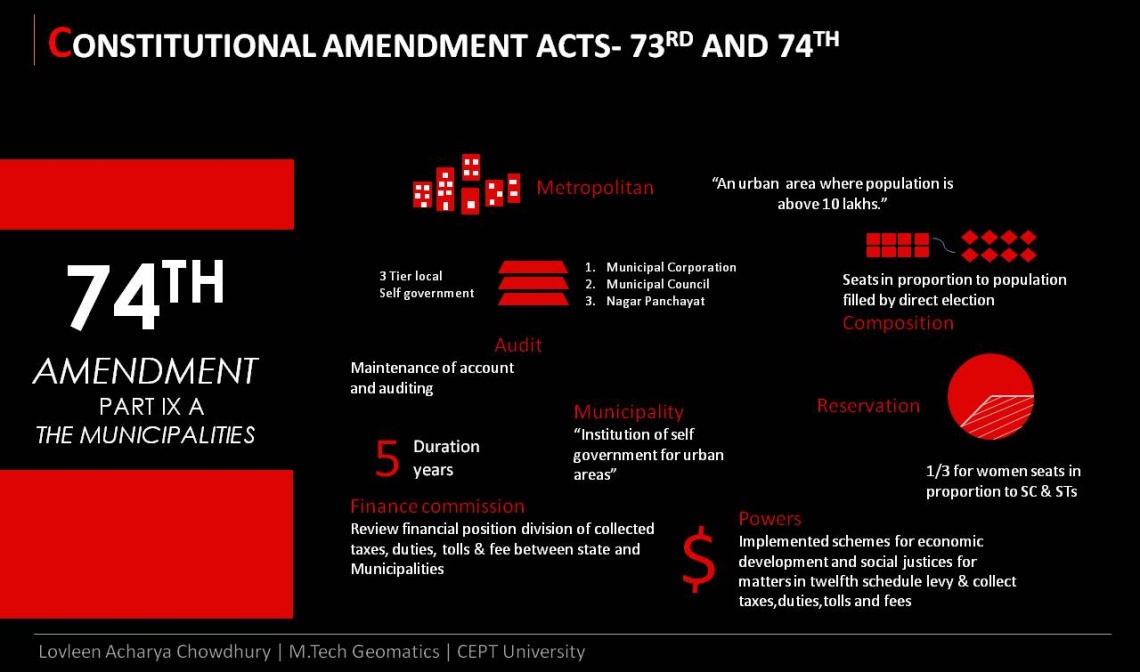
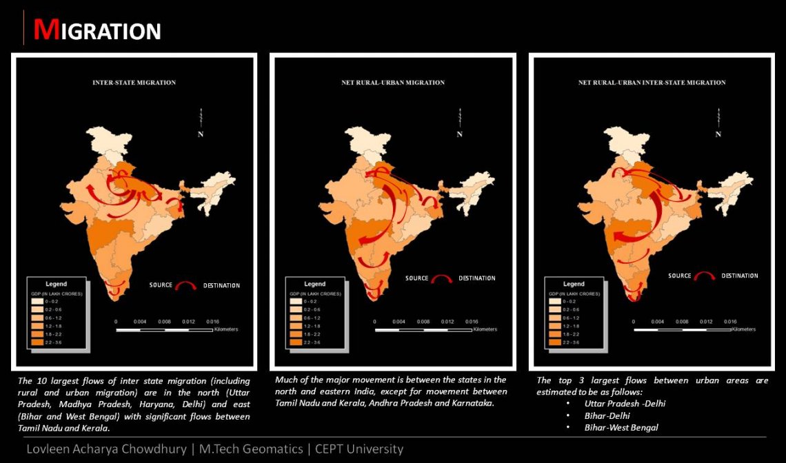
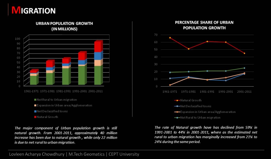
The purpose is to understand land use and its planning with the help of Geomatics. At the moment most urban settlements are facing water supply shortages, increase in urban encroachments in the fringe areas, high urban population growth, traffic congestion and poverty which has made urban governance a difficult task. Hence it becomes essential to adopt modern techniques of Geomatics which will help us analyse spatial data and offer a more meaningful and perspective interpretation. This in turn will help to optimize the entire process of urban planning.