Your browser is out-of-date!
For a richer surfing experience on our website, please update your browser. Update my browser now!
For a richer surfing experience on our website, please update your browser. Update my browser now!
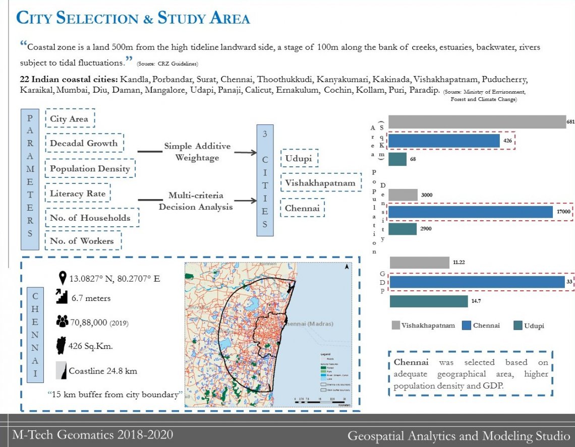
"Coastal zone is a land 500m from the high tide line landward side, a stage of 100m along the bank of creeks, estuaries, backwater, rivers subject to tidal fluctuations."
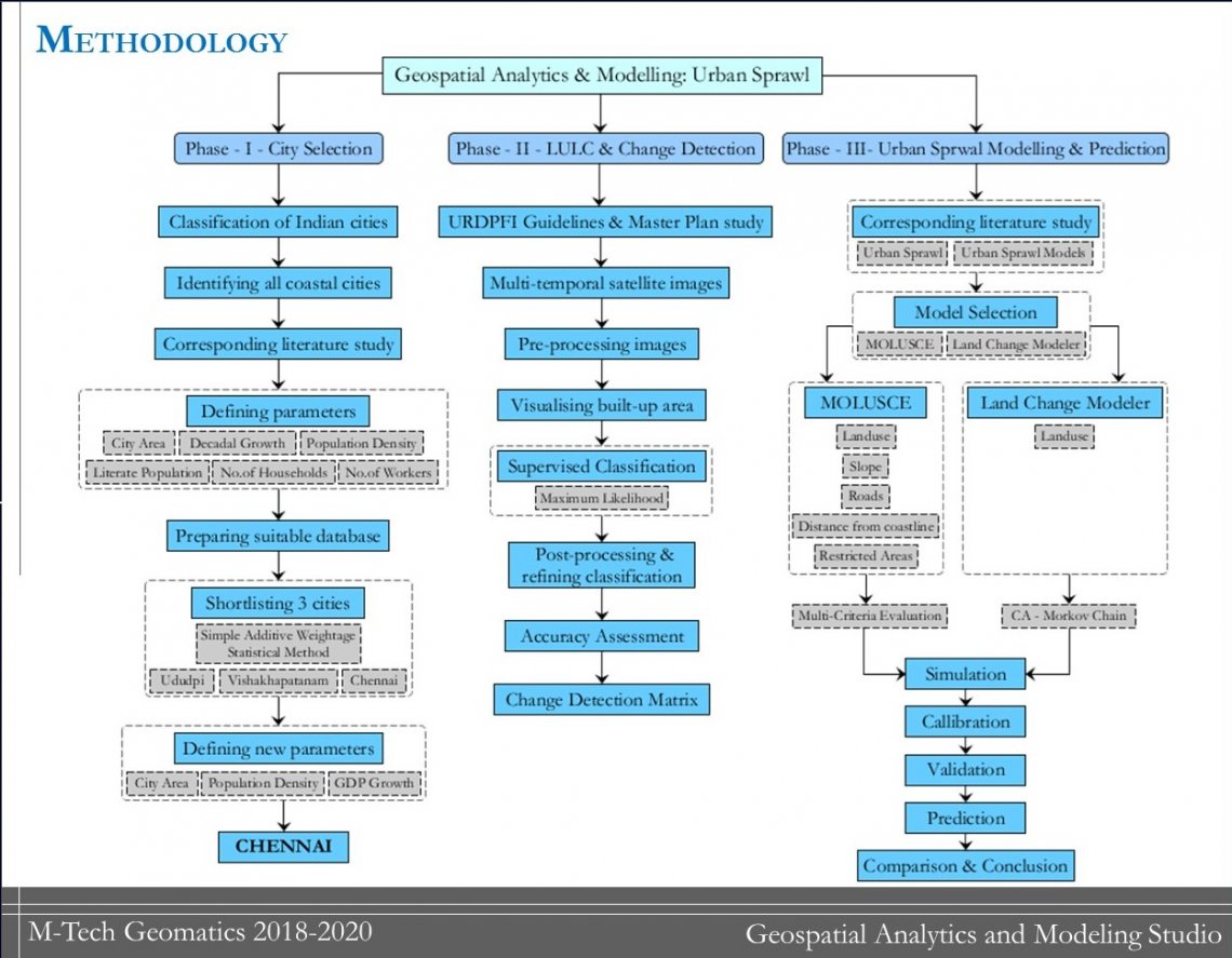
Different parameters were chosen for city selection based on literature review and Chennai city was chosen with the help of Multi Criteria Decision Analysis & Simple Additive Weightage techniques.
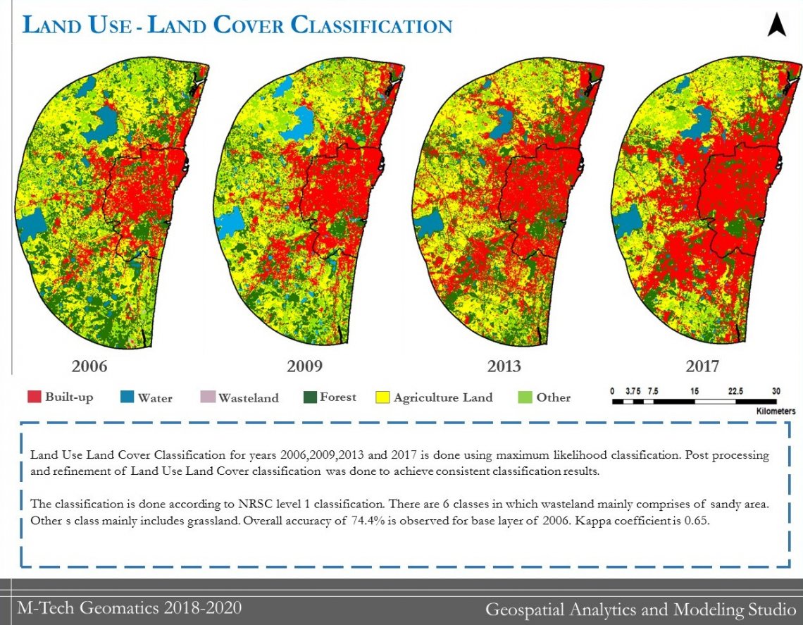
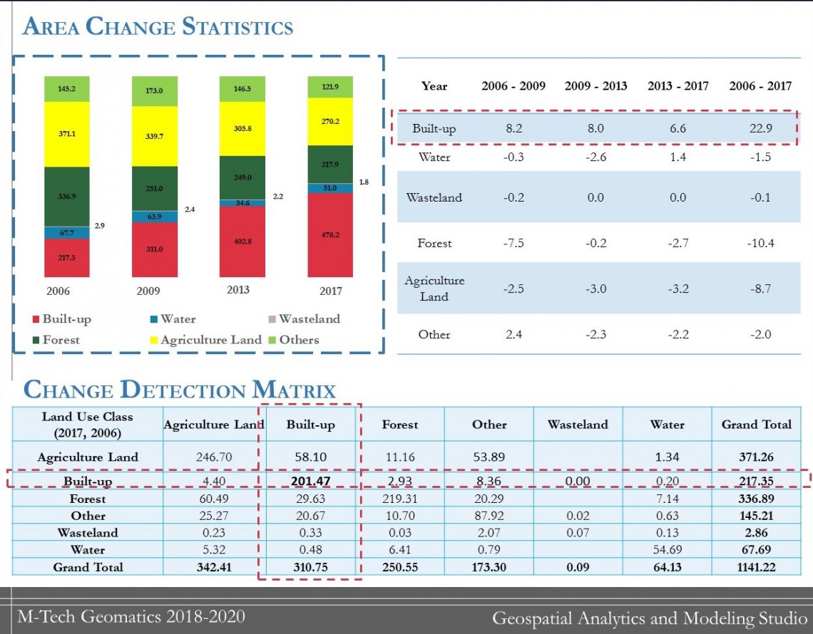
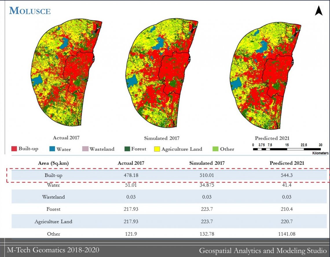
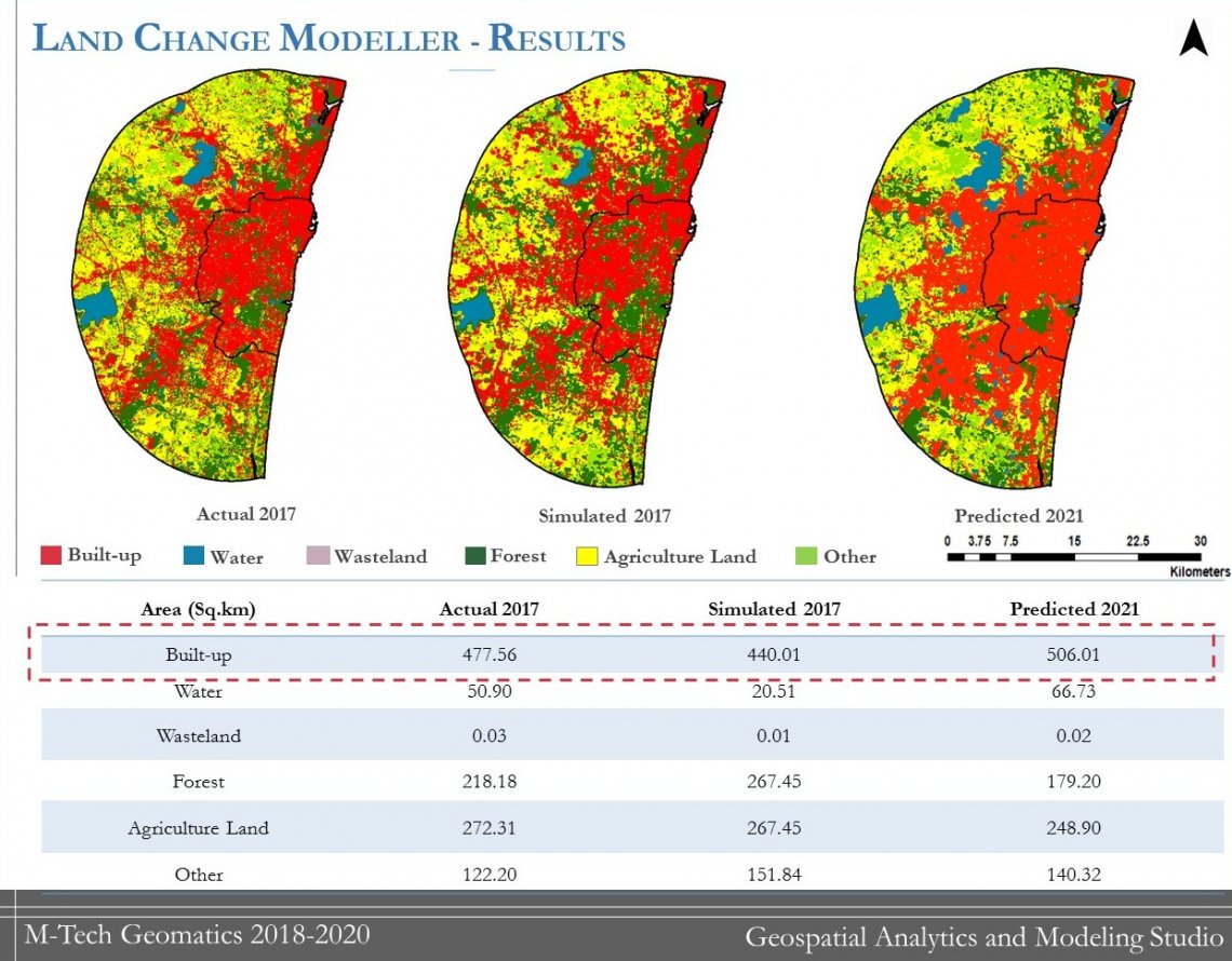
Land Use Land Cover Classification using maximum likelihood classification method was carried out for the years of 2006,2009,2013 and 2017. Overall accuracy of 74.4% was achieved for 30m resolution.
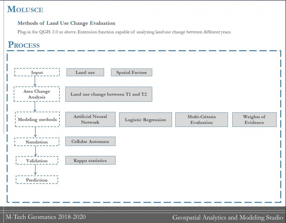
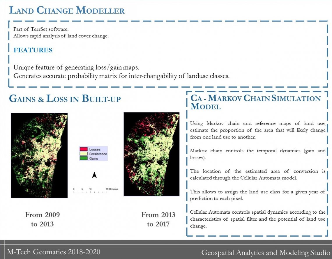
Urban sprawl prediction for year 2021 was done by using two prediction models: MOLUSCE and Land Change Modeler respectively.