Your browser is out-of-date!
For a richer surfing experience on our website, please update your browser. Update my browser now!
For a richer surfing experience on our website, please update your browser. Update my browser now!
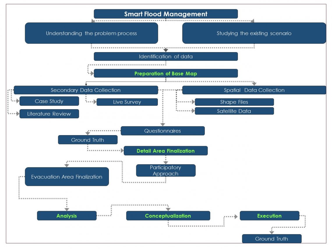
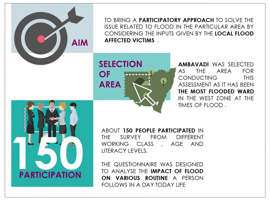
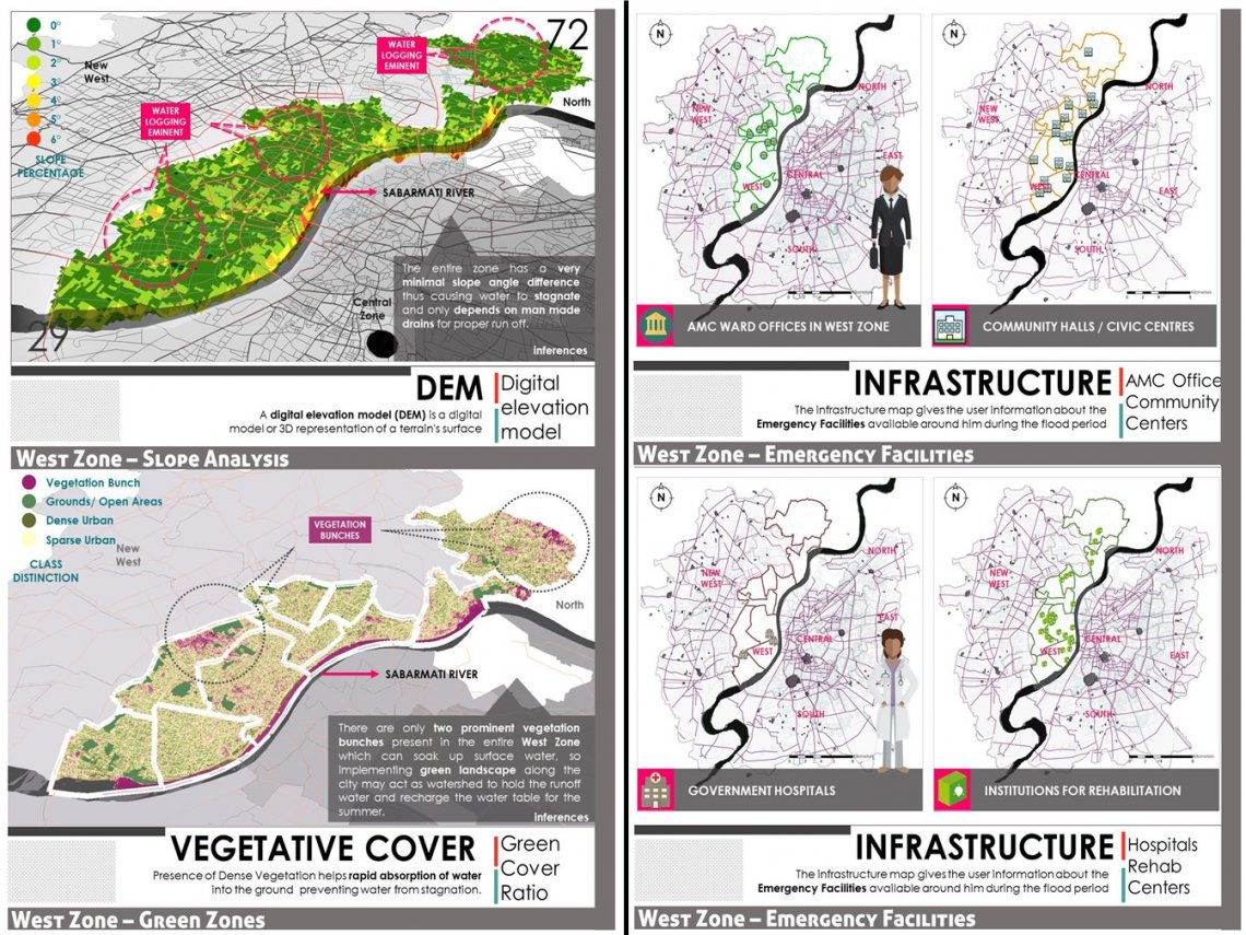
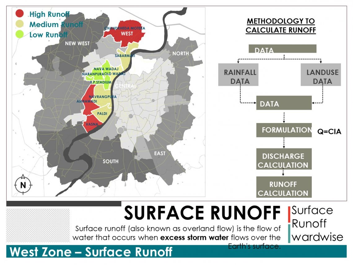
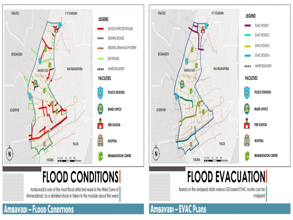
The study describes an efficient & scientific approach with suitable illustrations of map and real time flood inundations or water-logging inundations. The areas, which are highly affected by water-logging. So that, the affected people can be relocated or evacuated from inundation and can be evacuated to different safe places. Collecting available data from census and municipal websites; charts and shape-files were created to show infrastructures available in the Area of Study on a proper map. Using map overlay analysis in available GIS software (ArcGIS), water-logging prone areas and topographic areas in Area of Study were digitized.