Your browser is out-of-date!
For a richer surfing experience on our website, please update your browser. Update my browser now!
For a richer surfing experience on our website, please update your browser. Update my browser now!
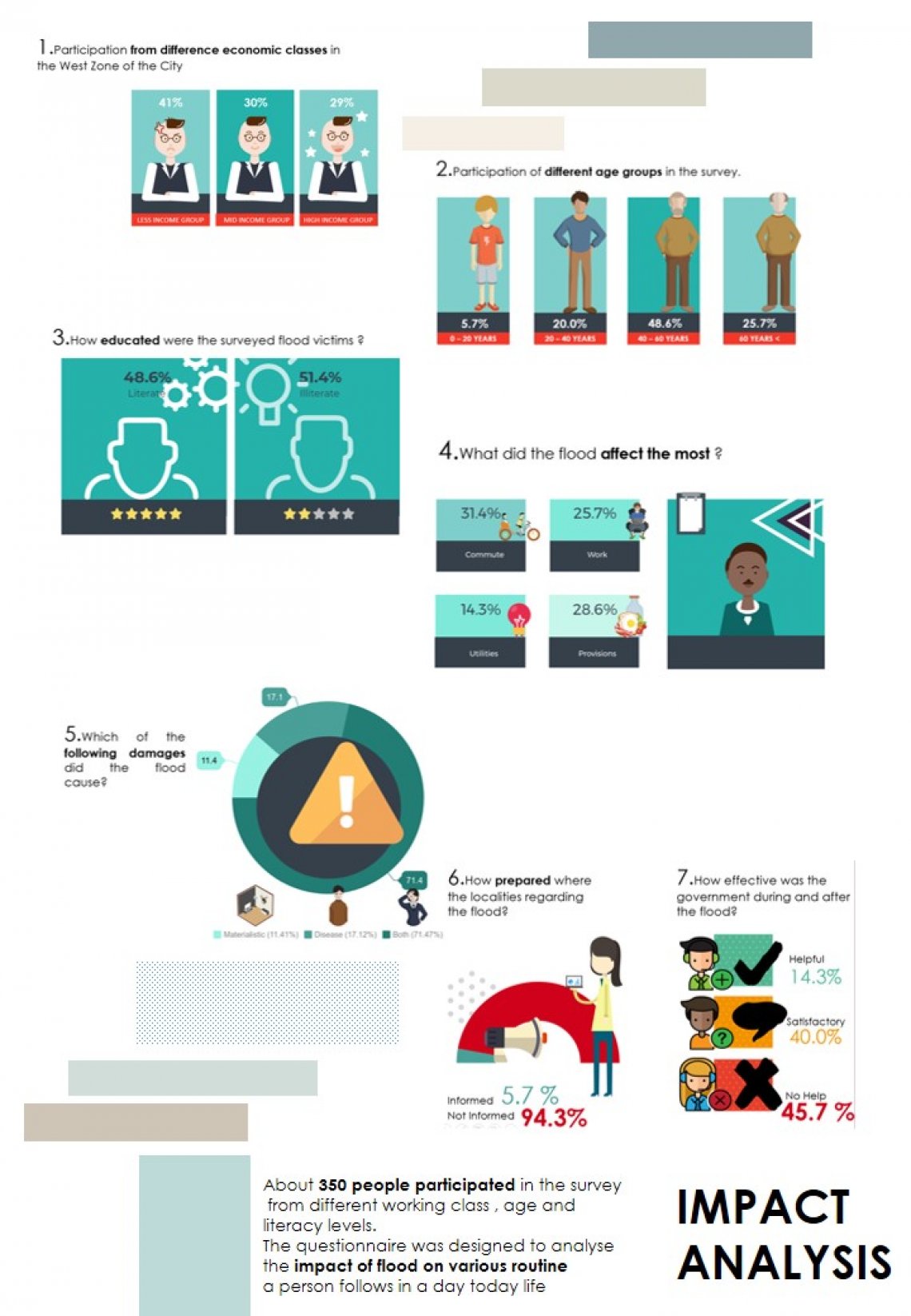
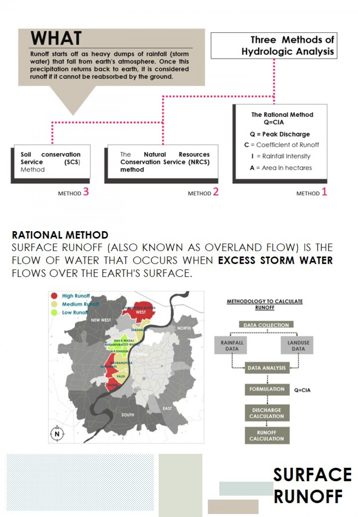
Using map overlay analysis in GIS software (ArcGIS); flood prone areas and topographic areas in Ambawadi region of Ahmedabad were digitized. Thus, the studio work is an effort to analyse the impact of a flood when areas are waterlogged using the citizens for data preparation, integrating, analyzing, and spatial data with attribute table information. Finally, to show GIS can be an effective tool for development of flood emergency system as a part of disaster preparedness by the decision makers.