Your browser is out-of-date!
For a richer surfing experience on our website, please update your browser. Update my browser now!
For a richer surfing experience on our website, please update your browser. Update my browser now!
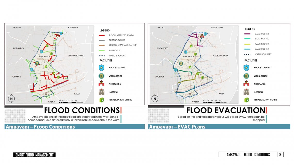
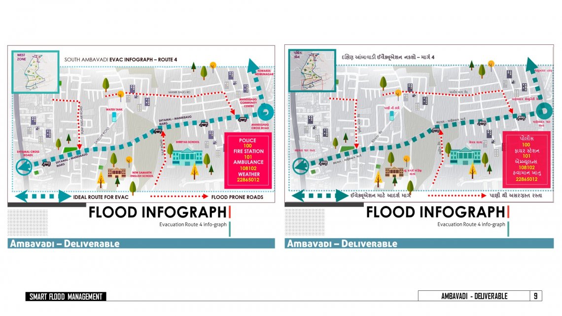
Flood management planning helps to rescue the flood affected people, mitigate the problem of flood and to take necessary preventive measures .It is a planned and integrated management approach with the help of remote sensing and geographic information system and data on socio economic characteristics to render right suggestions to the people. The study describes an efficient & scientific approach with suitable illustrations of map and real time flood inundations. The areas, which are highly flood affected and delineated. So that, the flood affected people can be rescued from inundation and can be evacuated to different safe places.