Your browser is out-of-date!
For a richer surfing experience on our website, please update your browser. Update my browser now!
For a richer surfing experience on our website, please update your browser. Update my browser now!
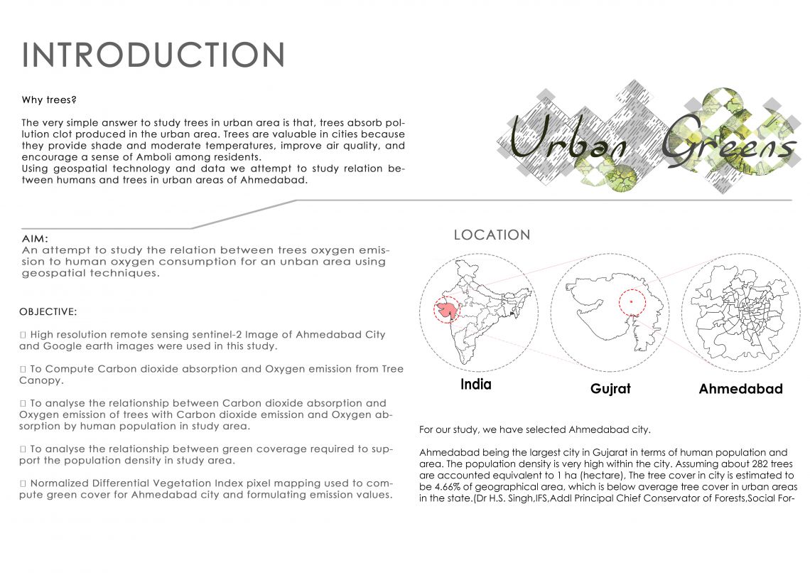
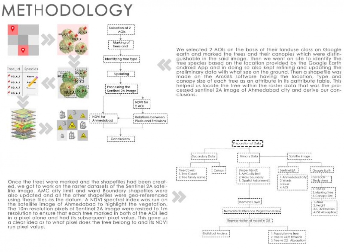
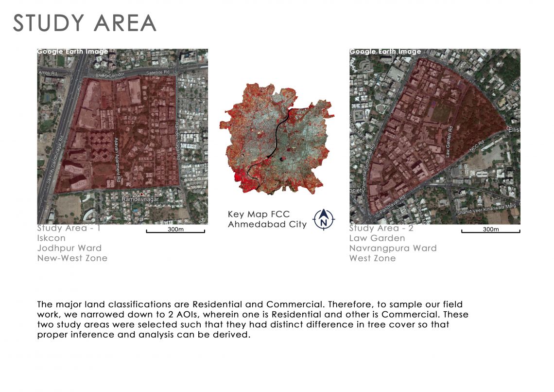
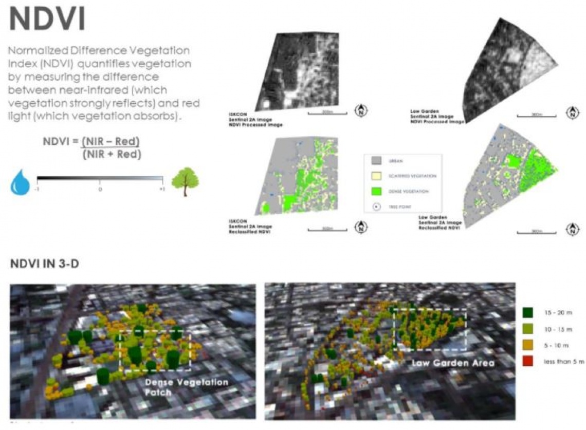
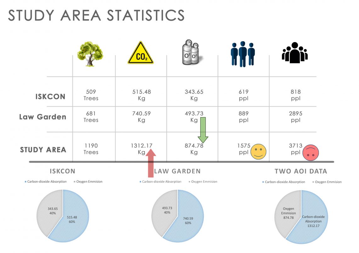
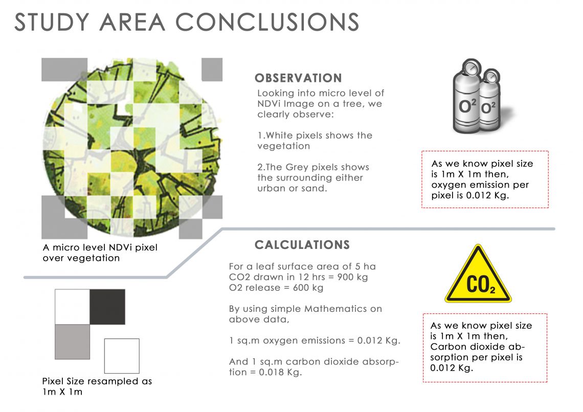
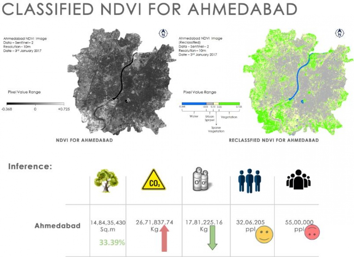
The main aim of this study is to use GIS and satellite data to compute the Carbon Dioxide absorption and Oxygen emission of trees and correlate it to the Carbon Dioxide emission and Oxygen absorption of the human population residing in an area. Two AOI were considered (Law Garden & ISKCON) and trees were marked and their canopies were measured using Google Earth. , NDVI has been used to use identify the tree cover in Ahmedabad city and determine the tree density and relate it to the population density.