Your browser is out-of-date!
For a richer surfing experience on our website, please update your browser. Update my browser now!
For a richer surfing experience on our website, please update your browser. Update my browser now!
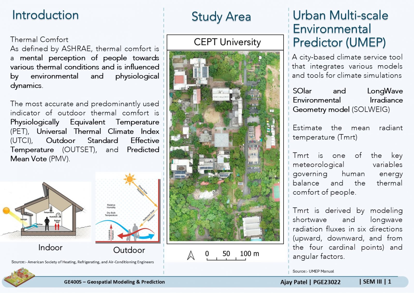
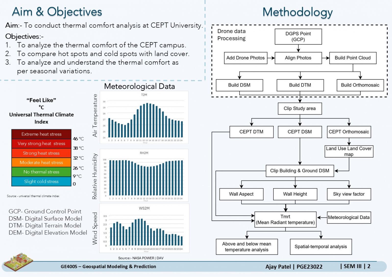
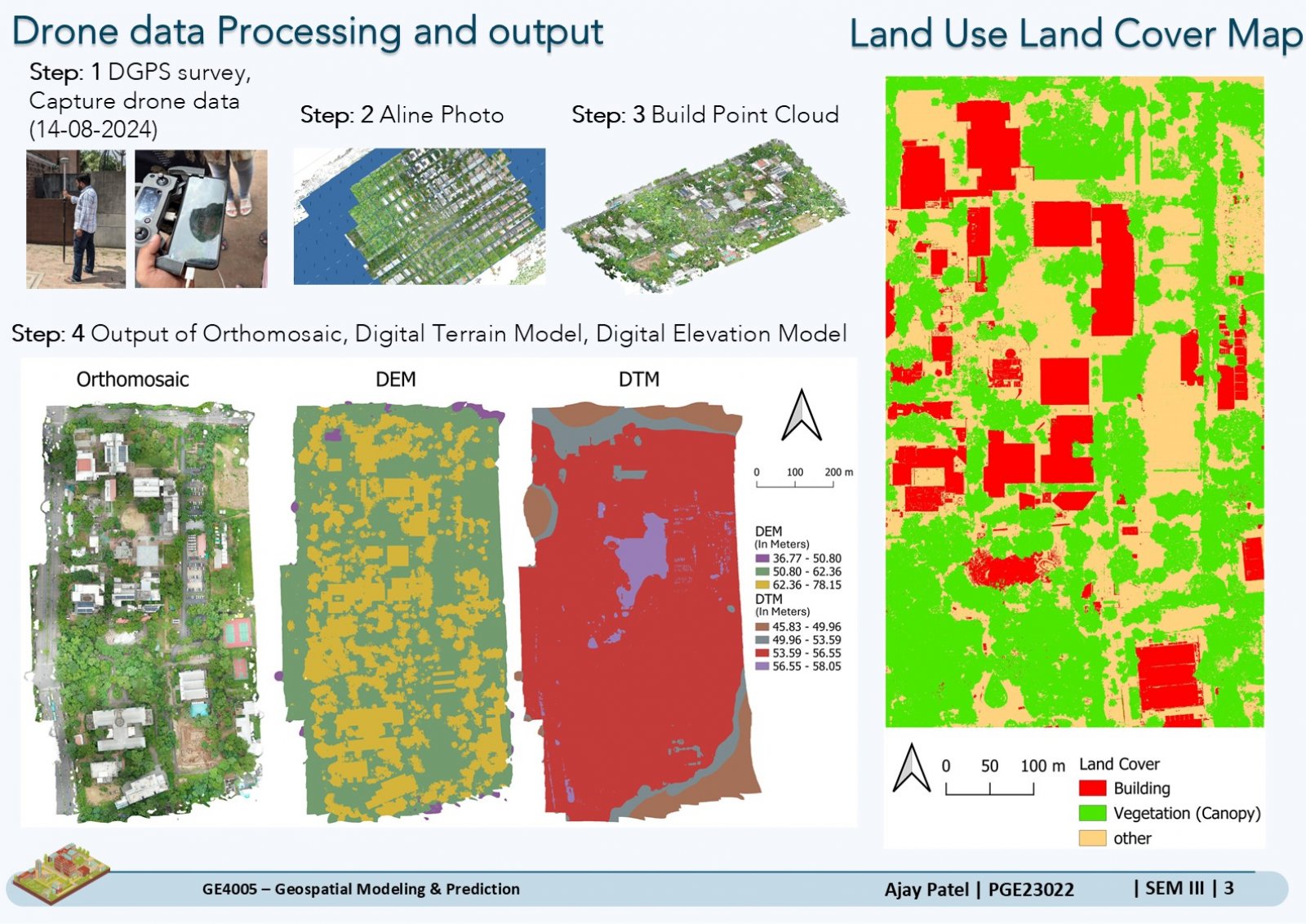
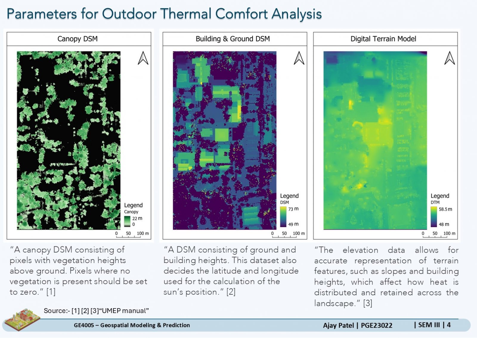
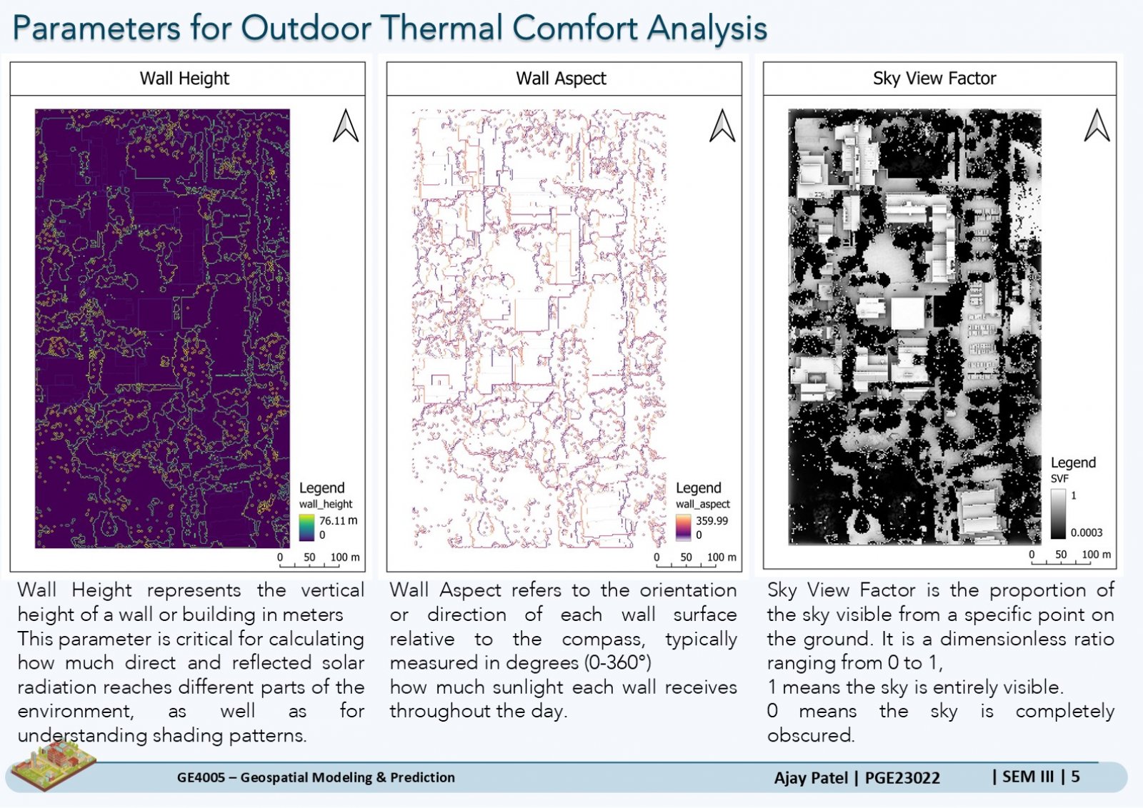
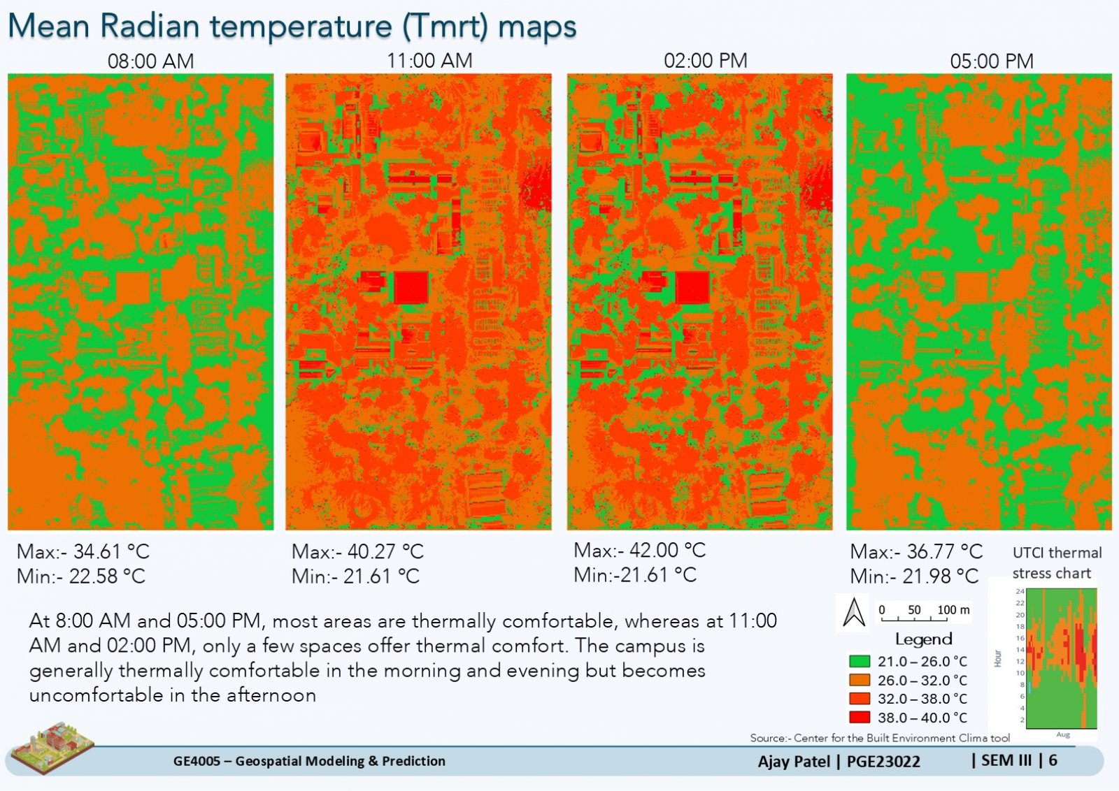
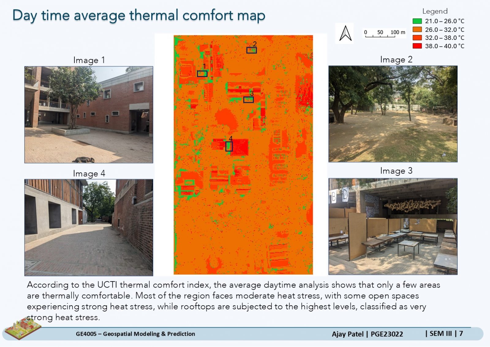
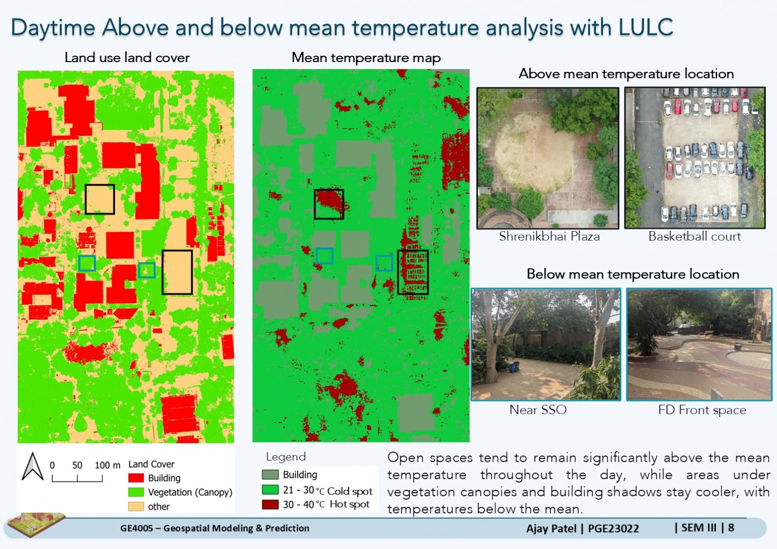
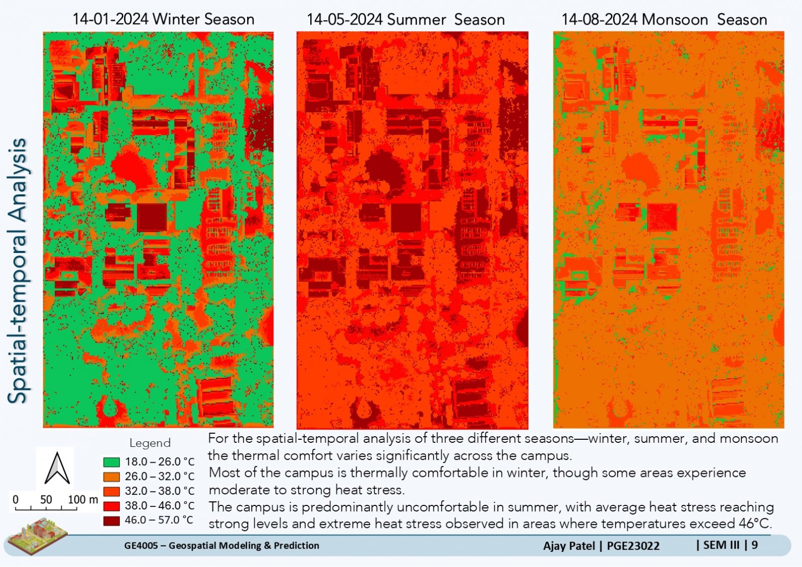
This project focuses on analyzing outdoor thermal comfort at CEPT University using GIS tools and drone-generated data. The study involves creating digital surface models (DSM), digital terrain models (DTM), and orthomosaic maps, which serve as inputs for thermal comfort simulations using the UMEP-SOLWEIG plugin in QGIS. By evaluating key meteorological factors like air temperature, humidity, wind speed, and solar radiation, the project assesses the spatial and seasonal variations in thermal comfort across the campus. The results highlight areas of heat stress and cooler zones, offering valuable insights for sustainable urban planning and improving campus livability.
