Your browser is out-of-date!
For a richer surfing experience on our website, please update your browser. Update my browser now!
For a richer surfing experience on our website, please update your browser. Update my browser now!
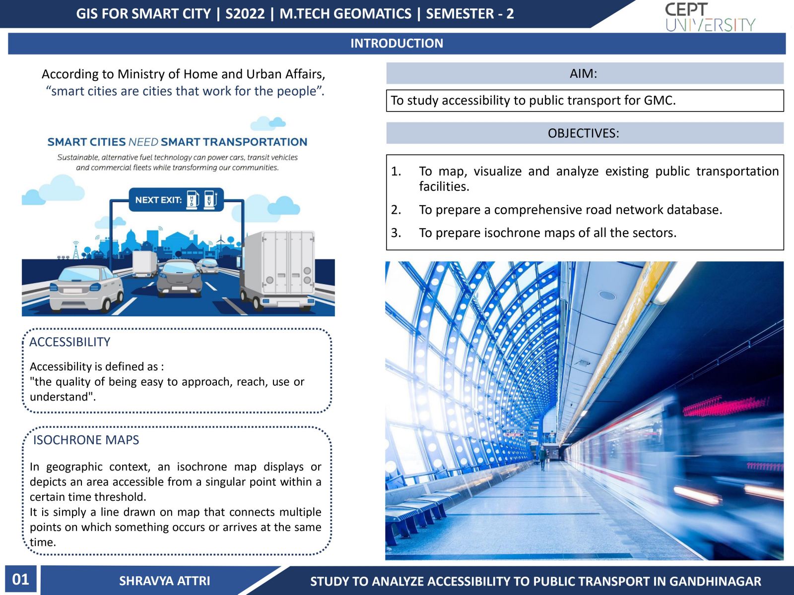
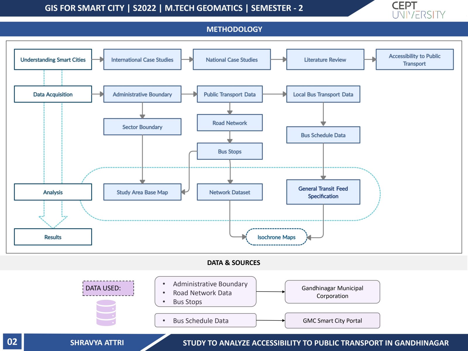
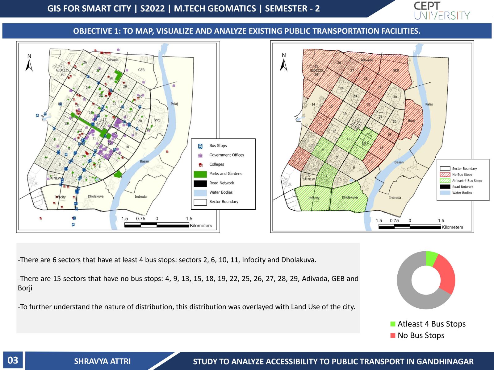
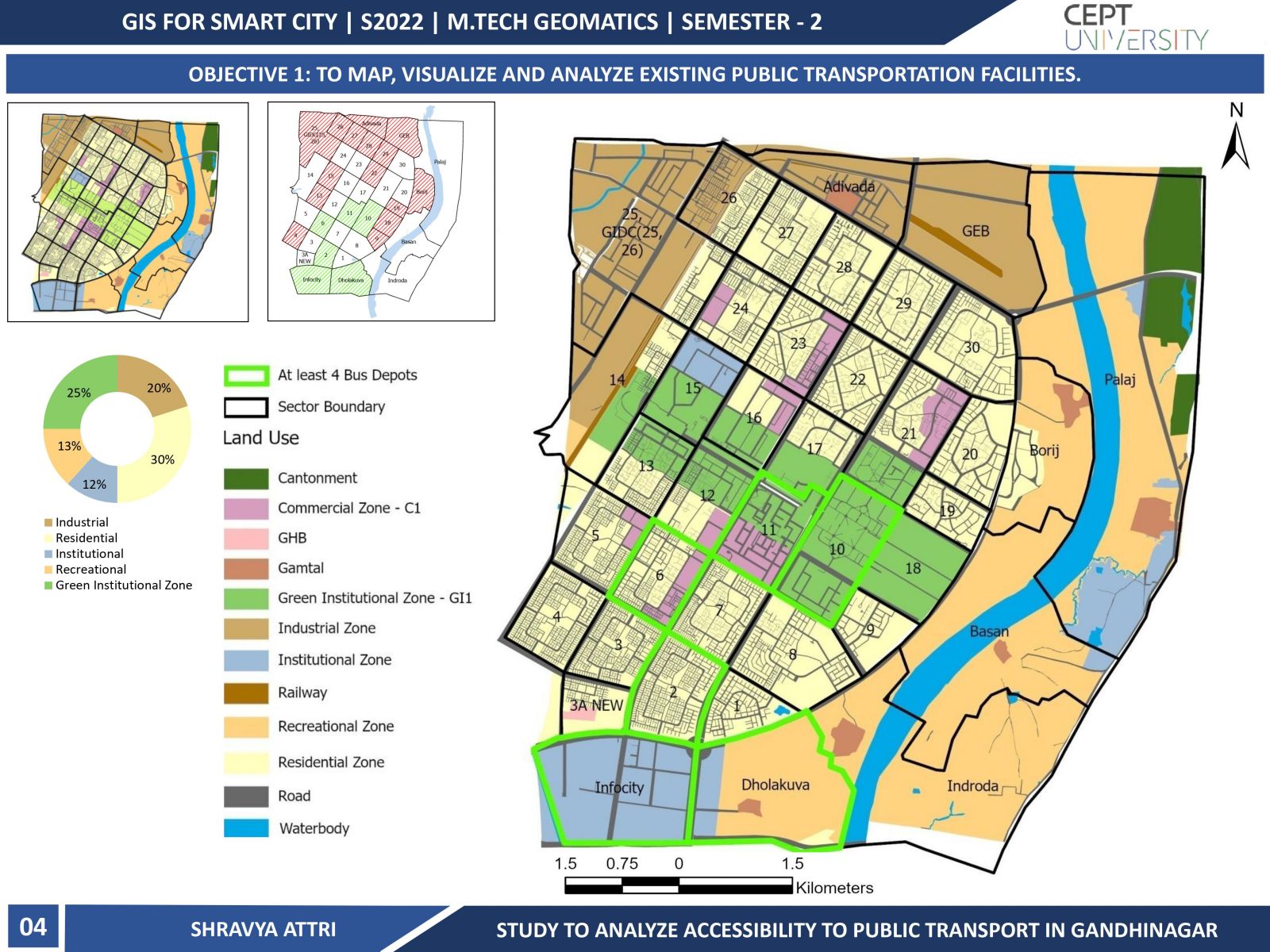
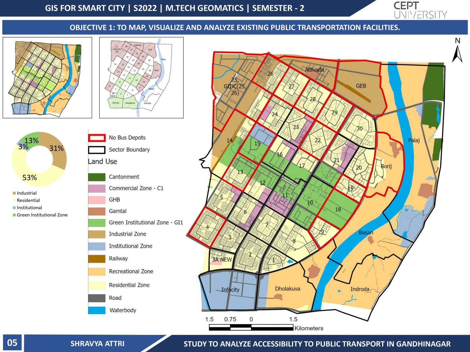
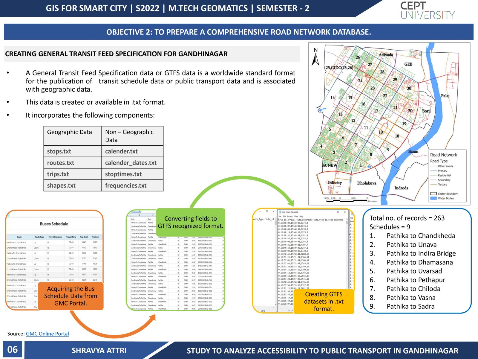
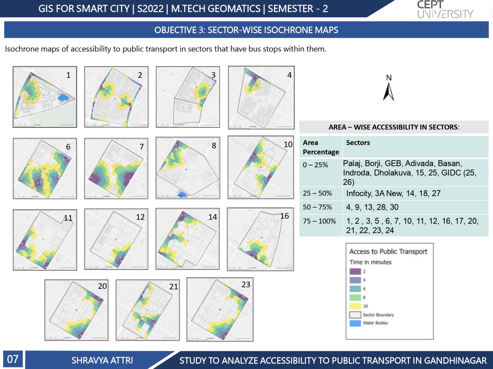
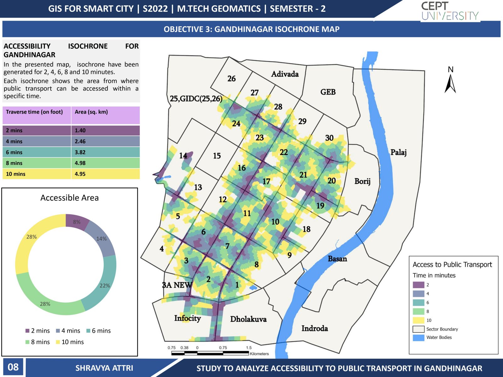
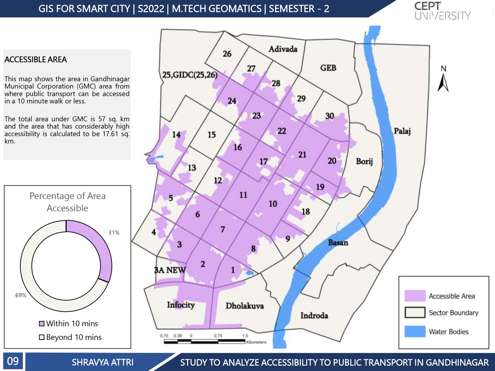
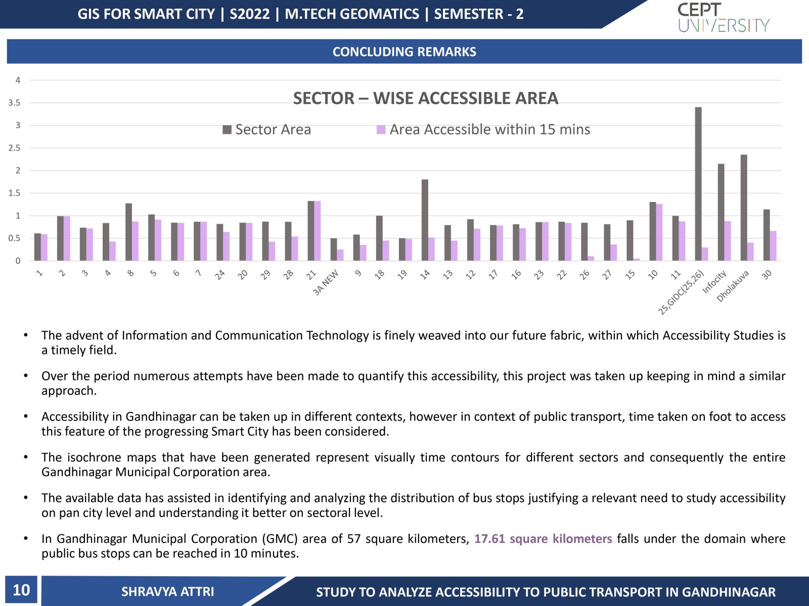
This project aimed to study the accessibility to public transport i.e. public bus transport for the Municipal Corporation area of Gandhinagar, Gujarat. Accessibility is used as a measure that is defined using the walking time(ease) in which one can access public transport or bus stops. The existing public transport infrastructure has been studied at the sector level. The citizen's accessibility to bus stops for each sector has been quantified and spatially represented using isochrone maps (or time contours). The study finally highlights the areas from where public transport is accessible within a 10, 8, 6, 4, and 2 -minute walking distance.