Your browser is out-of-date!
For a richer surfing experience on our website, please update your browser. Update my browser now!
For a richer surfing experience on our website, please update your browser. Update my browser now!
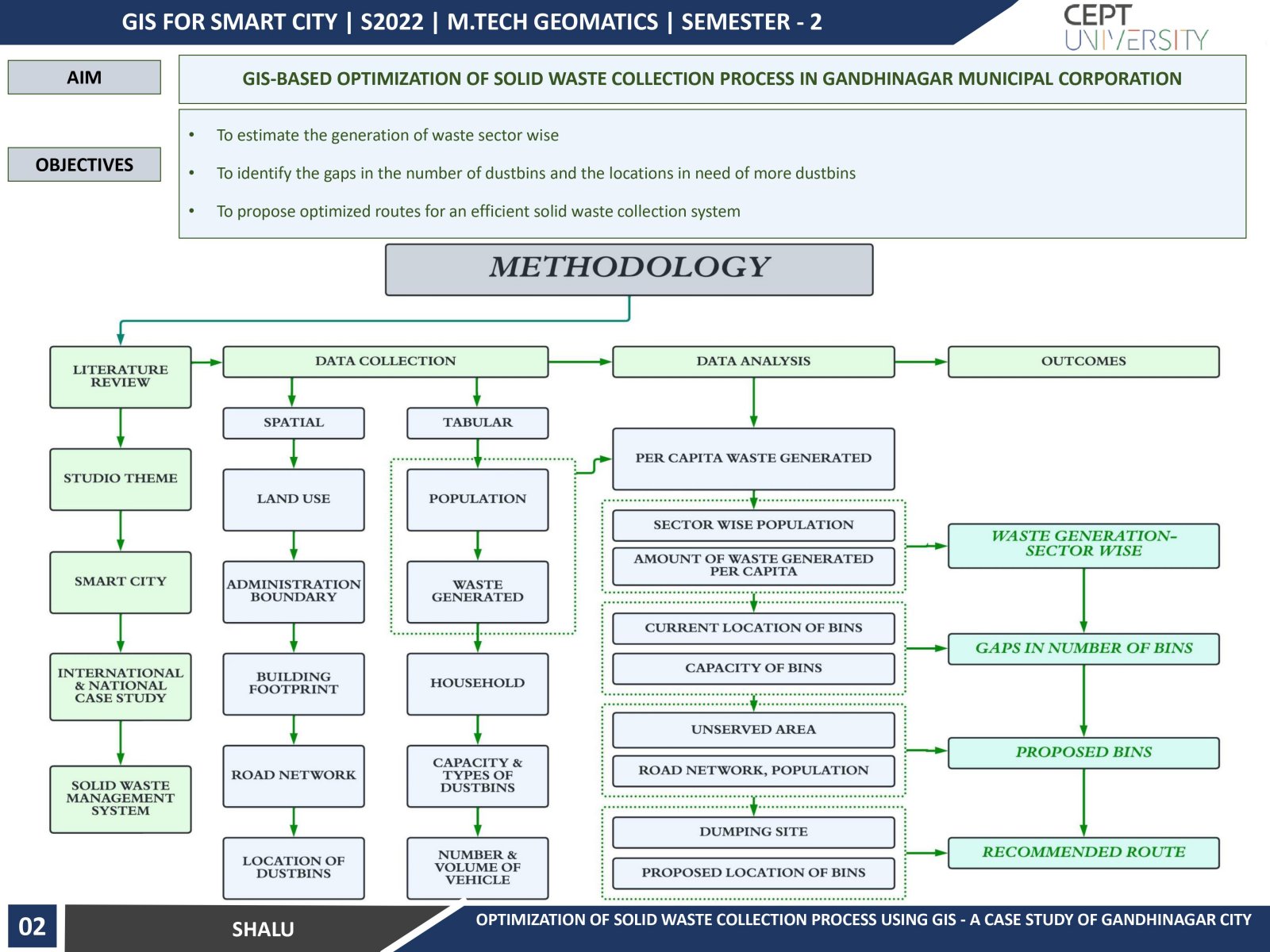
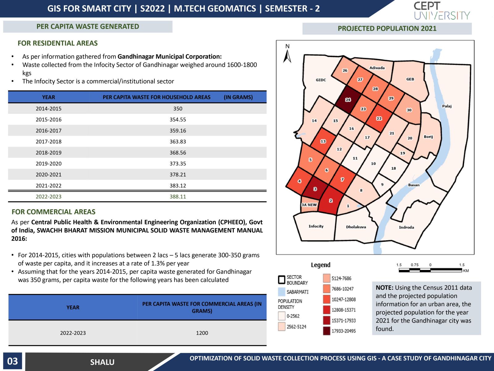
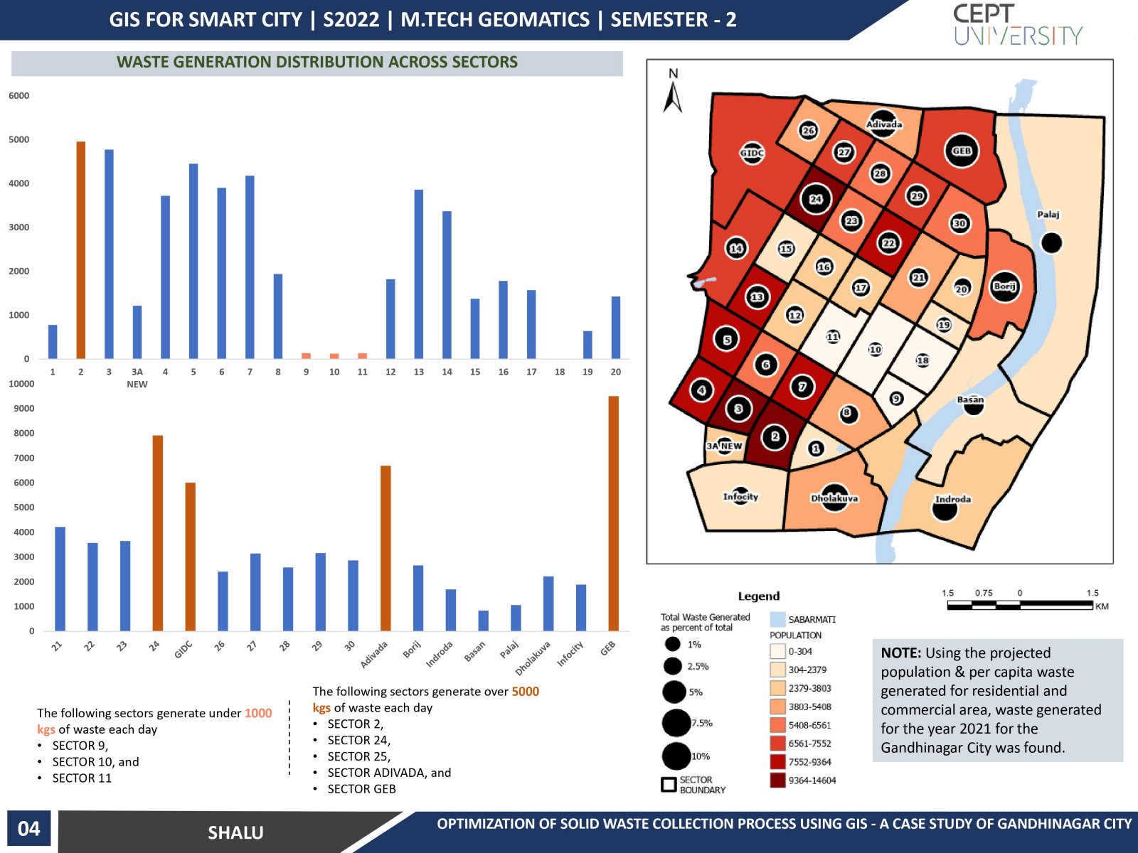
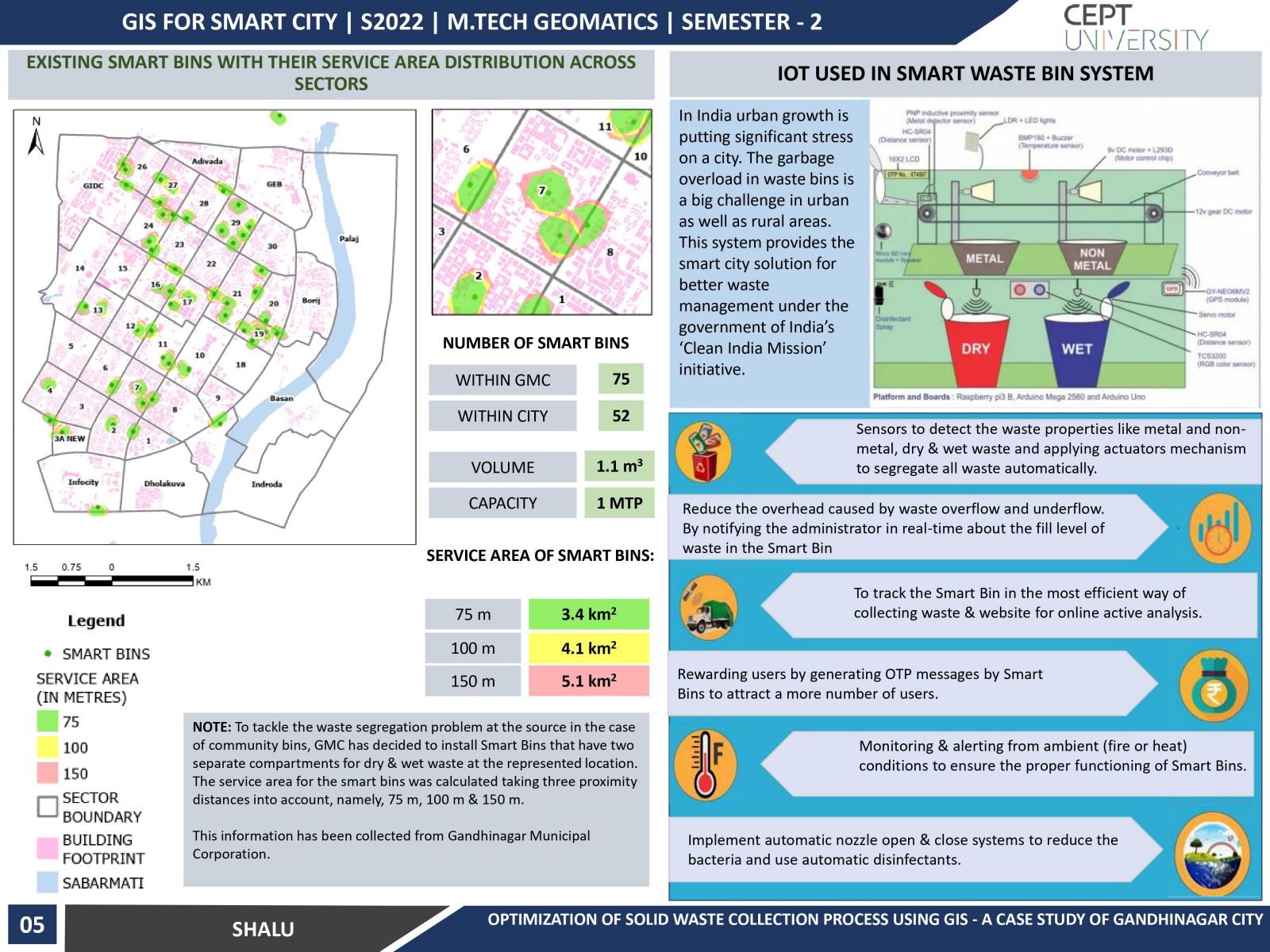
This study analyses the present scenario associated with the MSW collection services of Gandhinagar. The current location of the collection of Smart bins was analyzed for the proximity distances – 75 m, 100 m & 150 m in the Gandhinagar City to propose the optimal number & location of bins. It also recommends two levels of routes for the municipal authority to collect waste. In this study, GIS technology was used to develop a methodology for the optimization of Solid waste collection. The method uses various geographical data (road network, location of waste bins, land uses, etc.) with advanced Geospatial tools.