Your browser is out-of-date!
For a richer surfing experience on our website, please update your browser. Update my browser now!
For a richer surfing experience on our website, please update your browser. Update my browser now!
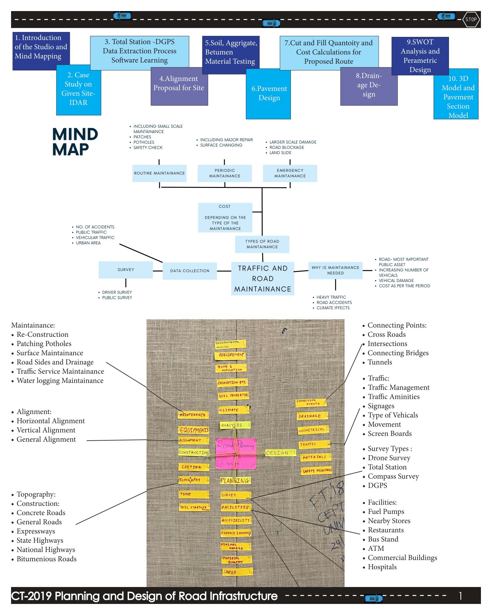
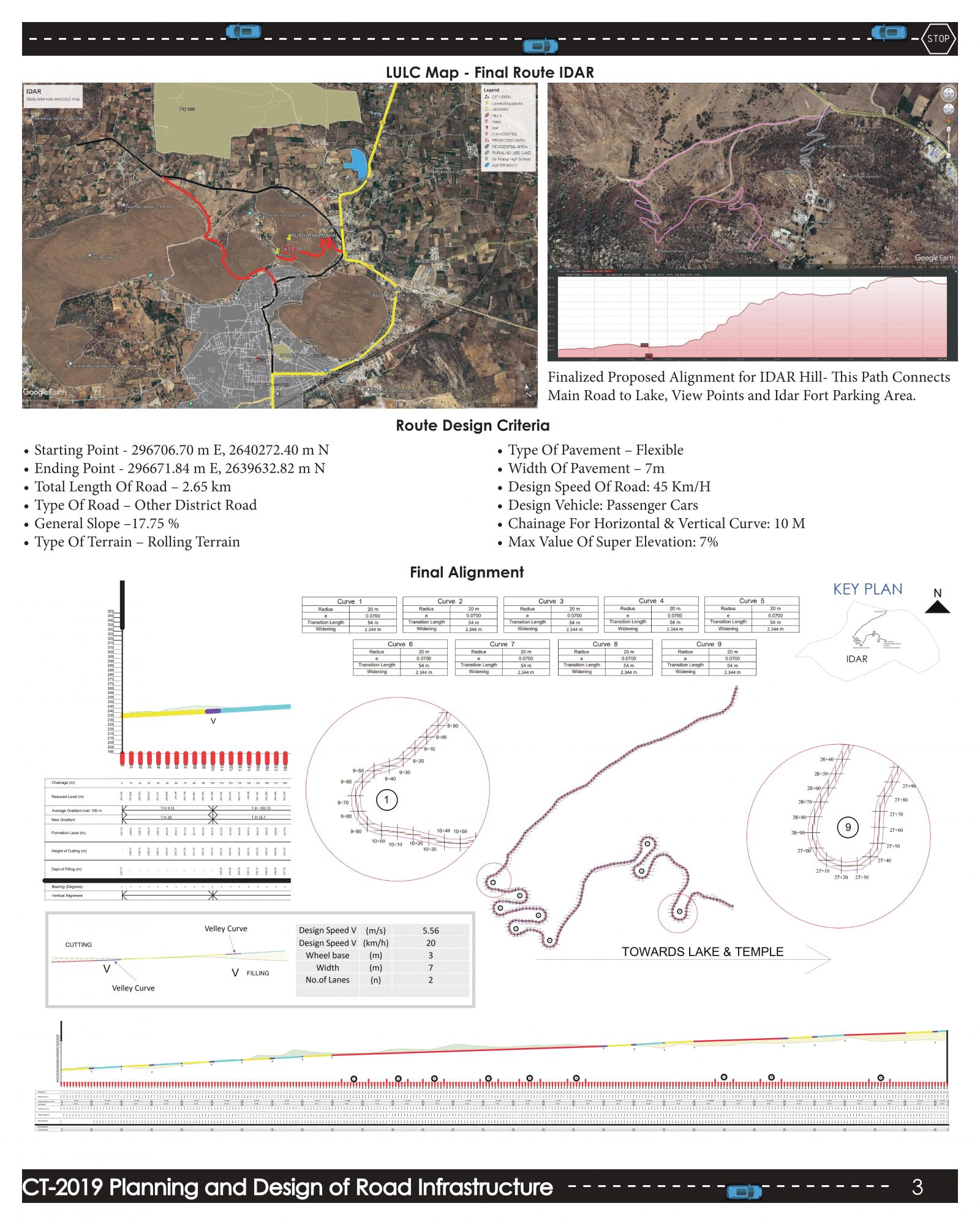
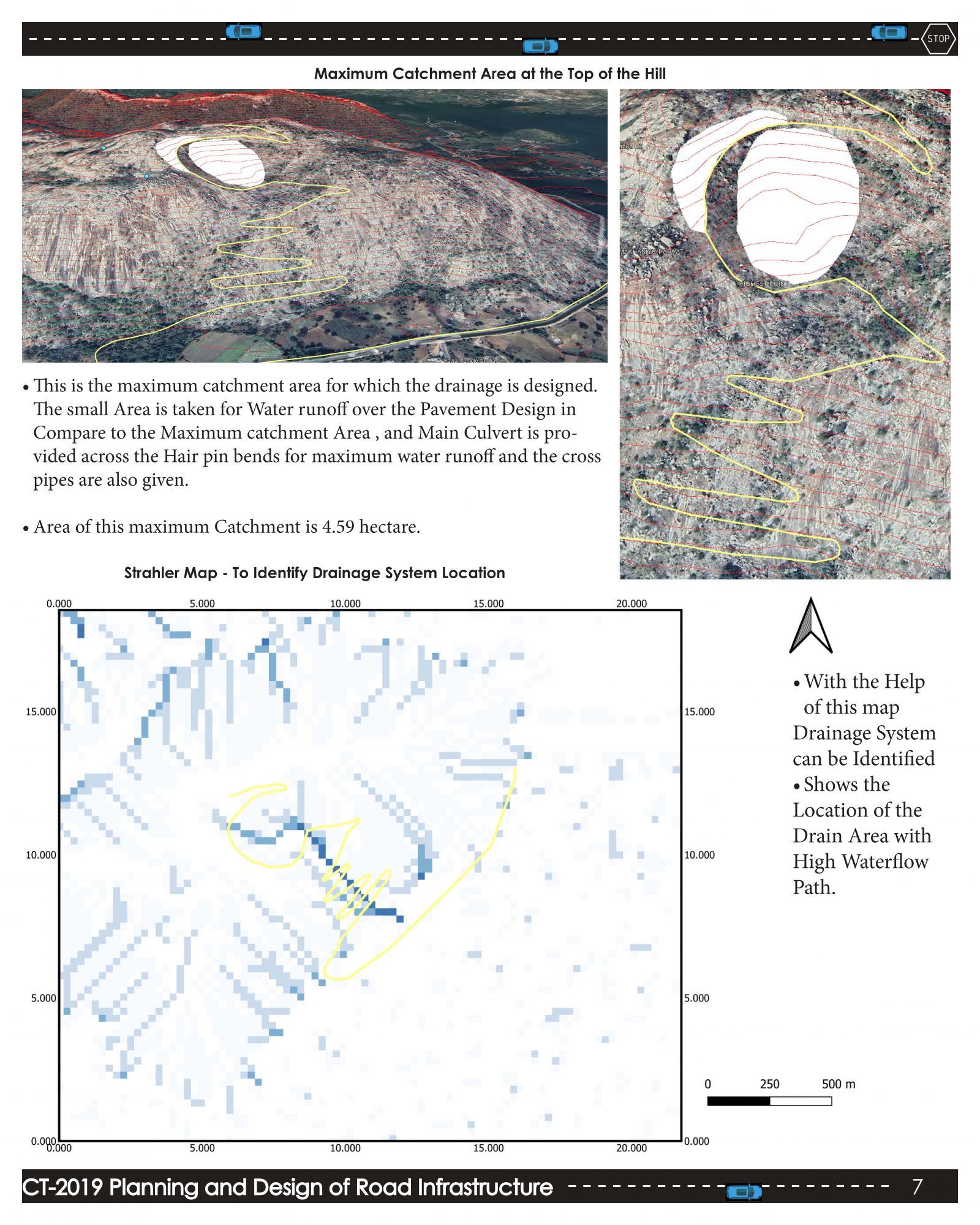
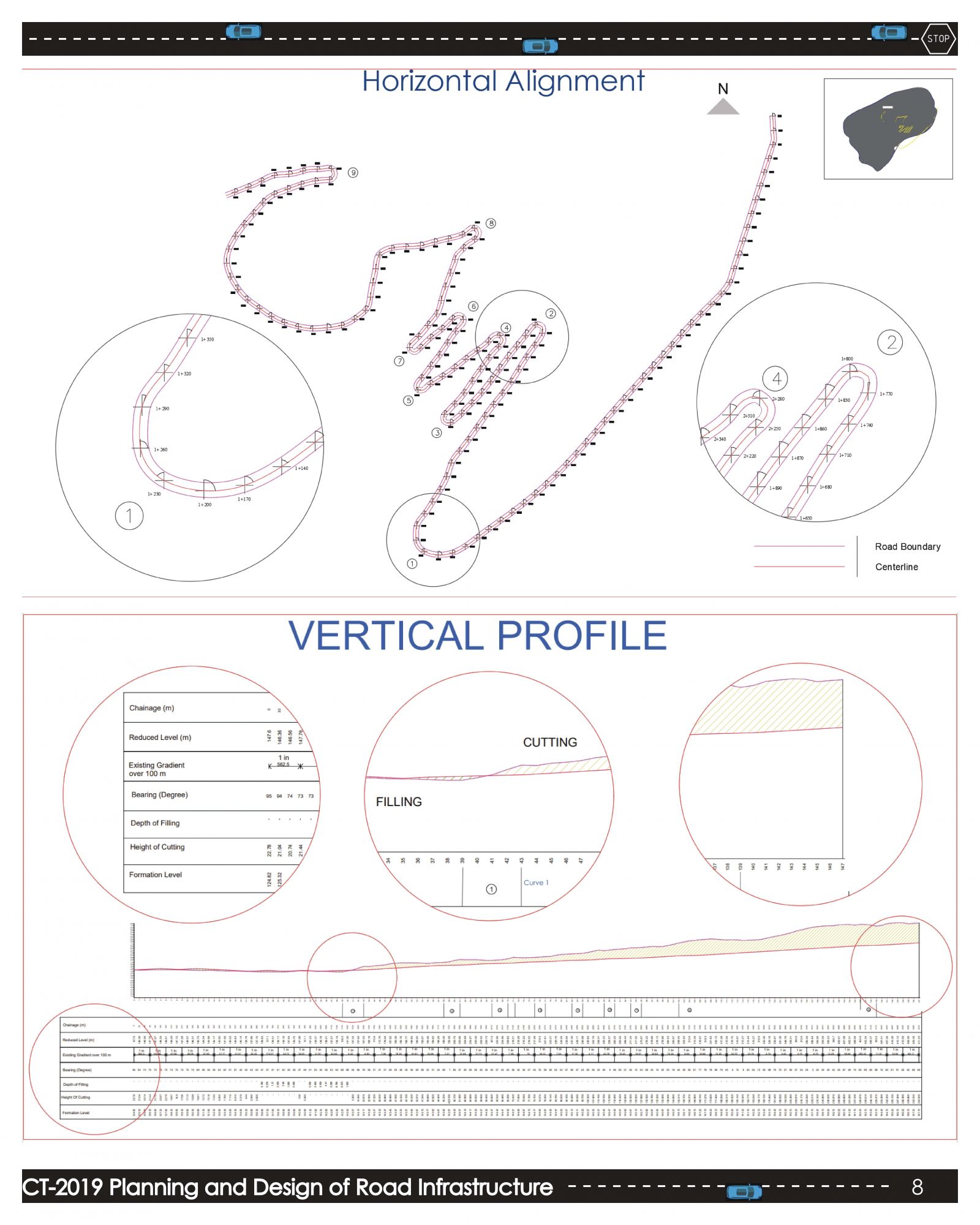
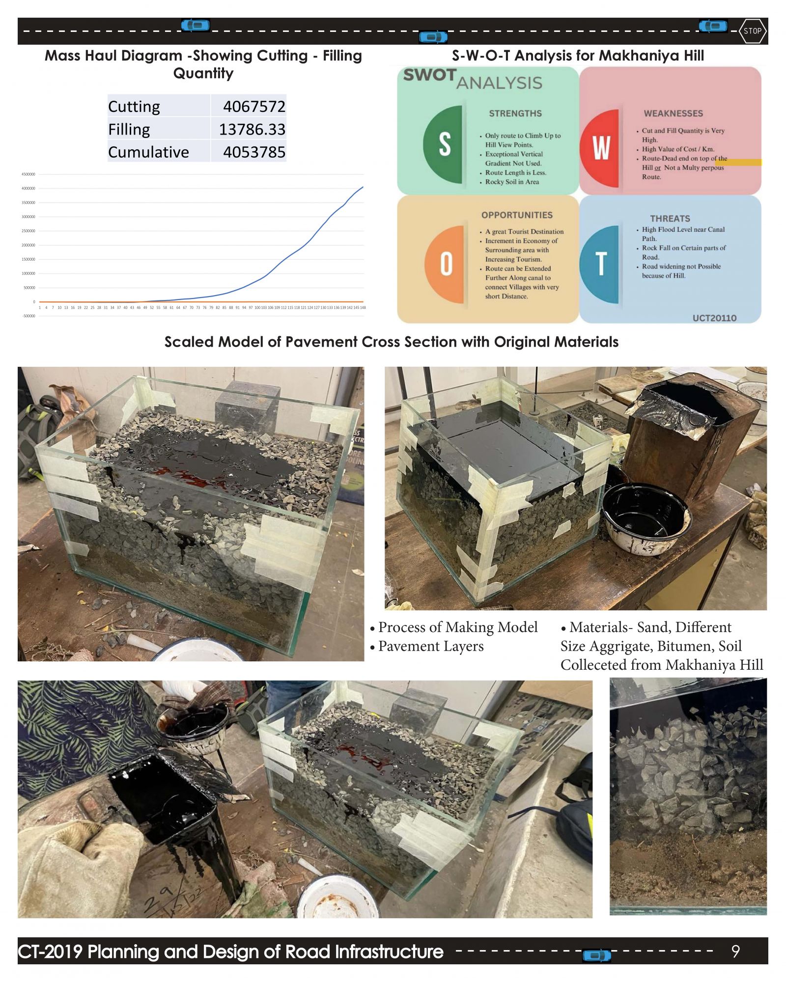
In different landscapes where the impacts of constructed and natural surroundings could be notable, the task of planning and establishing an appropriate road layout is the central focus of this Studio. Suitable solutions will be derived by employing civil engineering concepts and methods that bolster the scrutiny and formulation of the road pathway and its surfaces. Through practical instances of actual roadways and engaging activities, I acquired insights into survey theories, highway materials, and elements of highway configuration for diverse terrains. Consequently, I can propose my own layout, devise elements, calculate quantities, conduct parametric investigations, and evaluate road safety, drawing from the exercises and discussions regarding the present highway and its associated amenities.
View Additional Work