Your browser is out-of-date!
For a richer surfing experience on our website, please update your browser. Update my browser now!
For a richer surfing experience on our website, please update your browser. Update my browser now!
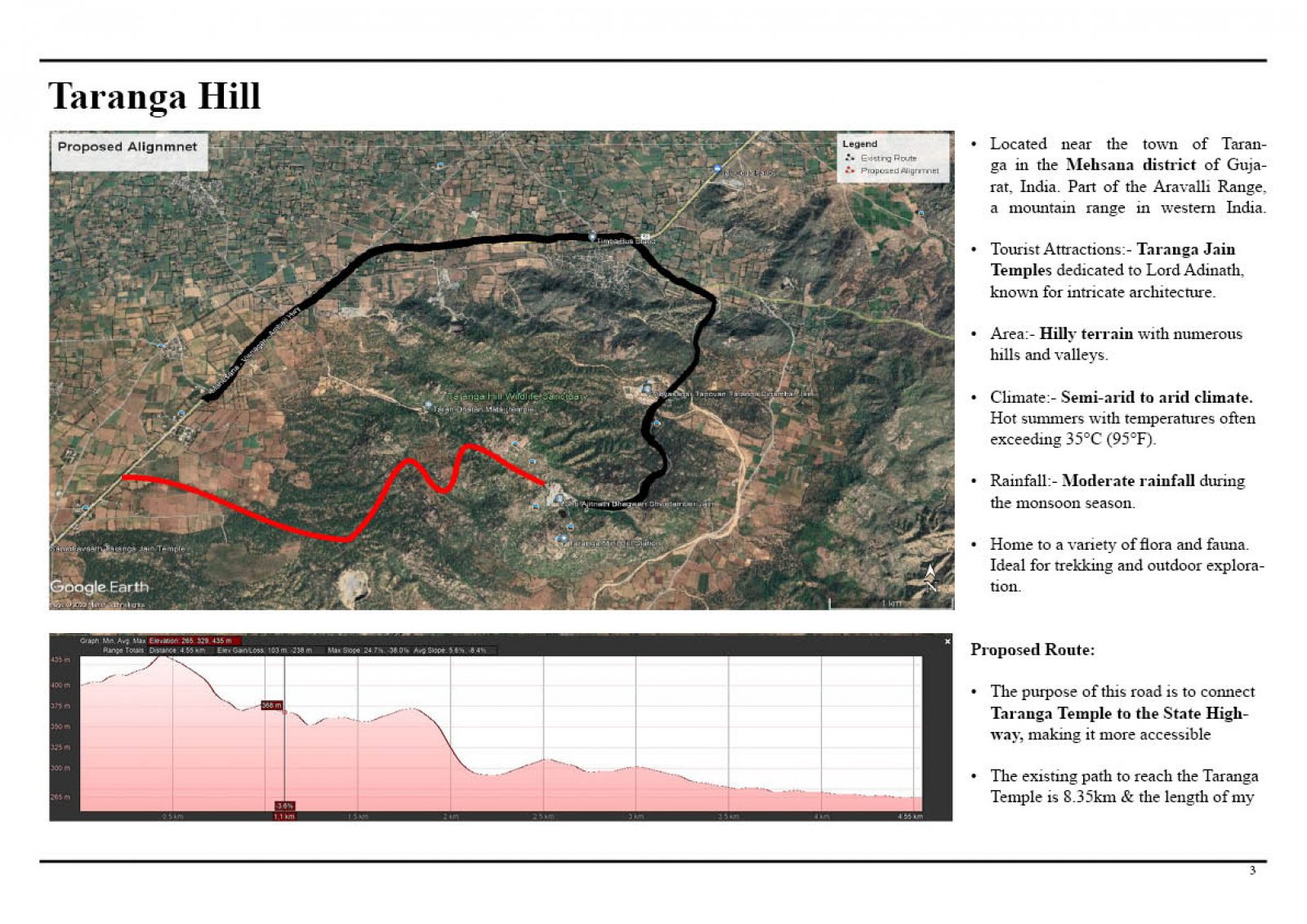
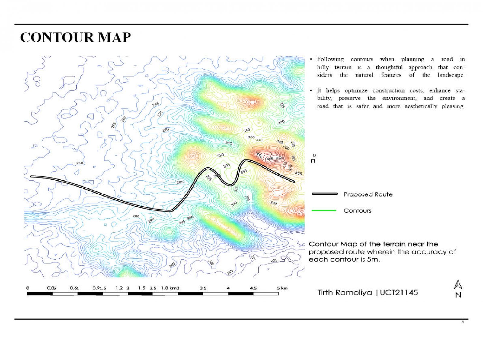
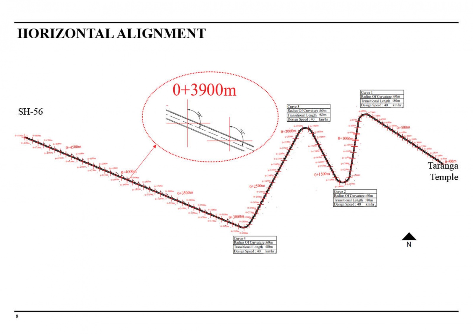
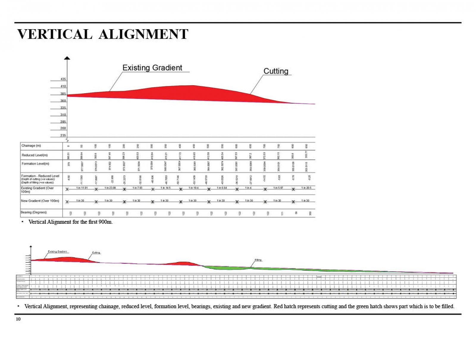
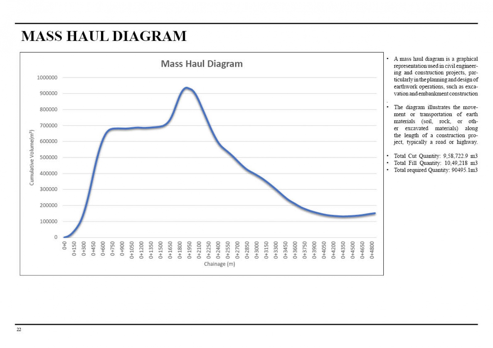
The project focused on meticulous planning and design in the challenging Taranga Hill region of Gujarat. The project incorporated comprehensive analyses, including Land Use and Land Cover (LULC) mapping, contour mapping, and SWOT analysis. The horizontal and vertical alignment, along with a mass haul diagram, were carefully crafted to optimize comfort, safety, cost-effectiveness, and environmental impact—additionally, parametric analysis provided valuable insights. The proposed road alignment adheres to IRC Codal provisions, ensuring a well-rounded approach that integrates diverse factors for an optimal and sustainable road network.
View Additional Work