Your browser is out-of-date!
For a richer surfing experience on our website, please update your browser. Update my browser now!
For a richer surfing experience on our website, please update your browser. Update my browser now!
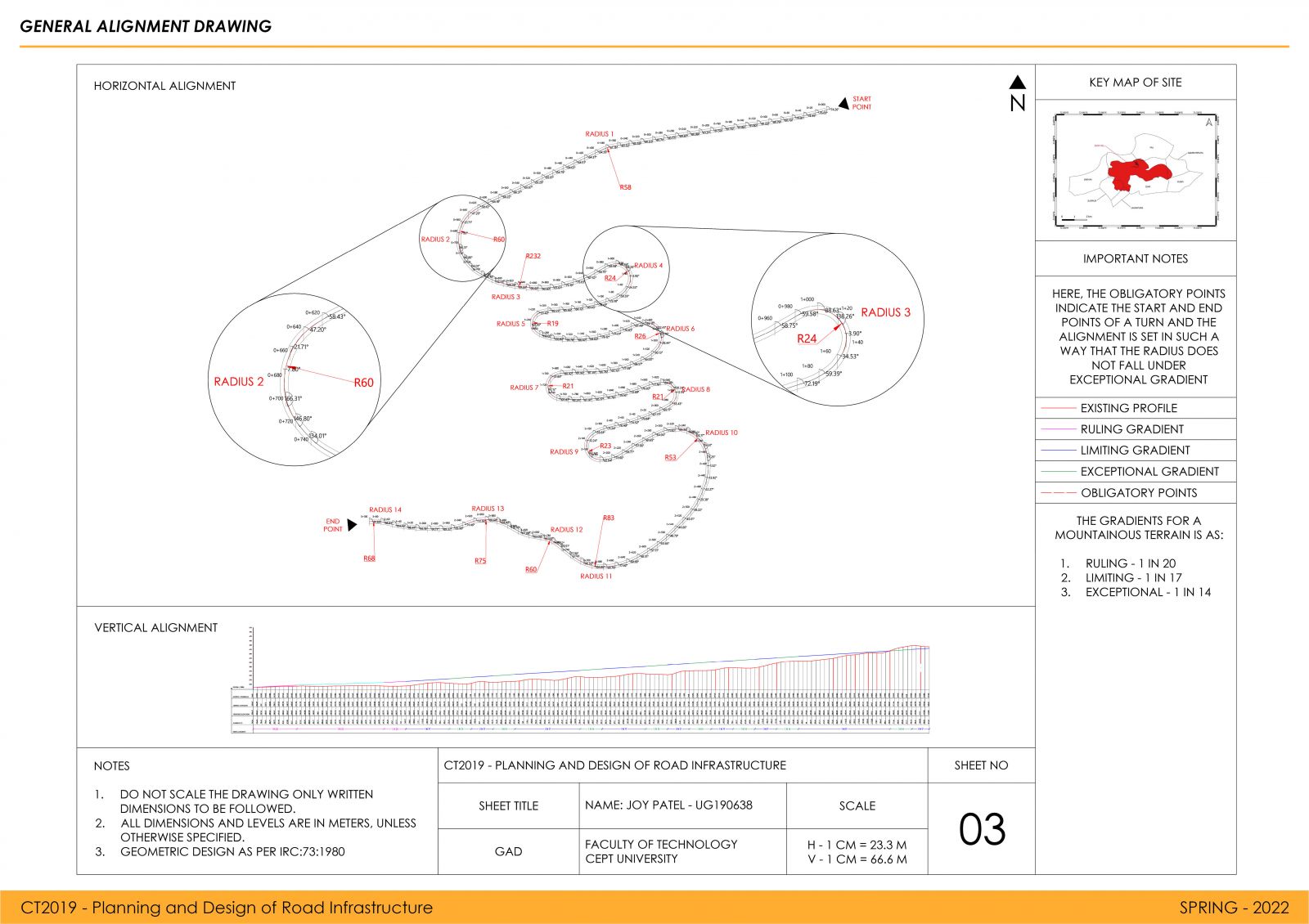
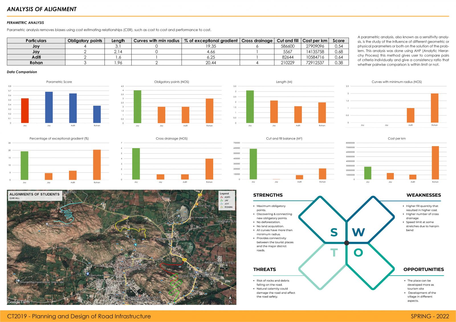
The studio work involves the study of maps and relevant BIS and IRC codes. Various surveys were conducted which involved measurement, processing of field data. The routes were identified based on logical assumptions and elevation data for ground for these routes was captured by geospatial tools. The geometric design was carried out with number of trials for both horizontal and vertical curves. The pavement design for the route was also done. The potentiality of the alignment was judged based on more than nine parameters. Alignments were compared with the help of parametric analysis.
View Additional Work