Your browser is out-of-date!
For a richer surfing experience on our website, please update your browser. Update my browser now!
For a richer surfing experience on our website, please update your browser. Update my browser now!
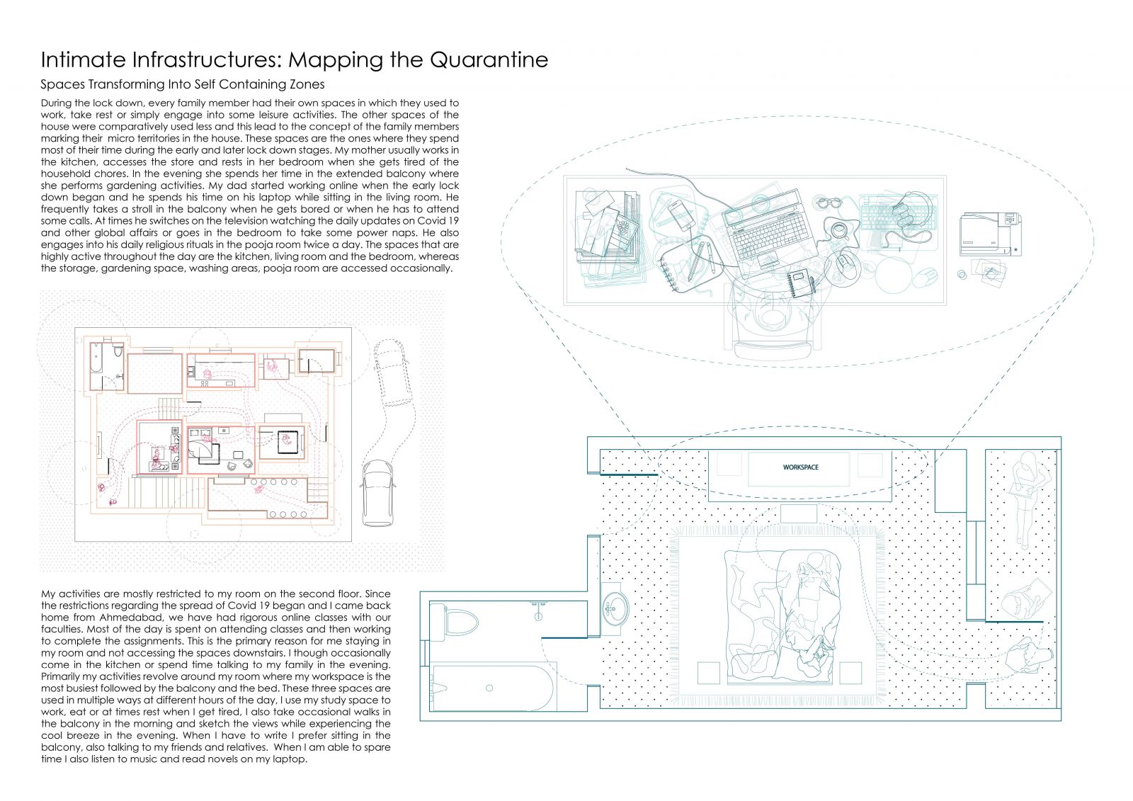
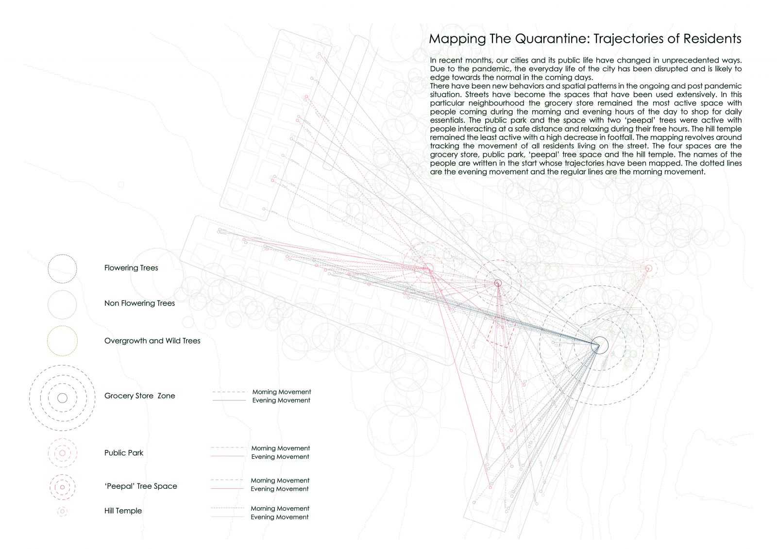
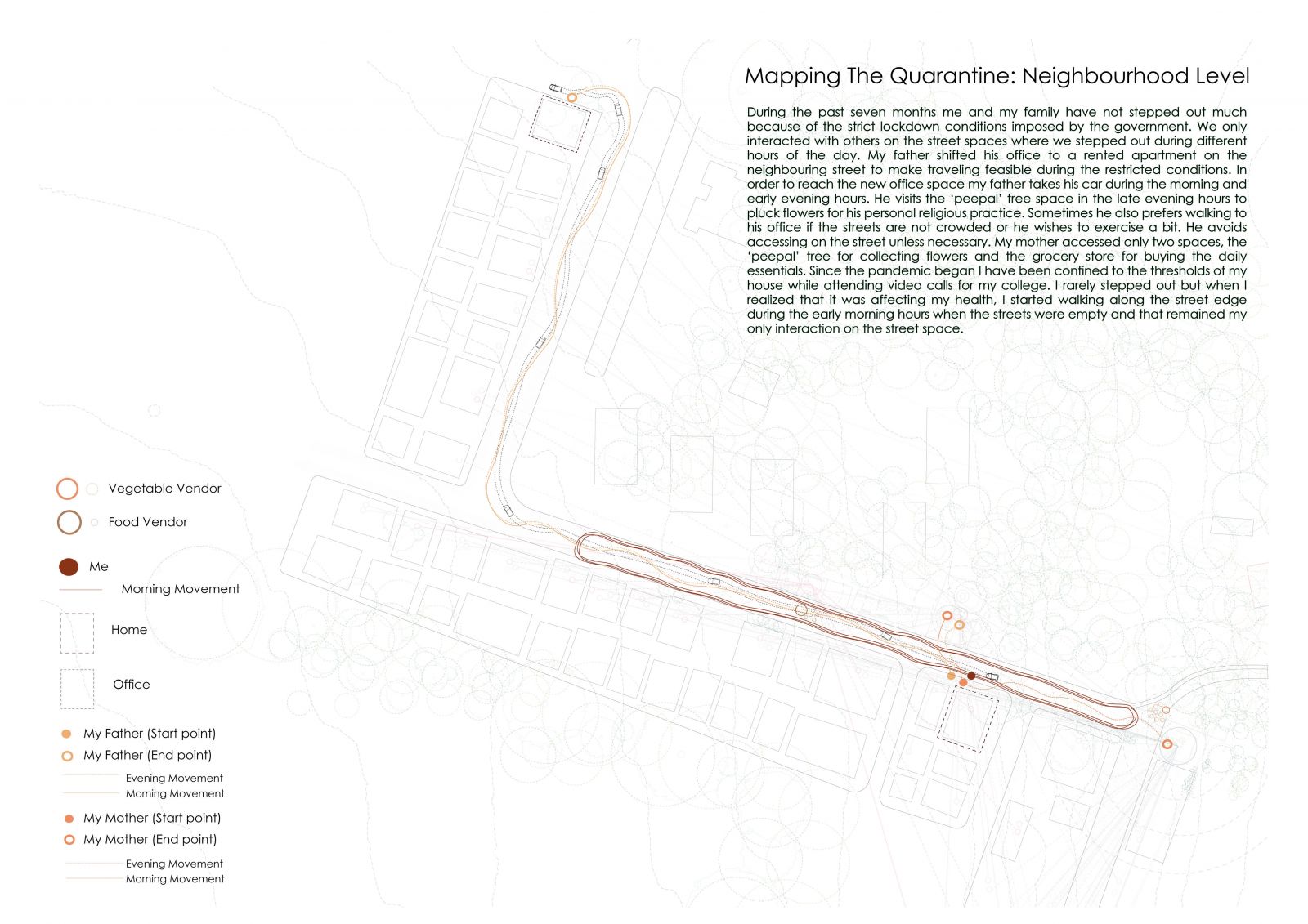
During the global COVID 19 pandemic, people remained confined to their households and neighbouring streets, the only spaces that remained active. This project aims to analyze the difference in activities and how the living style and movement patterns changed both inside homes and on a neighbourhood scale. Understanding how differently were spaces being used and the reasons behind the many negotiations that people had to make in order to live comfortably within the spatial restrictions of the pandemic. The scale varies from household to a neighbourhood, where the trajectories of all residents are tracked through daily observations.