Your browser is out-of-date!
For a richer surfing experience on our website, please update your browser. Update my browser now!
For a richer surfing experience on our website, please update your browser. Update my browser now!
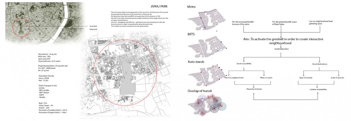
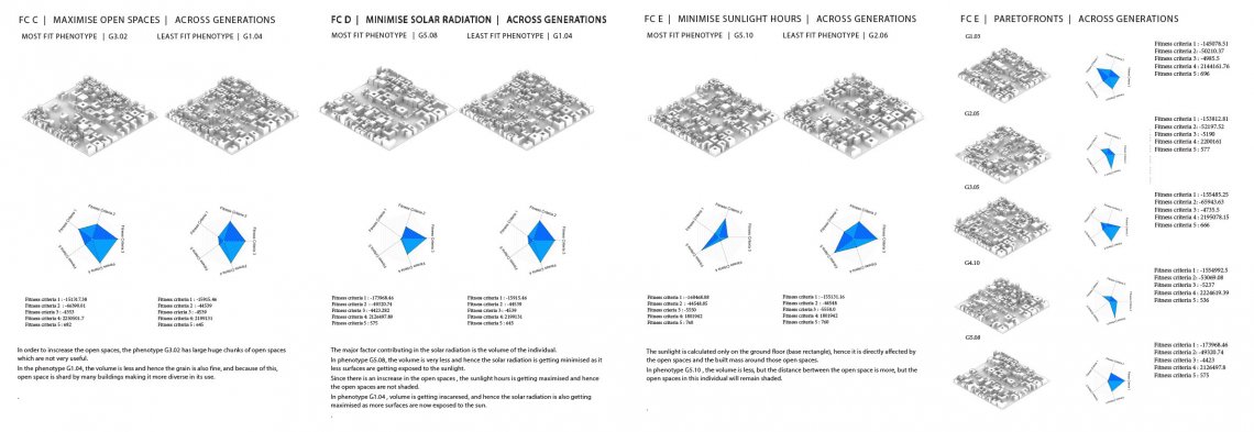
During industrialization, there was a lot of migration happening in the city. To avoid the expansion of the city after a certain limit, the greenbelt was introduced. However, it failed to retain the growth of the city. The city started expanding outside the greenbelt. The eastern greenbelt encroached completely and the western part of the greenbelt was started being encroached. The AUDA did not include a patch of the greenbelt in its boundary and hence there was no construction allowed on it. That’s why most roads have stopped on its periphery. Since the site is well connected from all the public transit modes and also have a very good potential social space, I thought of making the greenbelt active by increasing the interaction on the site. For this, I have taken a patch of 4 hectares and then tried dividing the open spaces into three levels, which is on the commercial, residential and the mixed-use and tried to develop various different networks connecting the open spaces and the main roads, so that the open spaces remain connected and easily accessible. Along with this, I have tried to make the patch mixed use with the mixed of grains and also climatic responsive which will are the parameters which may help in increasing the interaction on the site.