Your browser is out-of-date!
For a richer surfing experience on our website, please update your browser. Update my browser now!
For a richer surfing experience on our website, please update your browser. Update my browser now!
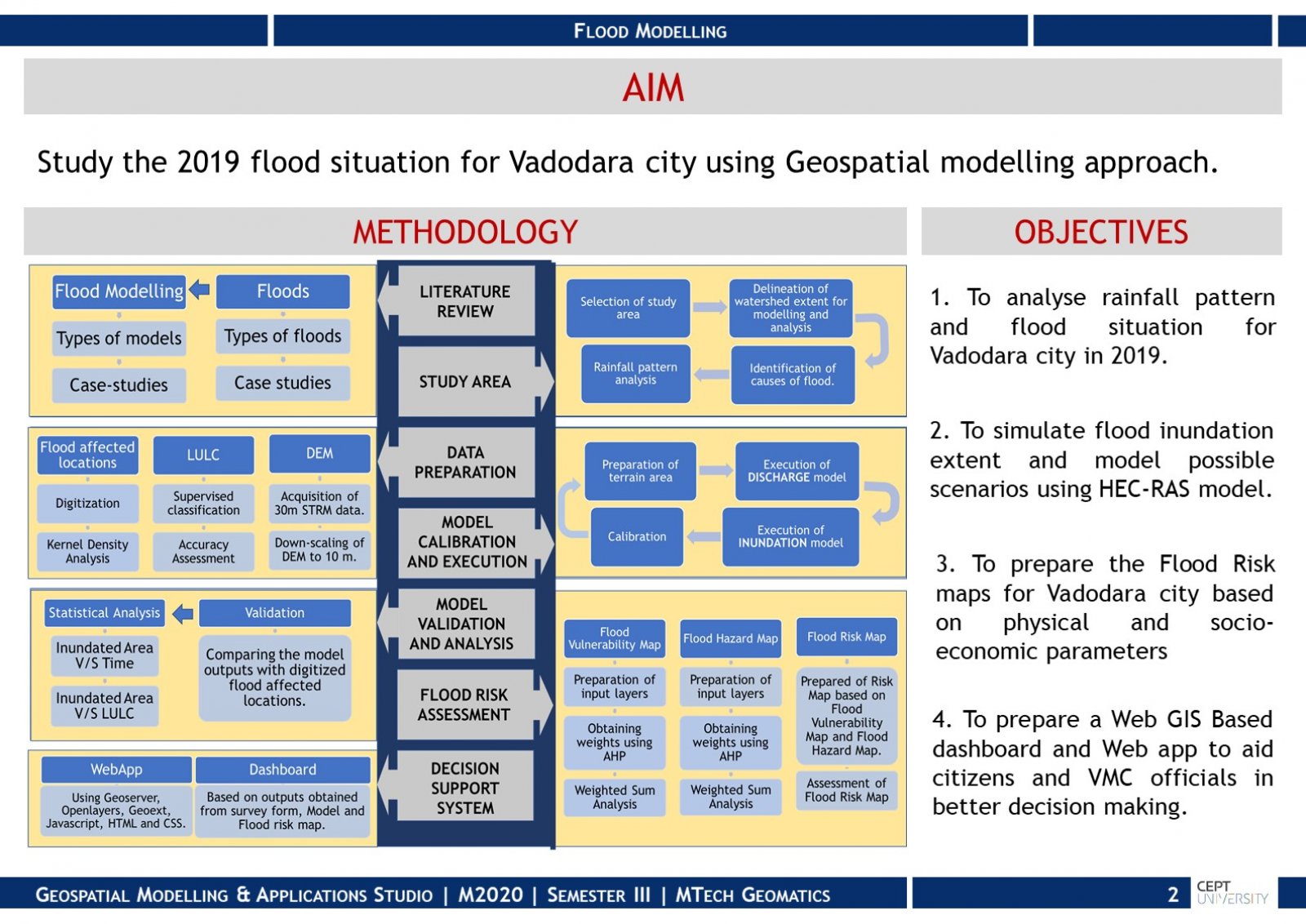
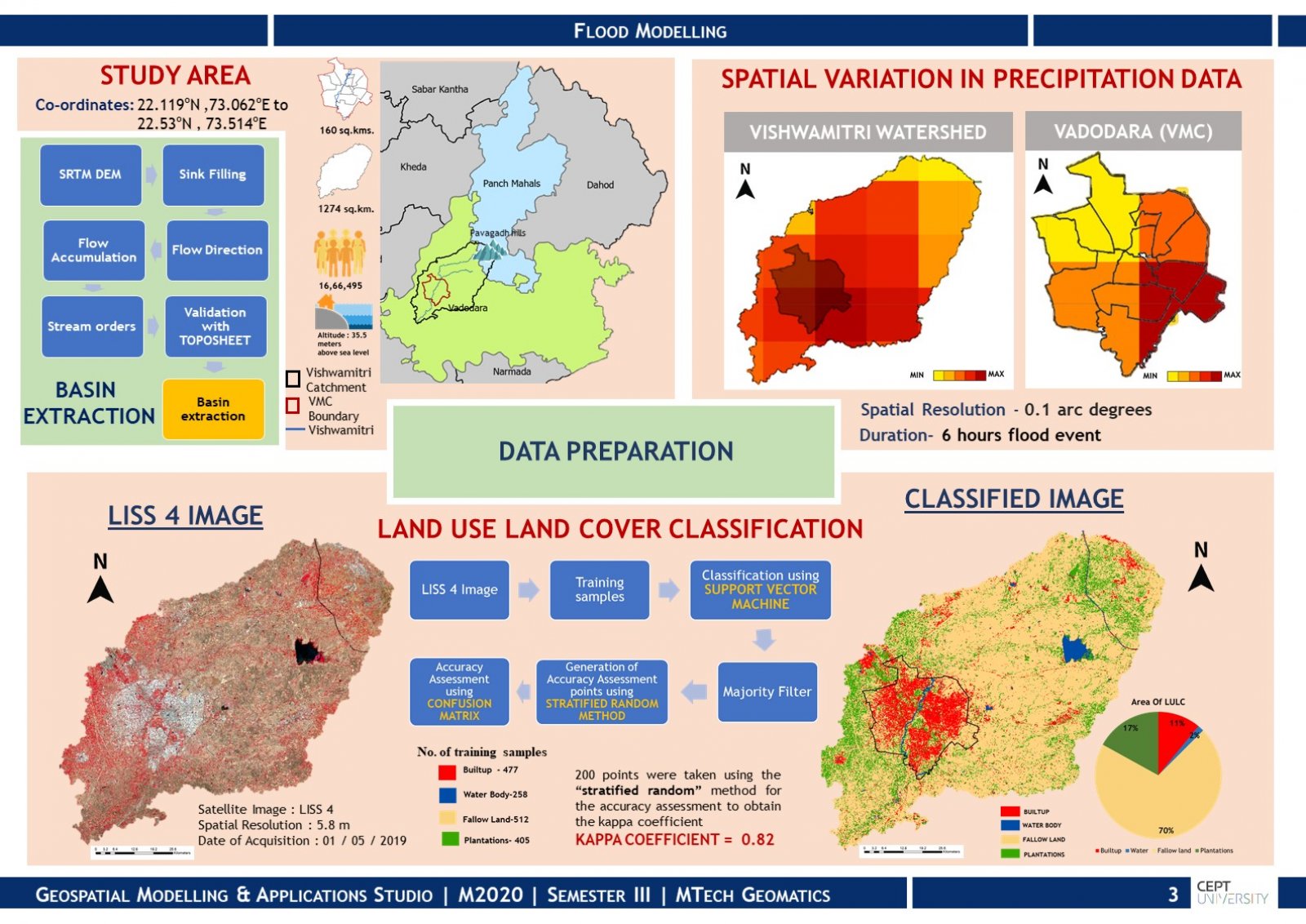
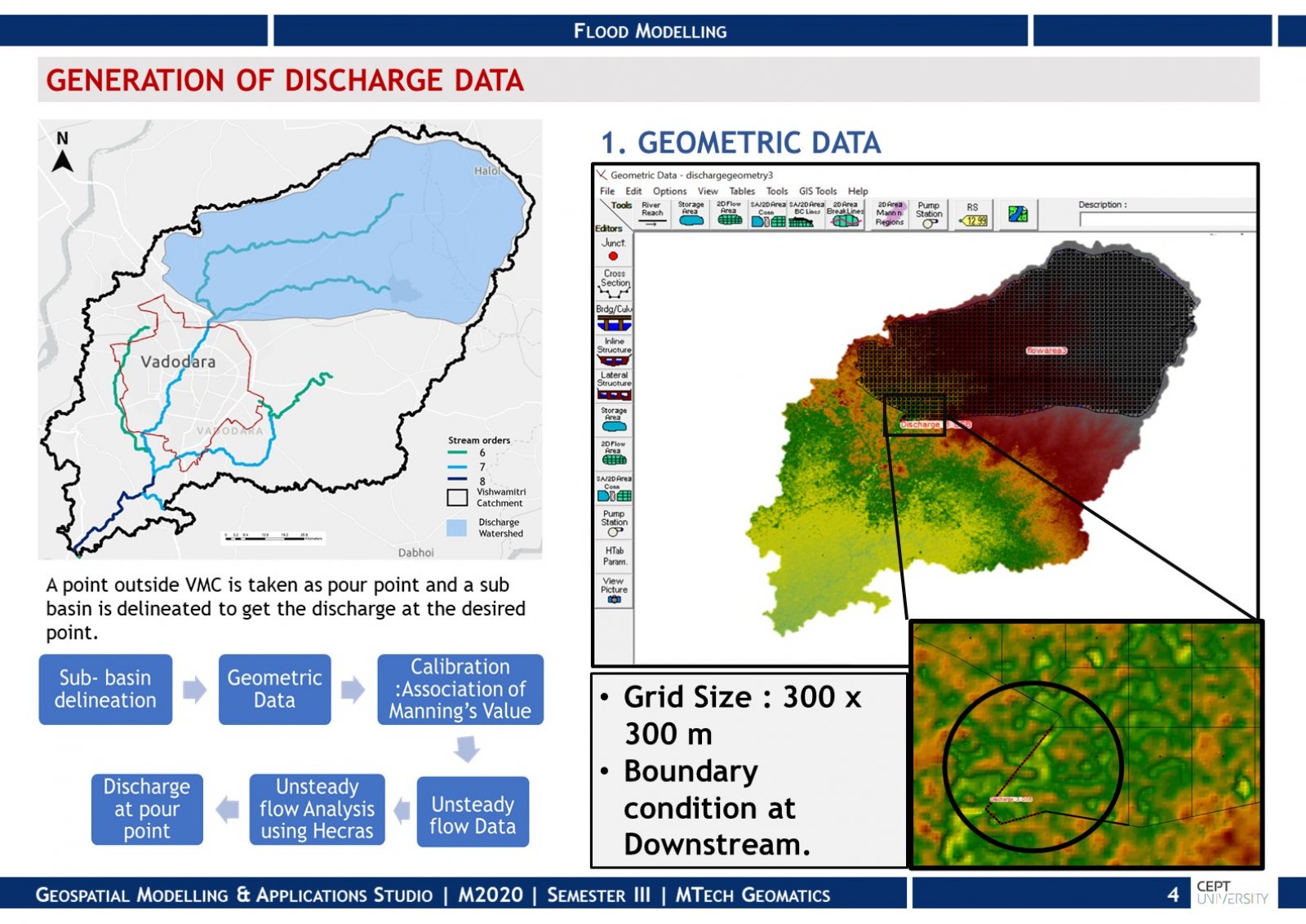
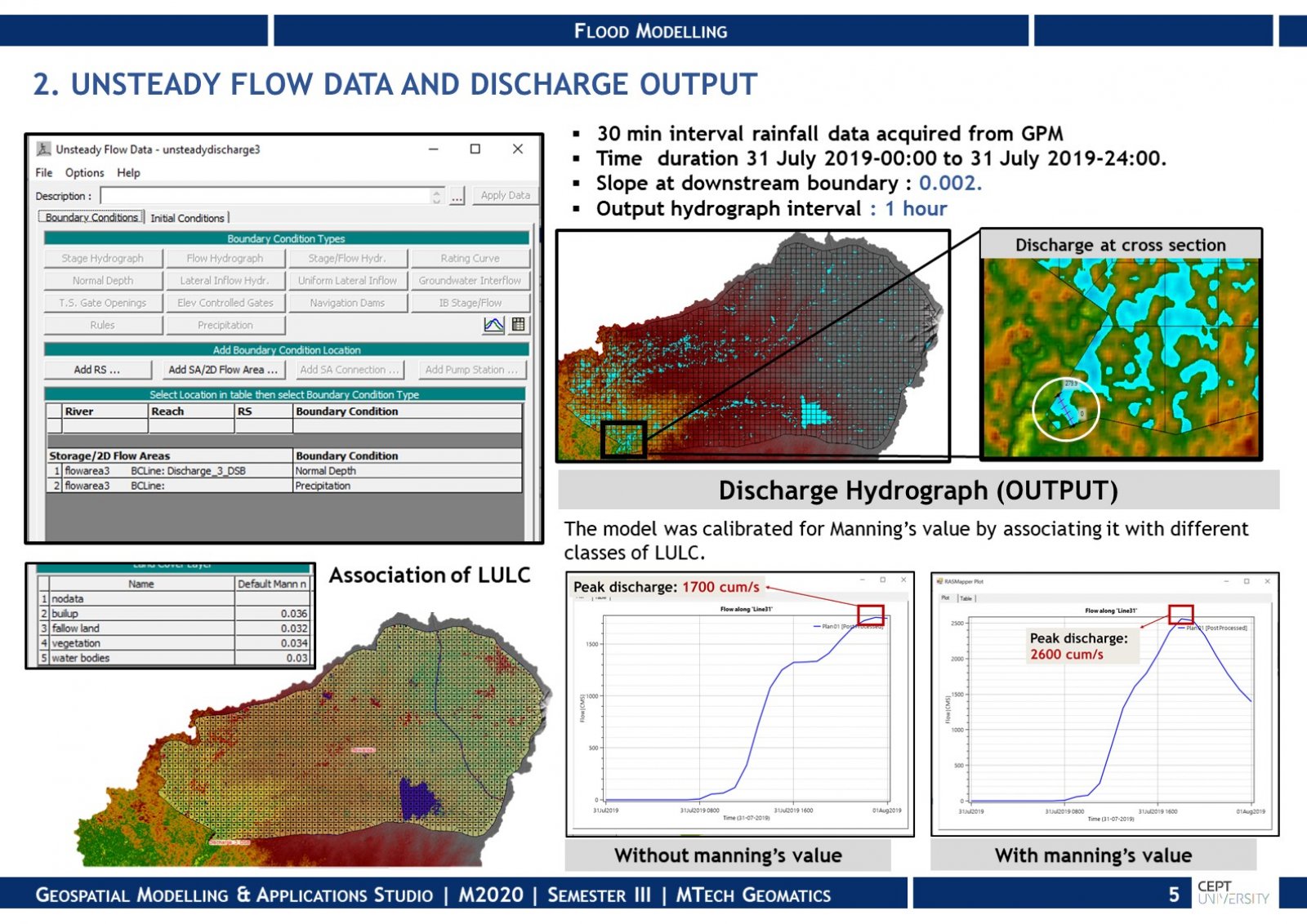
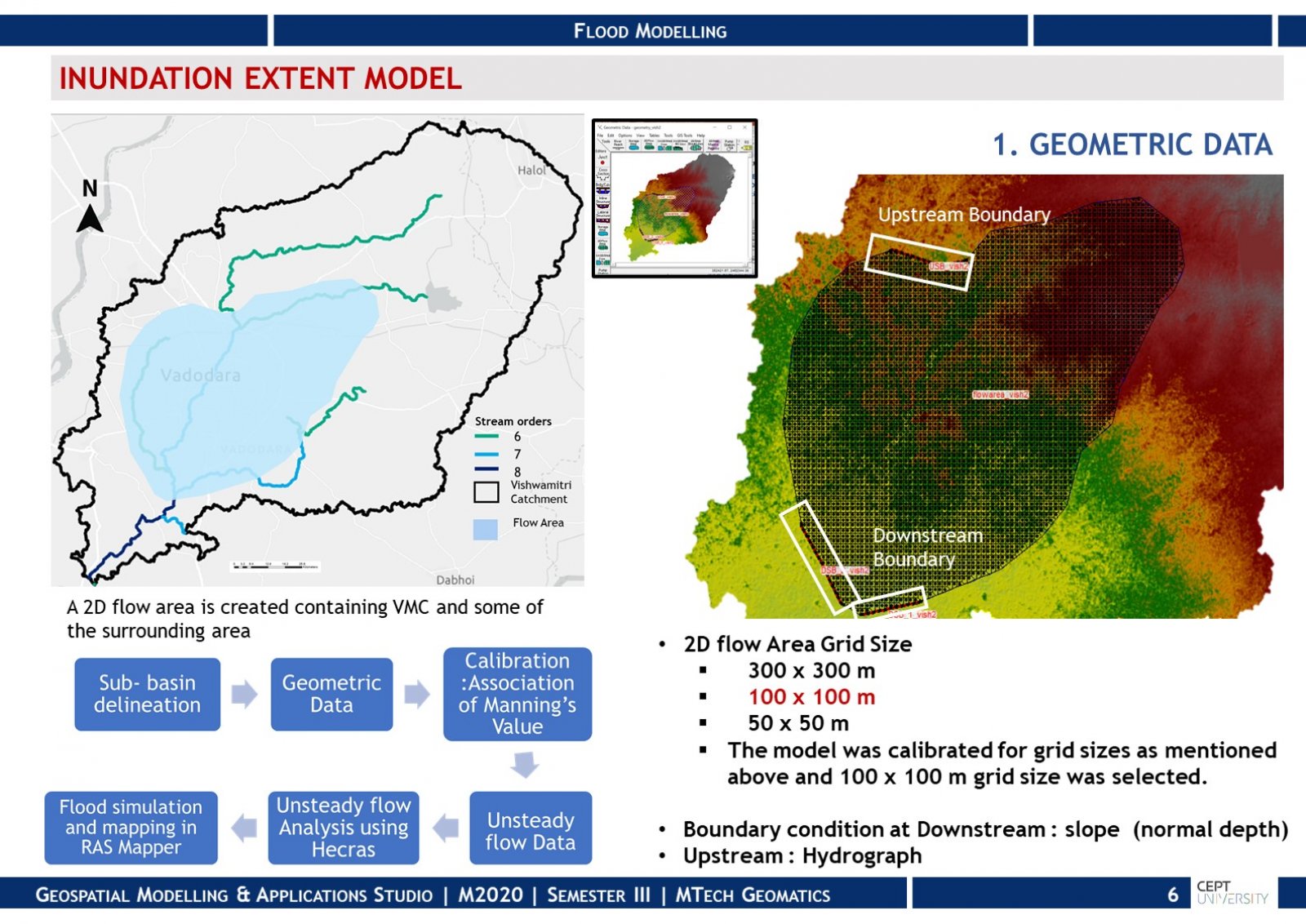
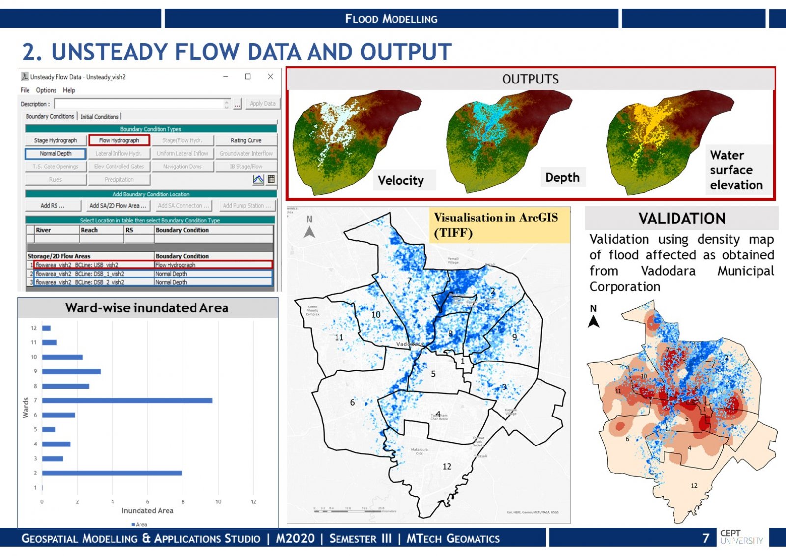
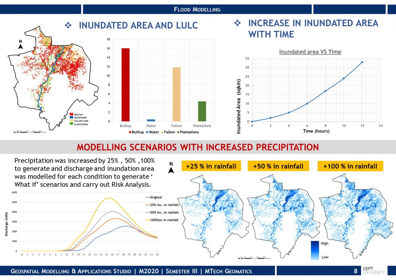
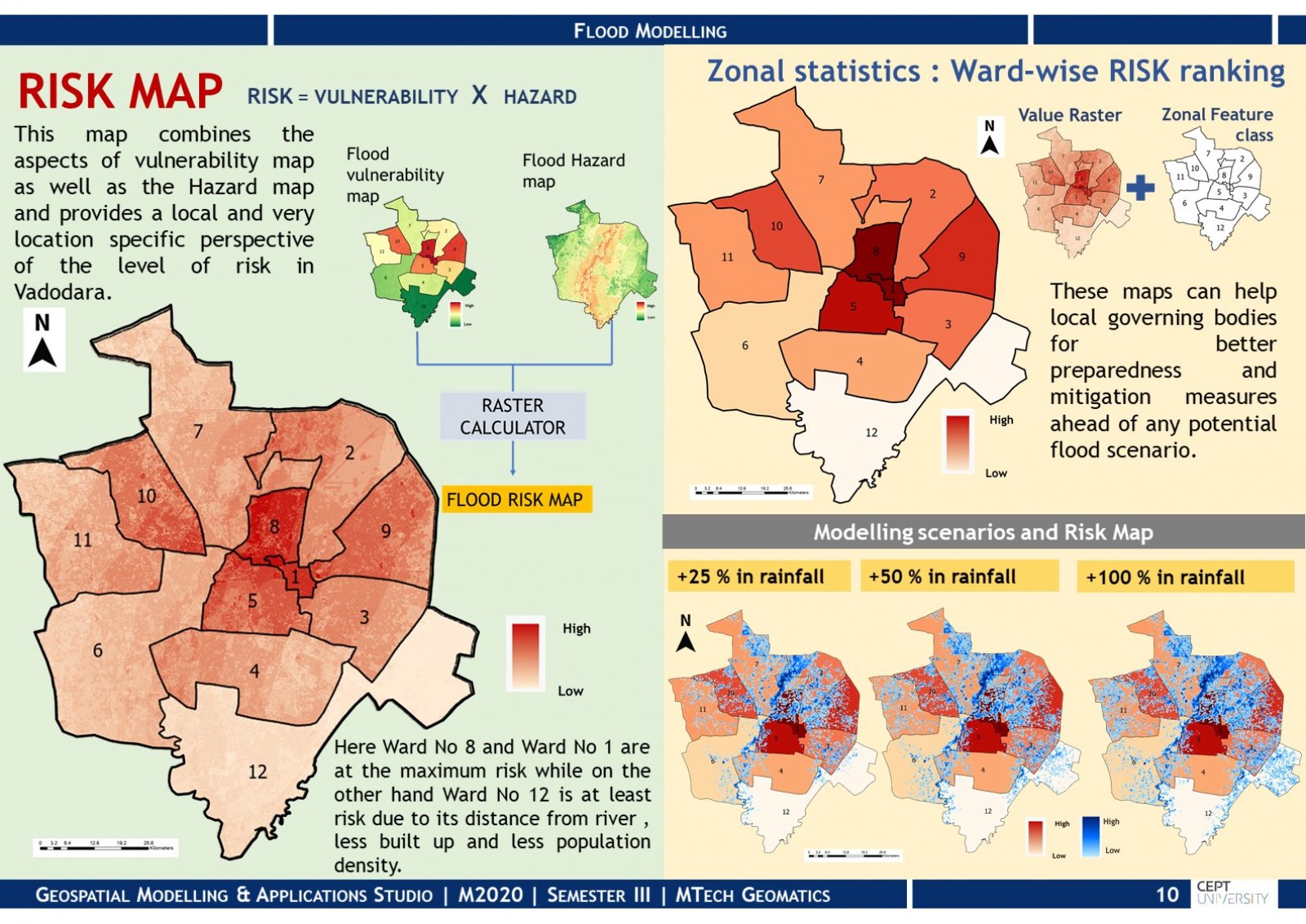
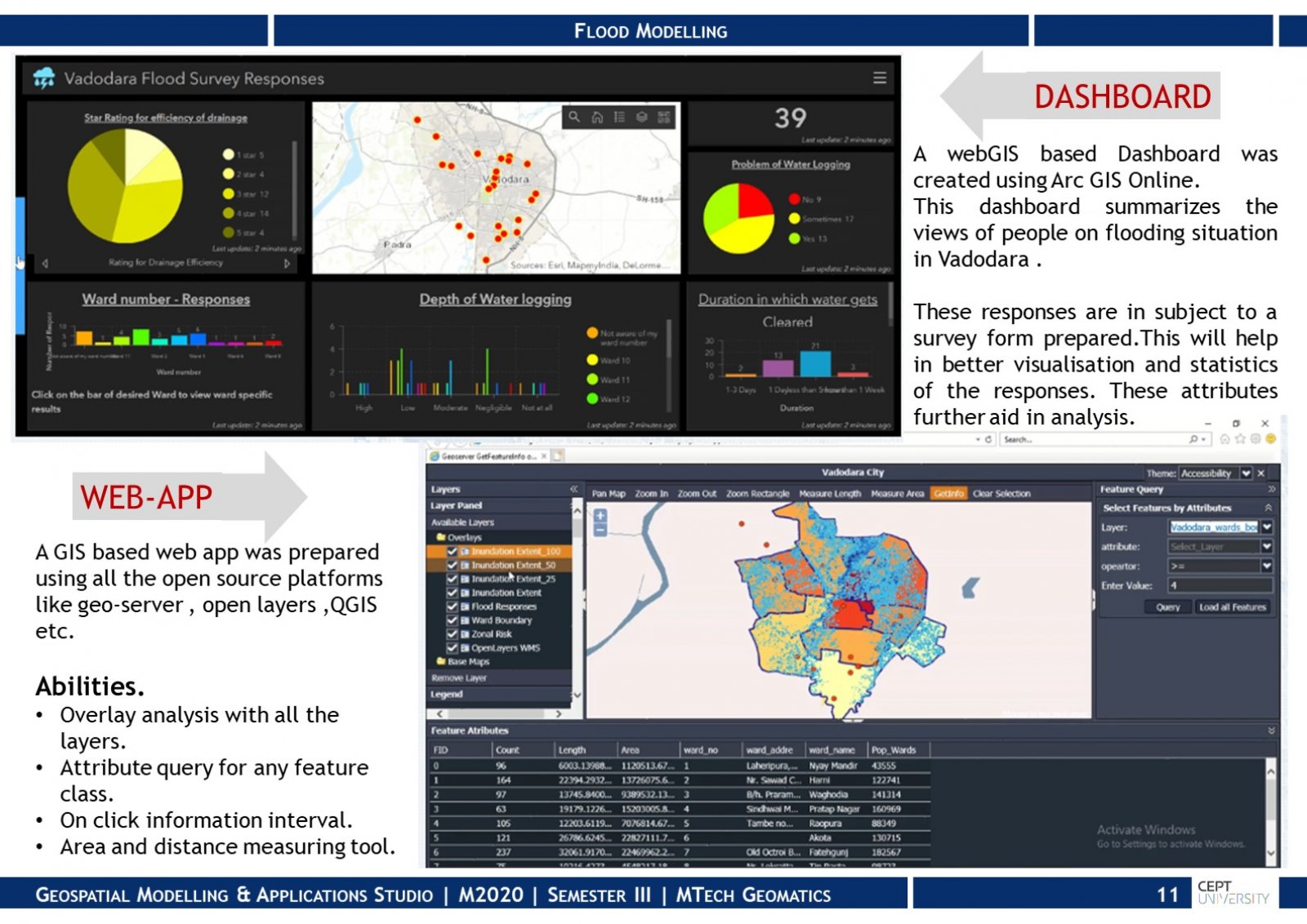
Flooding is one of the most common natural disaster that has a huge impact on life and property. Hence it is very important to simulation it for mitigation. This studio project focuses on modelling Vadodara 2019 flood by modelling the inundation areas. After validating the model, flood inundation extent was generated for increased precipitation scenarios. This study was supported by creating flood vulnerability, hazard and ward wise risk map for further analysis . To sum this up an open source GIS based WebApp and a Dashboard were prepared for better decision making and visualization.