Your browser is out-of-date!
For a richer surfing experience on our website, please update your browser. Update my browser now!
For a richer surfing experience on our website, please update your browser. Update my browser now!
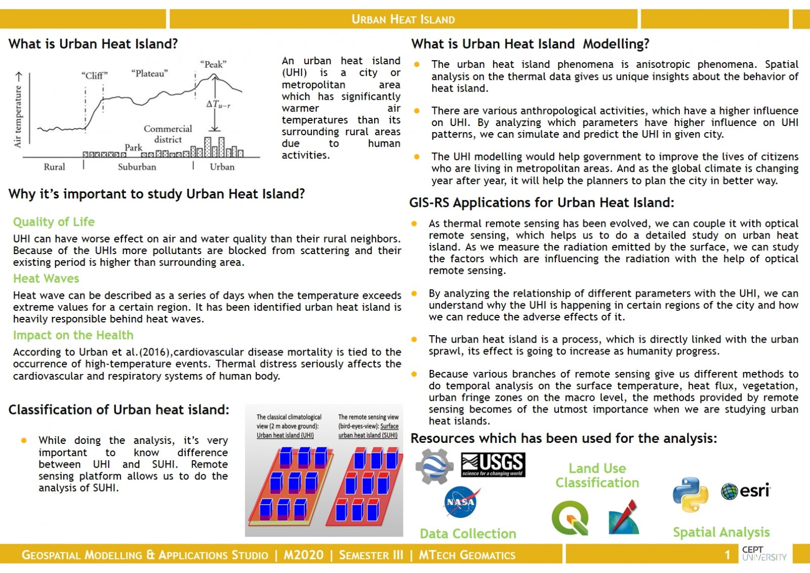
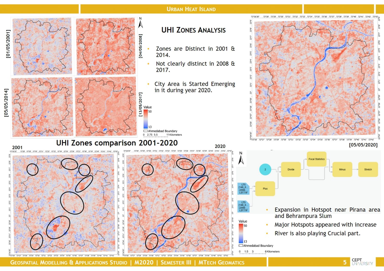
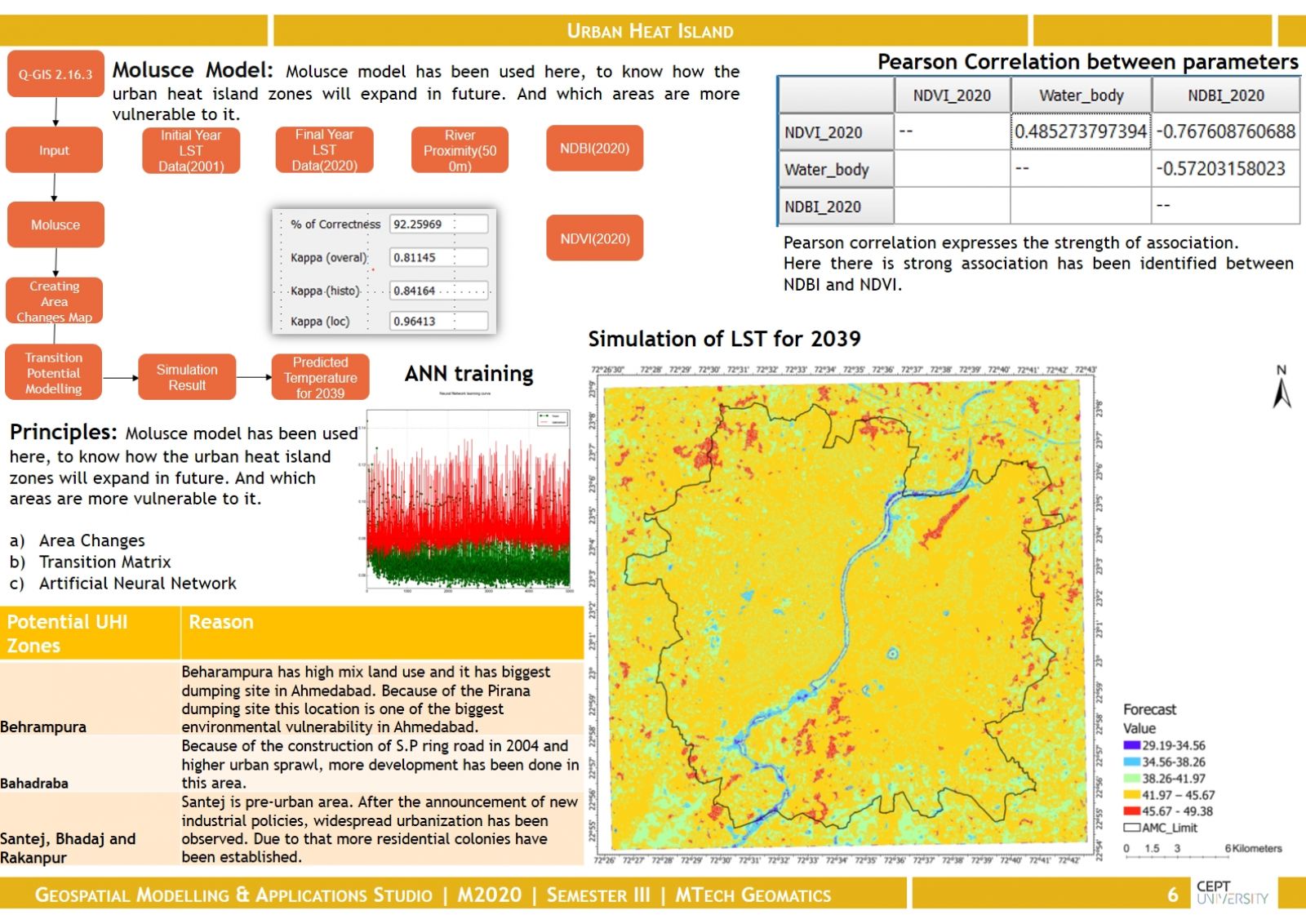
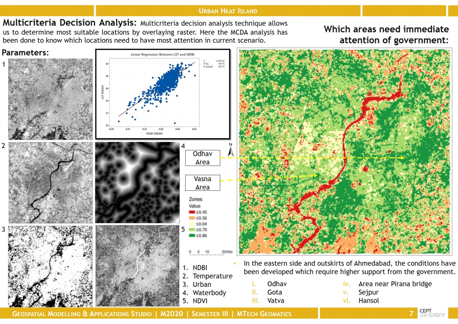
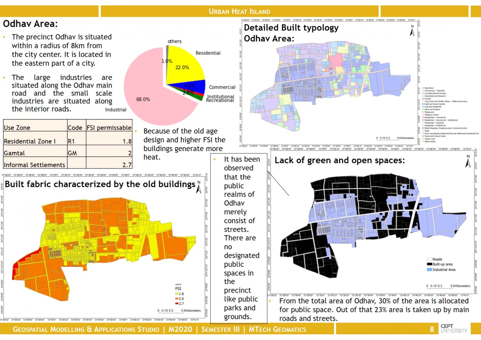
The urban heat island phenomenon is anisotropic phenomena. Spatial analysis on the thermal data gives us unique insights about the behavior of heat islands. There are various anthropological activities, which have a higher influence on UHI. We have analyzed the parameters which have a higher influence on UHI patterns, and by analyzing those parameters we have predicted UHI zones in a given city. This UHI modeling would help the government to improve the lives of citizens who are living in metropolitan areas. And as the global climate is changing year after year, it will help the planners to plan the city in a better way.