Your browser is out-of-date!
For a richer surfing experience on our website, please update your browser. Update my browser now!
For a richer surfing experience on our website, please update your browser. Update my browser now!
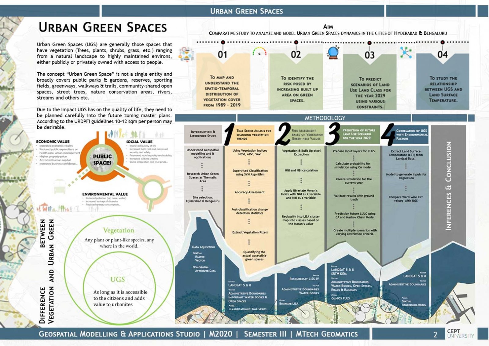
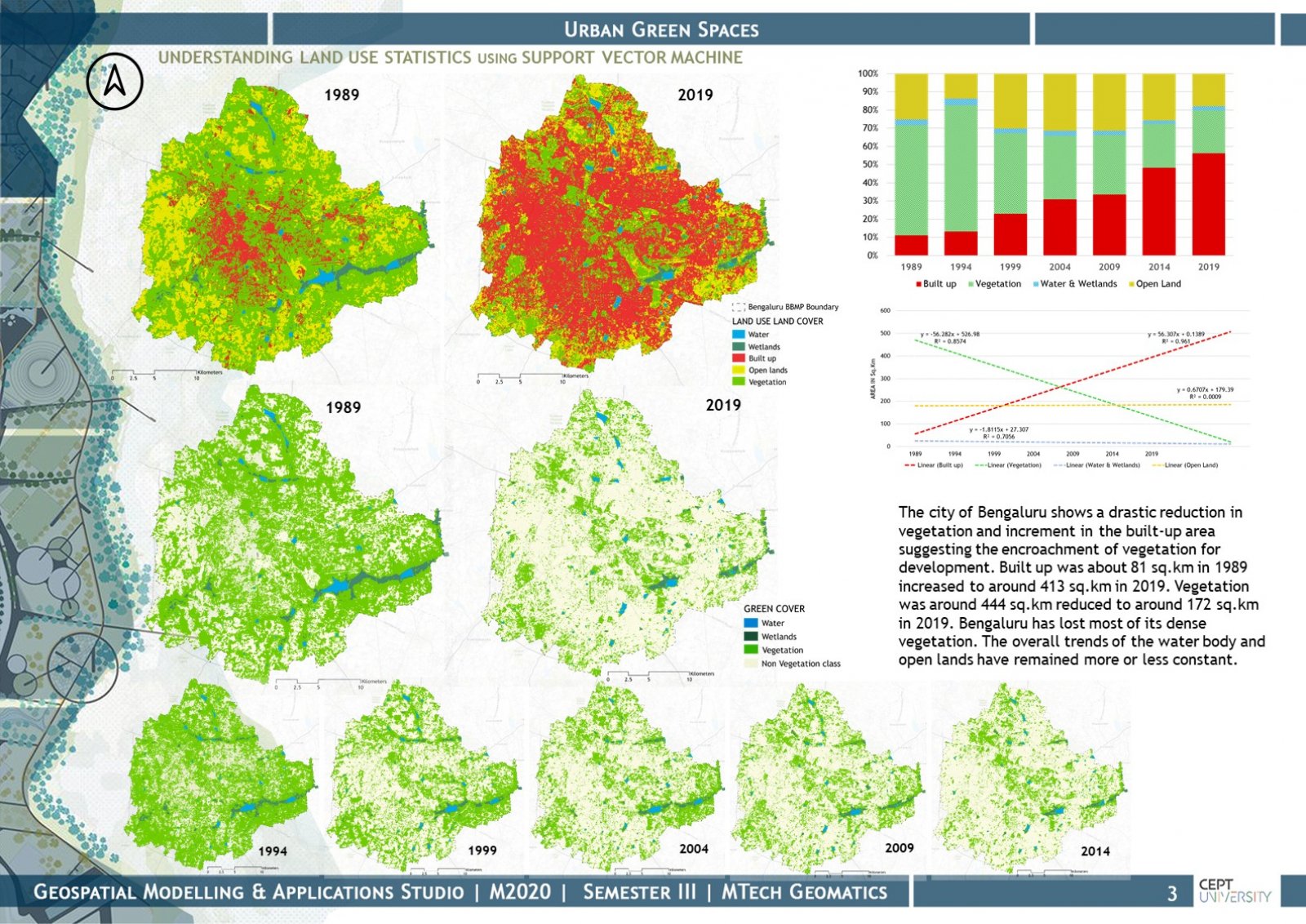
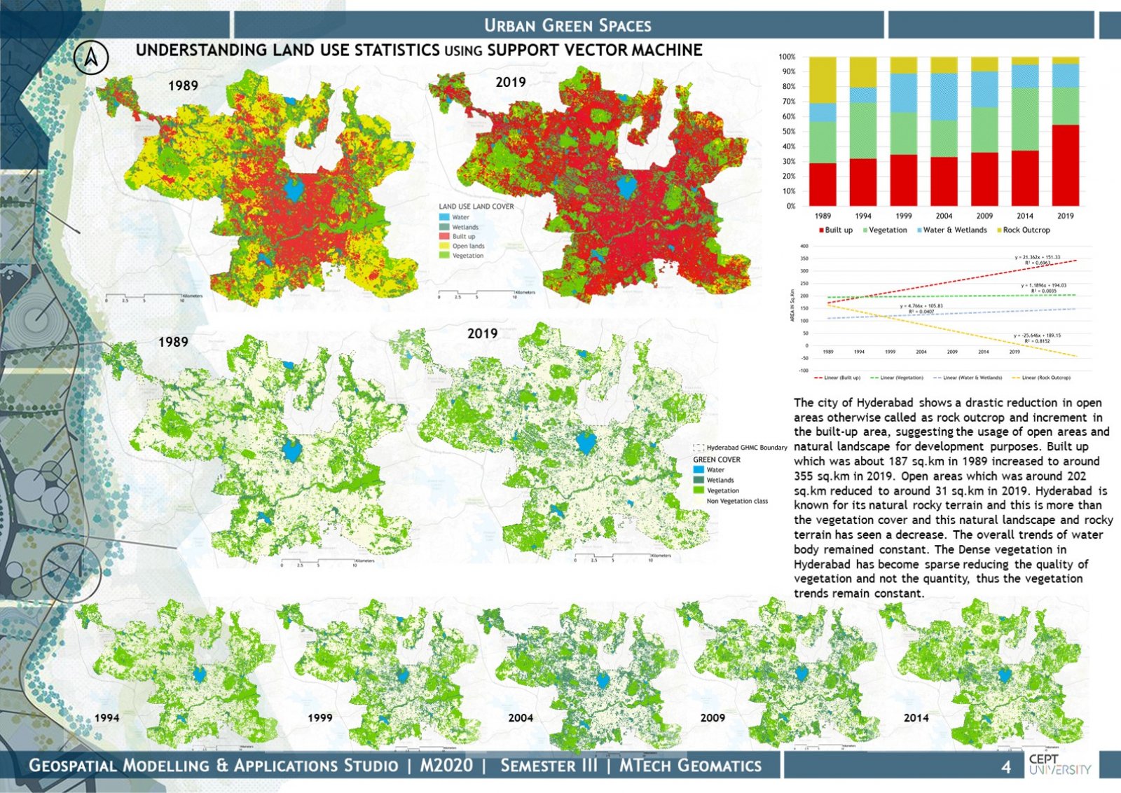
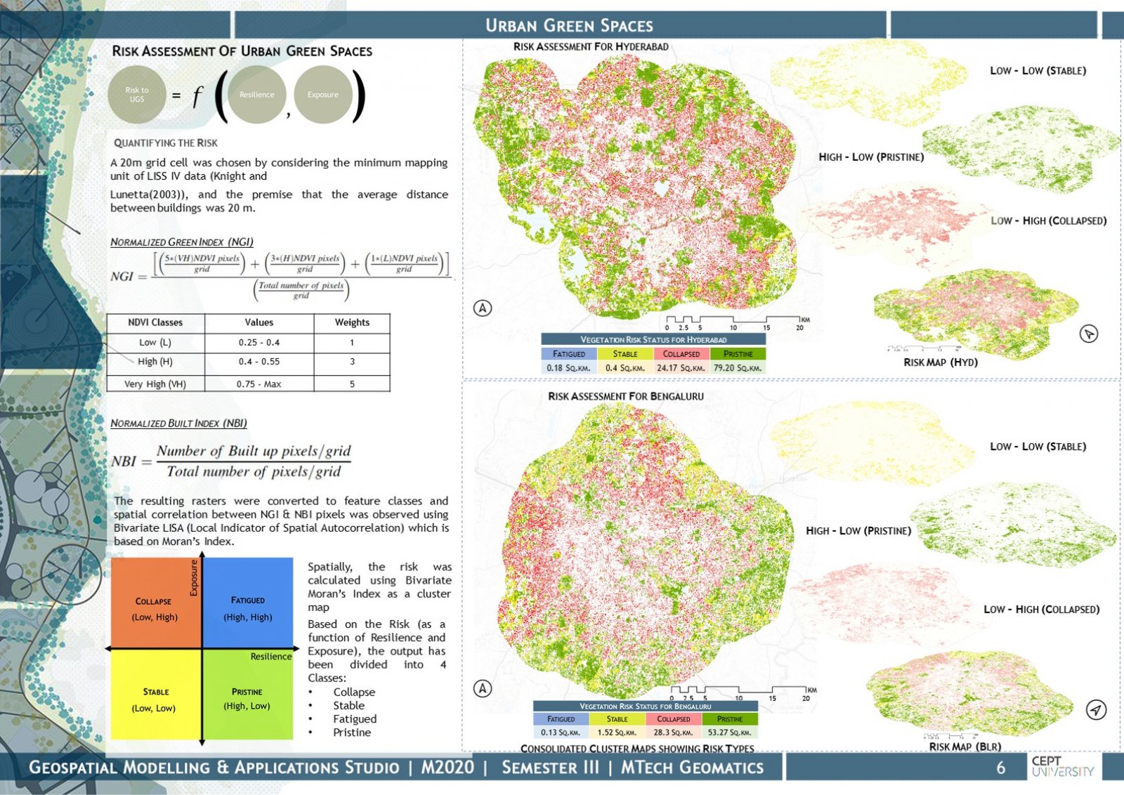
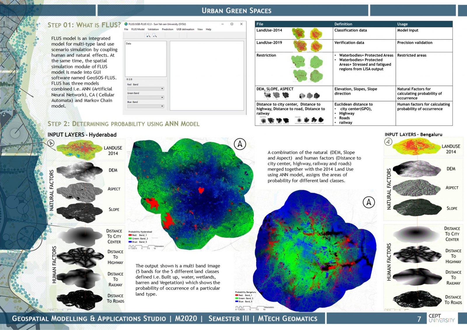
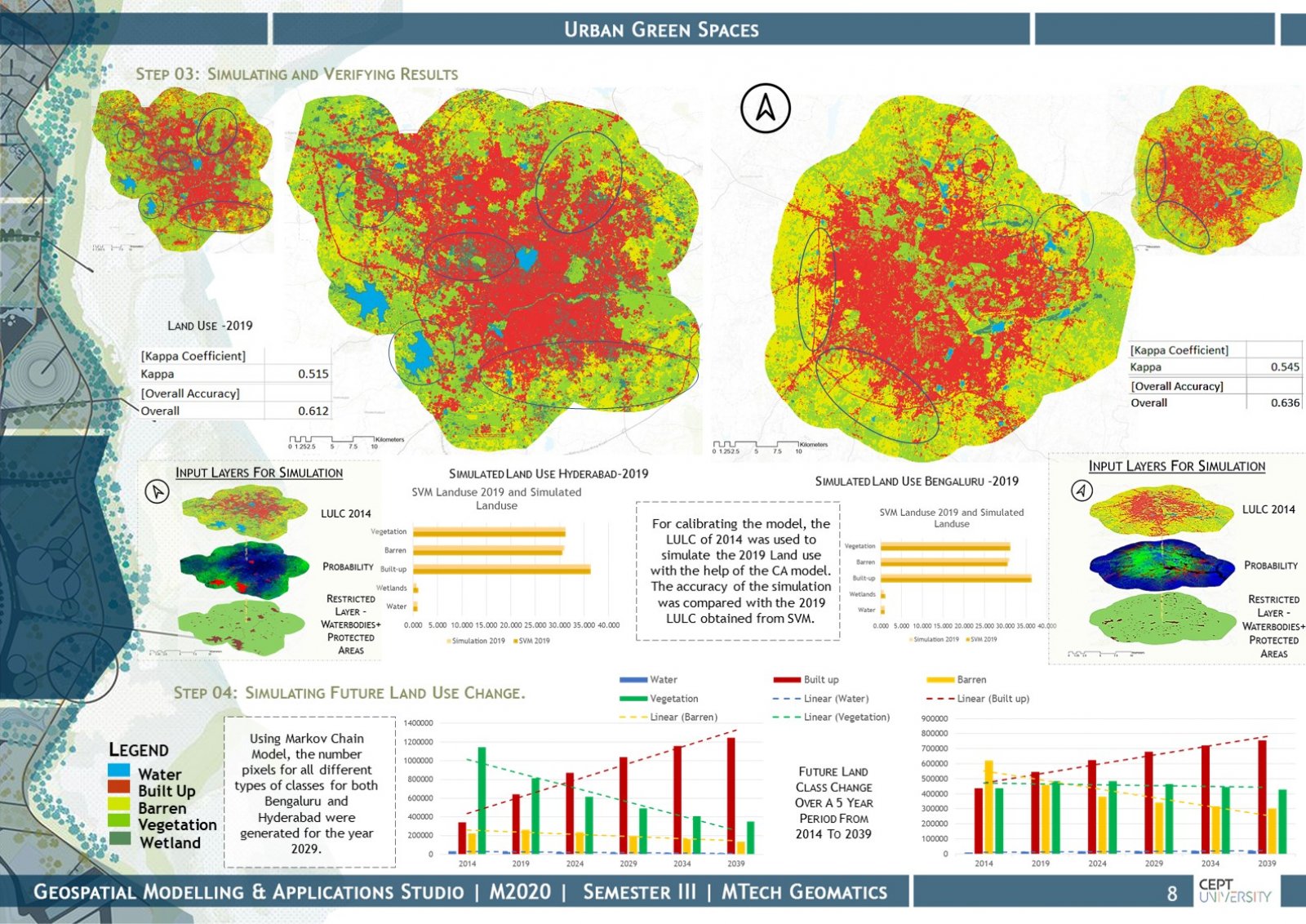
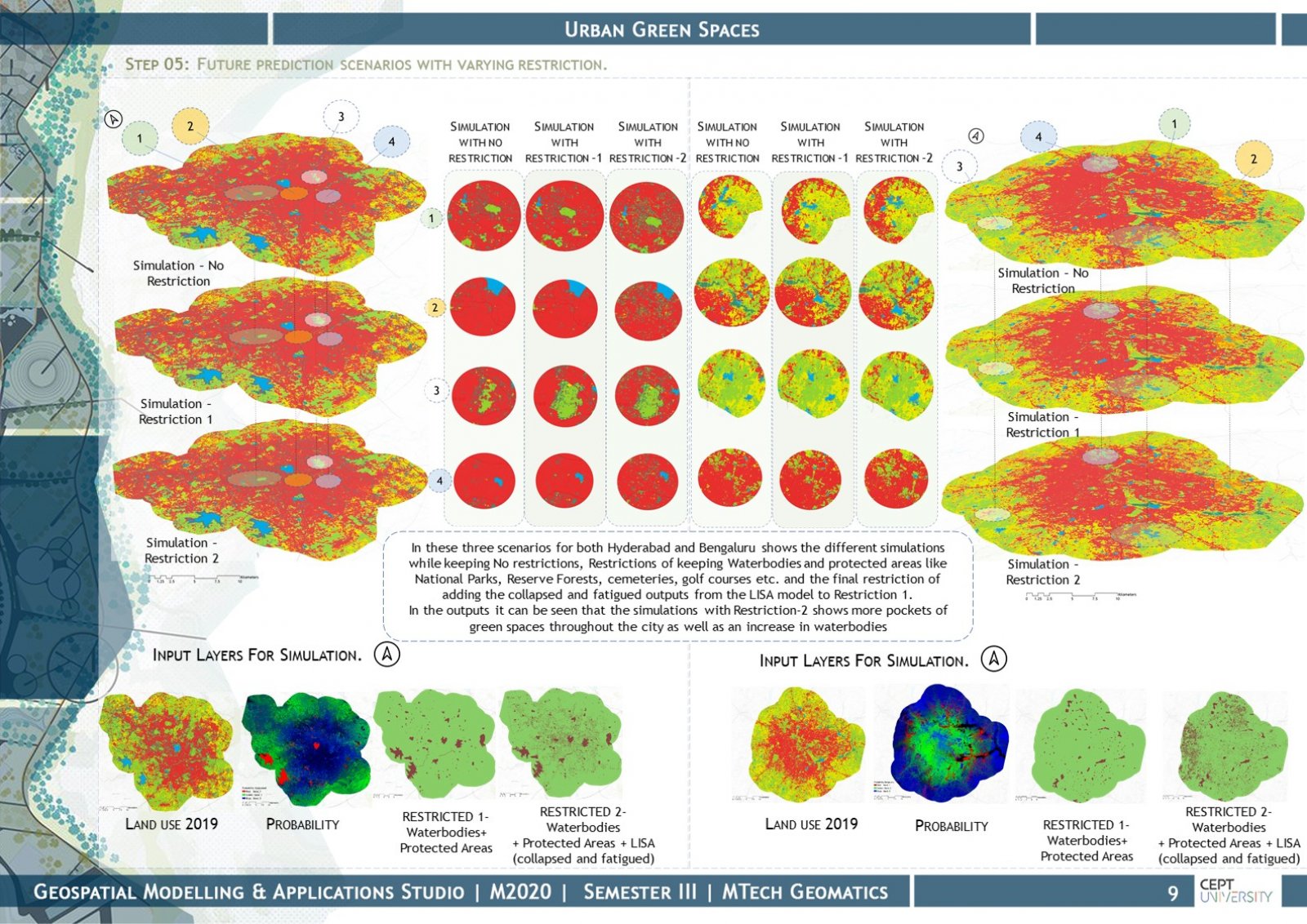
Urban Green Spaces can range from natural landscapes to highly maintained environs, either publicly or privately owned with access to citizens. Urban green spaces connect the urban fabric and nature while caring for the environment, social and economic elements. This concept is a significant part of urban design and planning especially in highly populous and rapidly growing cities like that of Hyderabad and Bengaluru (India’s X-cities). They improve the social, economic, and environmental values of the city while curbing urban sprawl in and around the city, leading to increased livability. This paper reviews the use of geospatial modeling and remotely sensed data to analyze the dynamics of urban green spaces by understanding the trends of the past, the present, and extrapolating to the future.