Your browser is out-of-date!
For a richer surfing experience on our website, please update your browser. Update my browser now!
For a richer surfing experience on our website, please update your browser. Update my browser now!
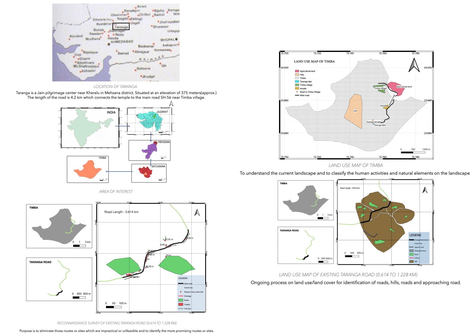
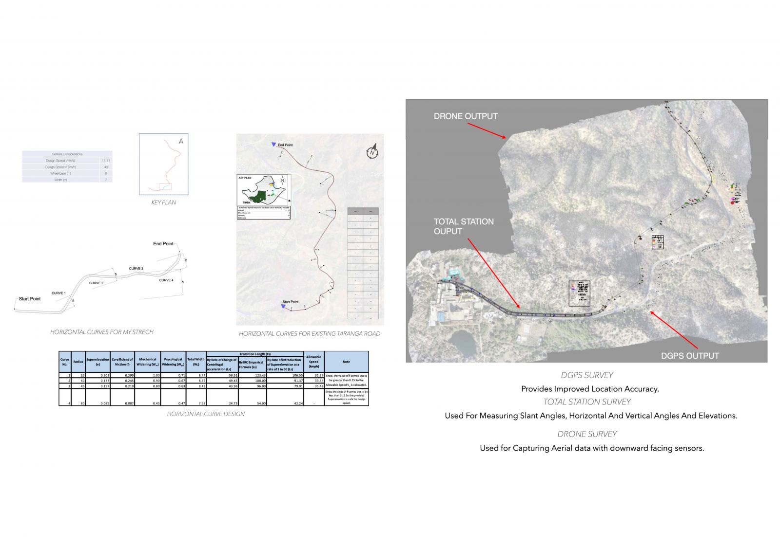
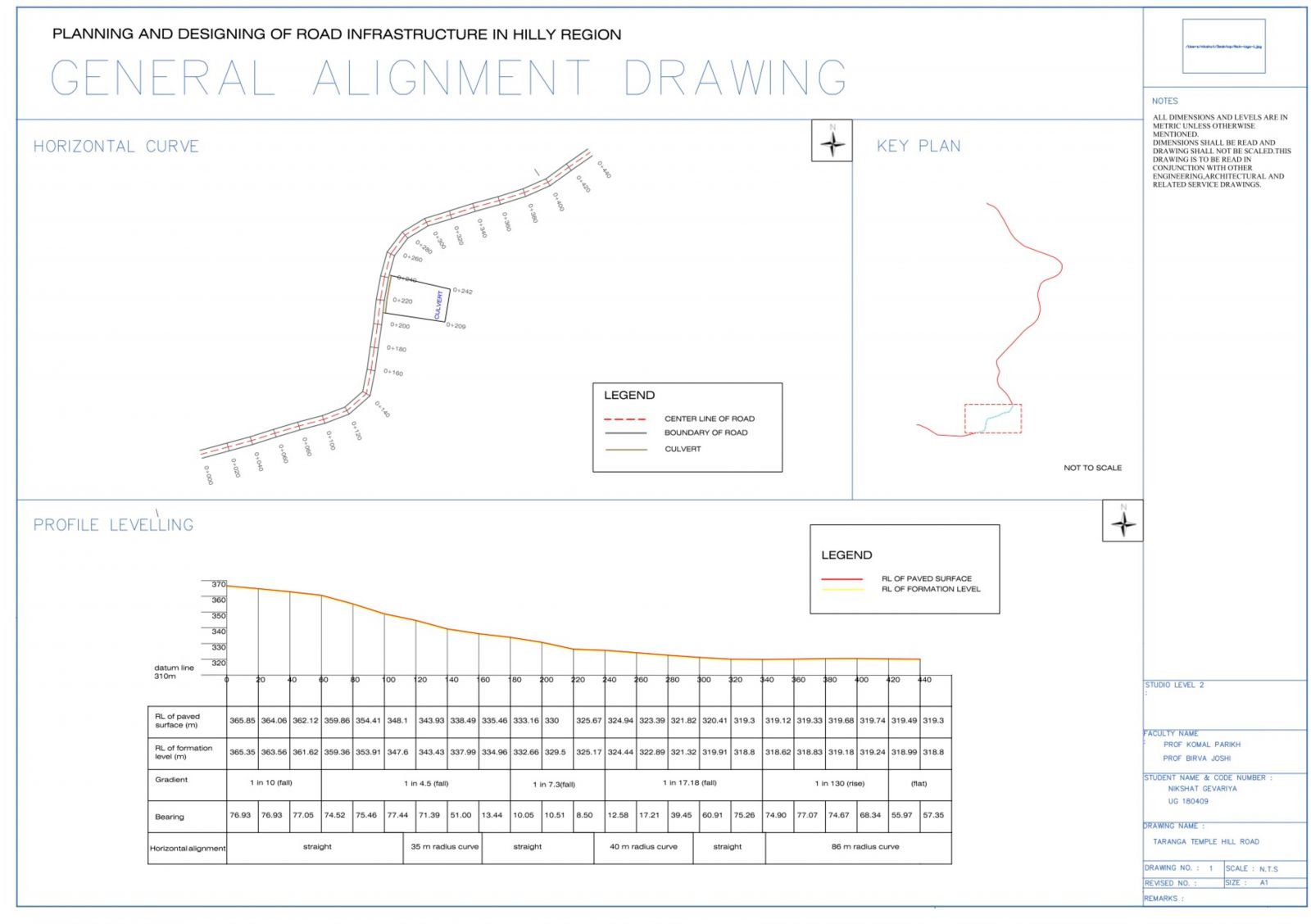
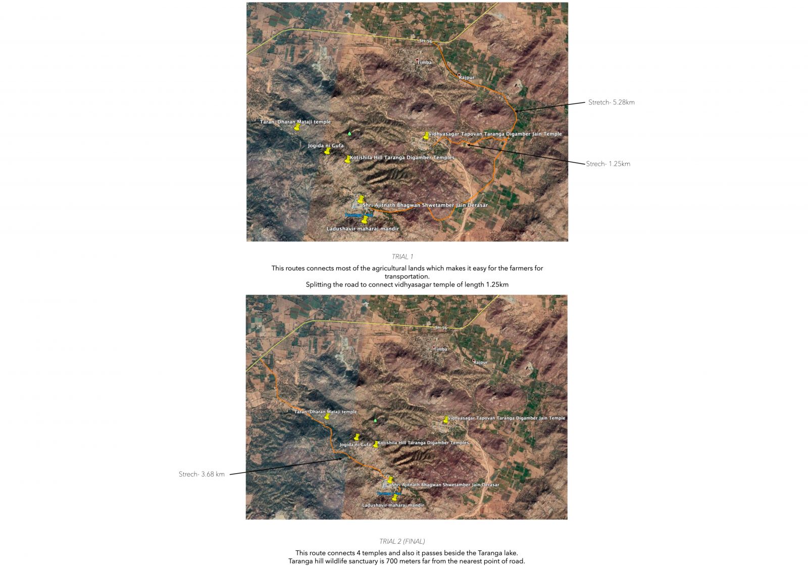
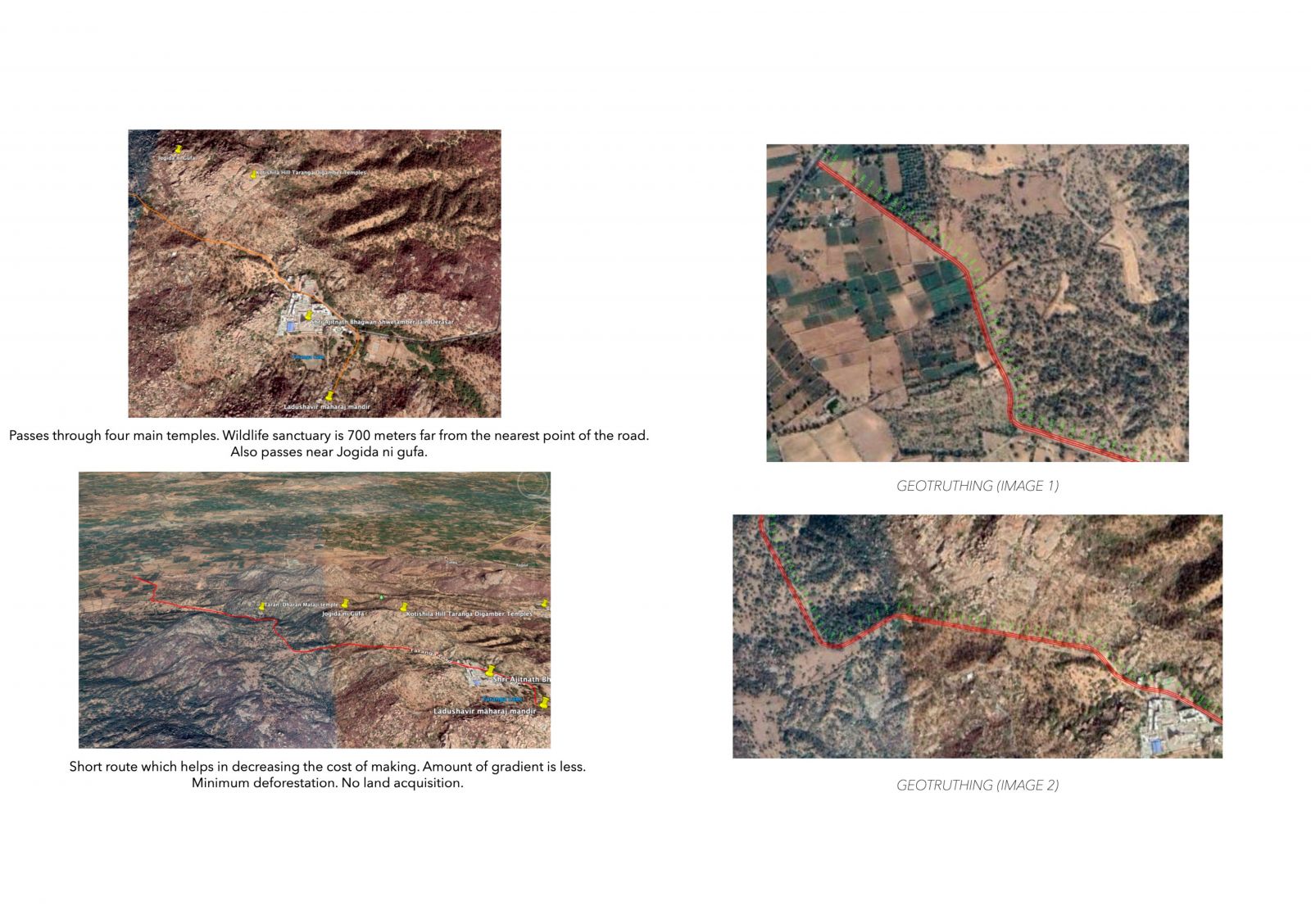
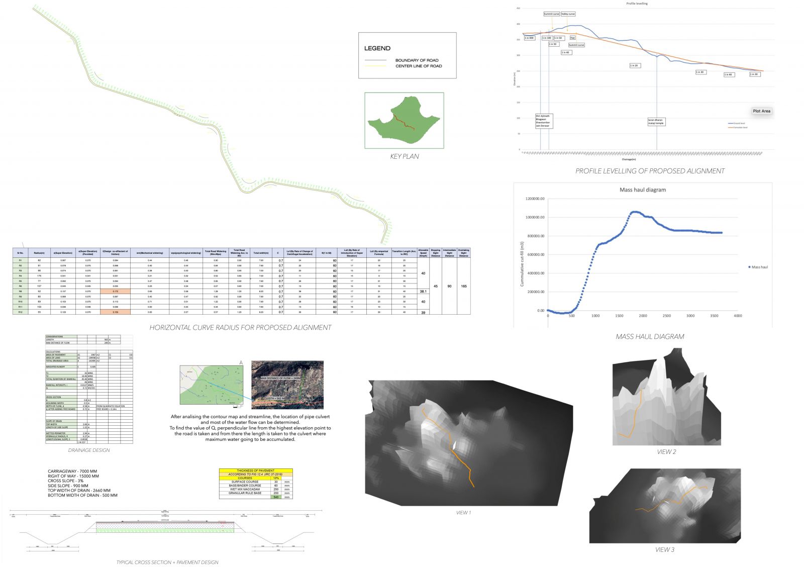
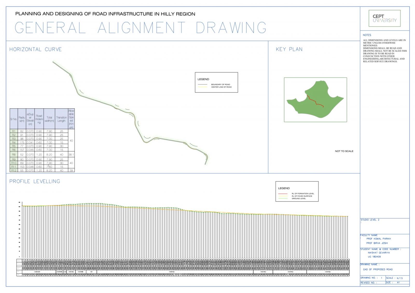
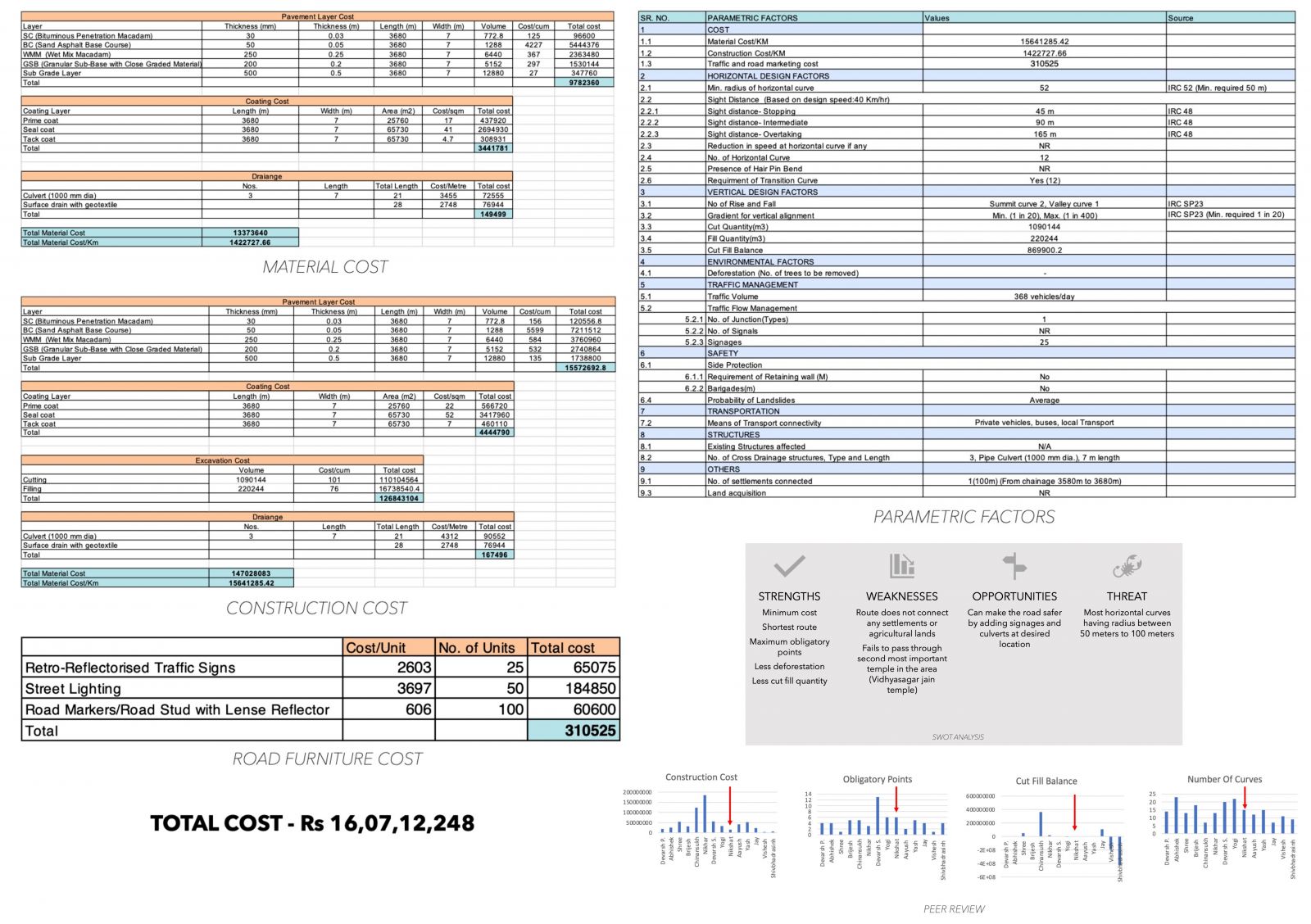
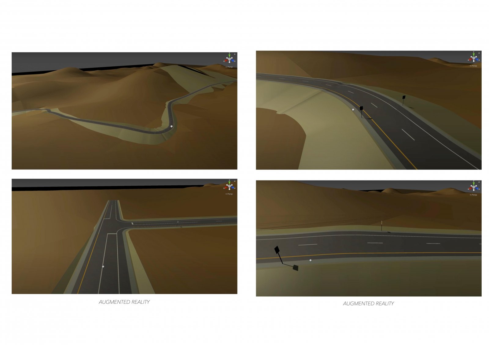
Started with the surveying of the existing taranga road using google earth pro and QGIS to collect the data for further analysis of geometric elements. After doing surveying from the data collected using DGPS, total station and drone survey, and after calculating the pavements mix design and geometric elements of the road. Two trials connecting different obligatory points and different agendas were performed. Further with the help of software, I analyzed the road elevation, gradient, streamline(STRALA), 3D model of terrain, and soil tests. The final outcome is a general alignment drawing of the proposed route which connects SH-56 to taranga temple.