• Home
  • FT
  • CT2019
  • Planning And Design Of Road Infrastructure In Hilly Regi

Aayush Vishal Palany

CT2019

Planning And Design Of Road Infrastructure In Hilly Regi

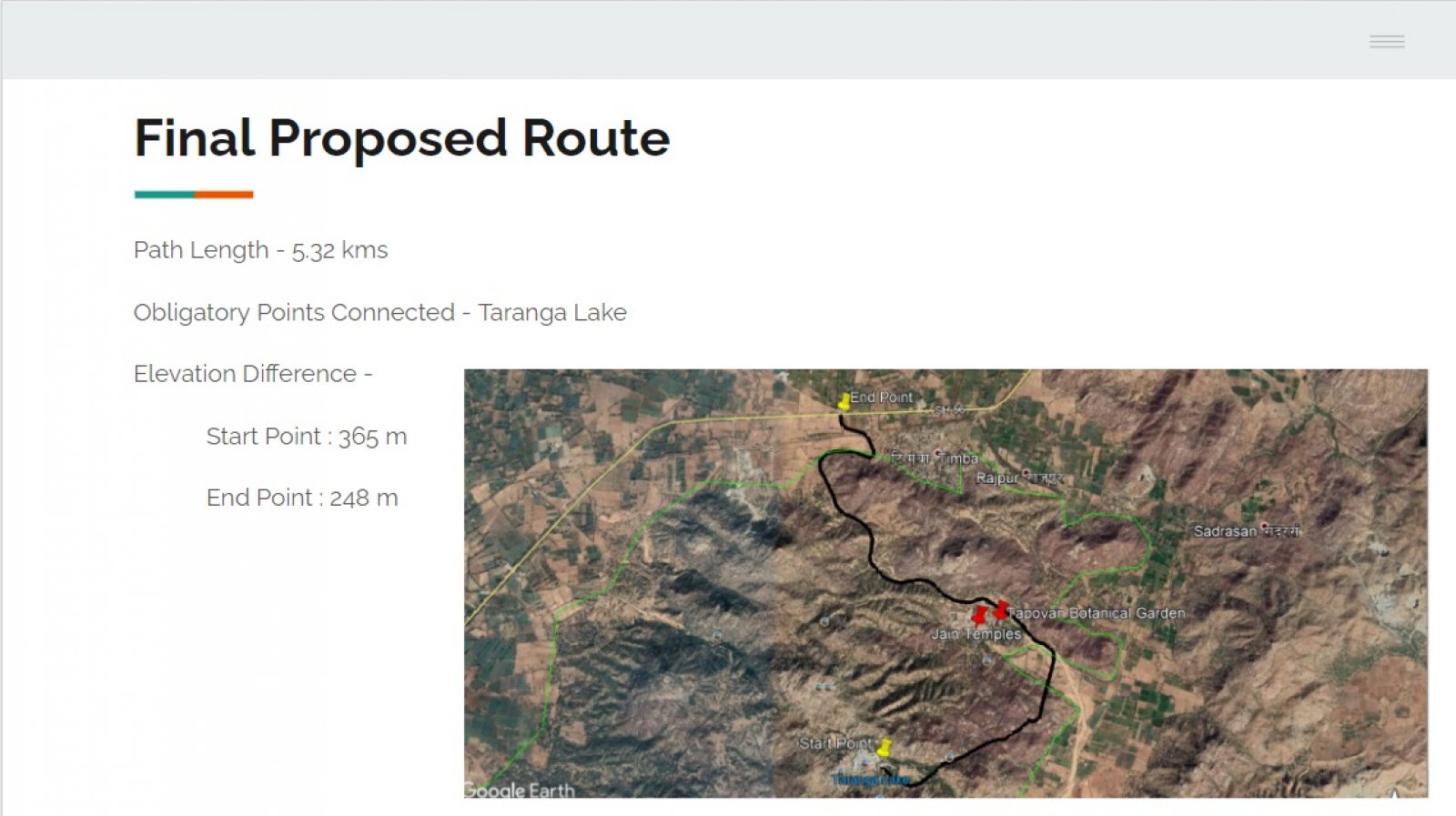
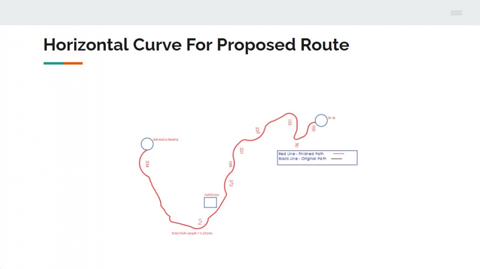
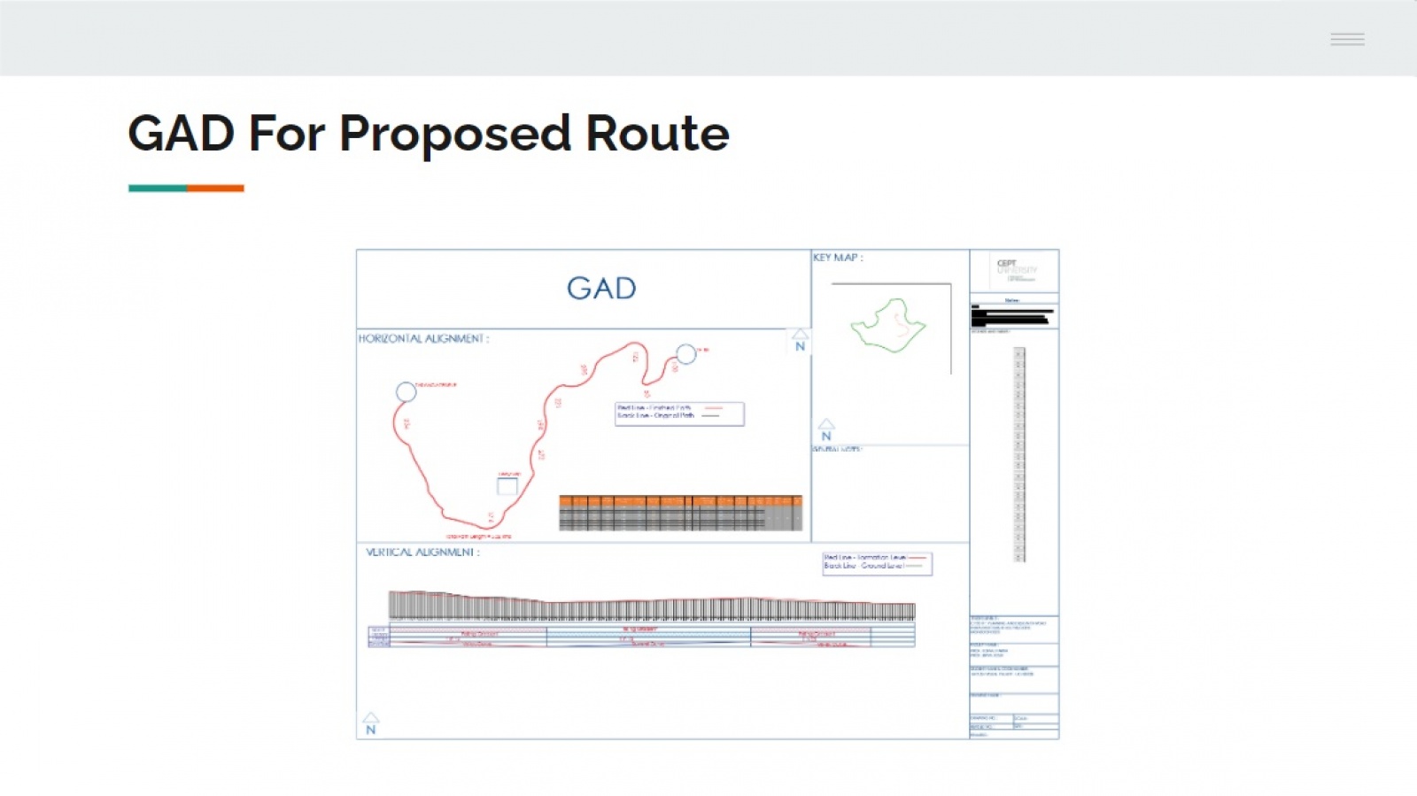
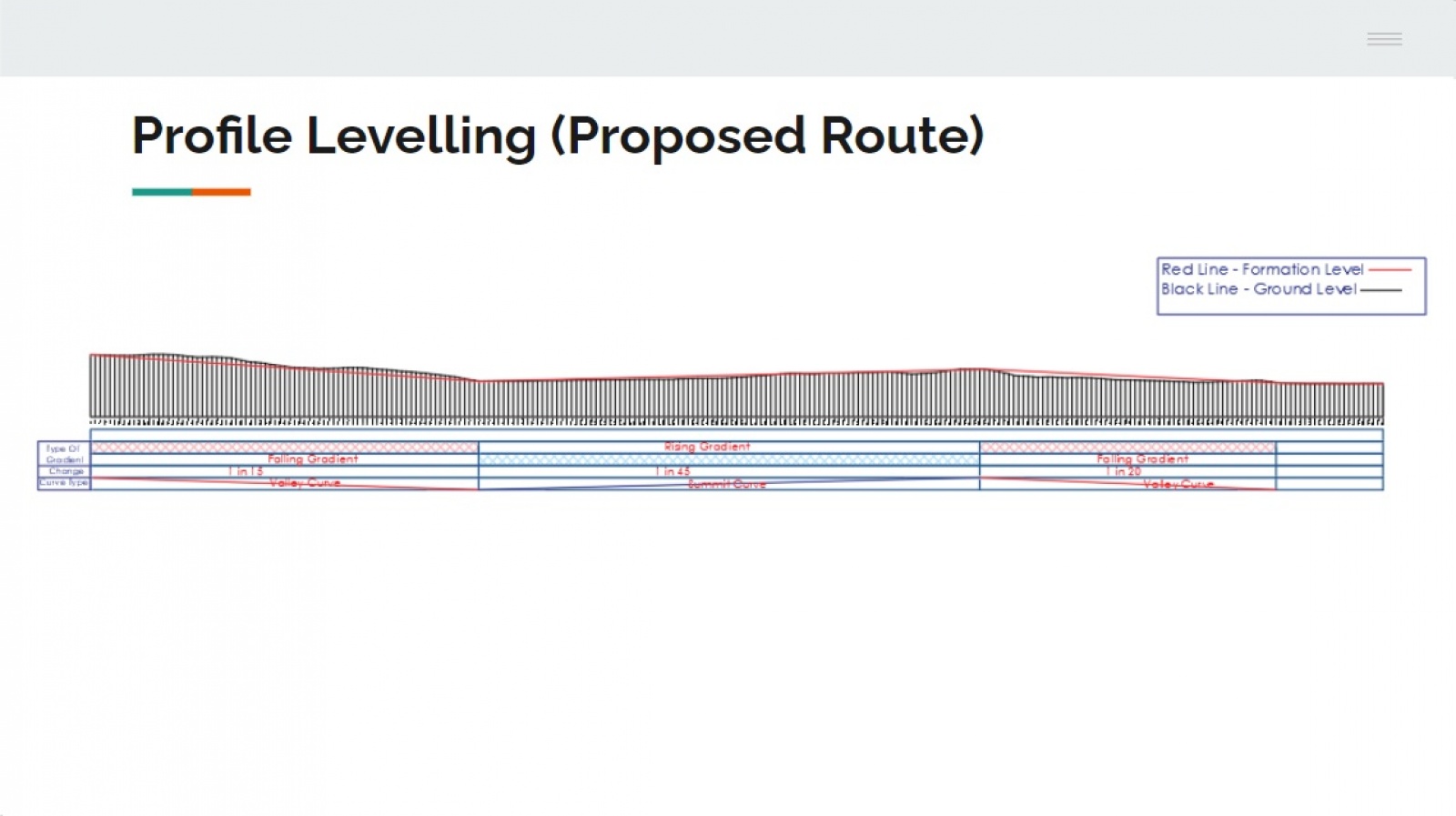
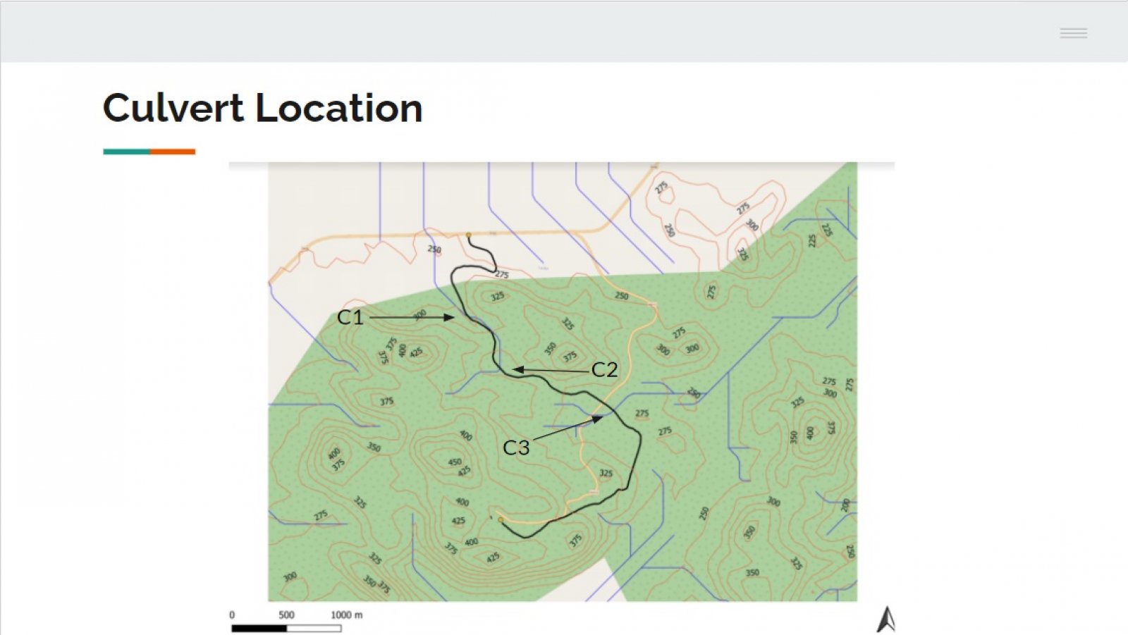
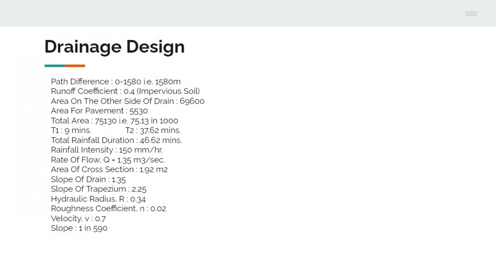
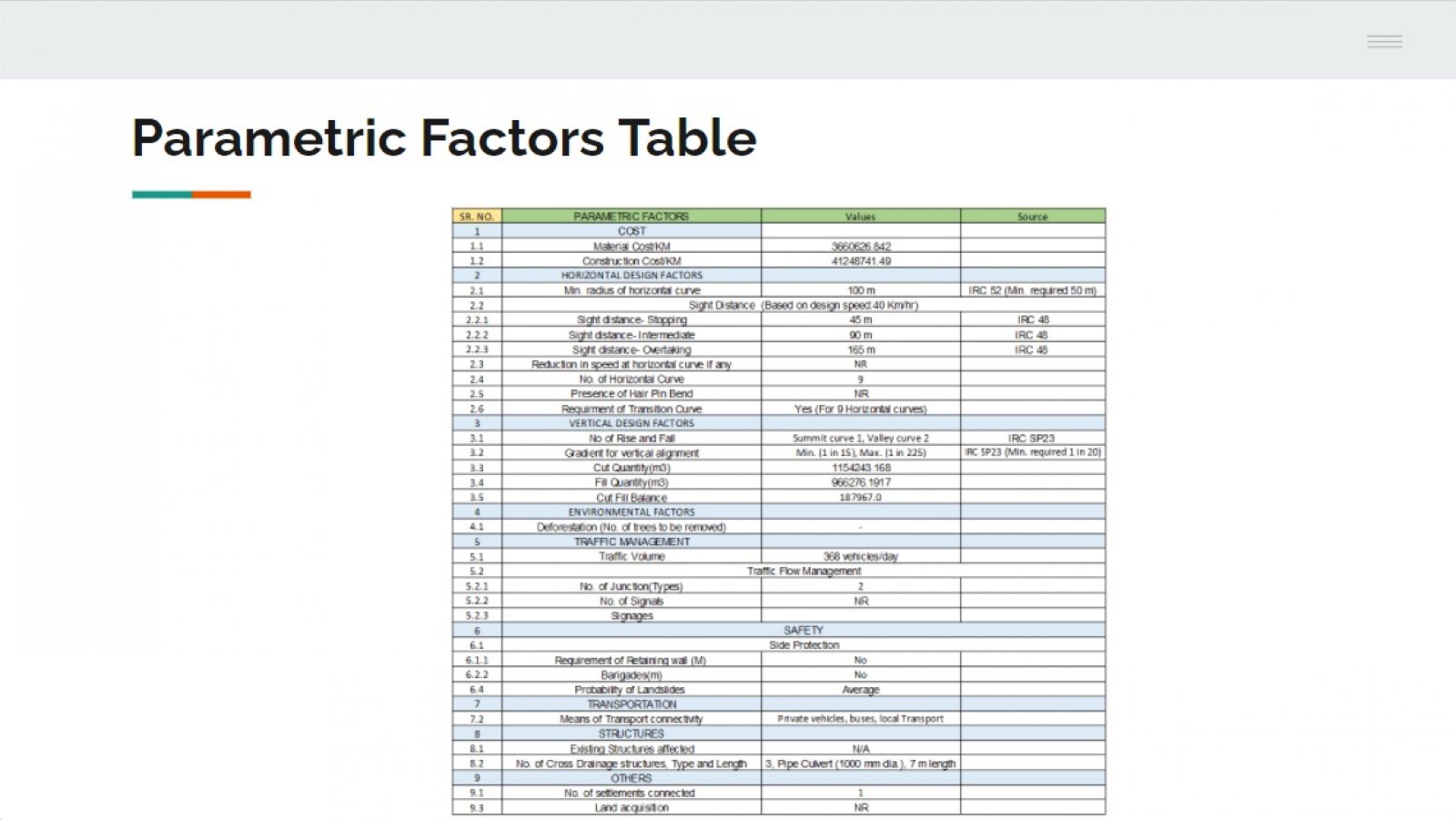
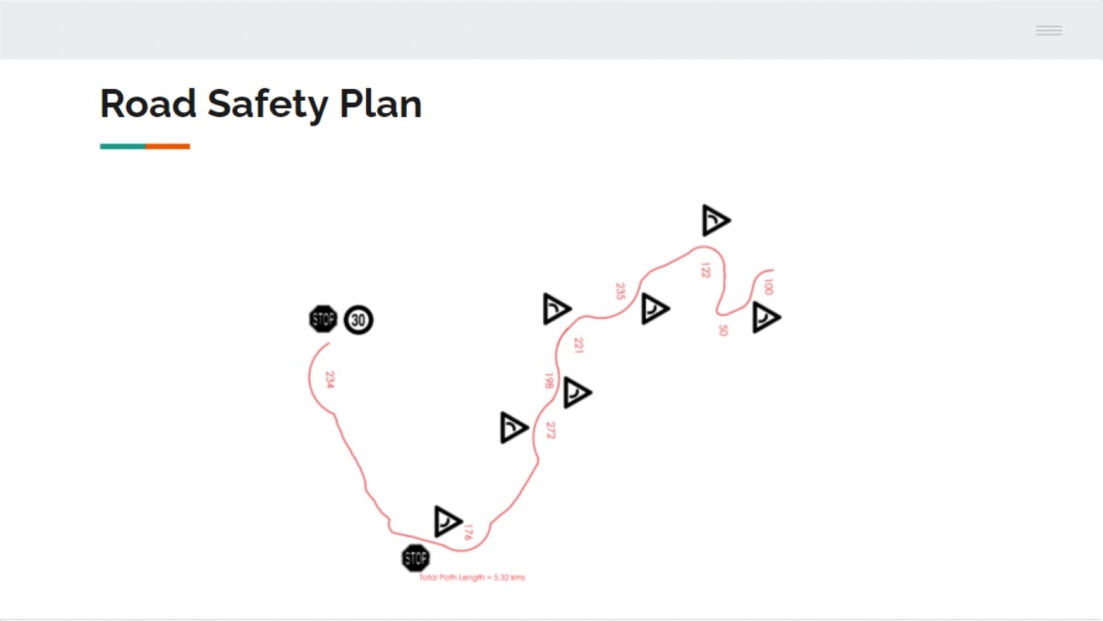
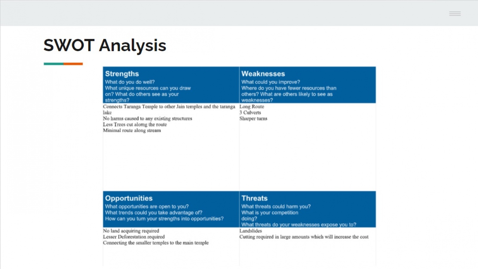
The objective of the studio is to plan and design the road approach to Taranga Jain Derasar from SH 56. The road approach to there includes a variety of curves with varying radii. The challenge includes the design of the vertical and horizontal slopes as well.  

View Additional Work

Report Content

I proposed an alternative route for the existing route from SH 56 to Taranga Jain Temple.

The varius radii for the proposed route which are in accordance to the IRC codes and help in the calculation of the horizontal curves.

The GAD for the proposed route which includes drawings for the horizontal and vertical curve along with the calculations and the key map of Timba village in the top right corner.

After finding out the elevations for a chainage of 20m, I plot the graph of Elevation v/s Chainage to get the profile levelling which helps us identify the Valley and Summit Curves which will help us get the calculations for Vertical curves.

On creating a stream line map in QGIS, we found the places where the road intersects the streamline which will help me locate the culverts.

The calculations for the design of drainage.

The list of all the parametric factors required for the road design and their values in accordance to IRC.

The road safety plan is a visual representation of the signage requirement along the path.

The strength, weakness, opportunities and threats related to my proposed route.