Your browser is out-of-date!
For a richer surfing experience on our website, please update your browser. Update my browser now!
For a richer surfing experience on our website, please update your browser. Update my browser now!
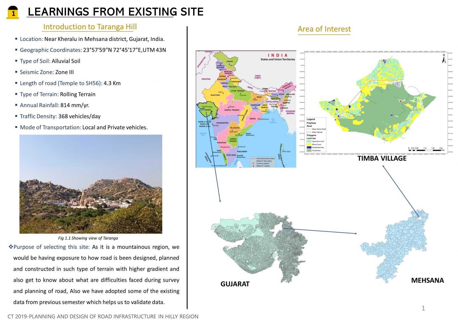
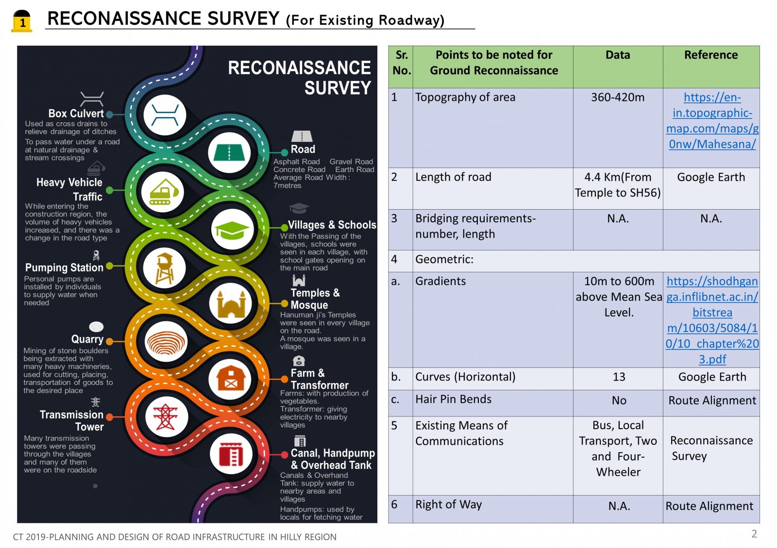
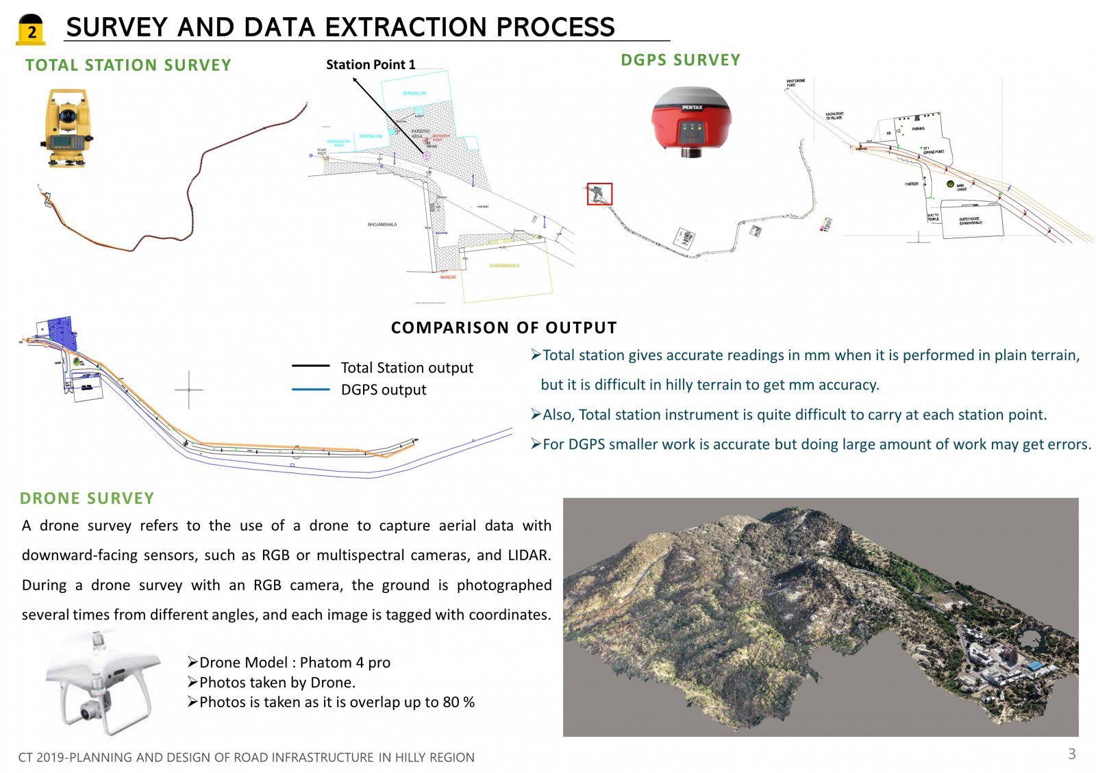
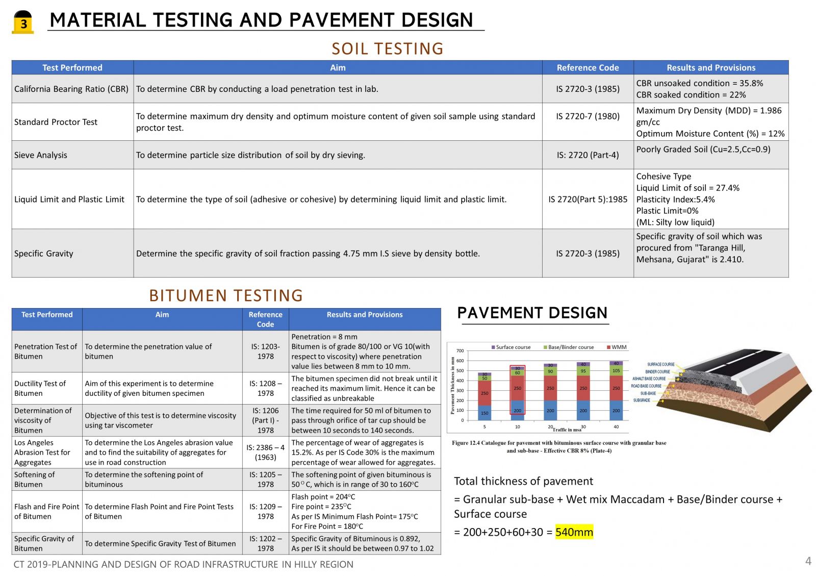
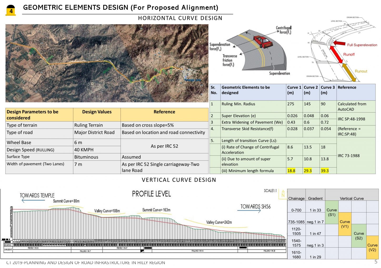
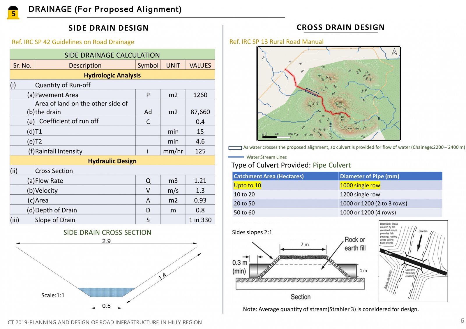
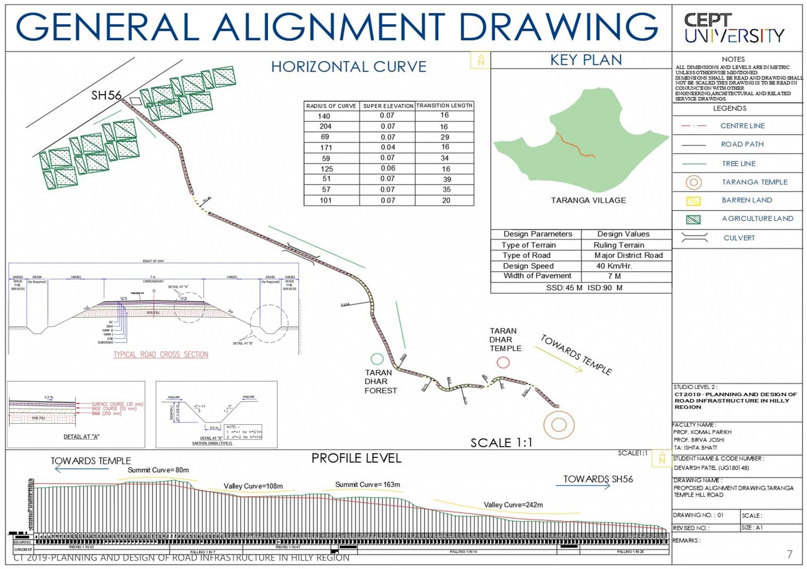
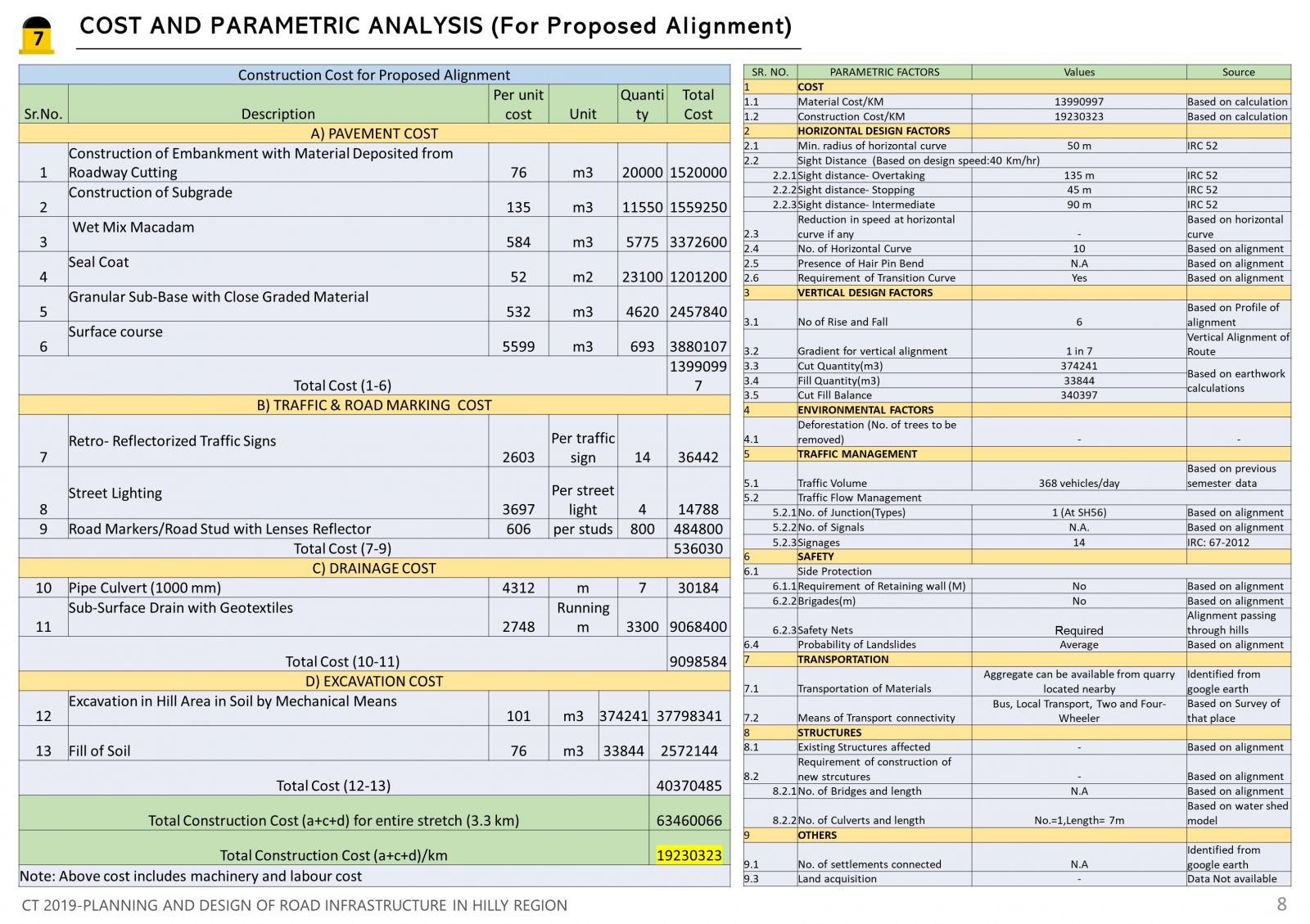
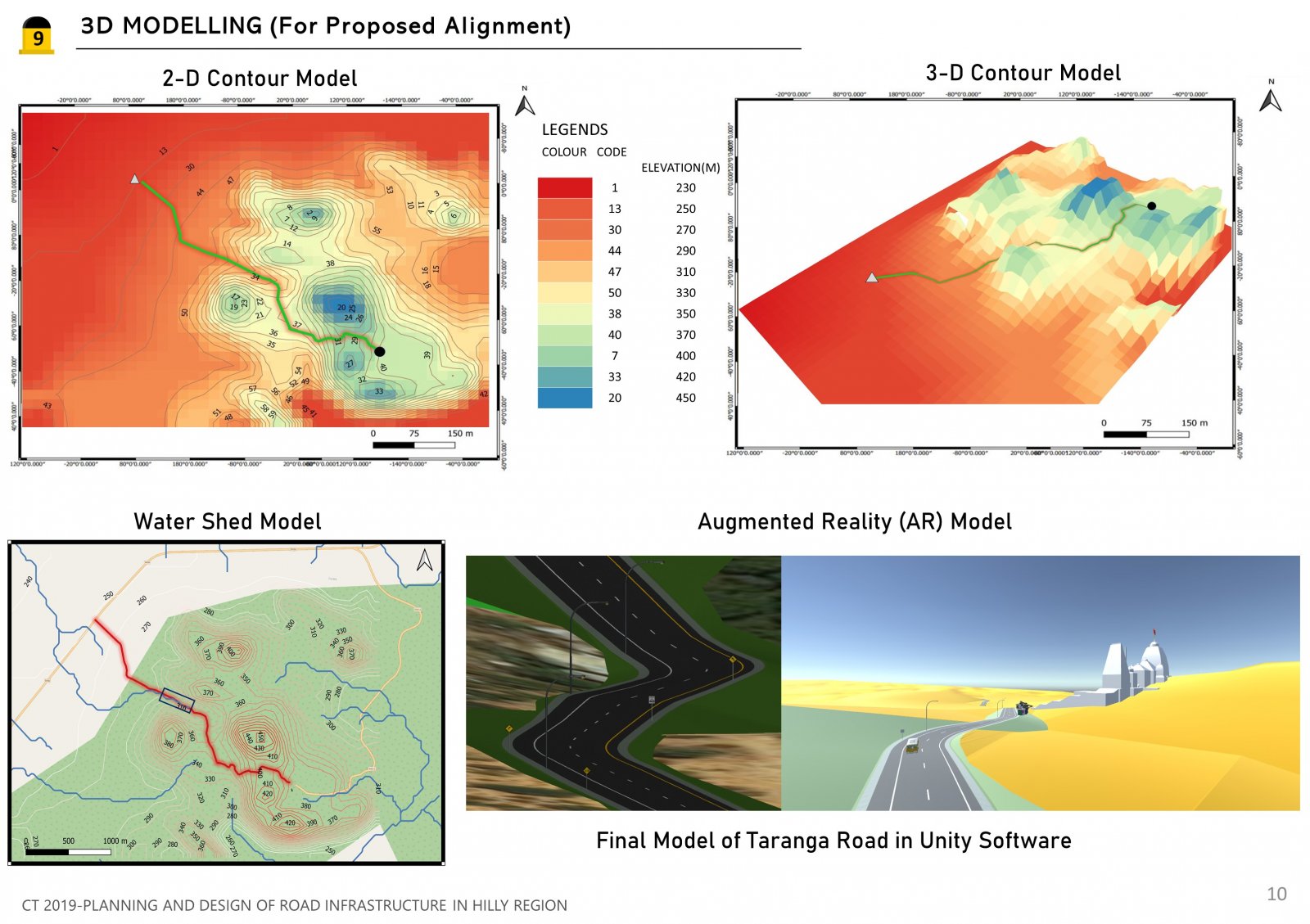
The Site: Taranga Hill ,Mehsana, Gujarat .The studio aims at exploring a design, planning and analysis of road infrastructure in hilly region the process which begins with the understanding of existing Taranga road and techniques developed (such as a reading of maps, interpretation of soil and material data) also we have exposure and skill-building through advanced mapping and to create a 3D Model; exposure through advanced design tools such as Open-Road, E-Survey, and Q-GIS software. Studio ends by designing a new proposed alignment which connects Taranga Temple to SH56 and worked with existing principles of designing and planning.
View Additional Work