Your browser is out-of-date!
For a richer surfing experience on our website, please update your browser. Update my browser now!
For a richer surfing experience on our website, please update your browser. Update my browser now!
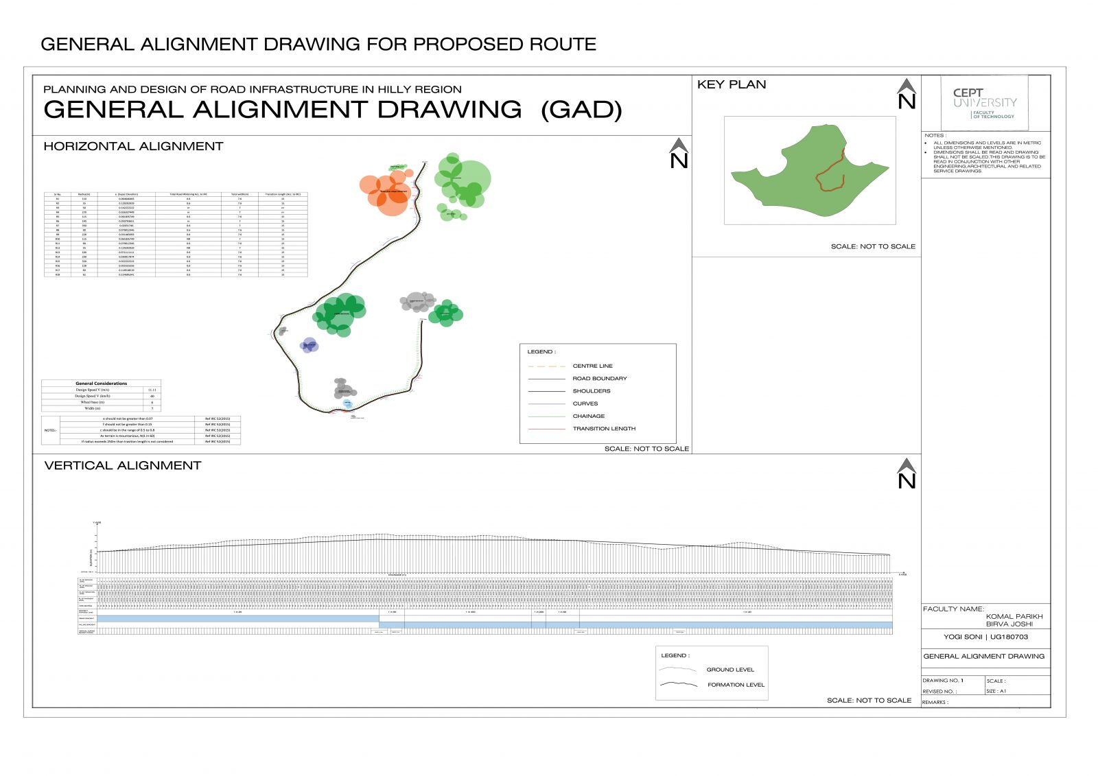
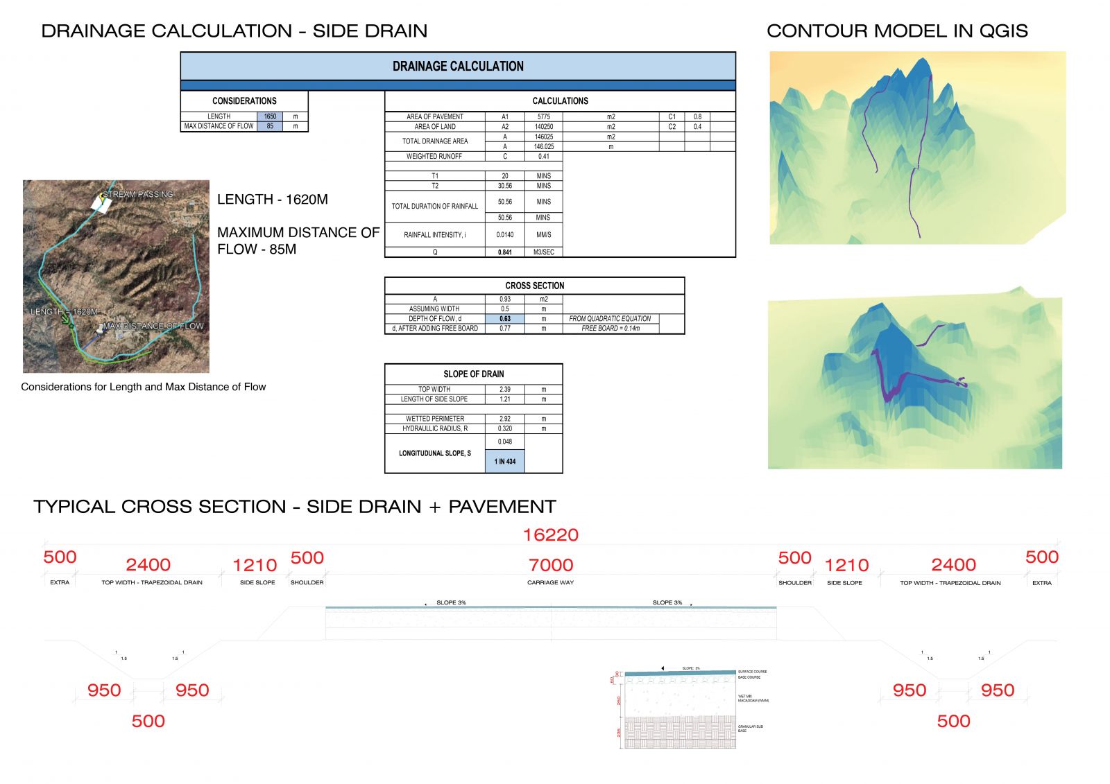
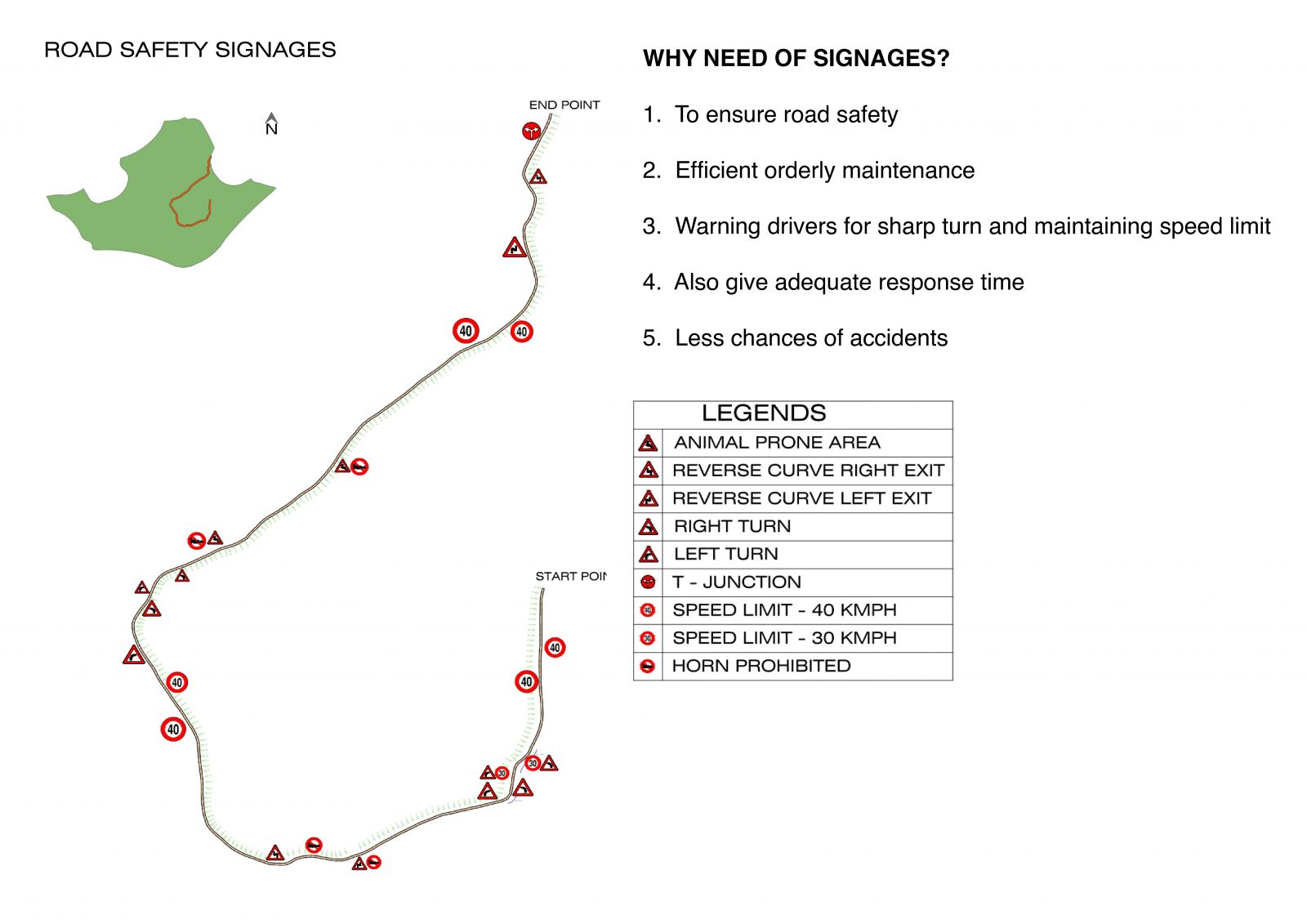
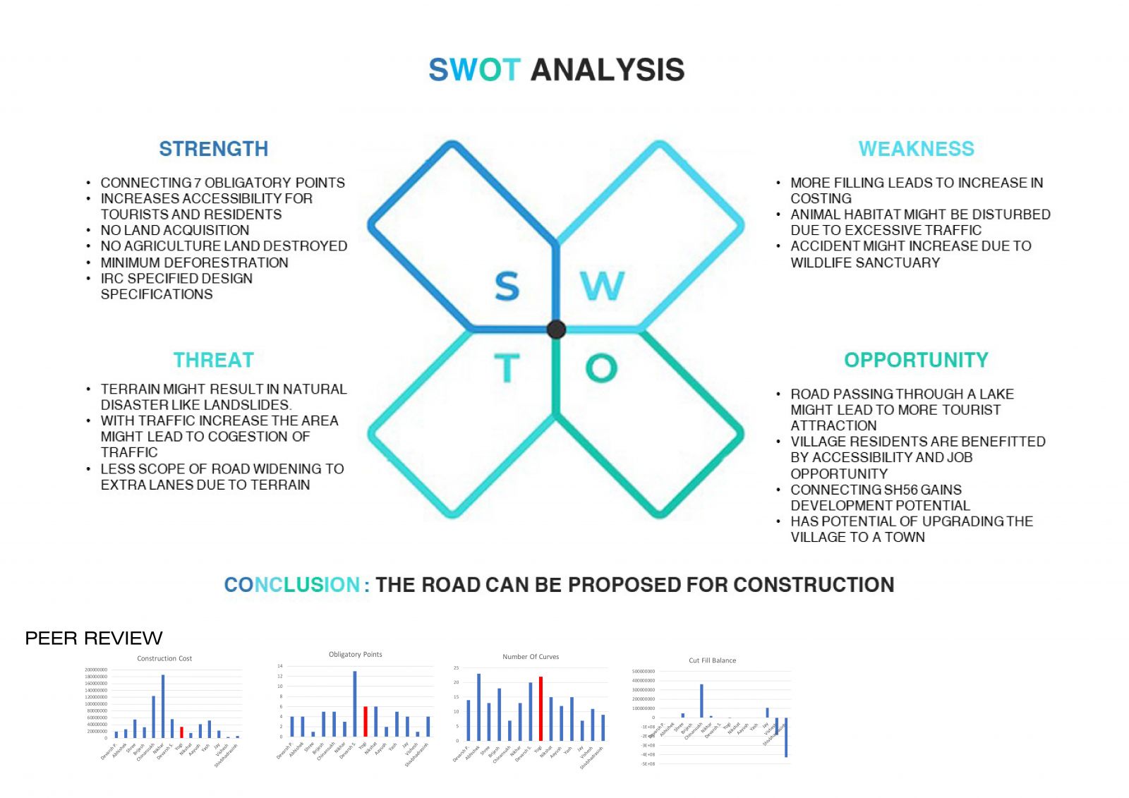
With the growing demands in the context of road infrastructure development in India and certain other countries, it is identified that a civil engineer equipped with the skills and strategies of road engineering principles and having a certain exposure to actual real-life road-related problems can be a useful professional. This course has been designed to equip the student with skills, rationales, and abilities in the context of road infrastructure planning and designs in the hilly region. The salient teaching methodology will include: Interactive discussions with students on existing principles and concerns of road planning and design Sensitivity and professional communication techniques (such as a reading of maps, interpretation of soil and material data) to these concerns through discussions Exposure and skill-building through advanced mapping and testing techniques Exposer to create and validate the 3D Model Exposure and skill-building through advanced design tools such as Open-Road, E-Survey, and Arc-GIS.