Your browser is out-of-date!
For a richer surfing experience on our website, please update your browser. Update my browser now!
For a richer surfing experience on our website, please update your browser. Update my browser now!
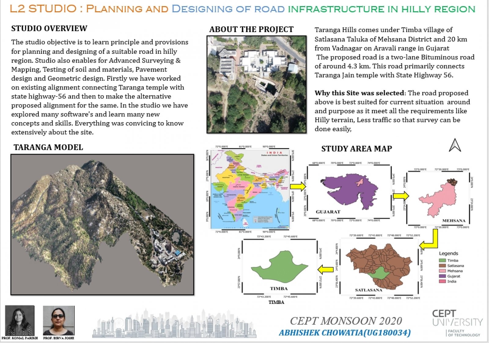
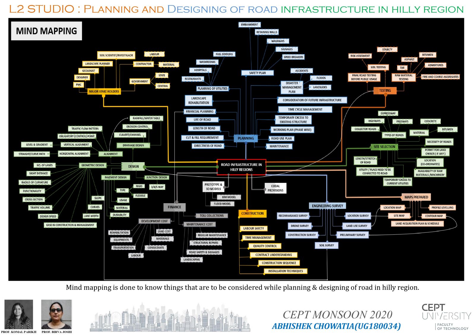
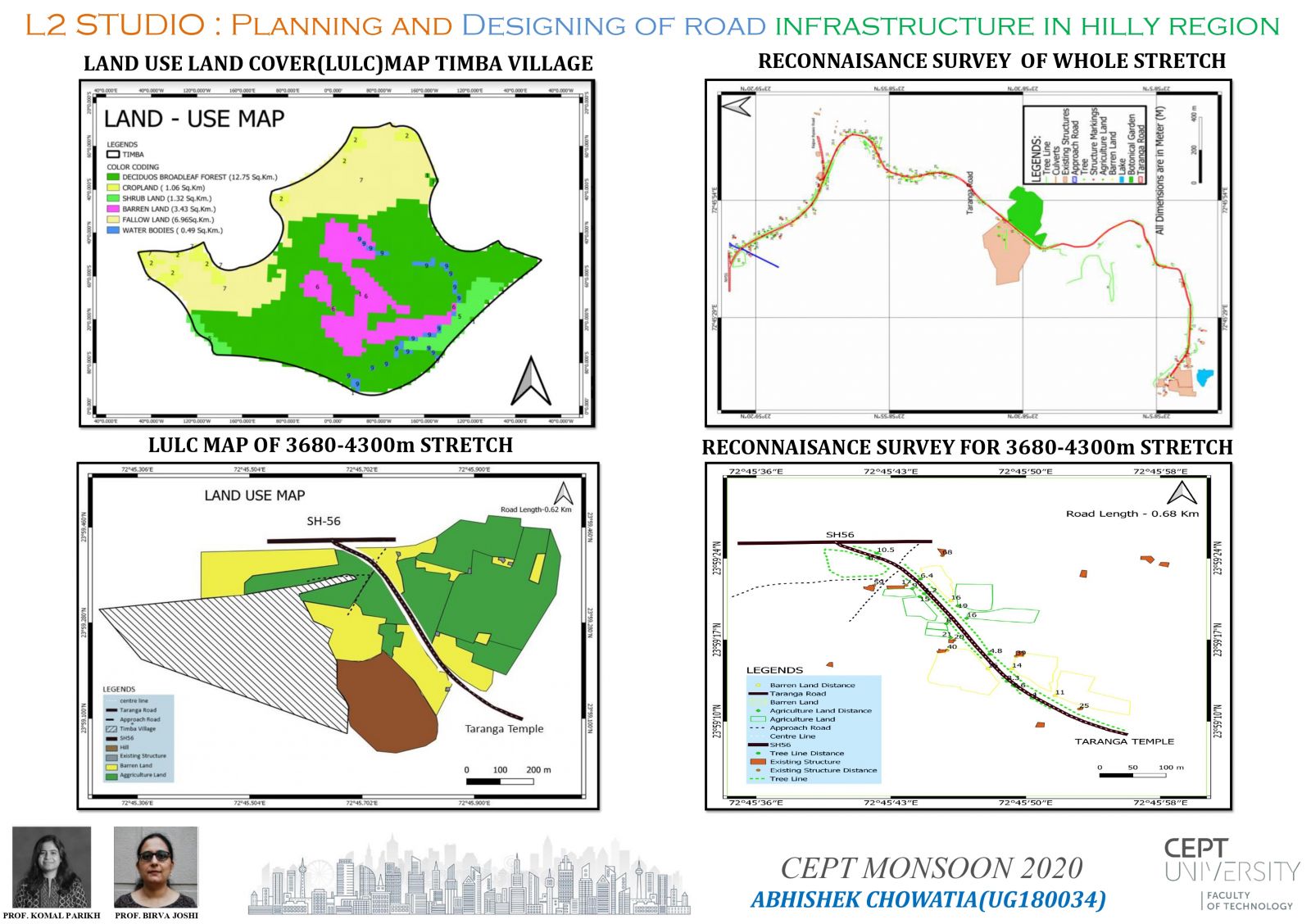
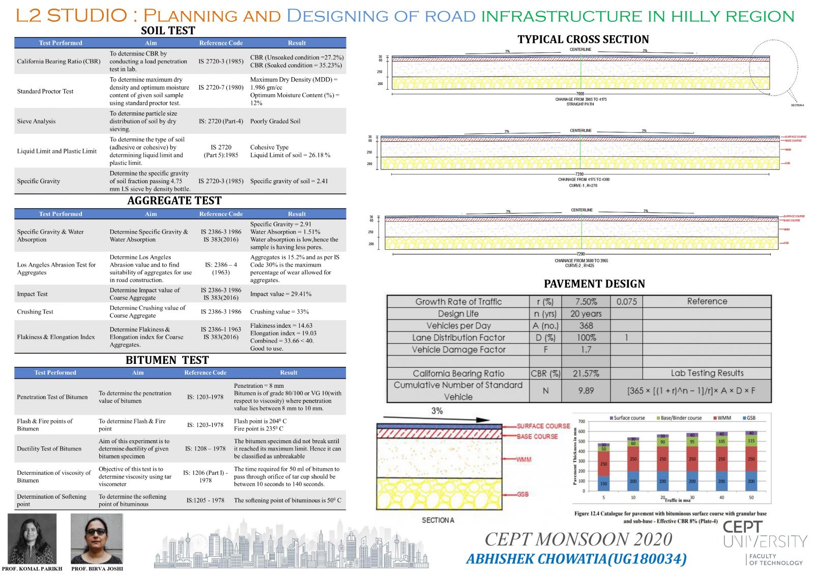
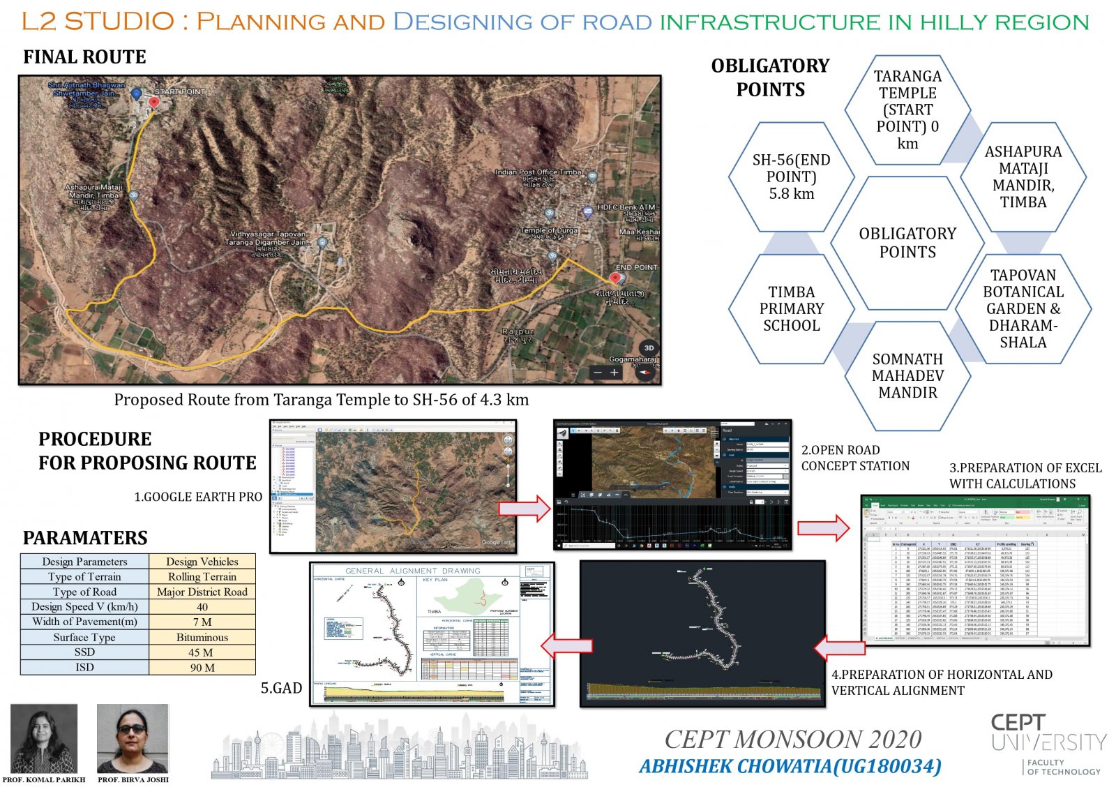
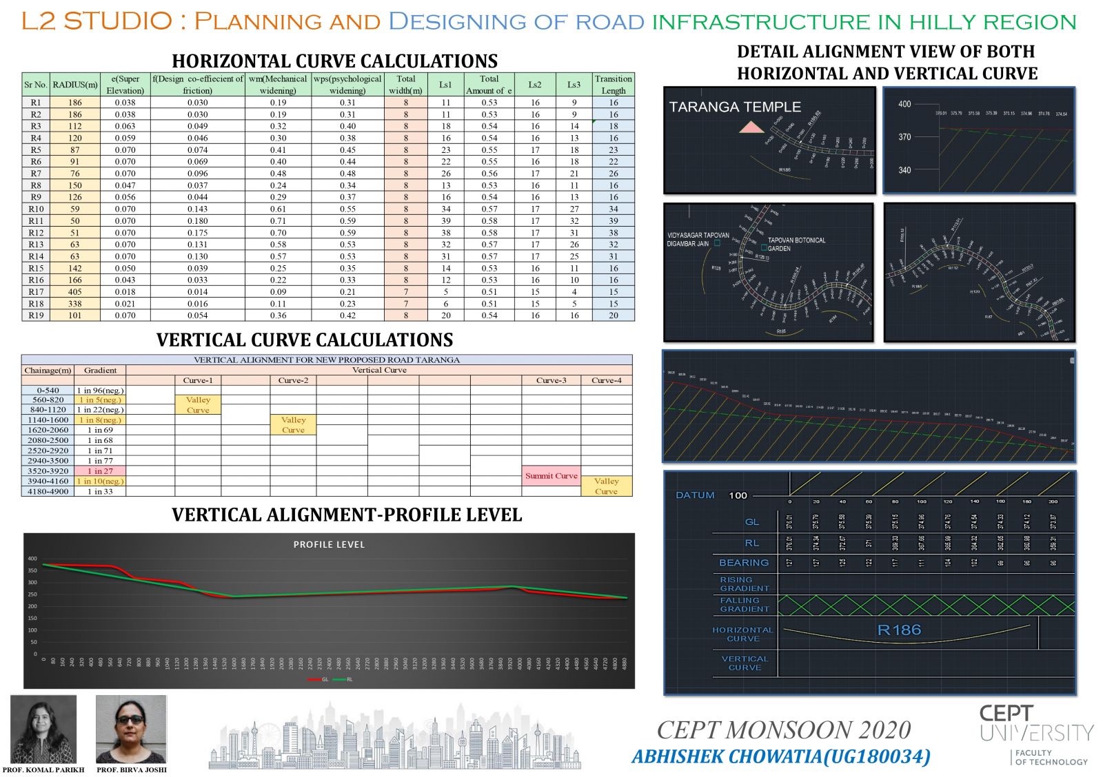
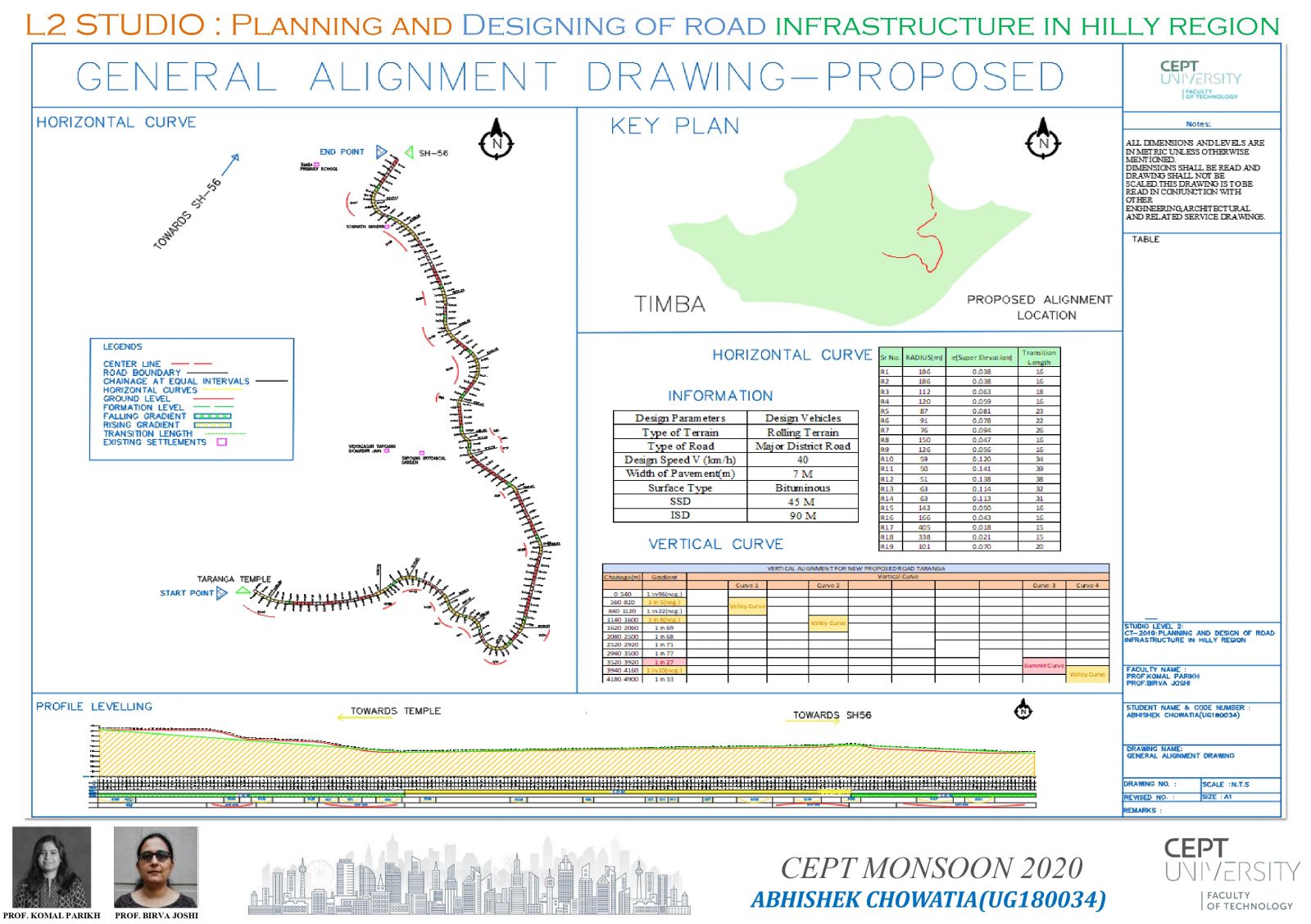
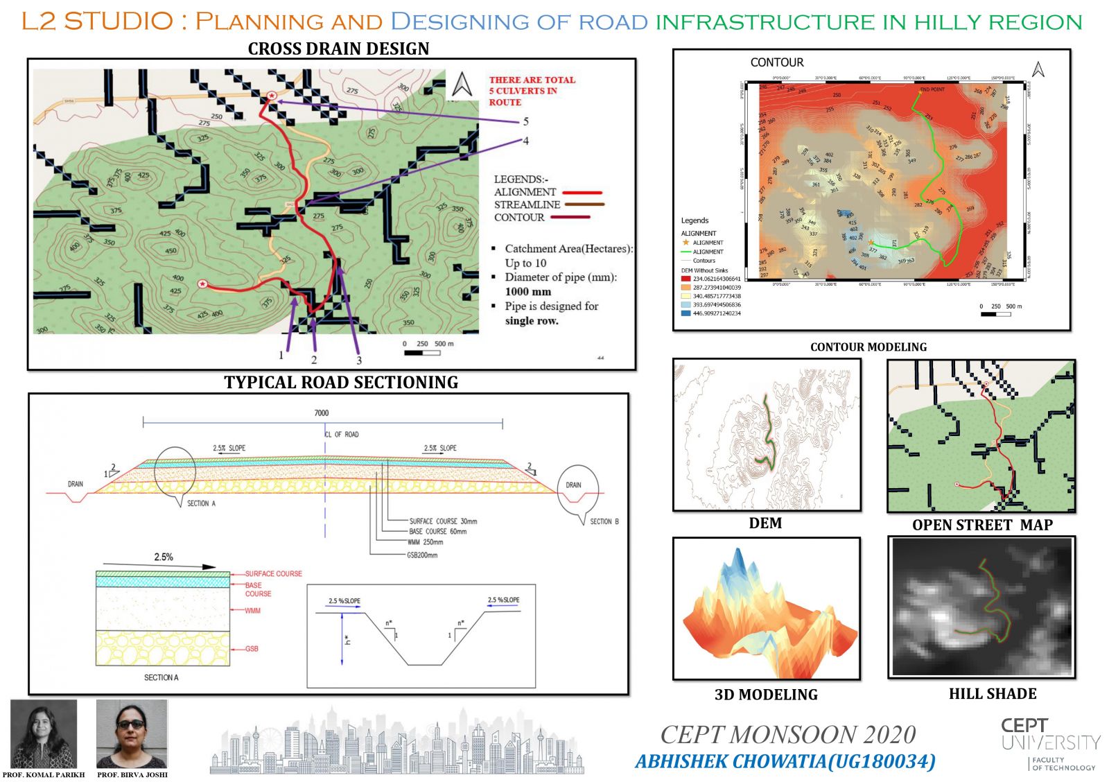
The studio objective is to learn principle and provisions for planning and designing of a suitable road in hilly region. Studio also enables for Advanced Surveying & Mapping, Testing of soil and materials, Pavement design and Geometric design. Firstly we have worked on existing alignment connecting Taranga temple with state highway-56 and then we have learned about the surveys and moving on to make the alternative proposed alignment for the same. In the studio we have explored many software's and learn many new concepts and skills. Click here for Portfolio & Report.
View Additional Work