Your browser is out-of-date!
For a richer surfing experience on our website, please update your browser. Update my browser now!
For a richer surfing experience on our website, please update your browser. Update my browser now!
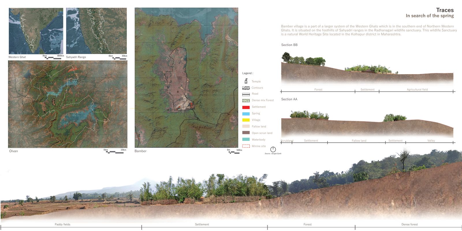
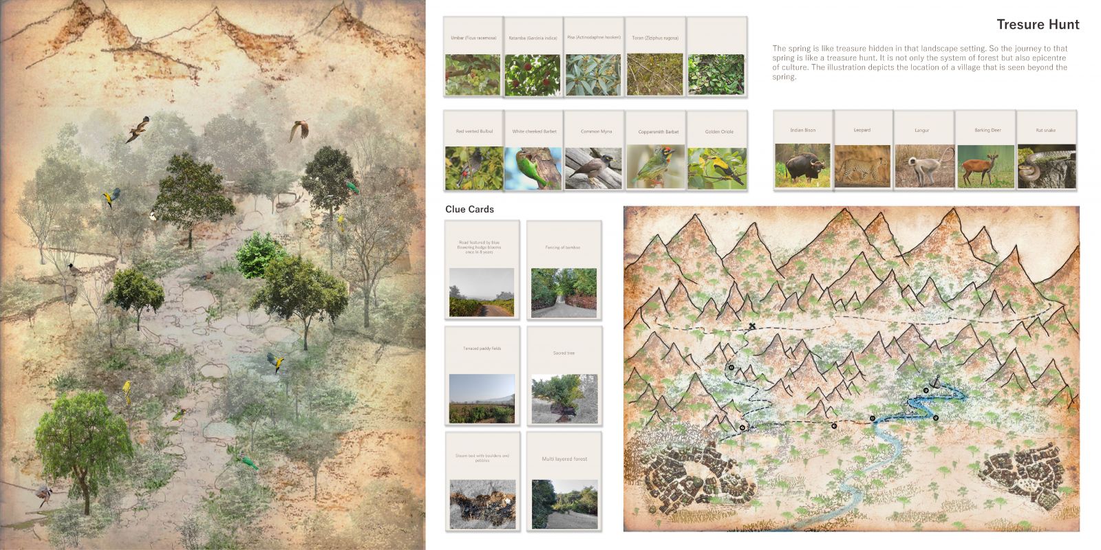
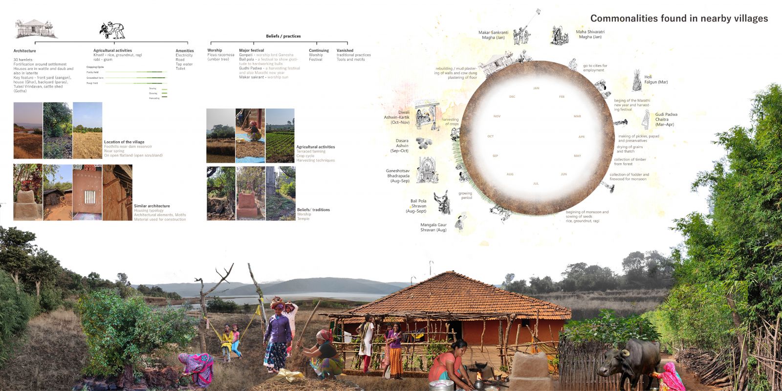
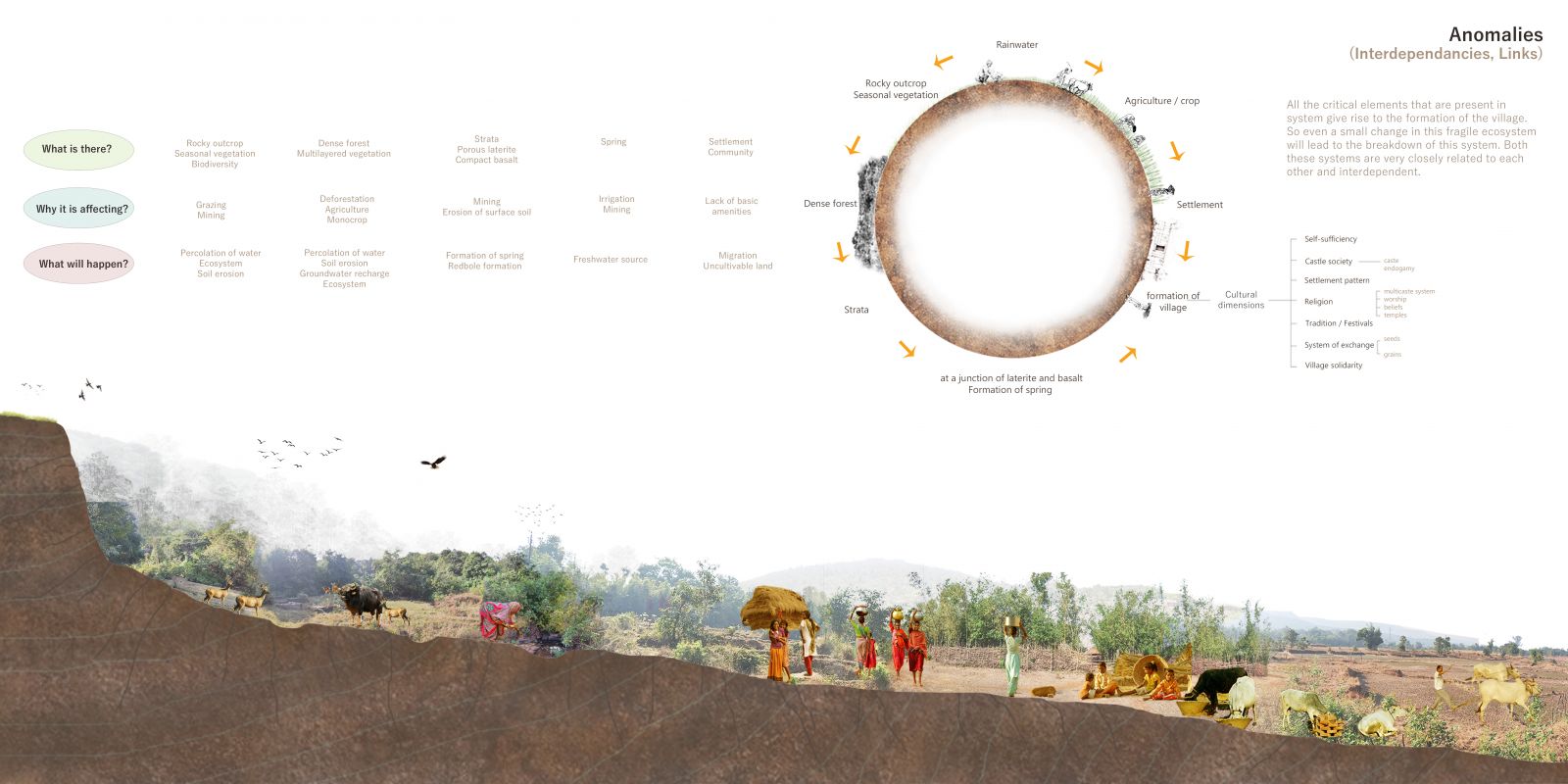
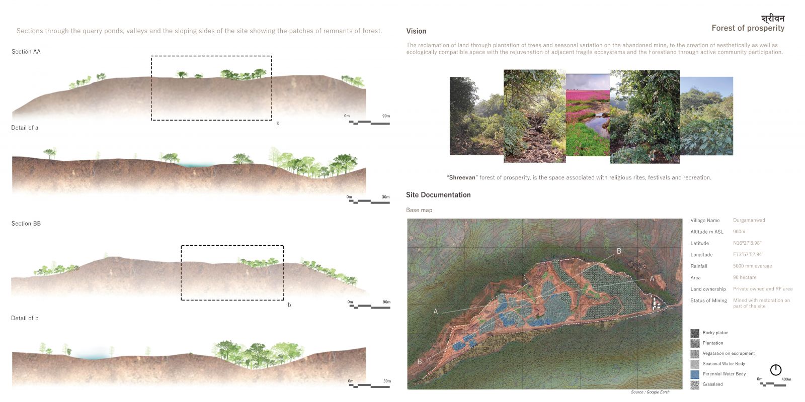
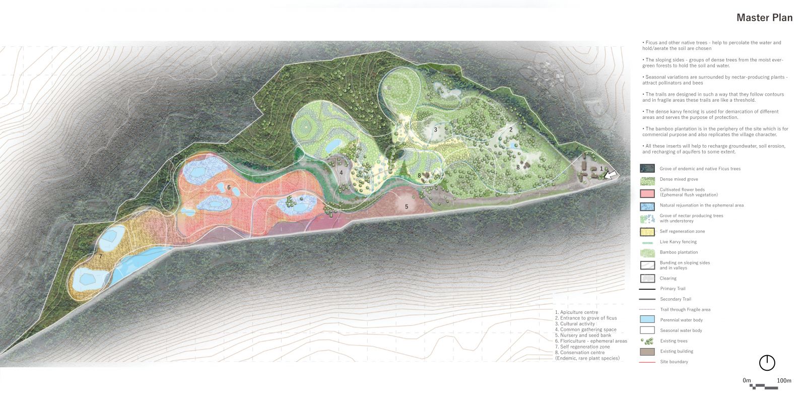
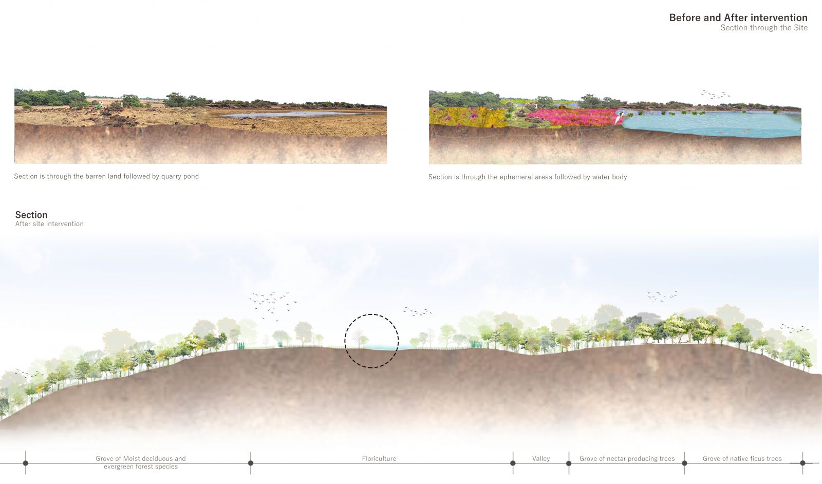
The village Bamber is a part of a larger system of the Western Ghats situated on the foothills of Sahyadri ranges as a part of Radhanagari wildlife sanctuary. The interlinked and layered systems of forest gives birth to a unique landscape dotted with numerous springs. This in turn nurtures the culture. The community that resides in the village is agrarians and honey gatherers and are known as the Bamber. On-field visit, it was observed that even the slightest disturbance to the interdependent systems of forest affect its fragile subsystems on which the life and culture of the people in turn sustain. One such major disturbance is the mining activity on the plateau tops. The mined lands remain like scars that remind the people of a certain past they have lost when it still exists intact in parallel time and space. The project looks at renewal for such a scarred land, an abandoned mining site. On a broad level, it aims at the regeneration of the natural systems that anchor the cultural systems. The metaphor through which the landscape and it's embedded culture is understood as ‘anchor’ and the idea that most aptly represents the state of the present is the true palimpsest. The site is an abandoned quarry by the plateau top. The site and its layers were also analysed using the lens of true palimpsest and the remnants of the original landscape were carefully identified to be preserved and acknowledged almost like treasures. Previously the plateau was covered with lateritic rocky outcrops which were giving rise to a fragile ecosystem and also helping to the filling of the aquifers. While the site was under mining activities such as continuous mining, vehicular movement, and explosive devices, it got damaged. Almost 10-15 meters of the top layer of the plateau which was rich in lateritic outcrops that supported a rich floristic diversity was removed. The absence of this layer affected the aquifers it fed too. Presently after mining, the topsoil and aquifers both are damaged but there are few signs of regeneration on the site which shows the potential is still there. The first part identified and preserved the past layers of the site. Then the lost layers of the landscape were studied. Based on the current potential of natural layers of the site – potential zones for re-introduction of the lost components form the second part. The program looks at the site as a prosperous forest that will provide for the people who have lost their livelihood and dependencies. The fourth layer of the project imagines a system of movement and clearing through the re-established layers of the site that will allow community participation and interaction areas. All these inserts will help to recharge groundwater, soil erosion, and recharging of aquifers to some extent. A reclamation project on this abandoned site may help to the rejuvenation of land and revitalization of the fragile ecosystem through active community participation.
View Additional Work