Your browser is out-of-date!
For a richer surfing experience on our website, please update your browser. Update my browser now!
For a richer surfing experience on our website, please update your browser. Update my browser now!
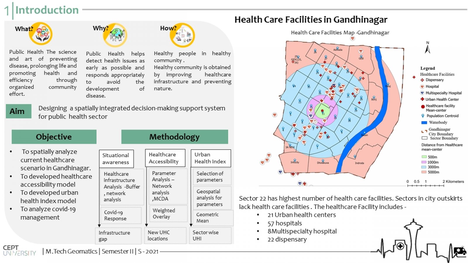
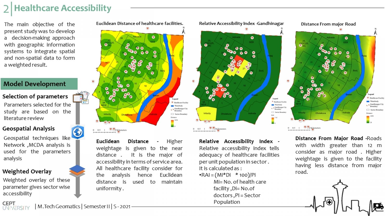
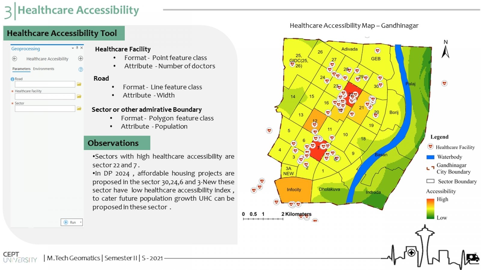
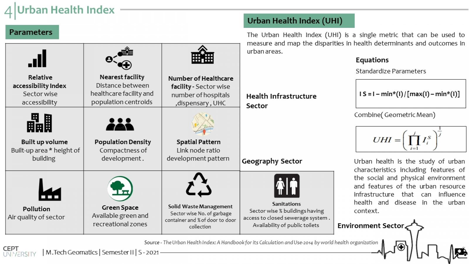
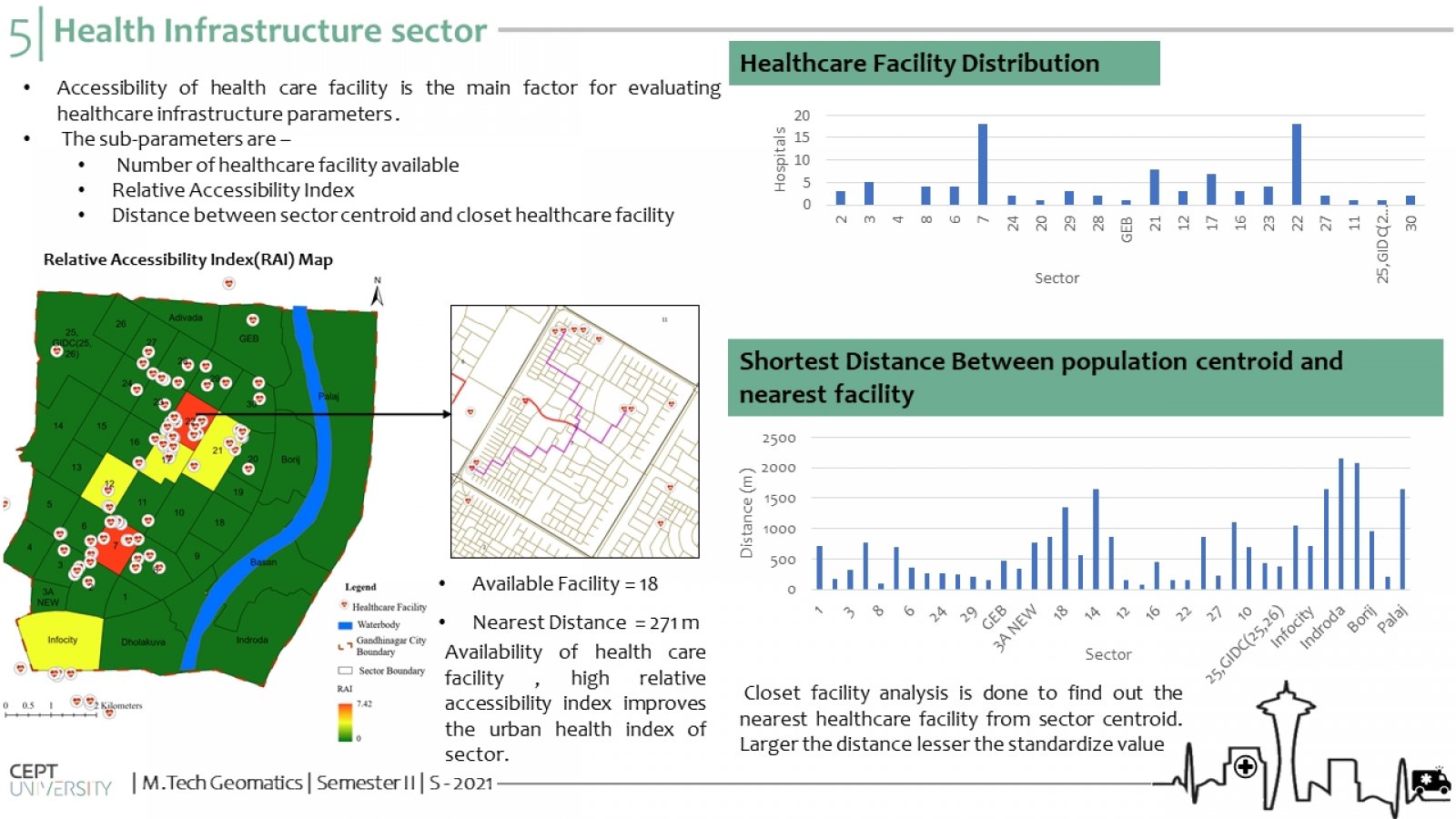
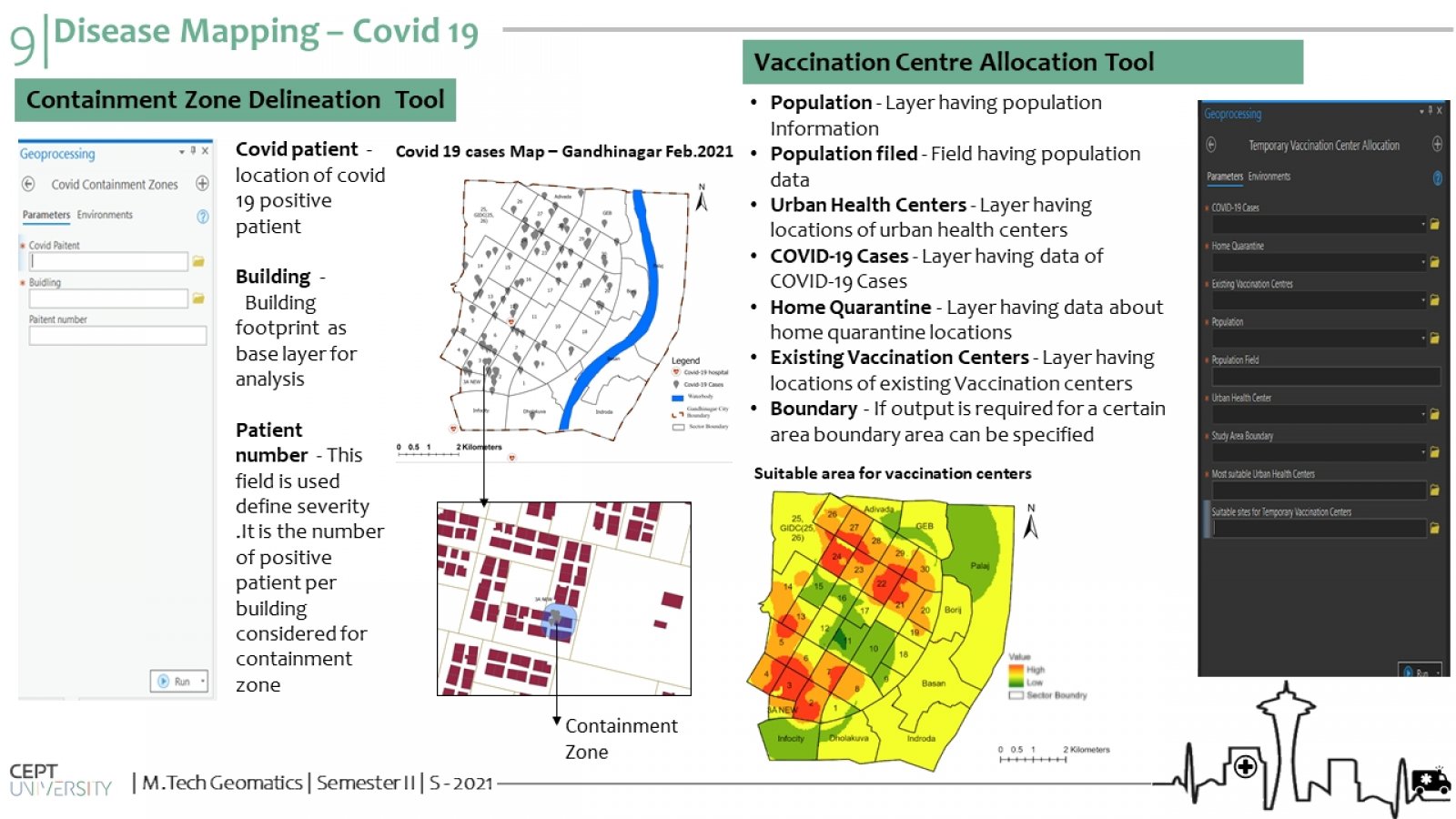
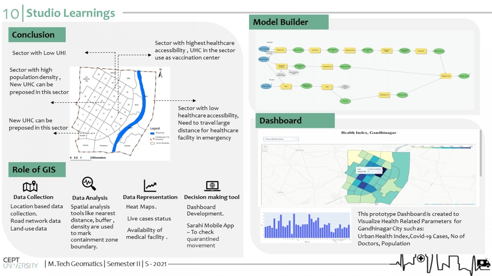
The COVID-19 outbreak has exposed the strained health infrastructure in Indian cities. The inadequacy in healthcare facilities and governance issues are serious policy concerns in front of experts and policymakers. As a city-government is a fundamental unit of governance structure in India, there is a need for strategic interventions and long-term scientific solutions to plan and regulate healthcare facilities at a city level. GIS is an important tool used for public health sector analysis. The project focused on the development of various GIS tools for analysis of the public health sector in Gandhinagar city.