Your browser is out-of-date!
For a richer surfing experience on our website, please update your browser. Update my browser now!
For a richer surfing experience on our website, please update your browser. Update my browser now!
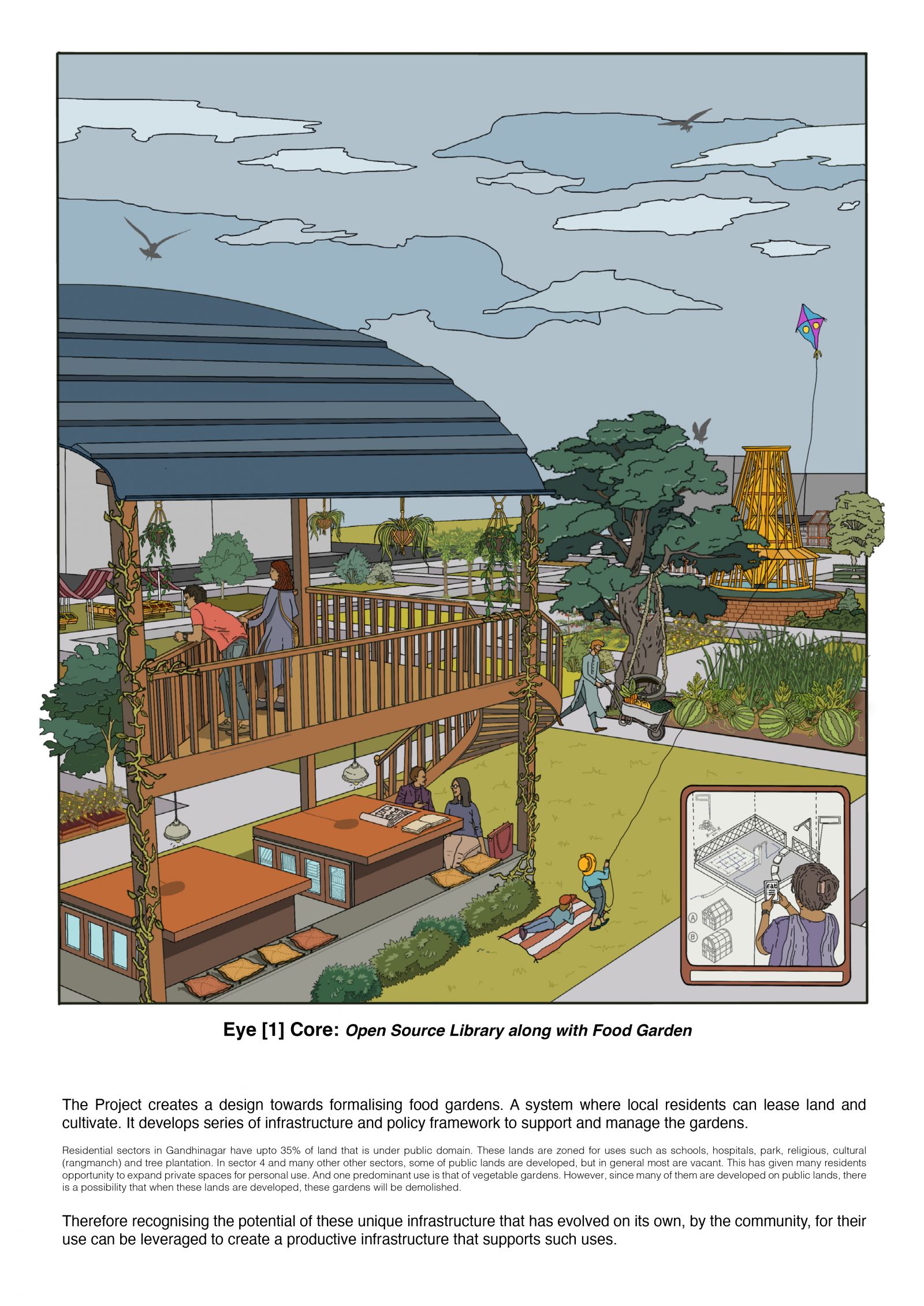
The Project creates a design towards formalising food gardens. A system where local residents can lease land and cultivate. It develops a series of infrastructure and policy frameworks to support and manage the gardens.
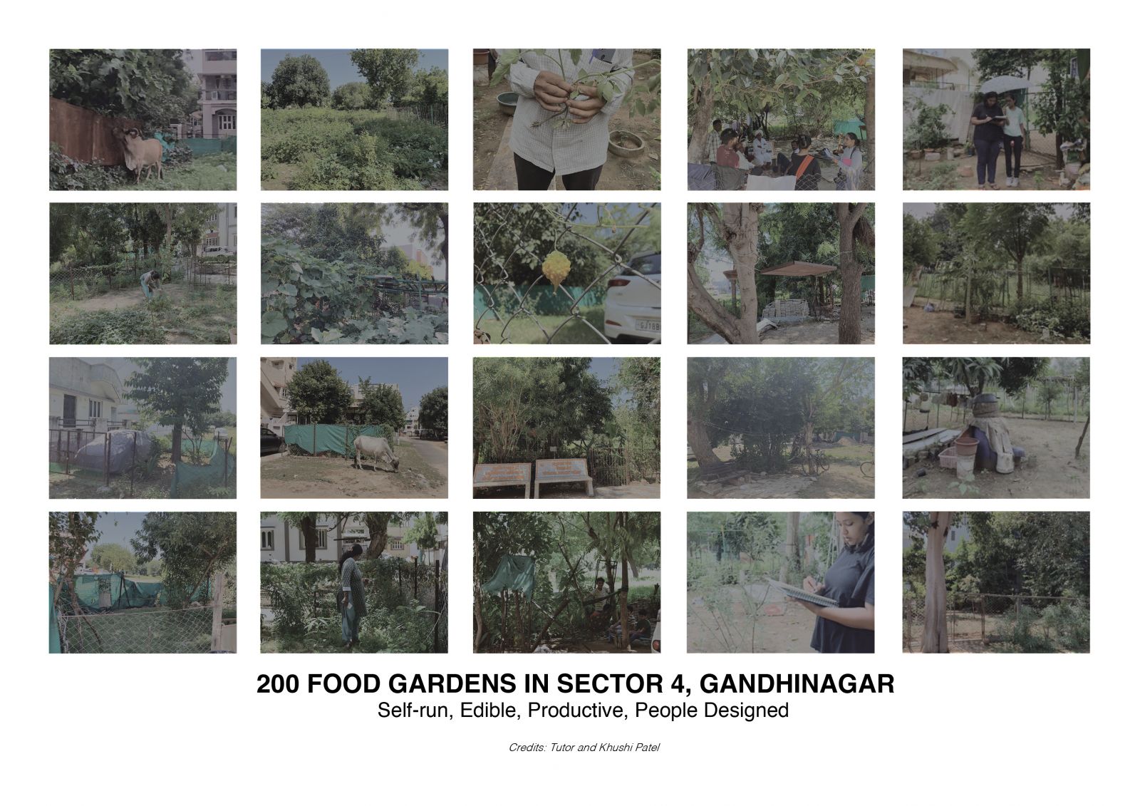
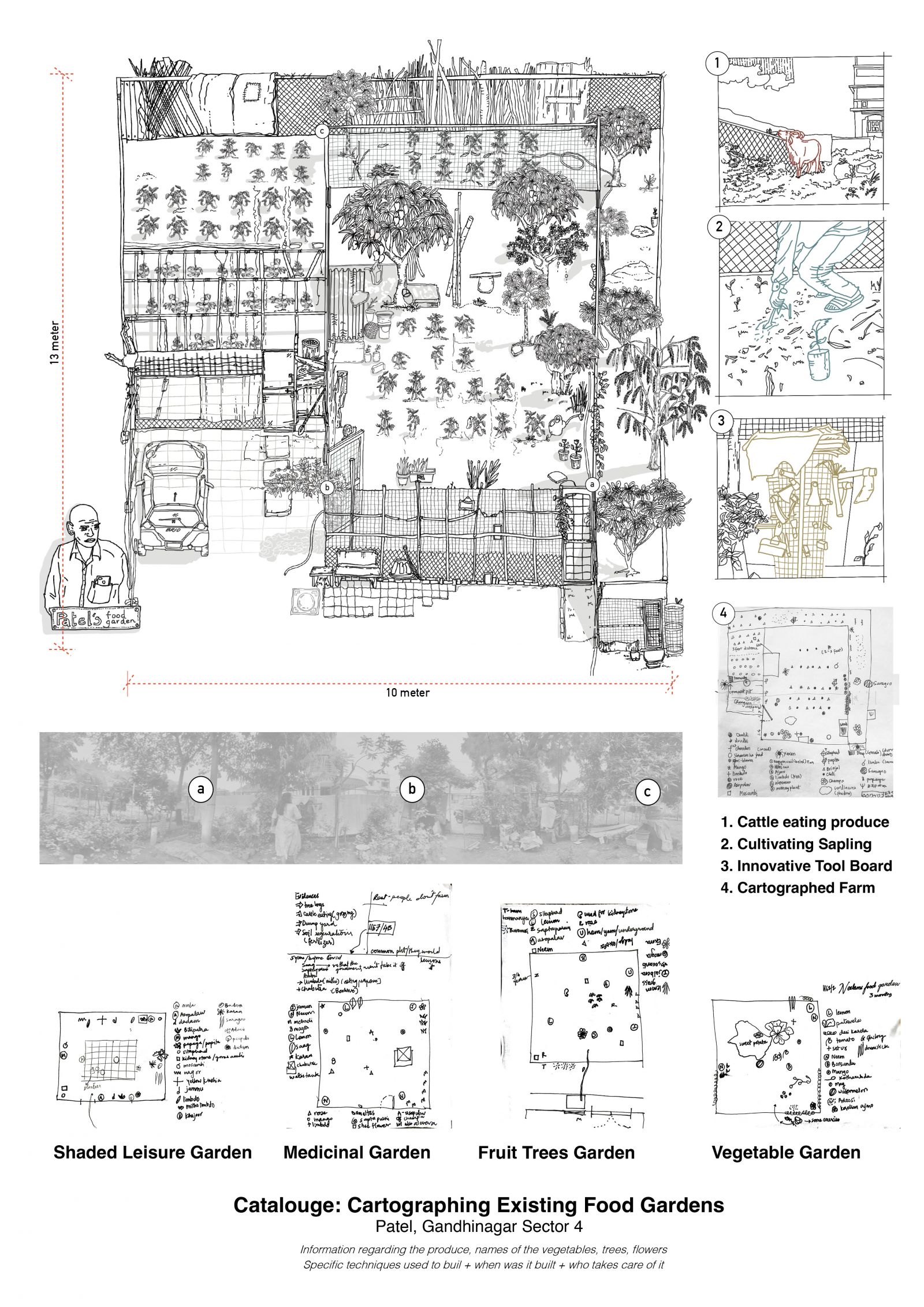
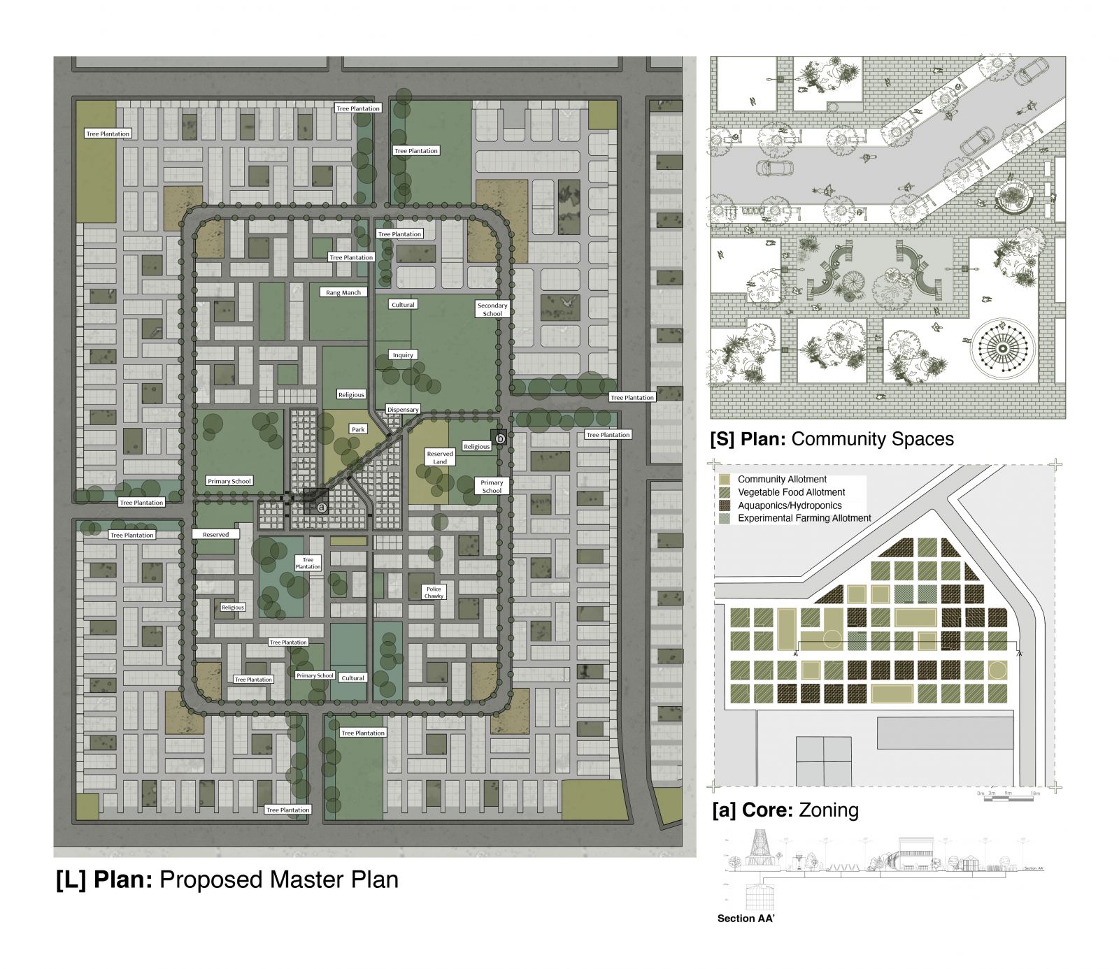
Residential sectors in Gandhinagar have up to 35% of the land under the public domain. These lands are zoned for uses such as schools, hospitals, parks, religious, cultural (rangmanch) and tree plantations. And one predominant use is that of vegetable gardens. However, since many of them are developed on public lands, there is a possibility that when these lands are developed, these gardens will be demolished.
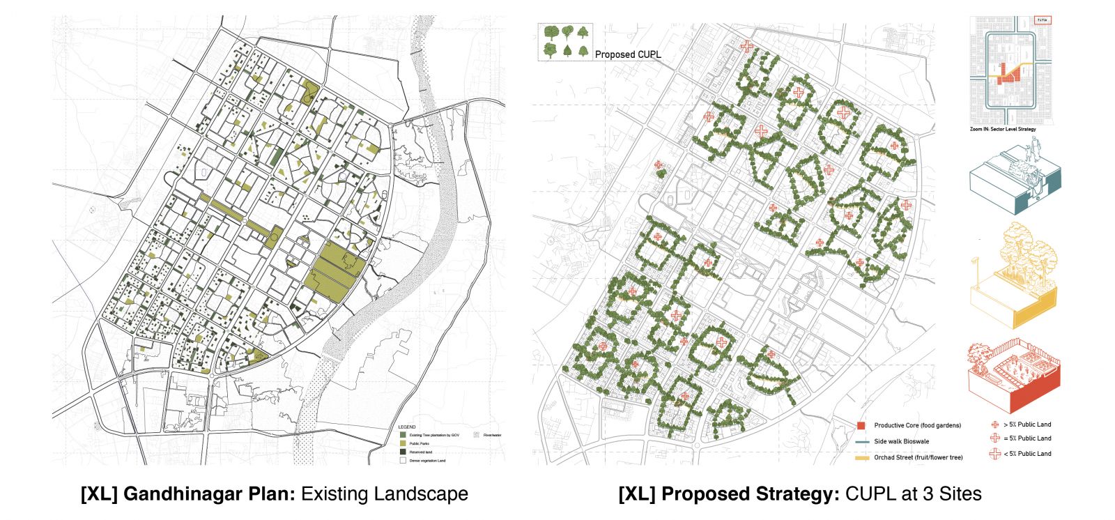
Three major sites identified in the sector, are the ROW 10m redesign, ROW 25m redesign and Core Grid for Vegetable gardens.
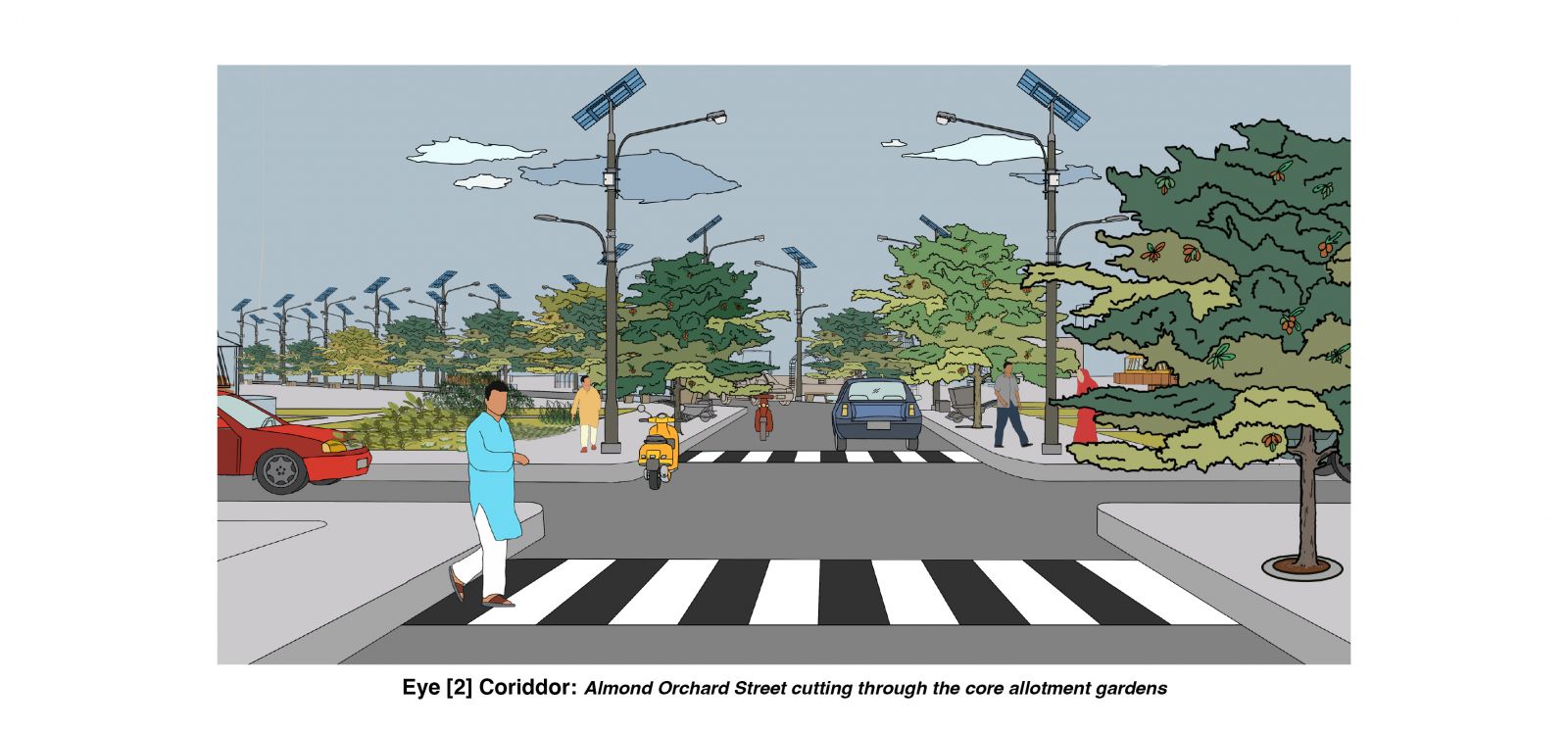
Carriage way- Re-design: ROW 25 mts is redesigned with allotment gardens. Each garden will be 2m x 5m at approximately 5mt distance. These gardens will include a plantation of 2-3 trees.
Redesign of 10 mts - These are the innermost streets, typically used by pedestrians and bicyclists. The ROW is redesigned with a continuous footpath incorporated with tree pits of diameter 1.2 mts at every 10 mts interval- Each corridor will be designated with a particular fruit tree.
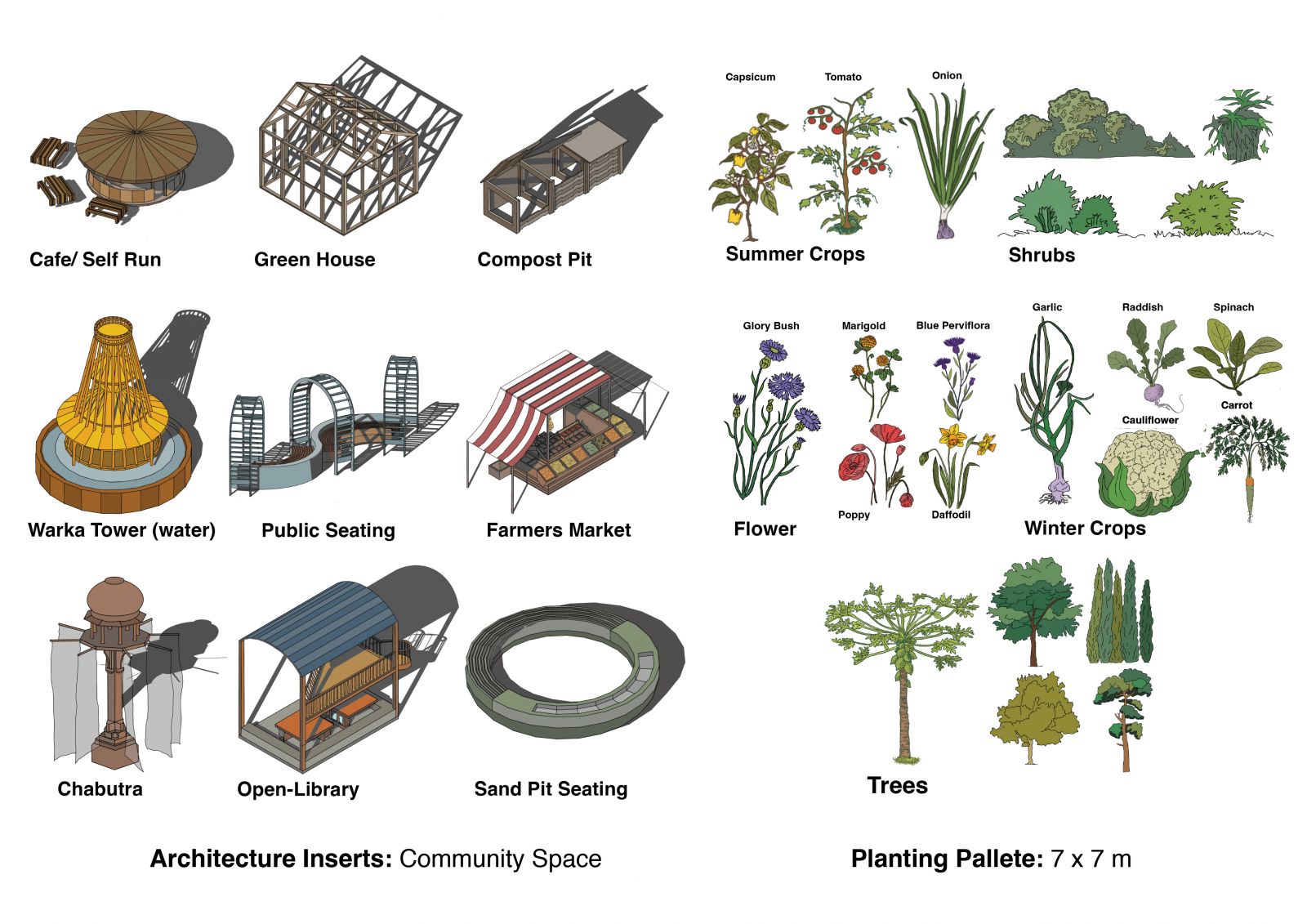
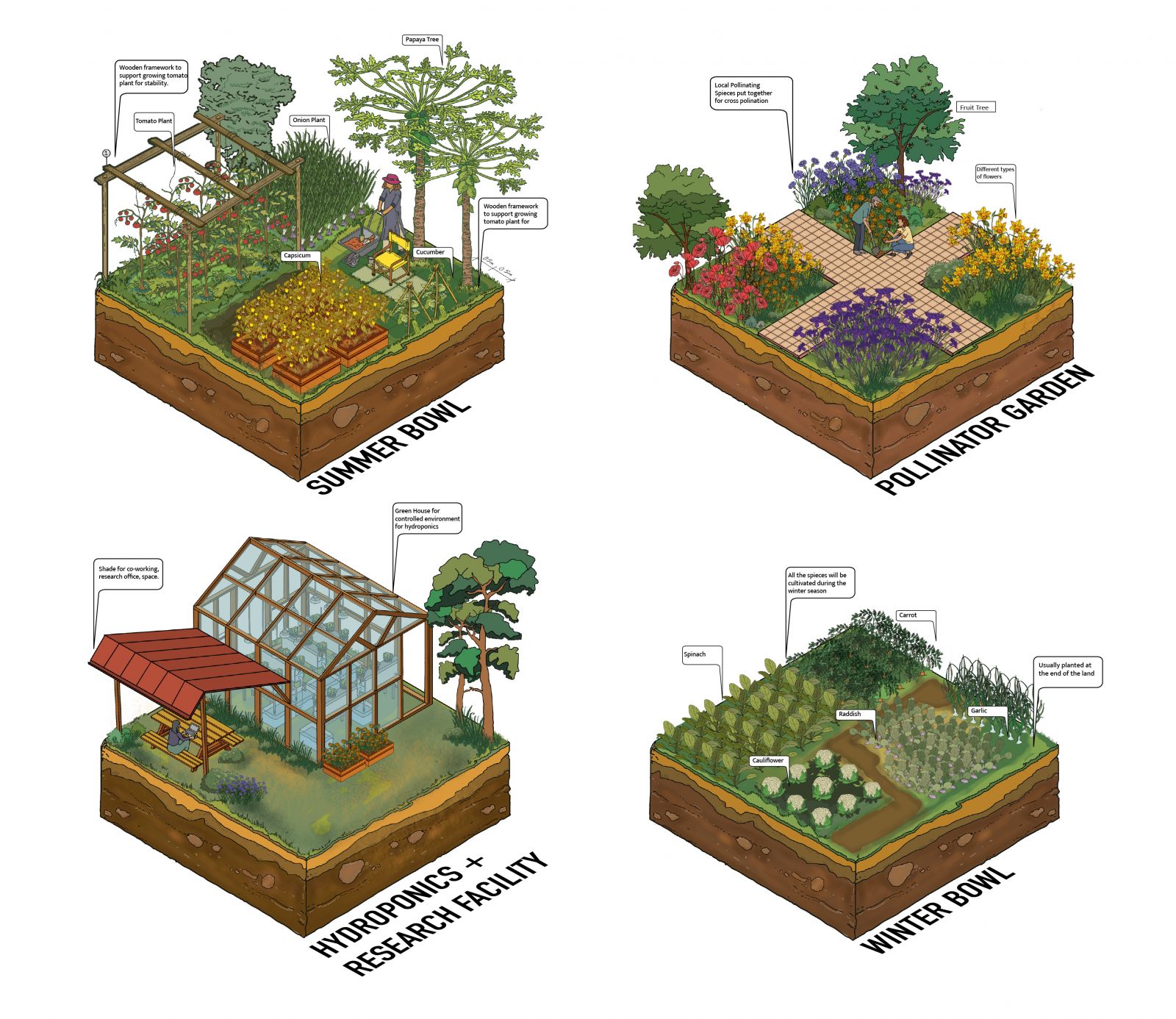
Division for allotment in the core: A grid (7 m x 7m) is considered post-analysis of gardens. These can be further subdivided as per the choices of the leaseholder.
Therefore recognising the potential of these unique infrastructures that has evolved on their own, by the community, for their use can be leveraged to create a productive infrastructure that supports such uses.