Your browser is out-of-date!
For a richer surfing experience on our website, please update your browser. Update my browser now!
For a richer surfing experience on our website, please update your browser. Update my browser now!
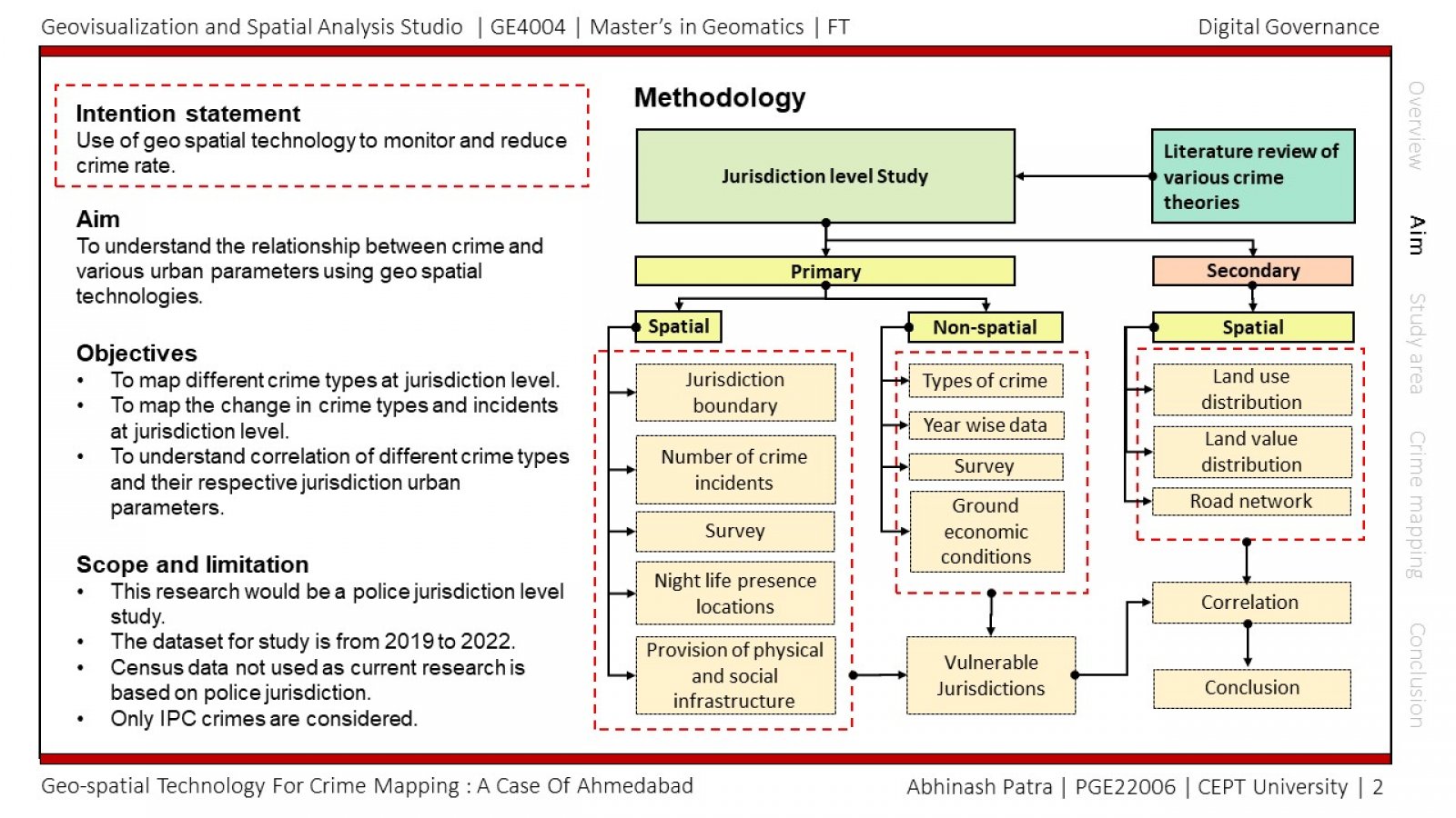
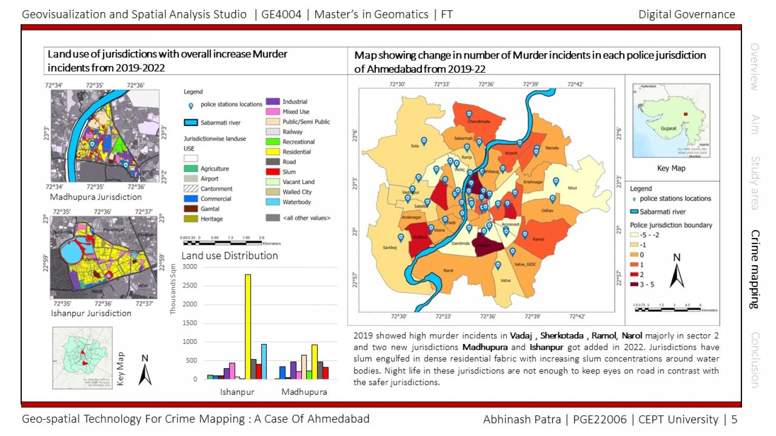
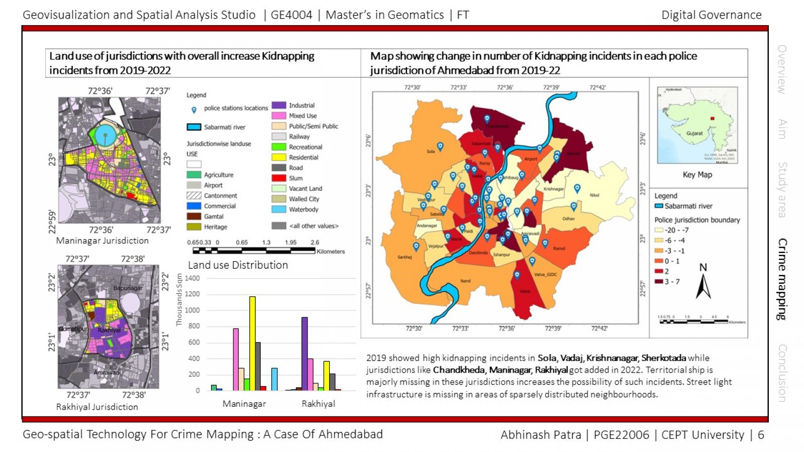
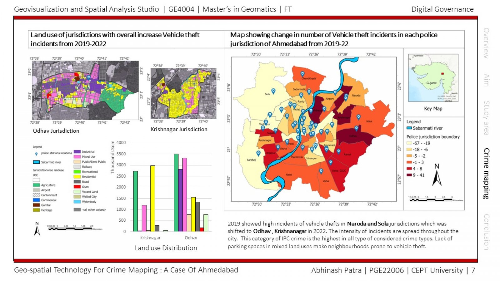
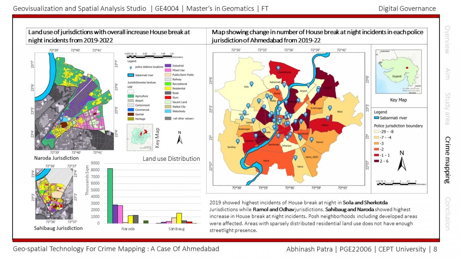
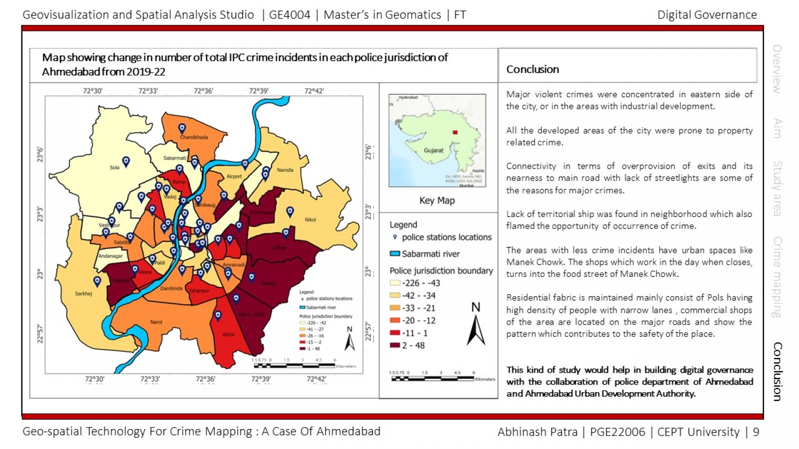
India's urbanization raises concerns, especially given the growing percentage of the poor that reside there. Different approaches to managing cities, the associated infrastructure and service needs are necessary due to the size and urgency of the challenge. Rapid urbanization not only provides advantages, but also significant drawbacks. Some of those detrimental effects have a negative impact on the city's safety and tranquilly. Population density in metropolitan areas is growing, which has led to issues with competing demands for land, inadequate infrastructure, environmental degradation, and safety and security. The greatest threats to life safety in metropolitan areas are an increase in crime. This study intends to use of Geo spatial technologies to improve understanding of crime and causational factors with their land uses to get a broader understanding of the situation by also looking into micro components of demographics of that area and various urban parameters.