Your browser is out-of-date!
For a richer surfing experience on our website, please update your browser. Update my browser now!
For a richer surfing experience on our website, please update your browser. Update my browser now!
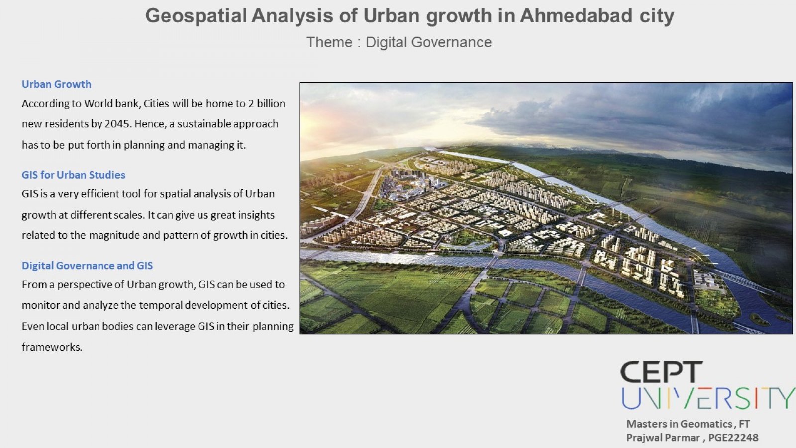
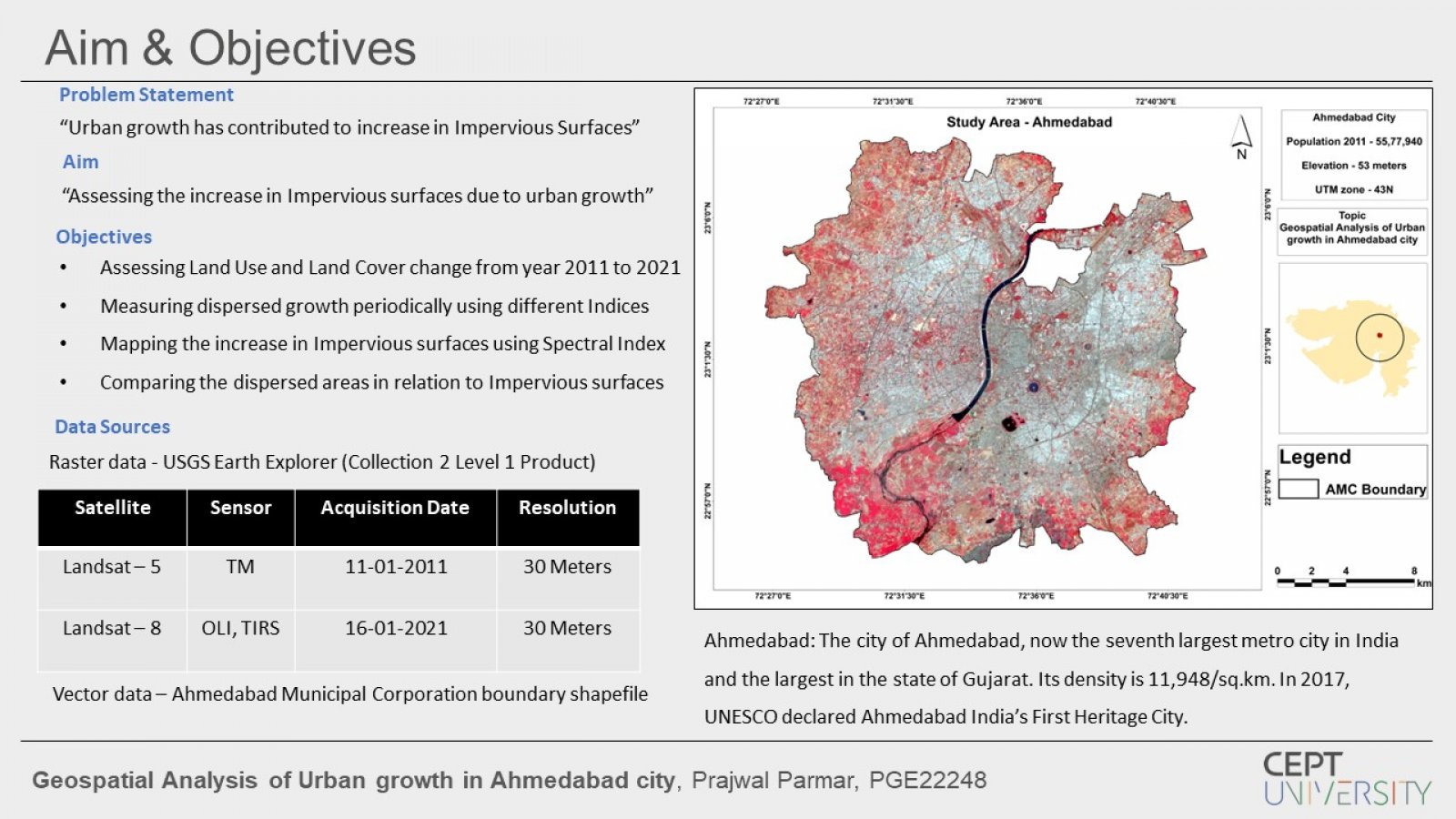
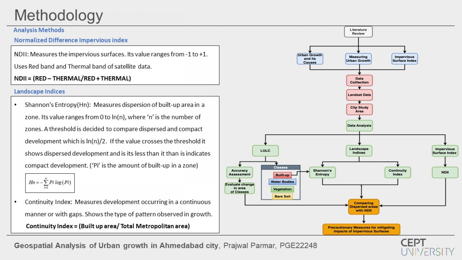
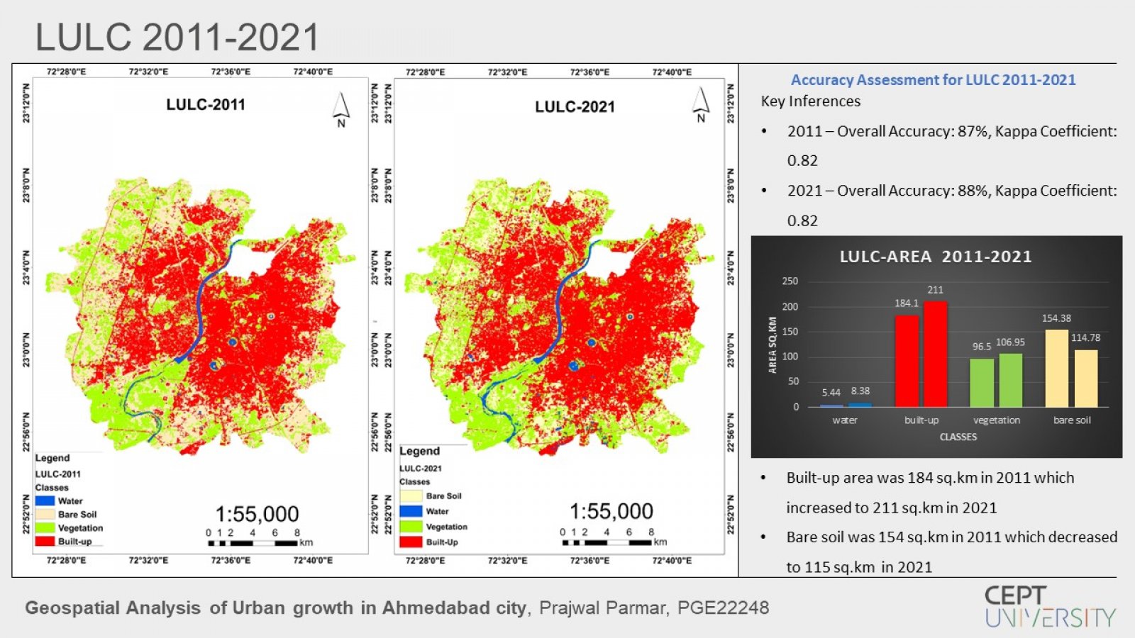
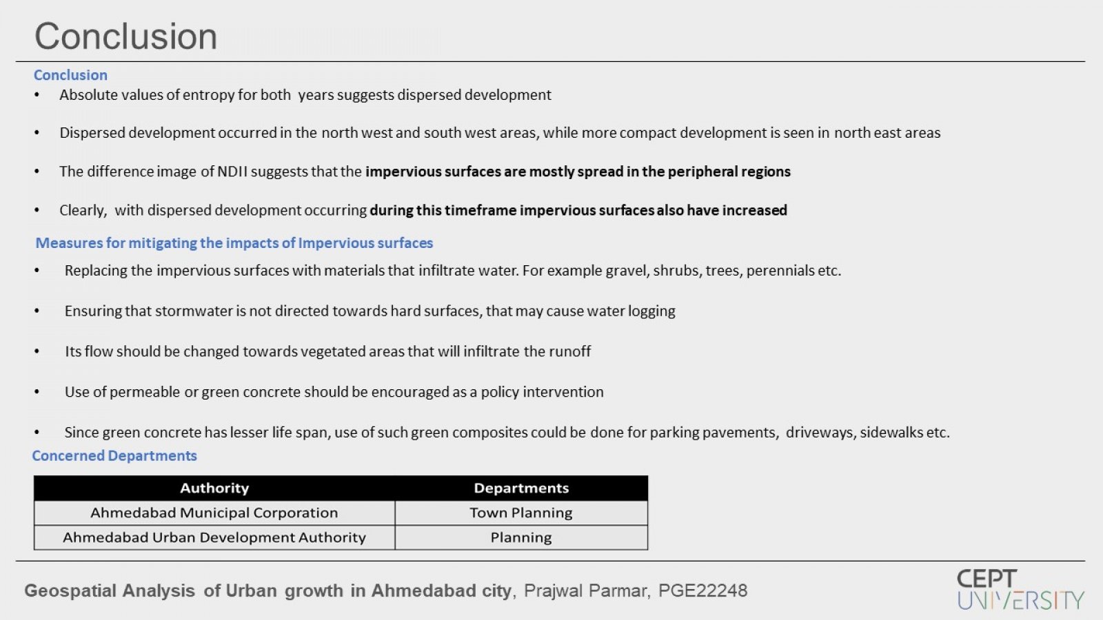
The project aims to spatially analyse urban growth of Ahmedabad city from 2011 to 2021 and relate it with increase in impervious surfaces.Analysis of growth for built-up area is done using Landscape indices like Shannon's Entropy and Continuity index. While, Impervious surfaces are mapped using Normalized Difference Impervious Index. Using satellite imagery all these analyses clearly indicate the rise in impervious surfaces in correlation to urban growth. The studio theme is "Digital Governance", hence this study envisages to aide the planning department's future endeavours.