Your browser is out-of-date!
For a richer surfing experience on our website, please update your browser. Update my browser now!
For a richer surfing experience on our website, please update your browser. Update my browser now!
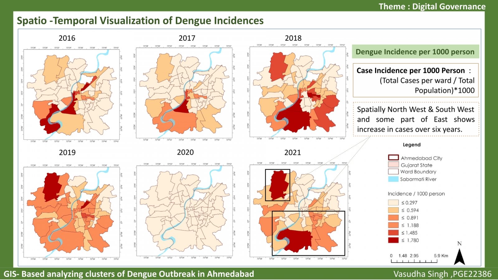
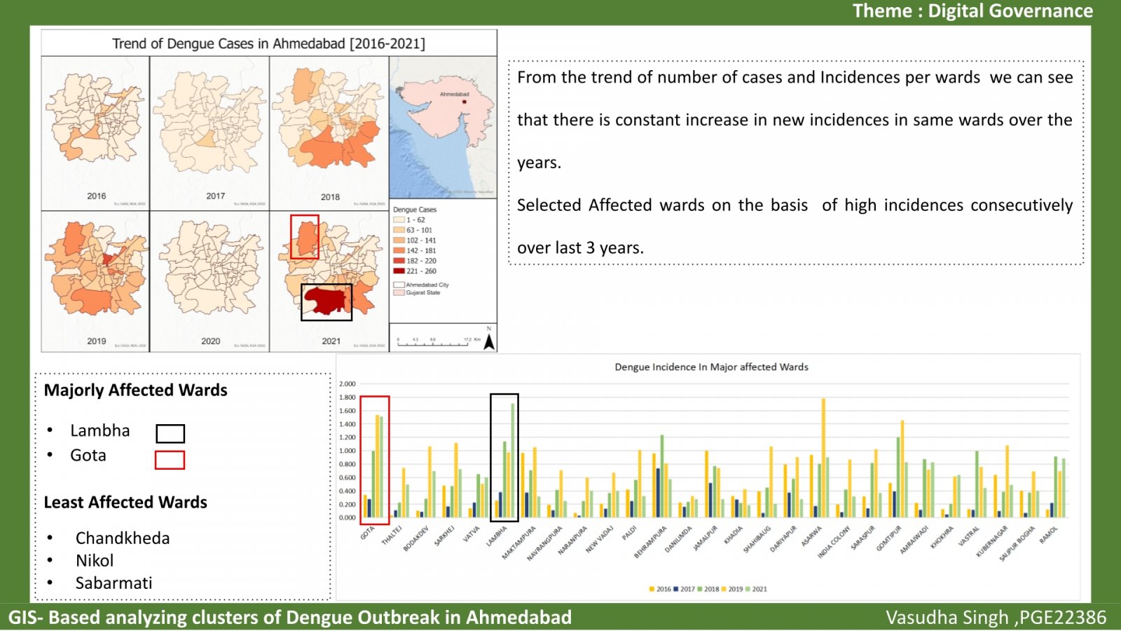
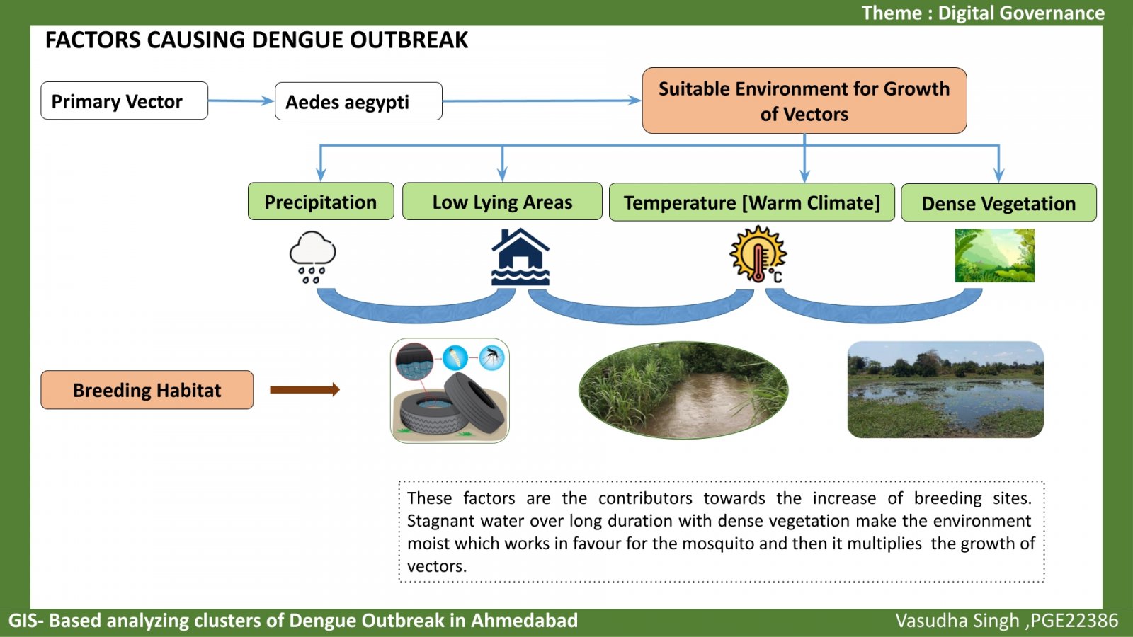
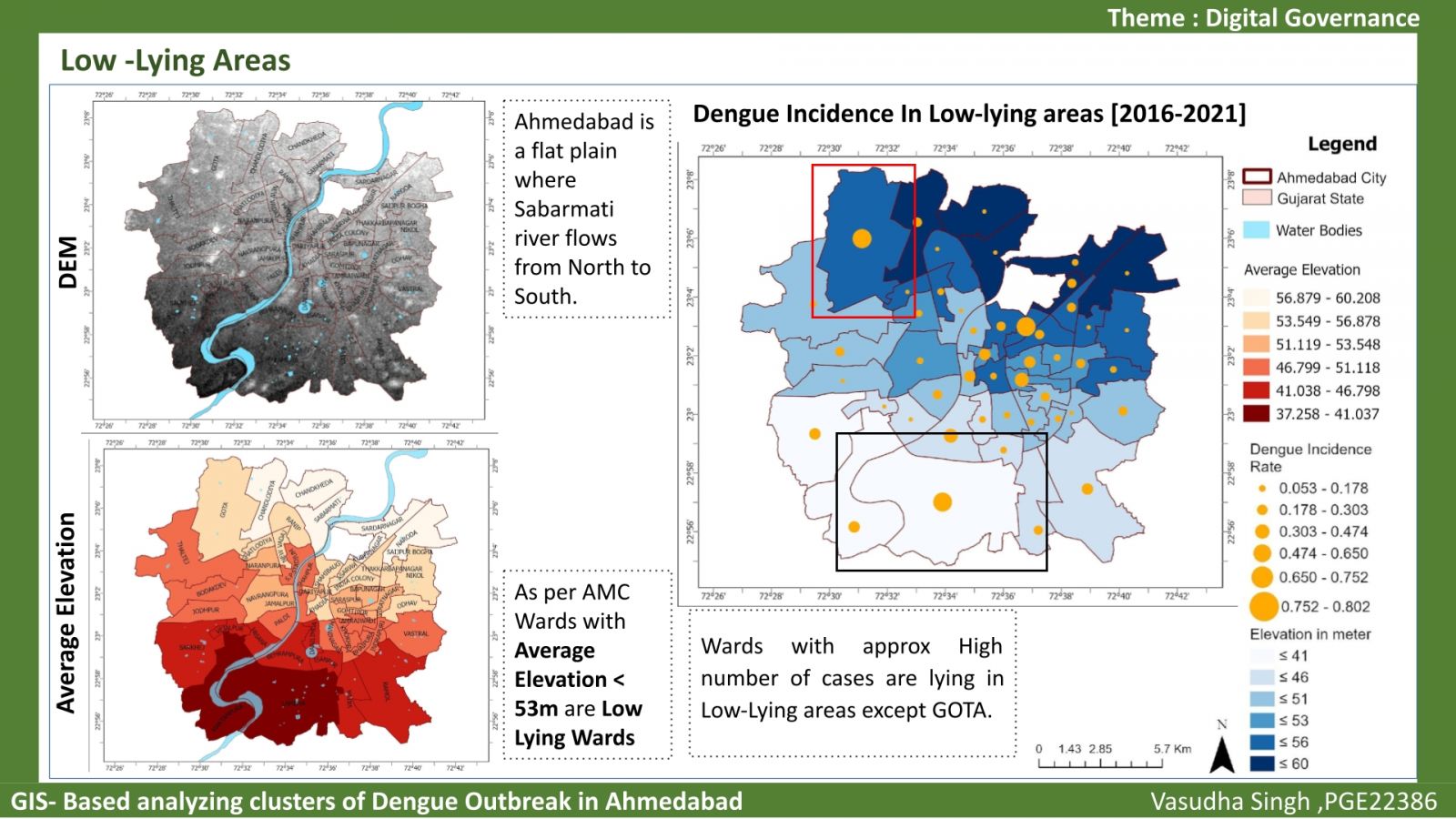
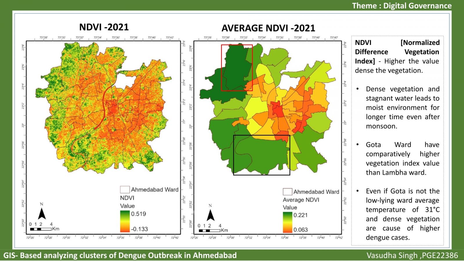
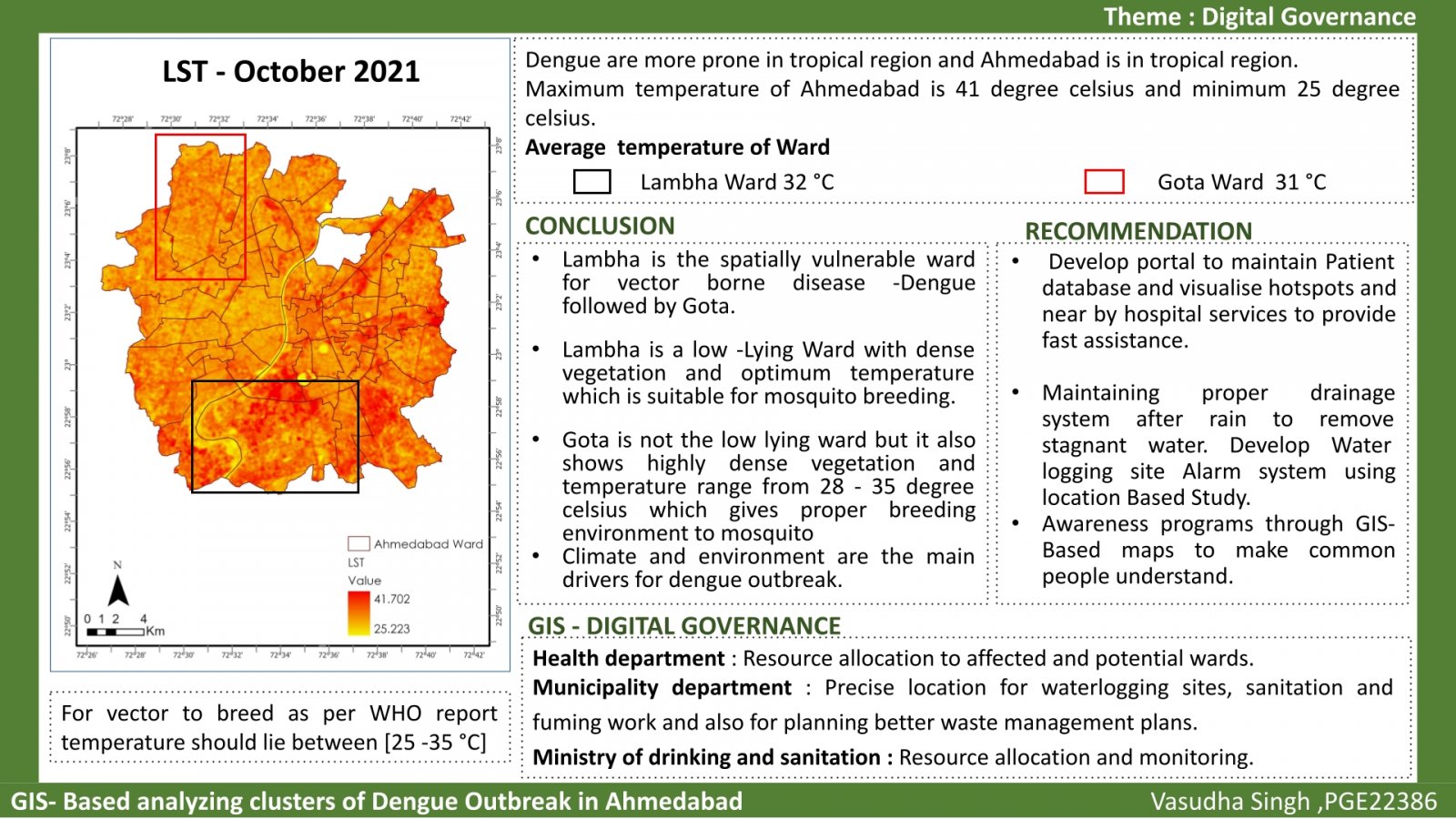
As per WHO, Global burden of vector borne disease is growing rapidly and causing menace to human kind. Ahmedabad city is one of the examples where we see a consecutive spike in dengue cases every year. This study aim to see Spatio- temporal visualization of incidences over 6 years 2016- 2021 and to identify the environmental and climatic factors which helps in growth of vector using remote sensing imagery and climatic data. This study aligns to the use of GIS in health sector and helps in exploring various ways to facilitate authorities in planning better public health services.