Your browser is out-of-date!
For a richer surfing experience on our website, please update your browser. Update my browser now!
For a richer surfing experience on our website, please update your browser. Update my browser now!
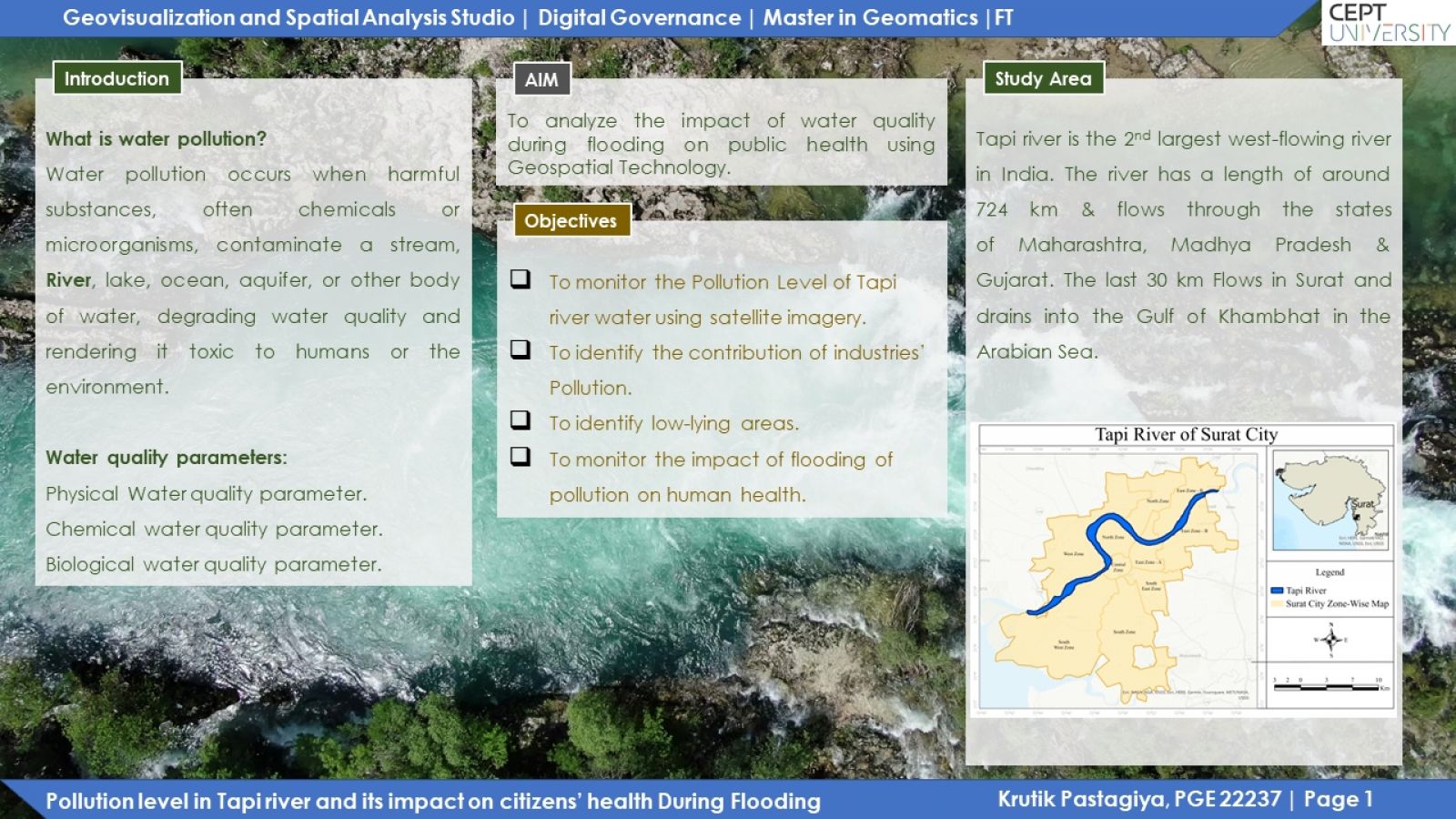
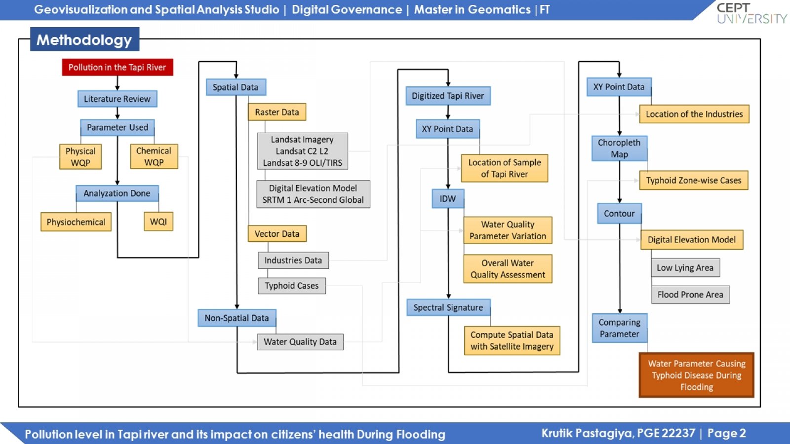
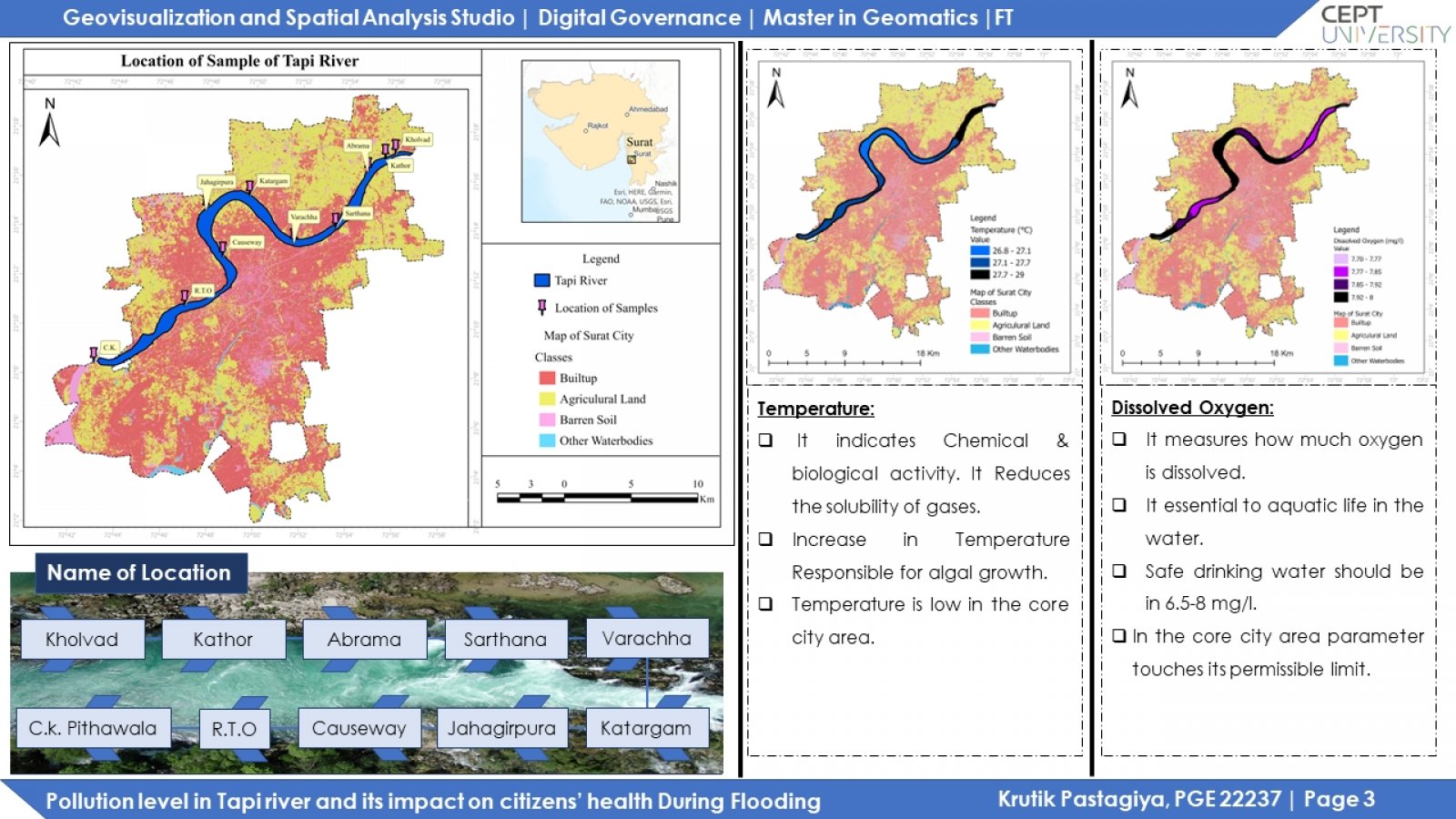
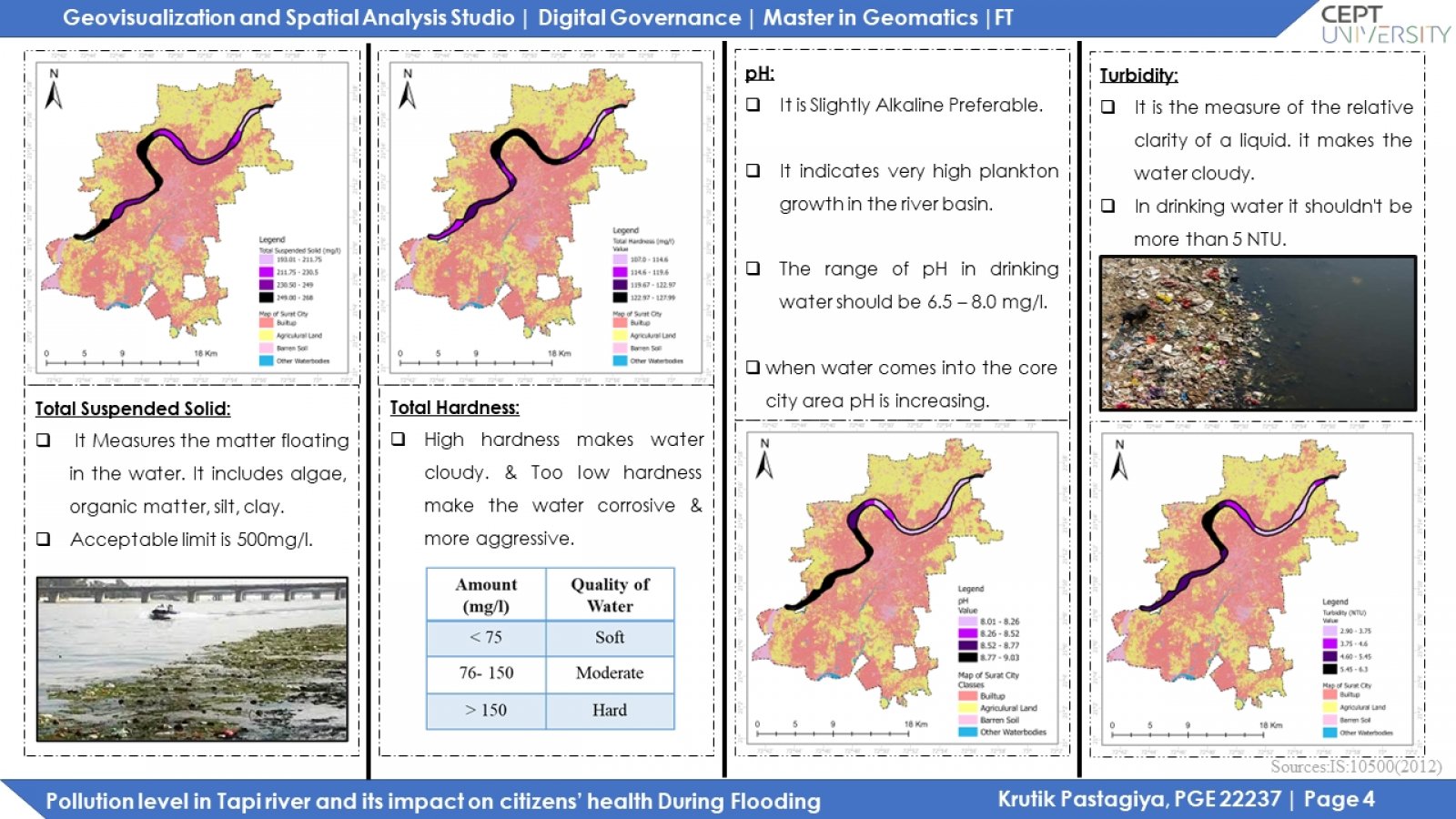
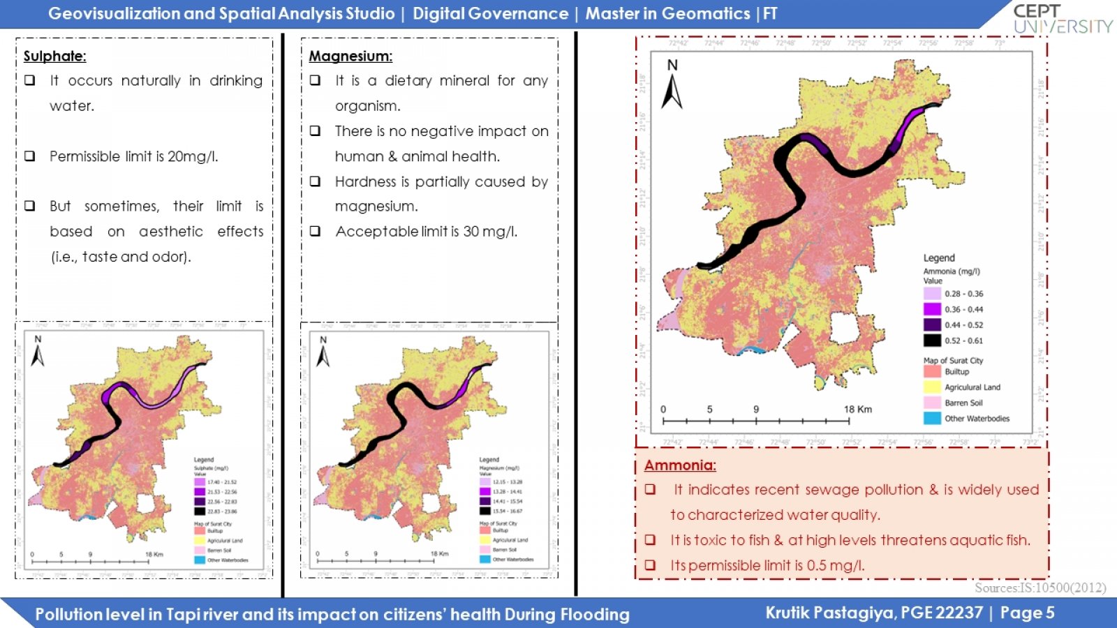
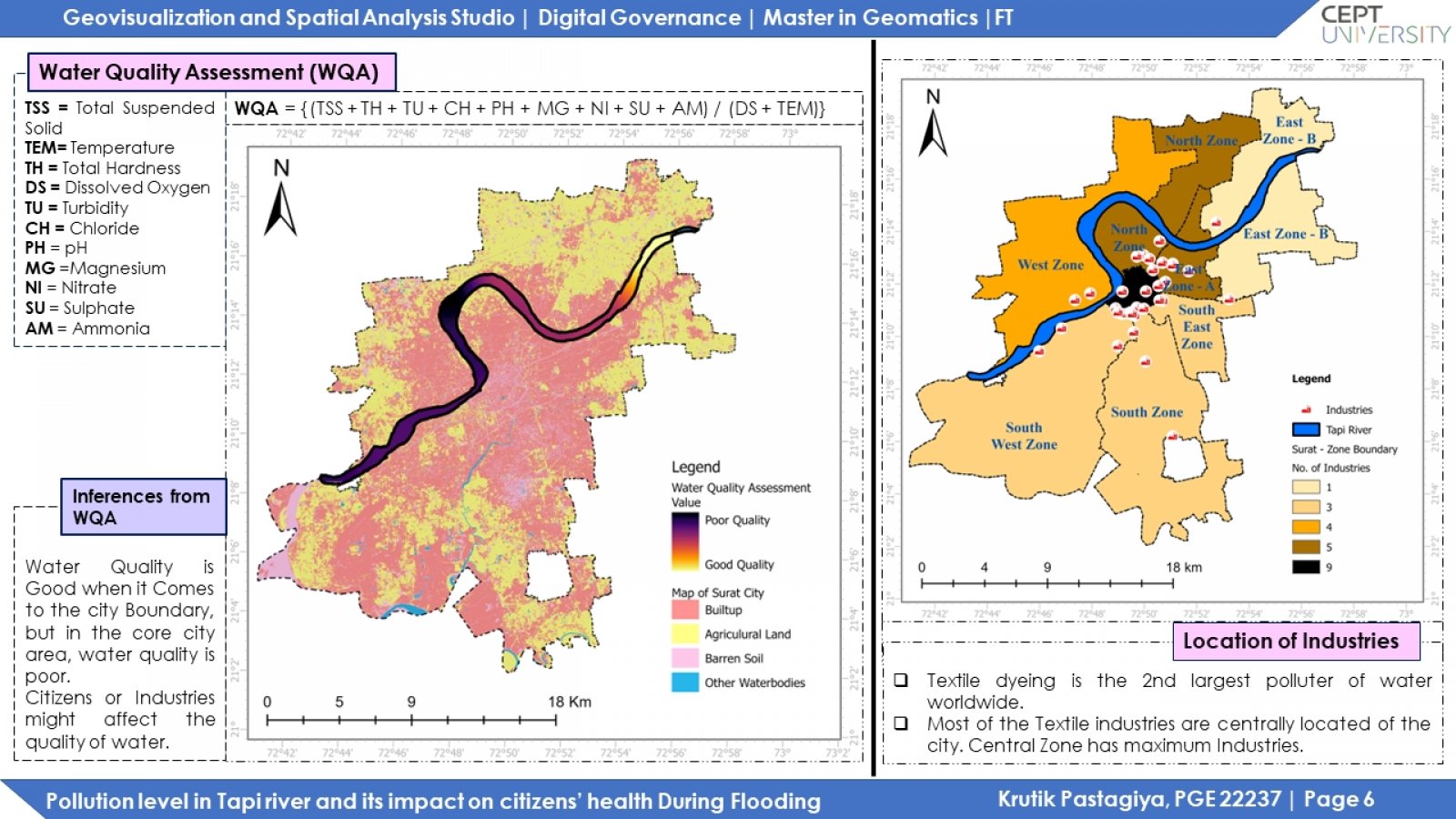
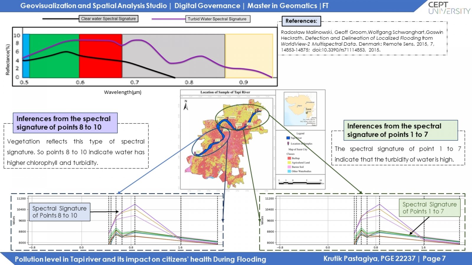
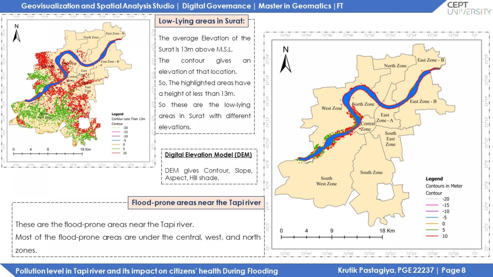
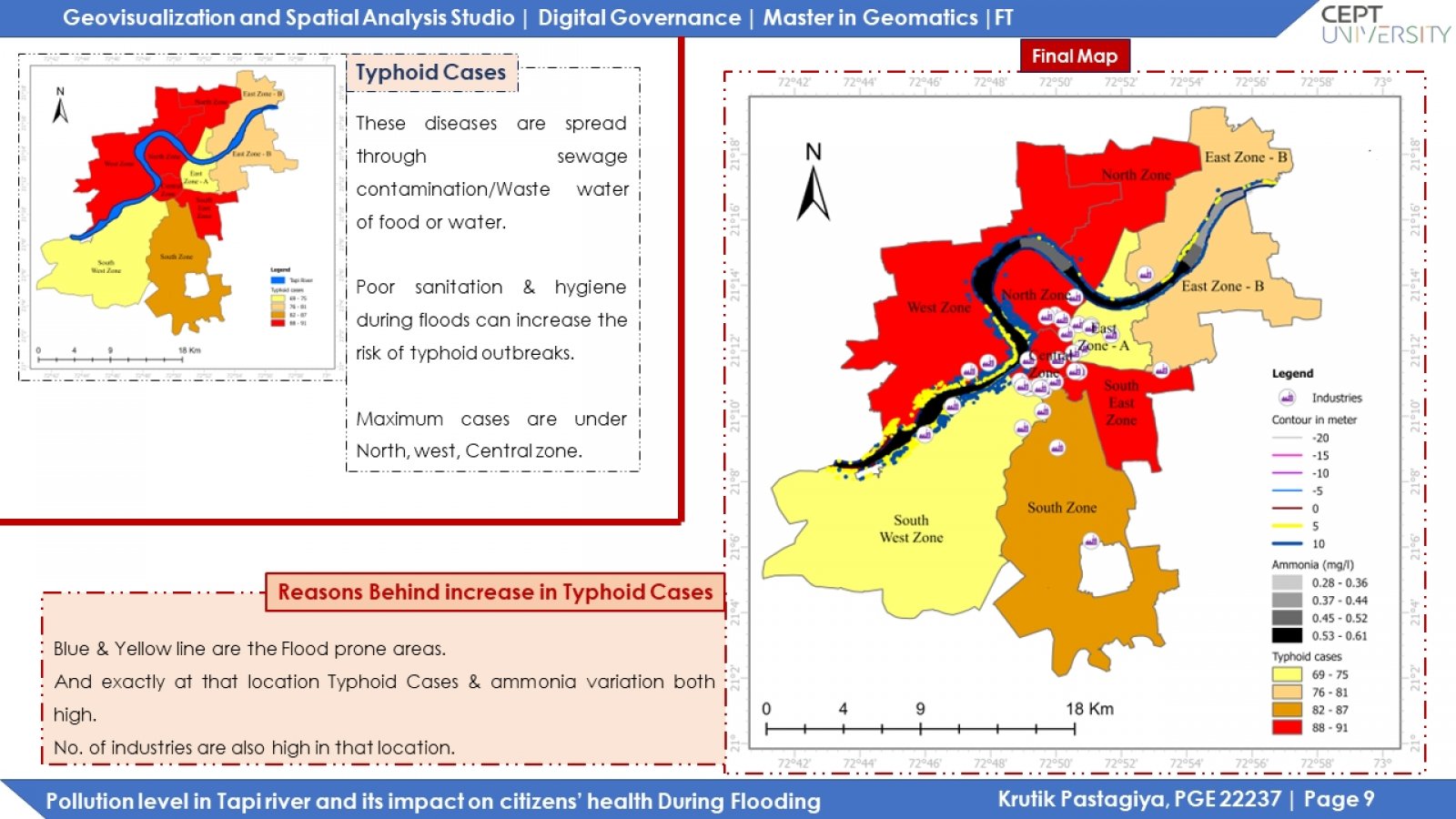
Tapi river is the 2nd largest west-flowing river in India. The river has a length of around 724 km. The last 30 km flows into Surat city, draining into the Gulf of Khambhat in the Arabian Sea. This study focuses on monitoring the water quality of the Tapi river in Surat city. Water quality parameters variation is shown in the map of Surat city. After that, compare spatial data with satellite imagery. The satellite imagery only gets turbidity and chlorophyll content of water. After this, using a digital elevation model, plot low-lying areas in Surat and the flood-prone regions near the Tapi river. After this, generate a choropleth map of typhoid cases for Surat. And then compare which water parameter variation affects to increase in typhoid cases during flooding.