Your browser is out-of-date!
For a richer surfing experience on our website, please update your browser. Update my browser now!
For a richer surfing experience on our website, please update your browser. Update my browser now!
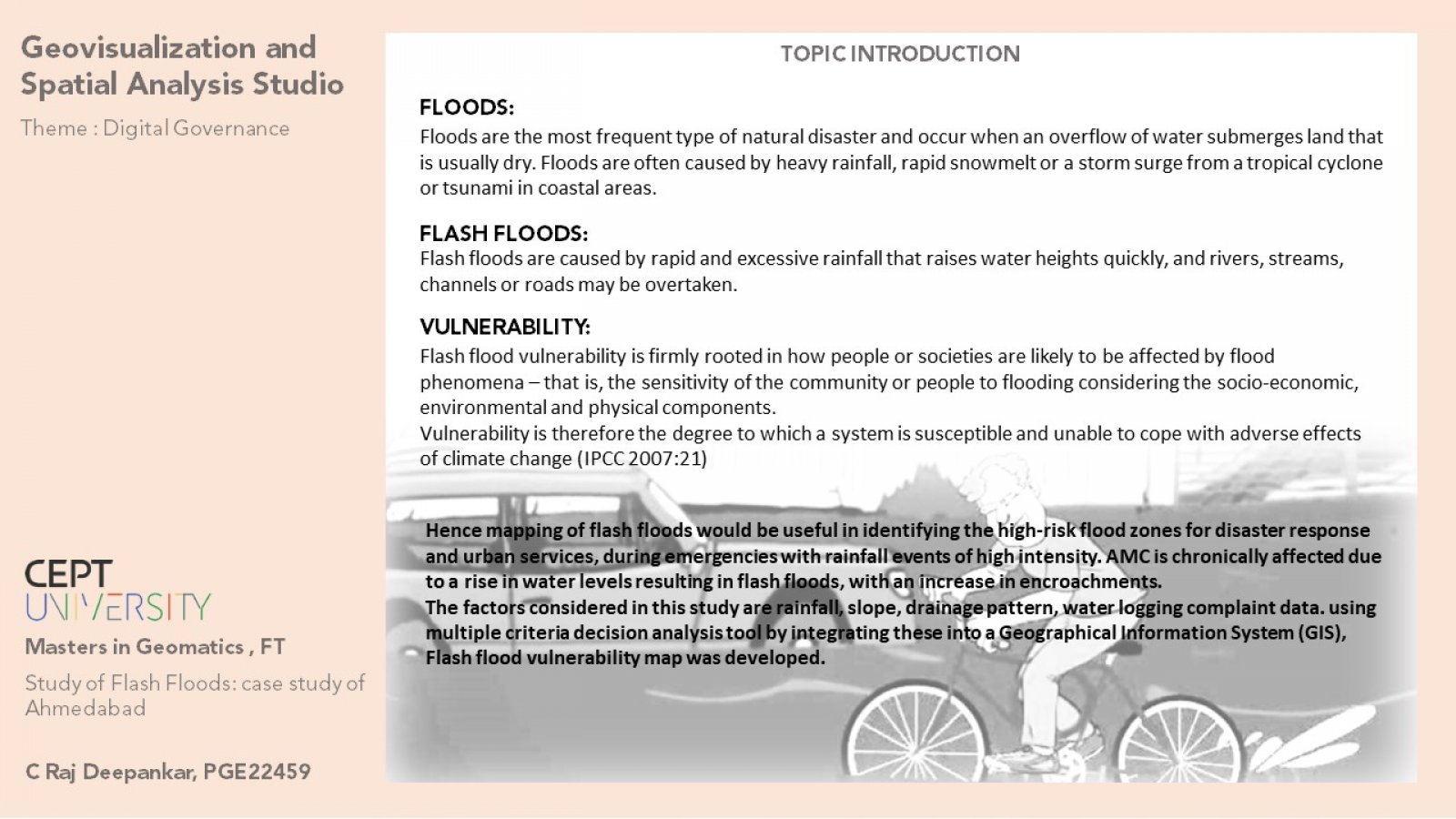
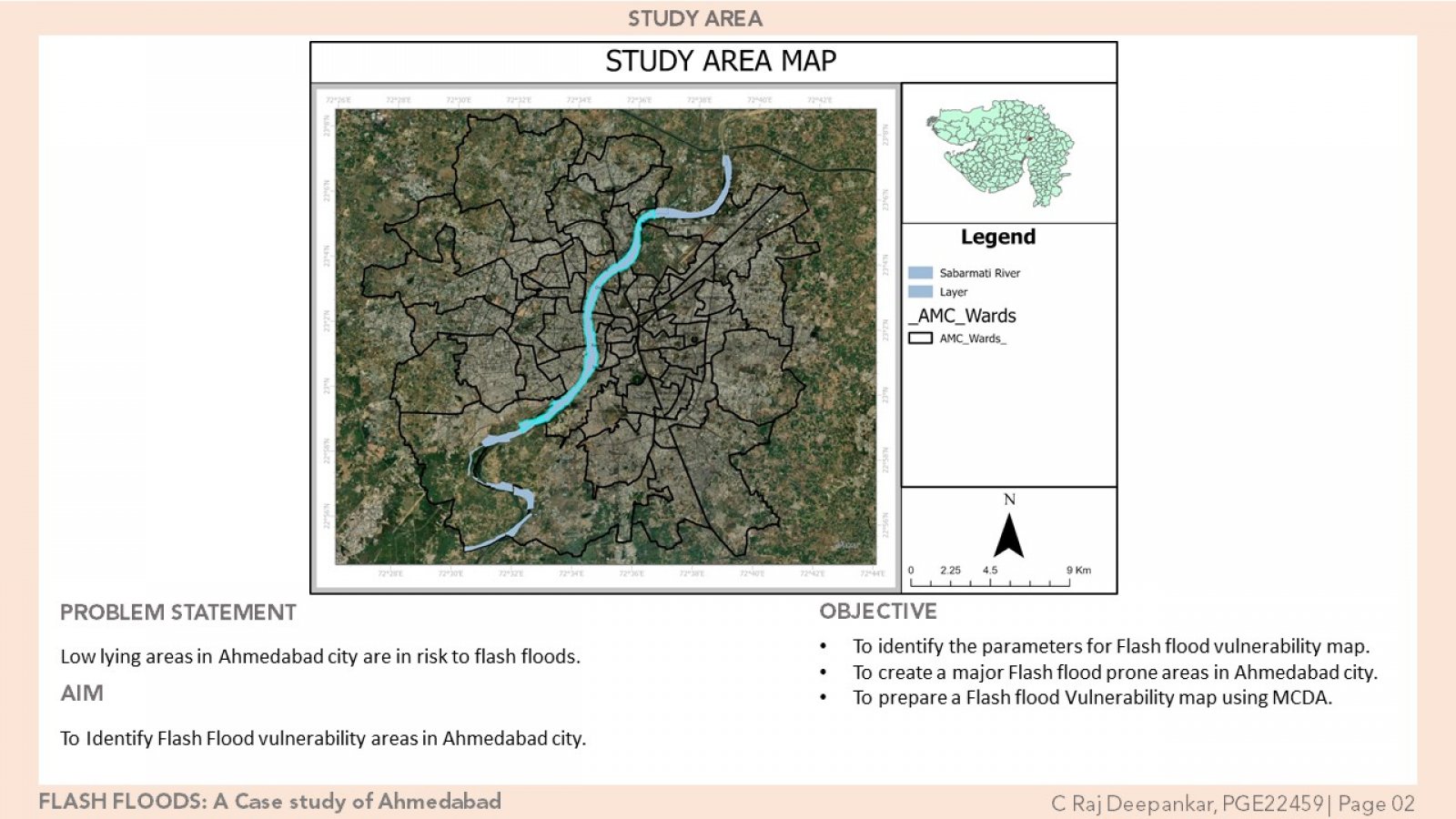
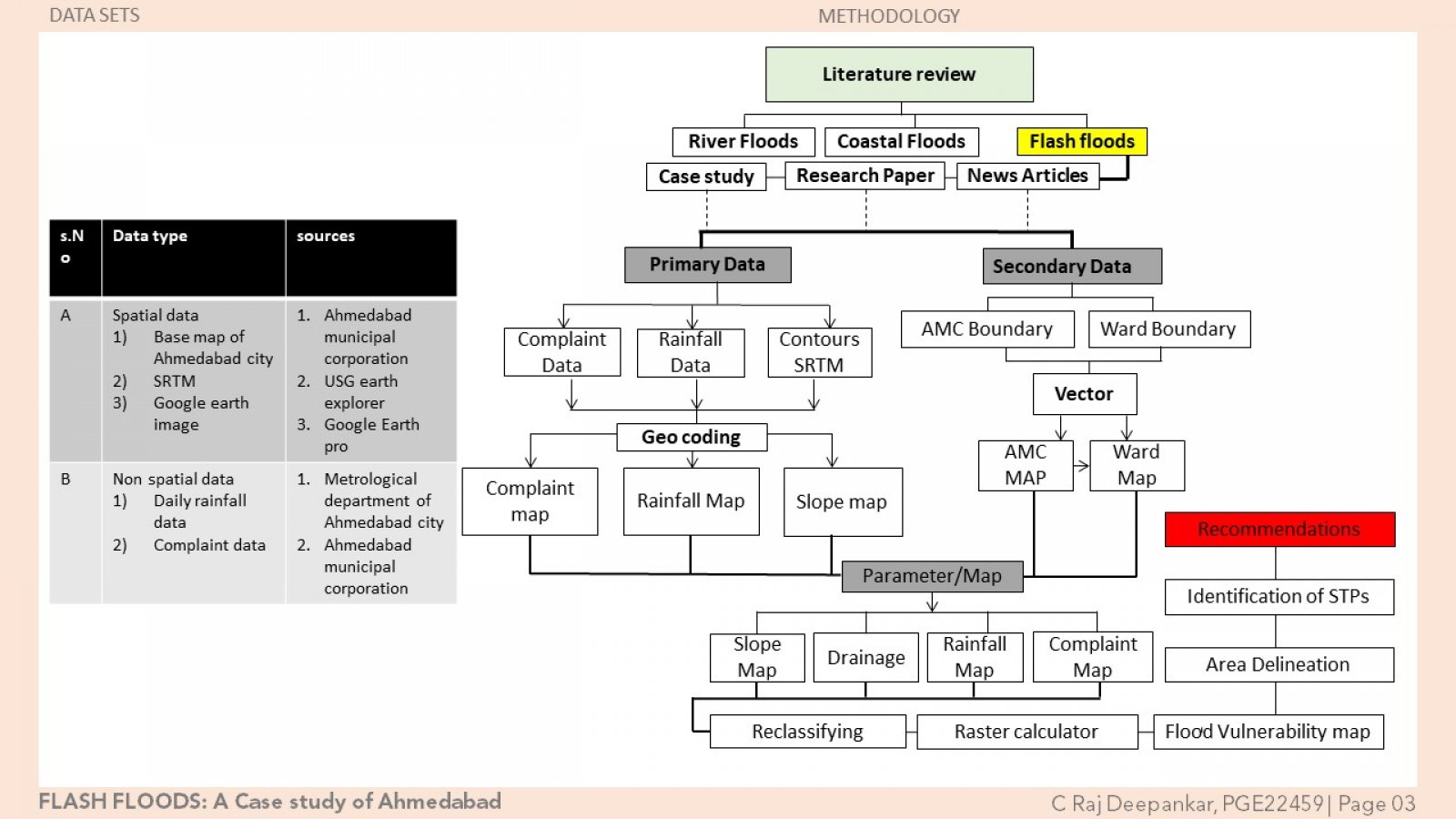
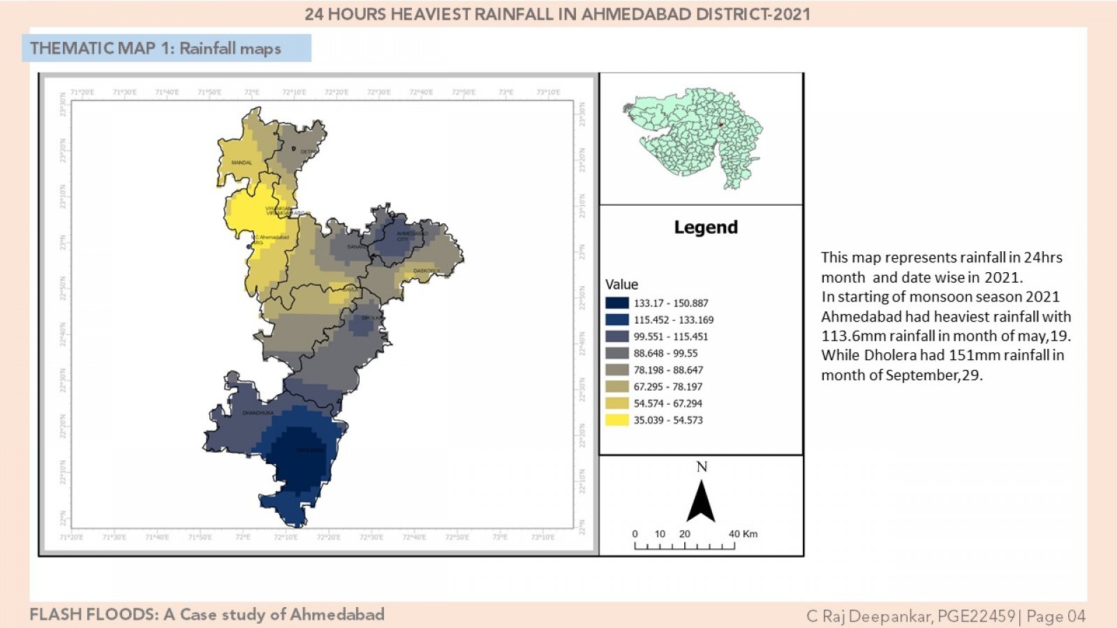
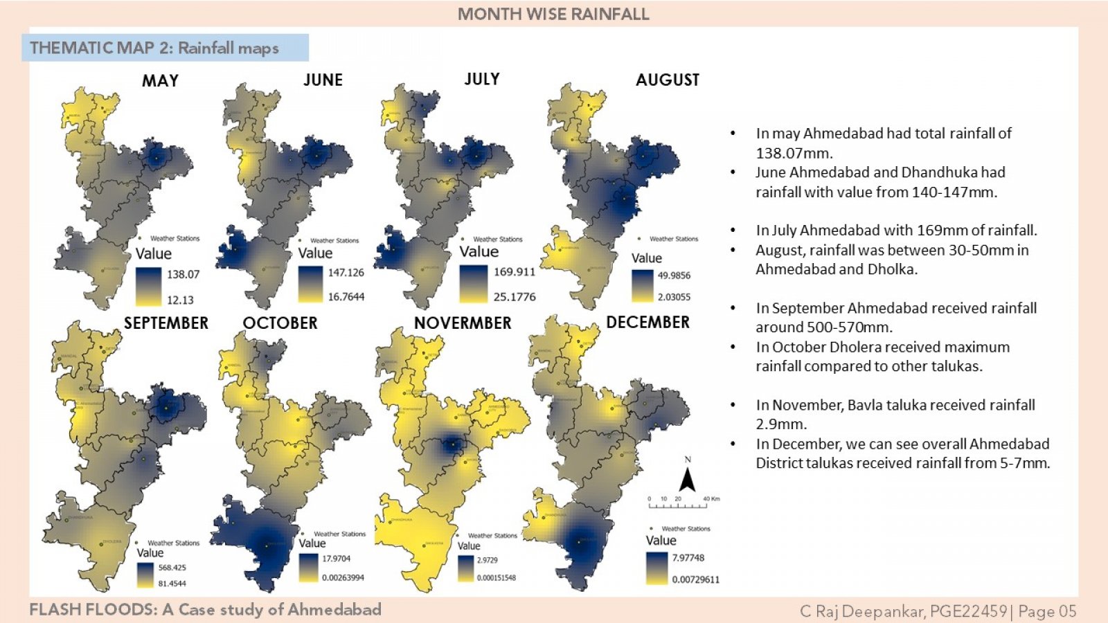
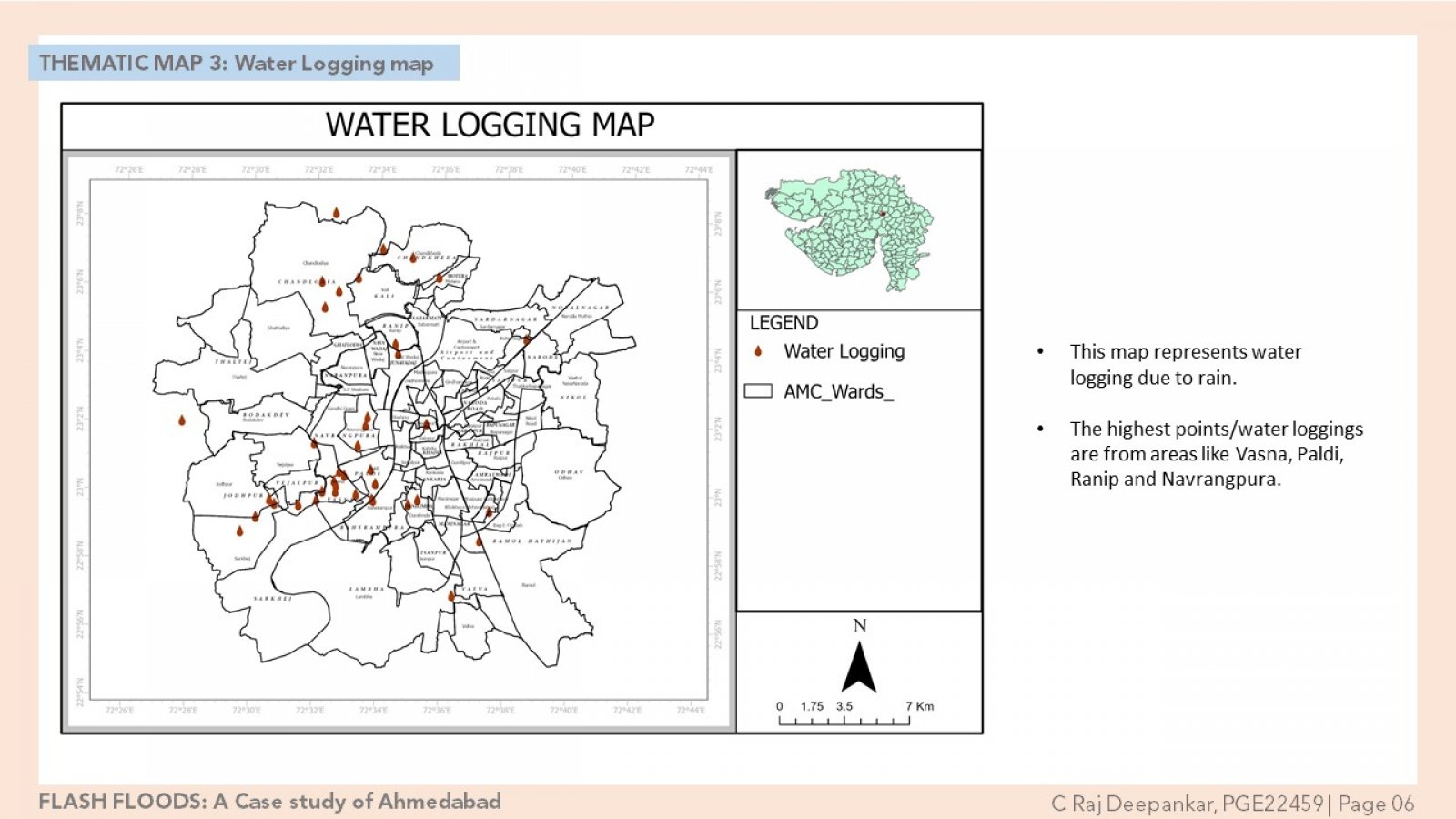
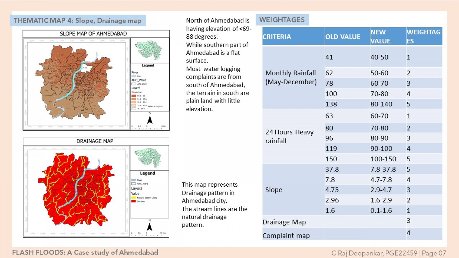
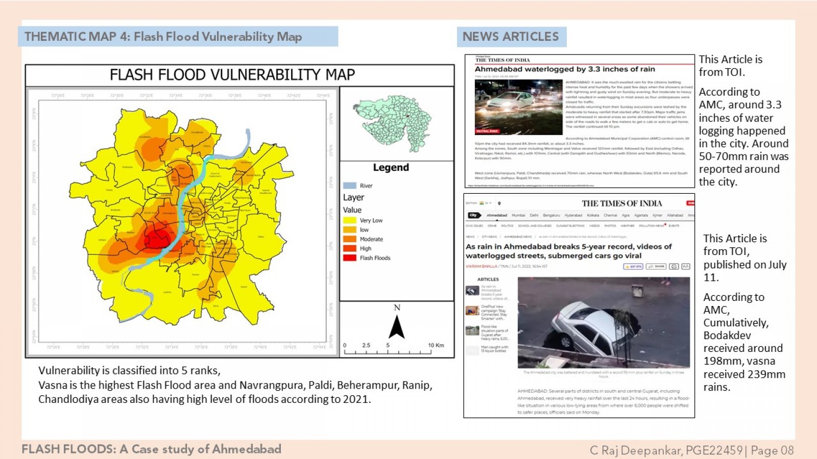
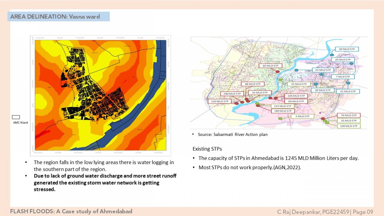
Low lying areas in Ahmadabad city are in risk to flash floods. Dense urbanization leading to uncontrolled transformations within settlements result in flash flooding with overflowing drains leading to a greater inconvenience for the public and damage to private properties. Hence mapping of flash floods would be useful in identifying the high-risk flood zones for disaster response and urban services, during emergencies with rainfall events of high intensity. AMC is chronically affected due to a rise in water levels resulting in flash floods, with an increase in encroachments. The factors considered in this study are rainfall, slope, drainage pattern, water logging complaint. using multiple criteria decision analysis tool by integrating these into a Geographical Information System (GIS), Flash flood vulnerability map will be developed.