Your browser is out-of-date!
For a richer surfing experience on our website, please update your browser. Update my browser now!
For a richer surfing experience on our website, please update your browser. Update my browser now!
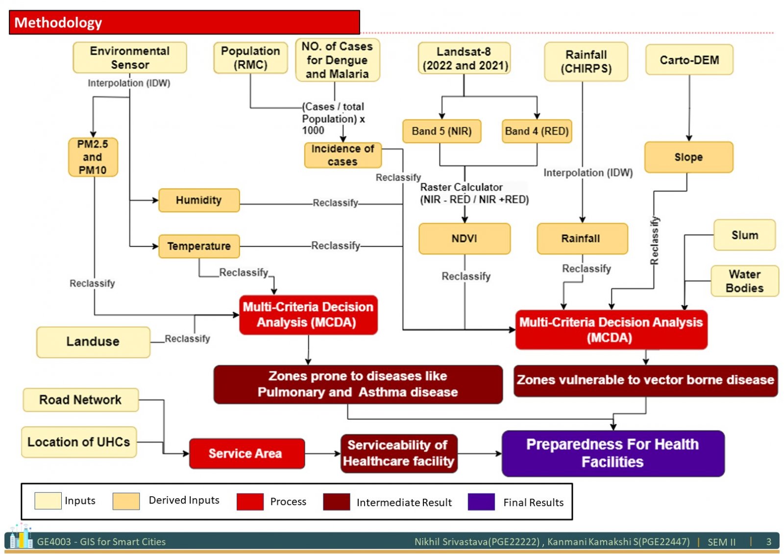
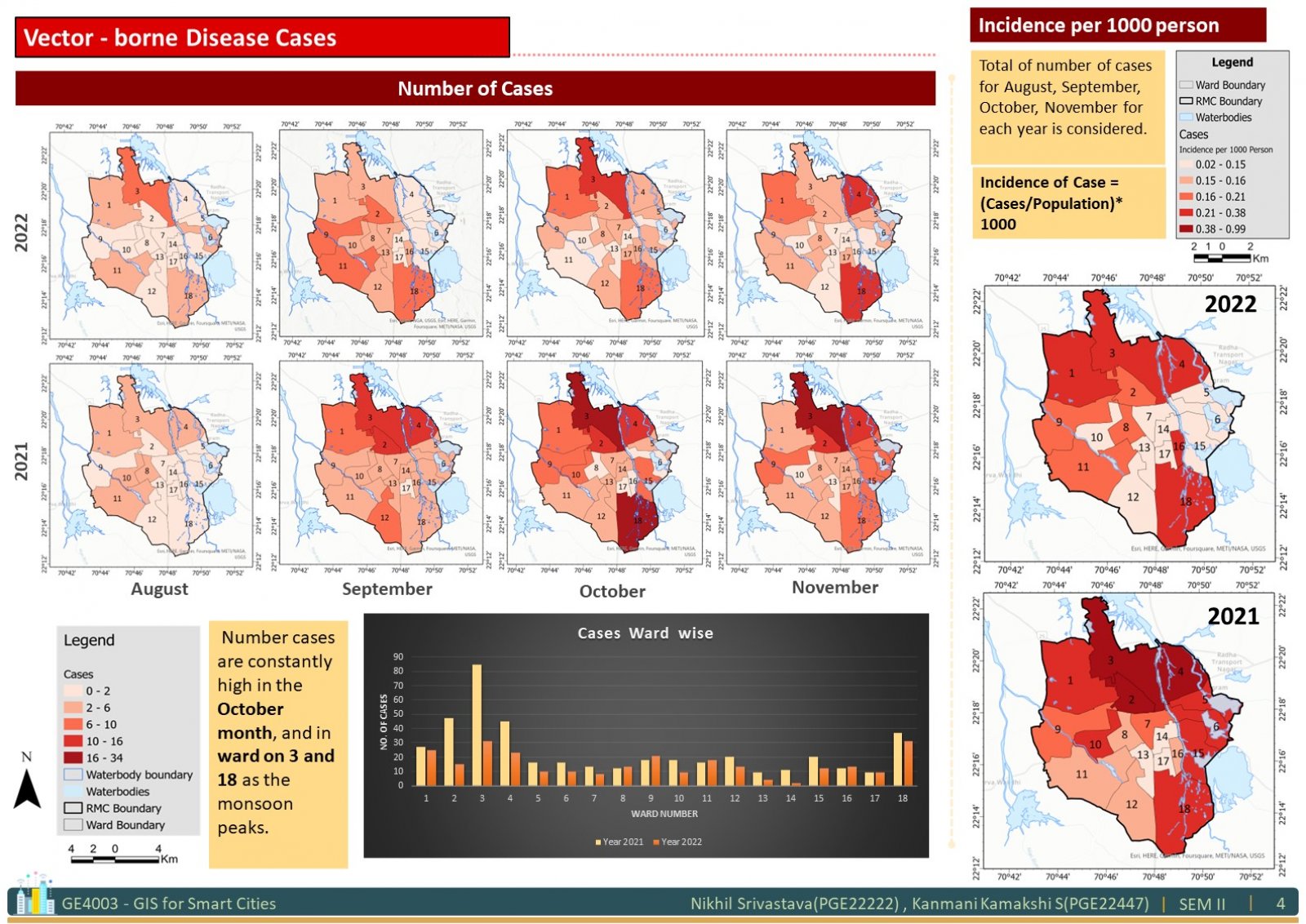
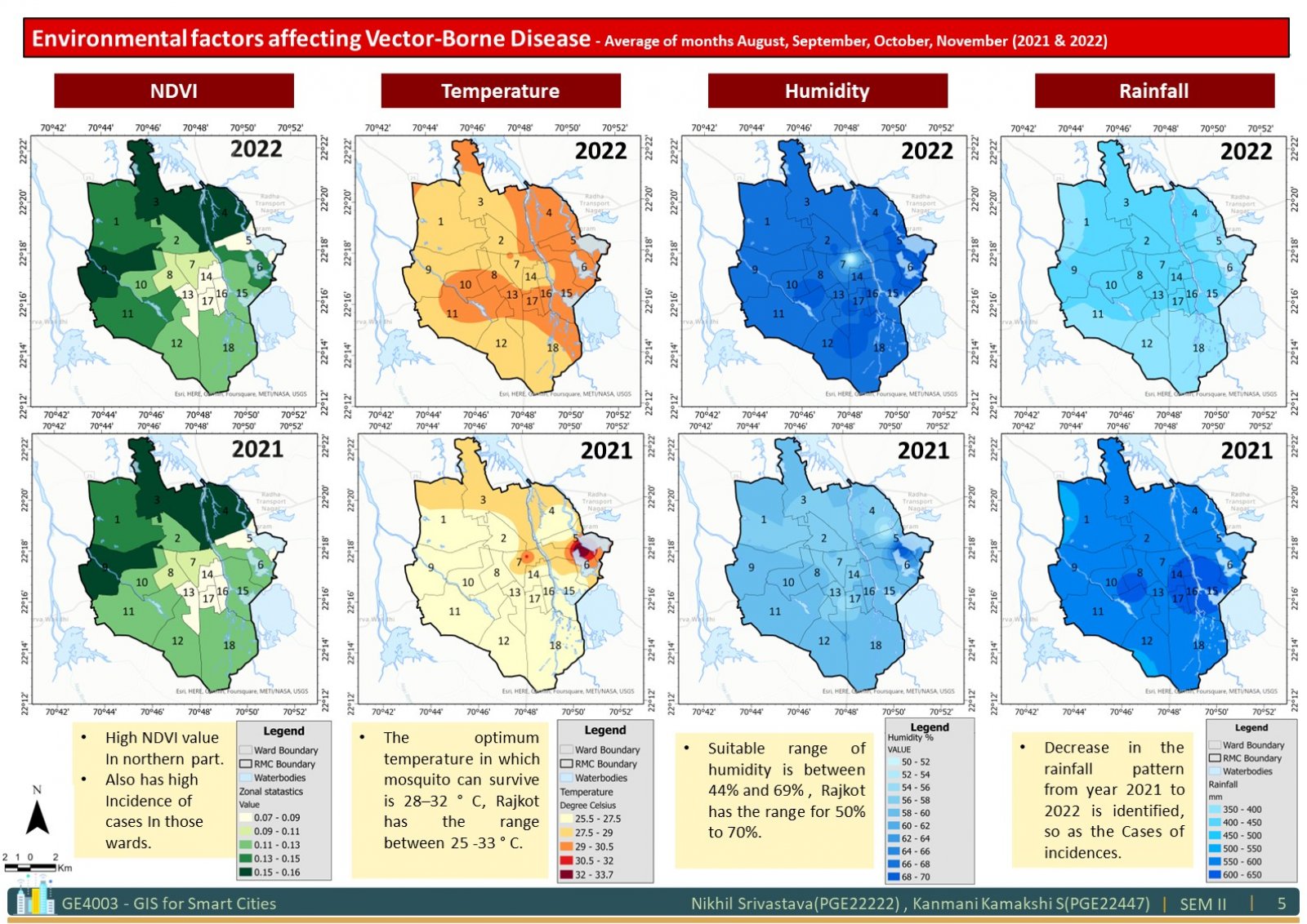
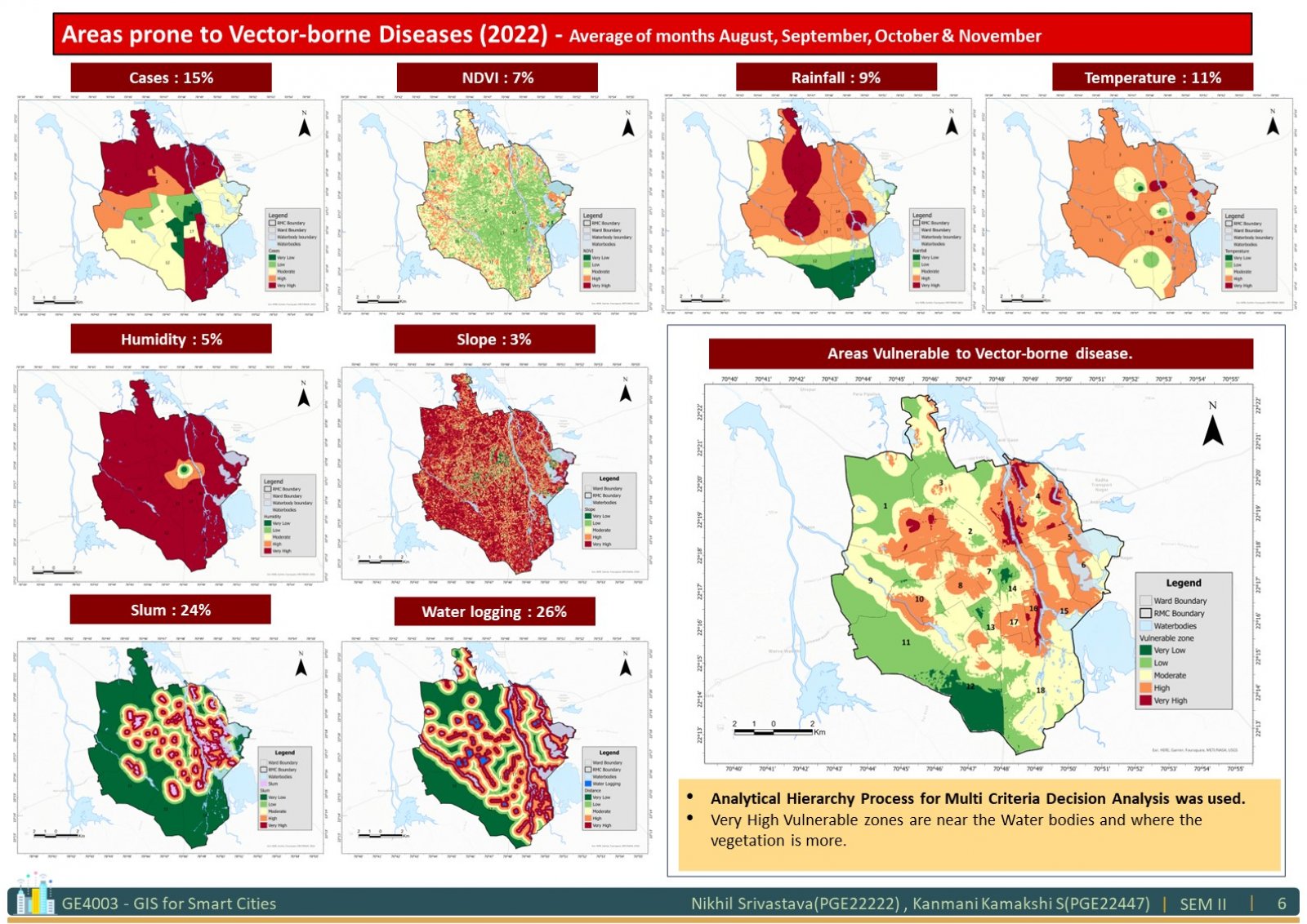
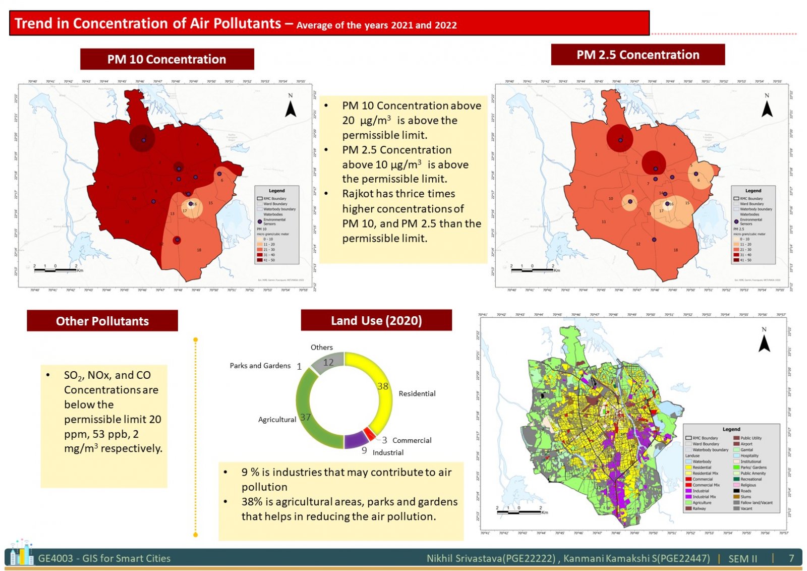
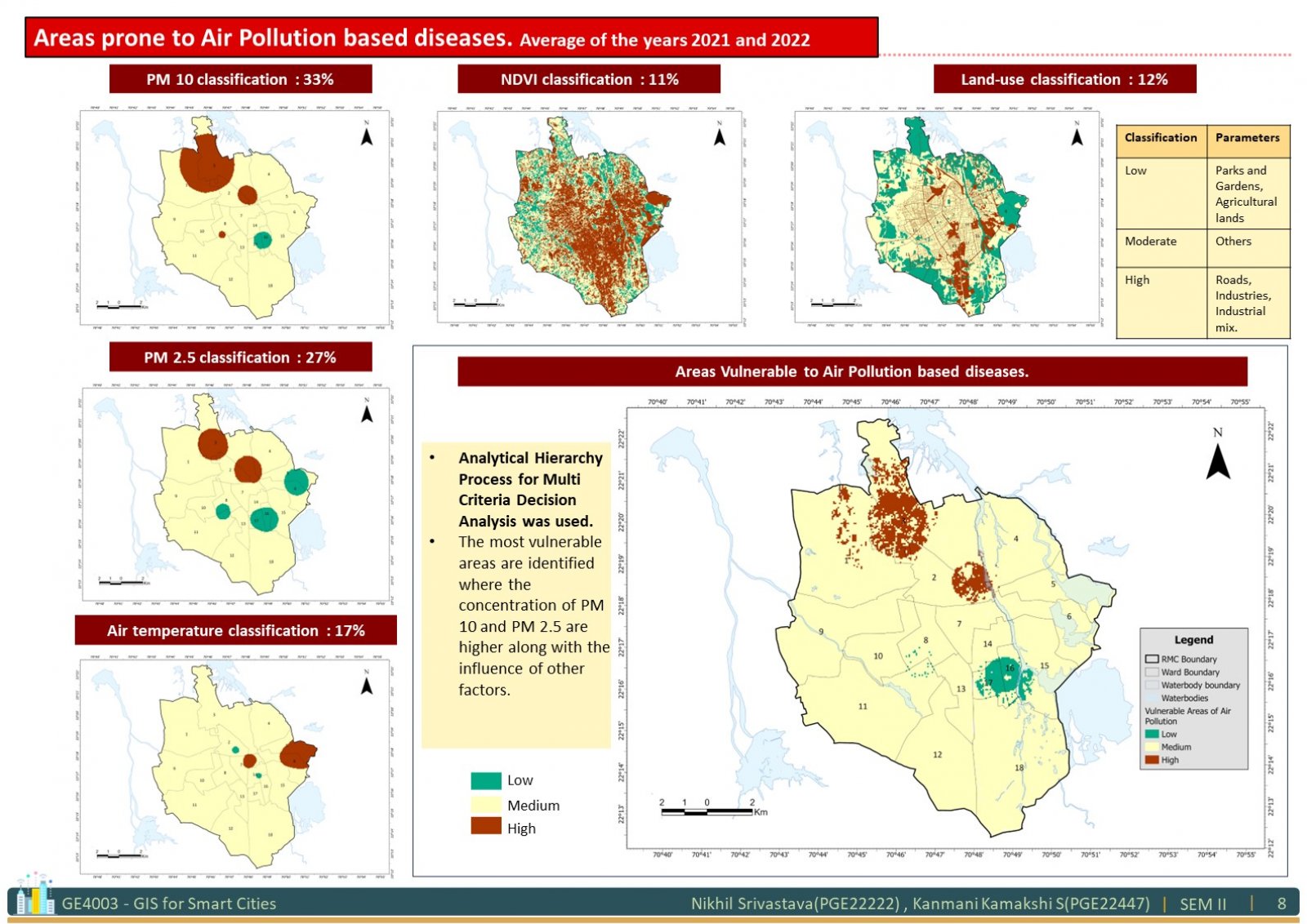
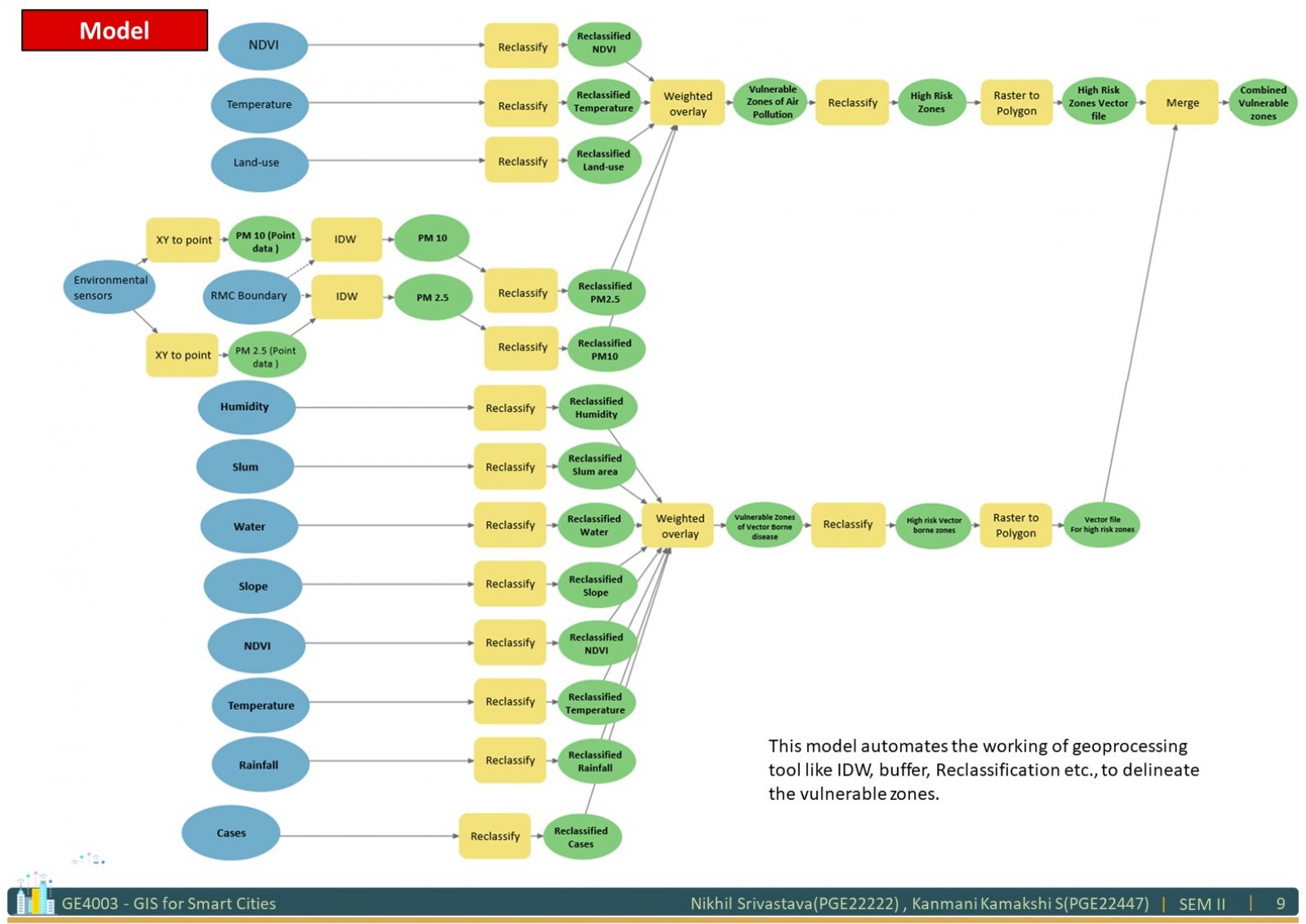
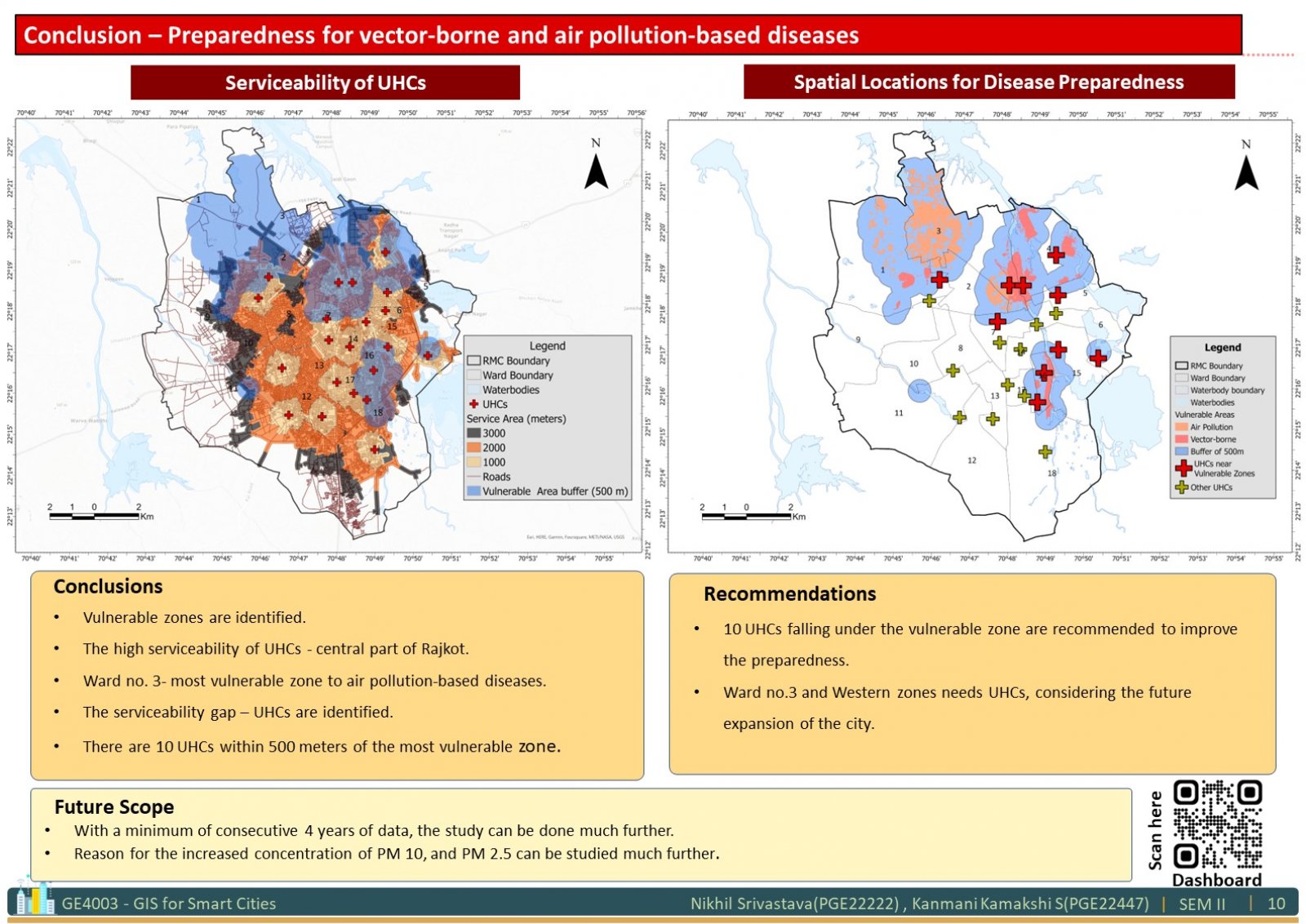
The study focuses on identifying the spatial locations for disease preparedness in a city. Environmental factors influencing Vector-borne diseases, diseases due to poor Air Quality, and serviceability of present healthcare infrastructures were analysed using geospatial technology. Vector-borne diseases like Malaria and Dengue are very prominent in monsoon seasons and it is one of the episodes consistently happening every year. The non-communicable diseases considered for the study are Asthma and Pulmonary diseases which have more correlation with the Air Quality of an environment. So, the most vulnerable zones to these diseases were identified with Multi-Criteria Decision Analysis for Vector-borne diseases, Diseases due to poor Air Quality and are provided suggestions to plan for preparedness with respect to respective diseases.
View Additional Work