Your browser is out-of-date!
For a richer surfing experience on our website, please update your browser. Update my browser now!
For a richer surfing experience on our website, please update your browser. Update my browser now!
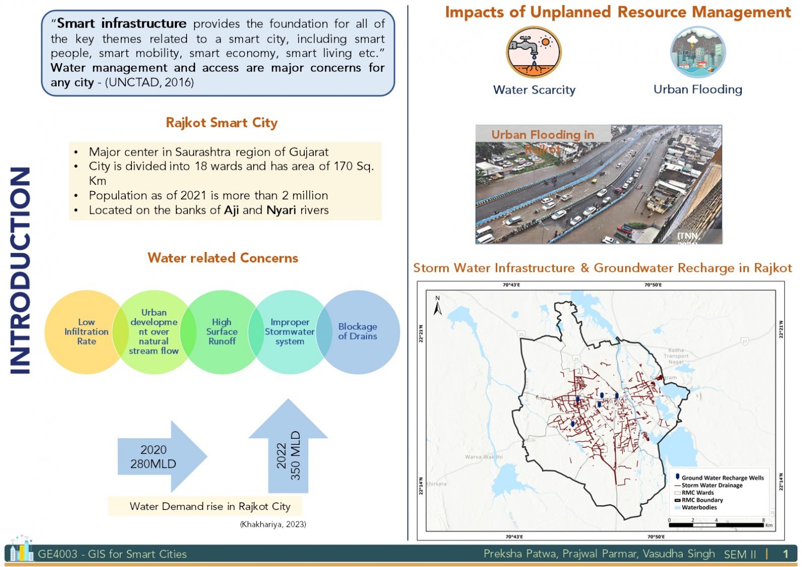
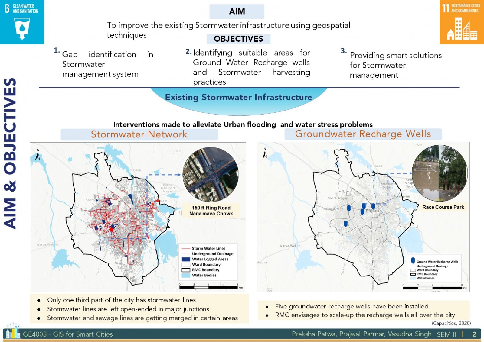
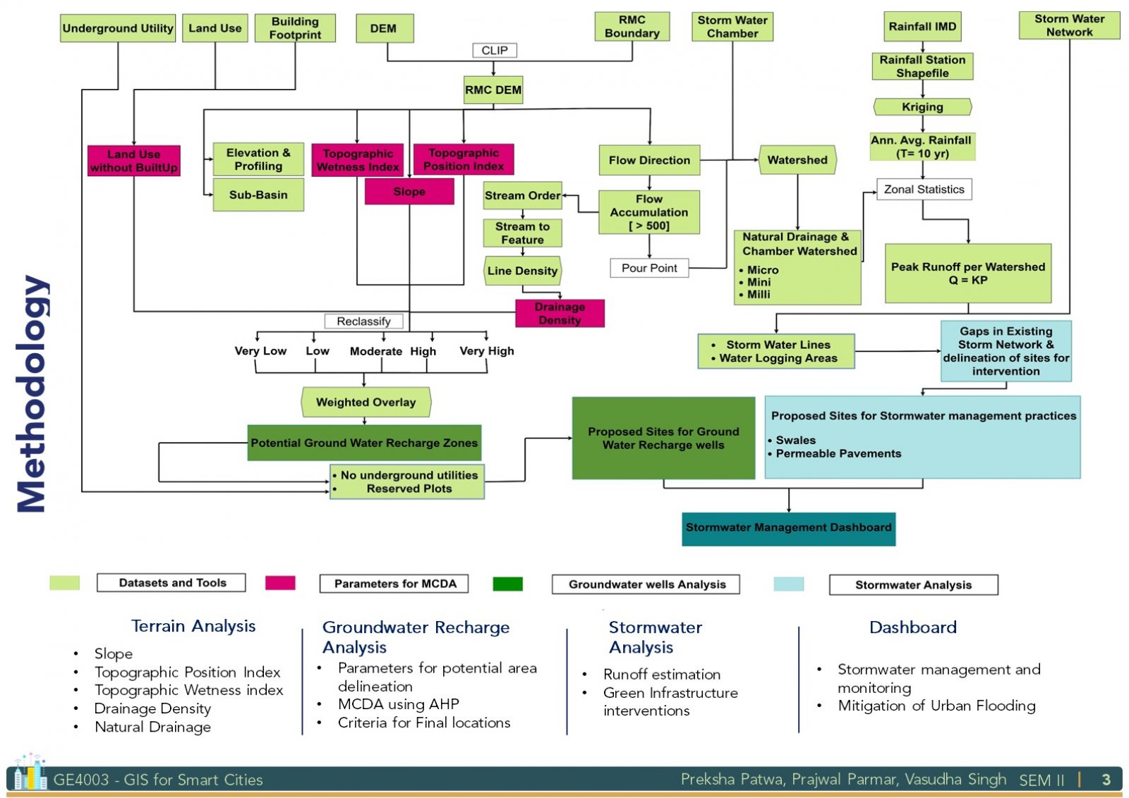
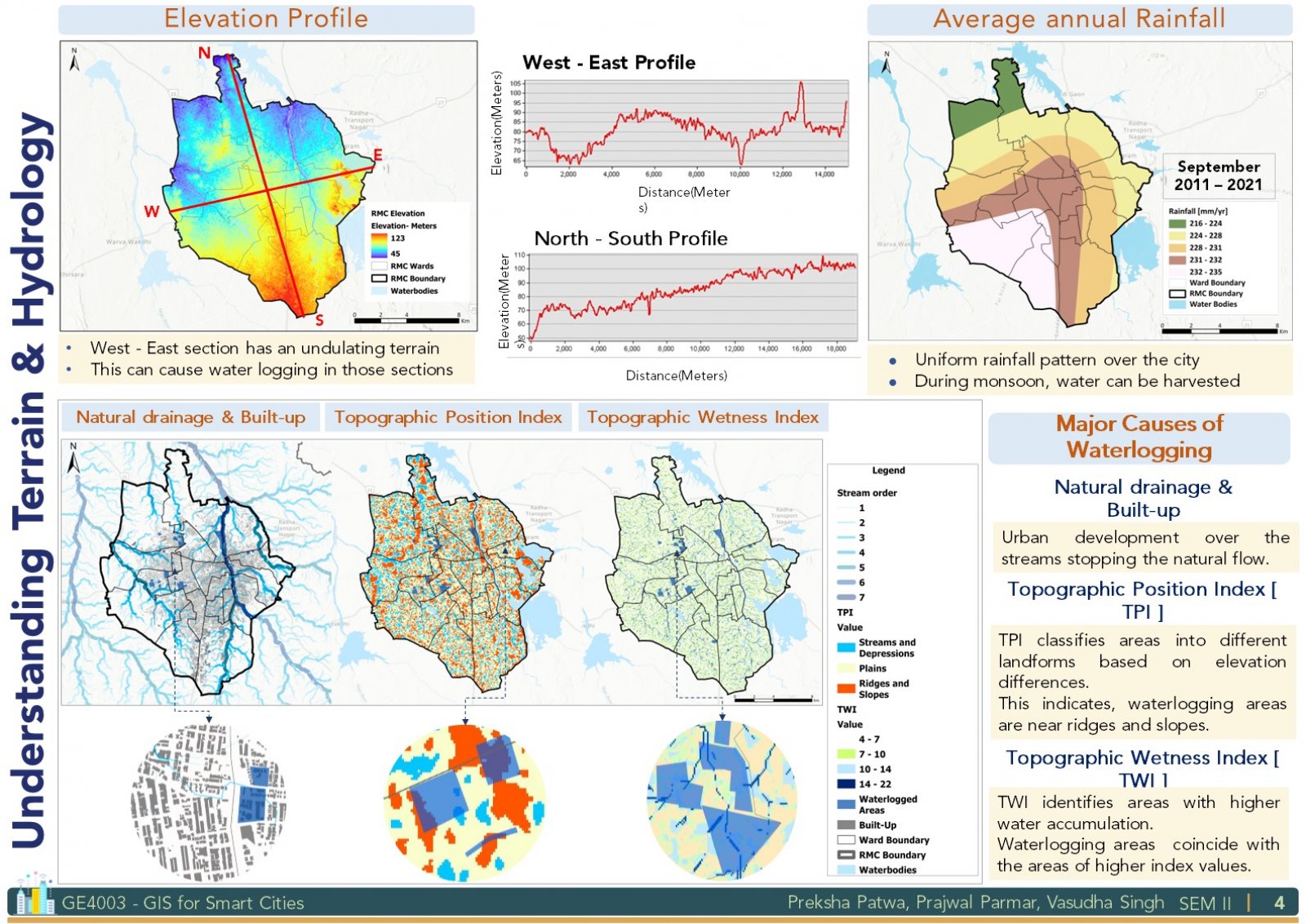
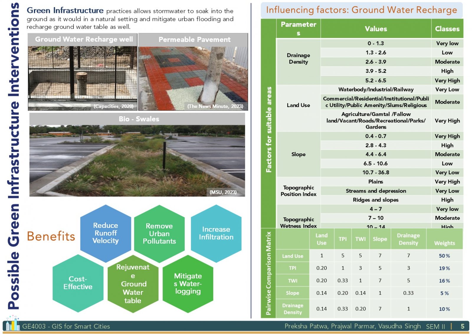
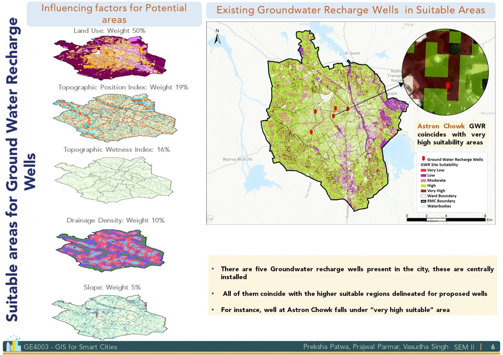
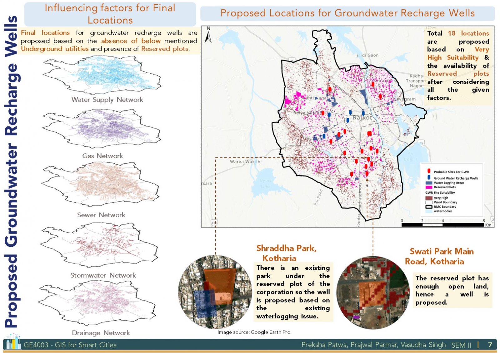
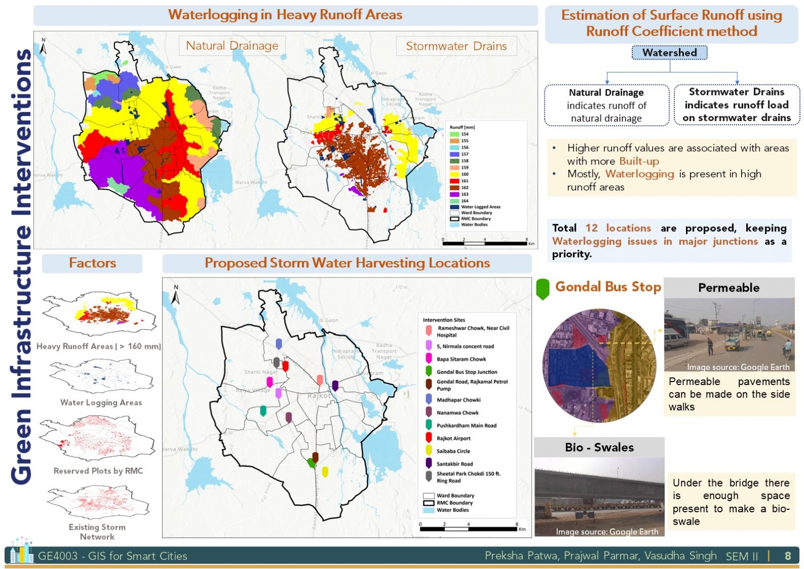
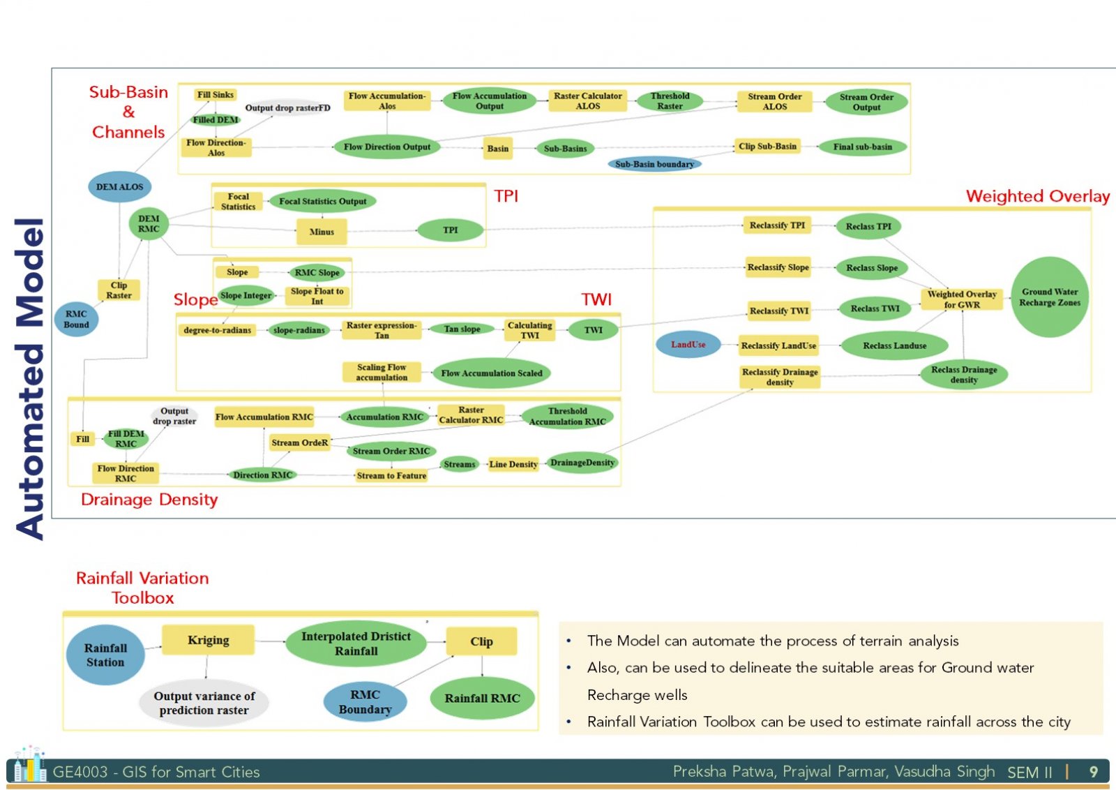
The project focuses on providing geospatial solutions to alleviate water stress and urban flooding issues in Rajkot. Using satellite imagery and different water-related utilities datasets, firstly the understanding of the present scenario has been carried out. Later, green infrastructure that is (Groundwater recharge wells, Bio-swales and permeable pavements) based interventions are proposed using geospatial techniques to improve the existing stormwater infrastructure of the city. The Studio's theme is "GIS for Smart Cities", therefore the study provides smart solutions for the local authorities to develop a better framework for their functioning.
View Additional Work