Your browser is out-of-date!
For a richer surfing experience on our website, please update your browser. Update my browser now!
For a richer surfing experience on our website, please update your browser. Update my browser now!
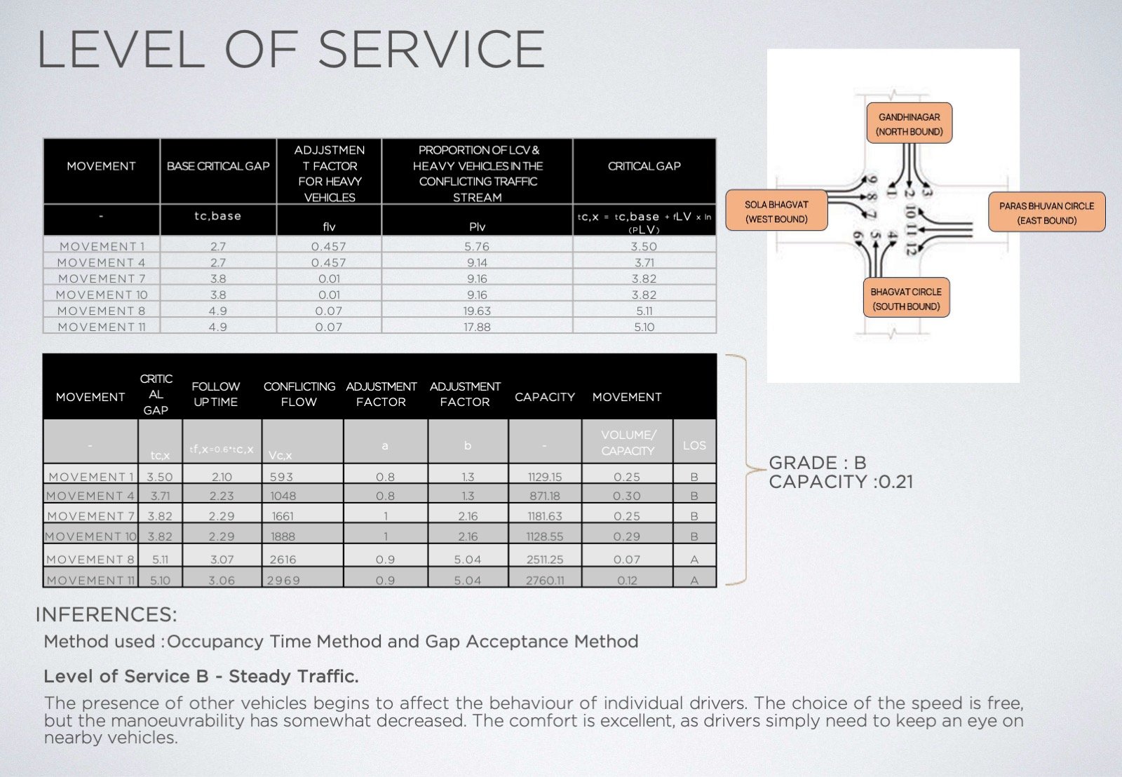
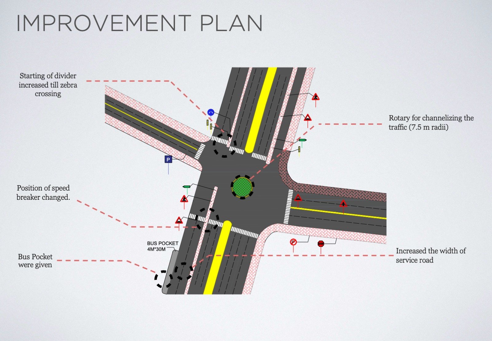
The transportation network in urban areas is inherently complex, shaped by various transport modes, diverse traffic types sharing the same infrastructure, and multiple potential origins and destinations. It includes different components such as road infrastructure, vehicle and pedestrian flows, and public transport facilities. The interplay between the design and operation of these elements is vital for ensuring an efficient transport system. This studio focuses on analyzing and redesigning a selected urban ward's transport network, emphasizing road infrastructure design, traffic control measures, public transport facilities, non-motorized transport (NMT) considerations, and pedestrian infrastructure. Students will assess the current transport network, identify challenges—whether related to infrastructure, traffic flow, pedestrian movement, road or intersection management, or public transit design—and develop a comprehensive improvement strategy. The studio will equip students with the skills to apply predictive data analysis in creating inclusive, sustainable solutions that address the needs of drivers, pedestrians, and transit users alike.
View Additional Work