Your browser is out-of-date!
For a richer surfing experience on our website, please update your browser. Update my browser now!
For a richer surfing experience on our website, please update your browser. Update my browser now!
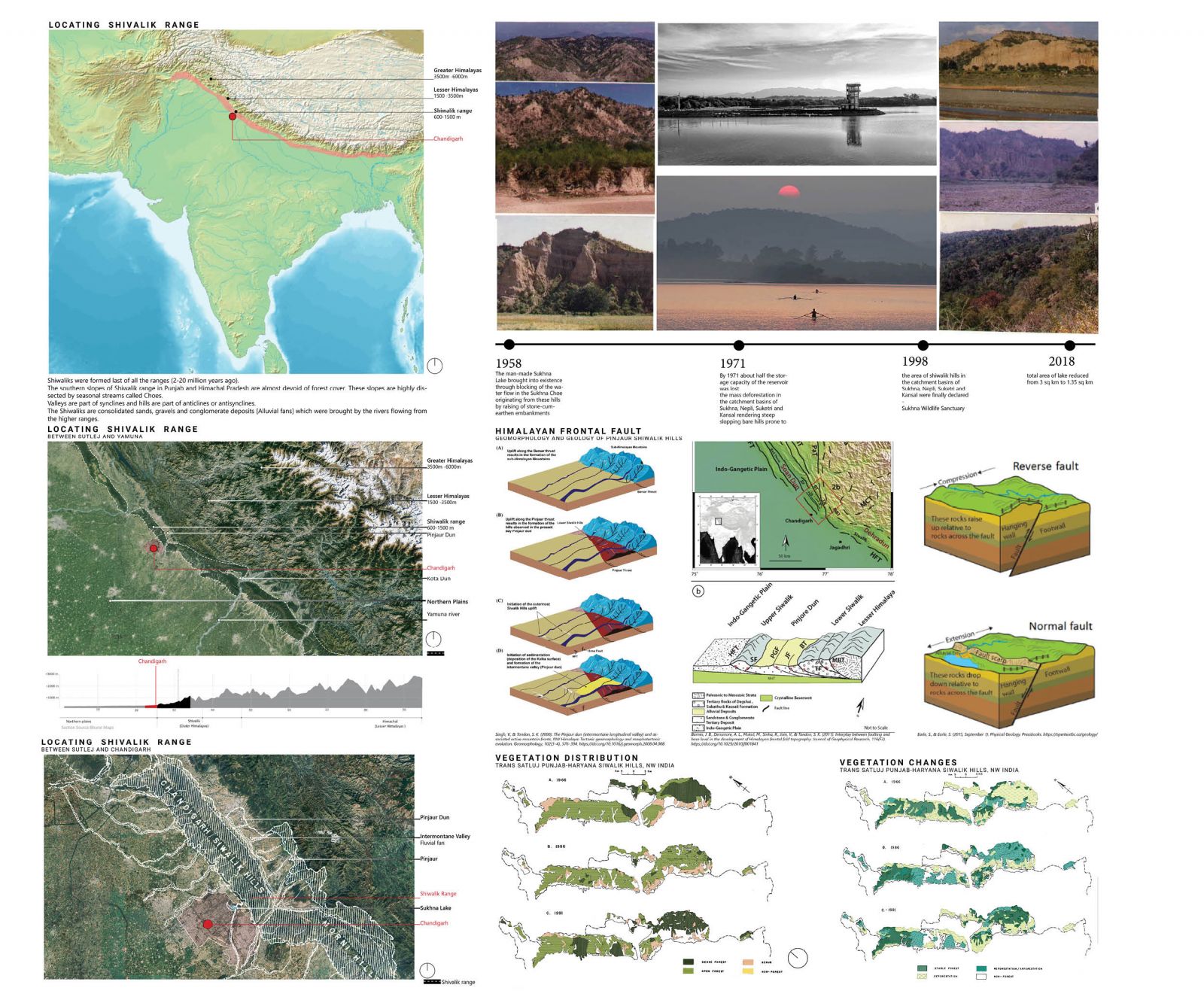
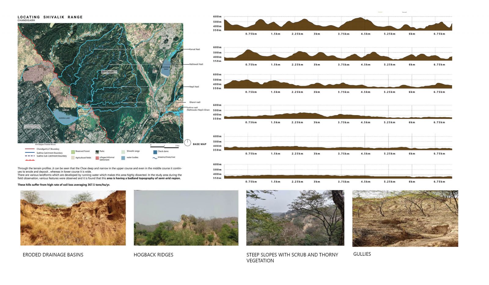
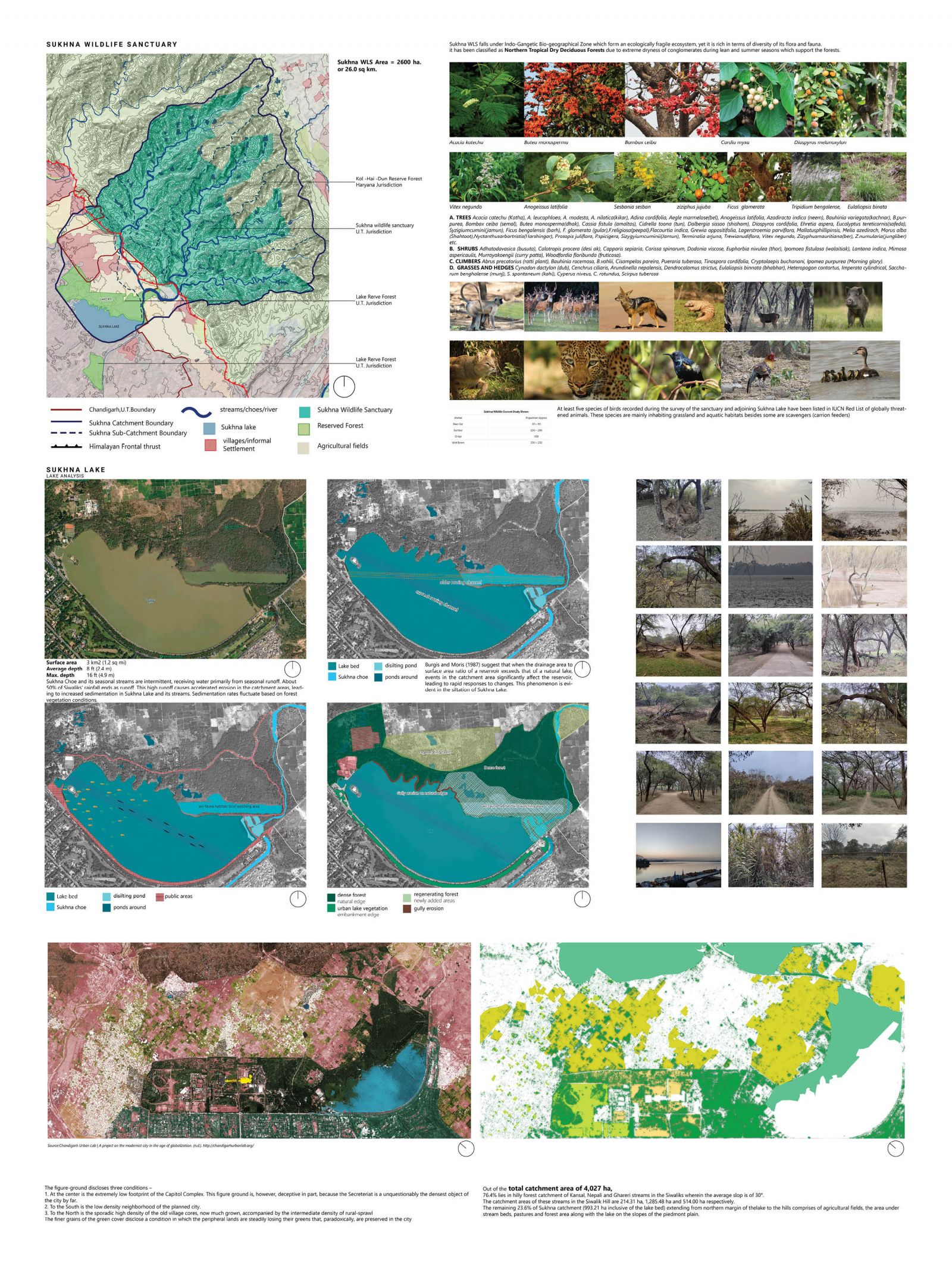
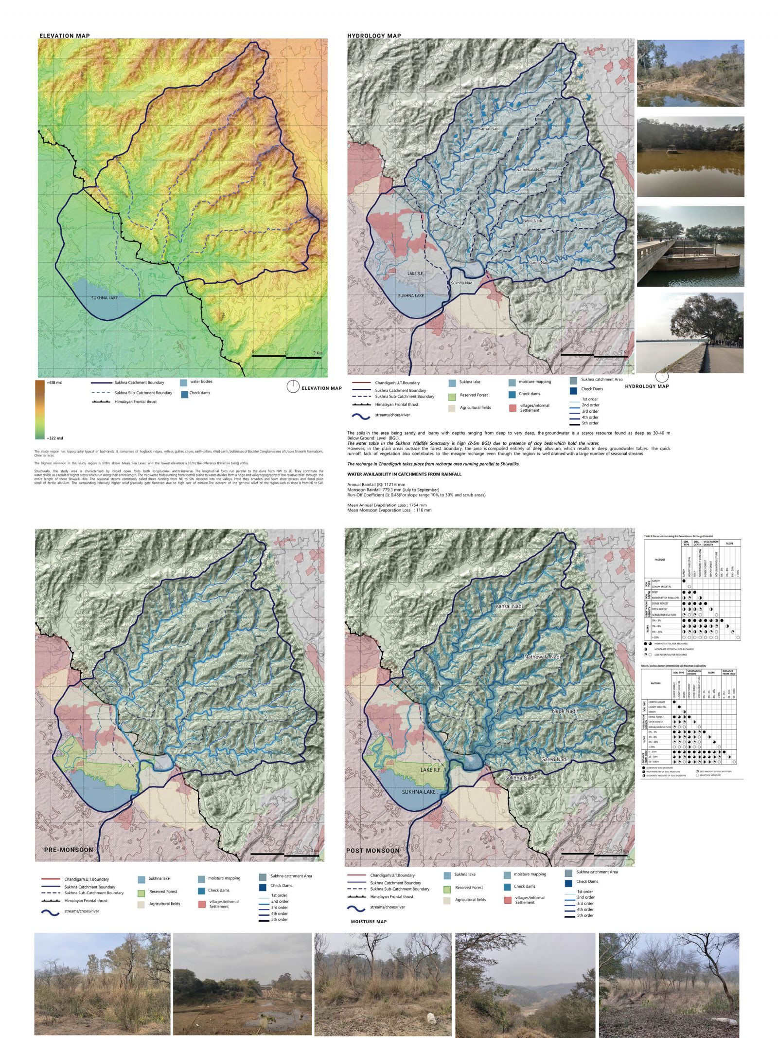
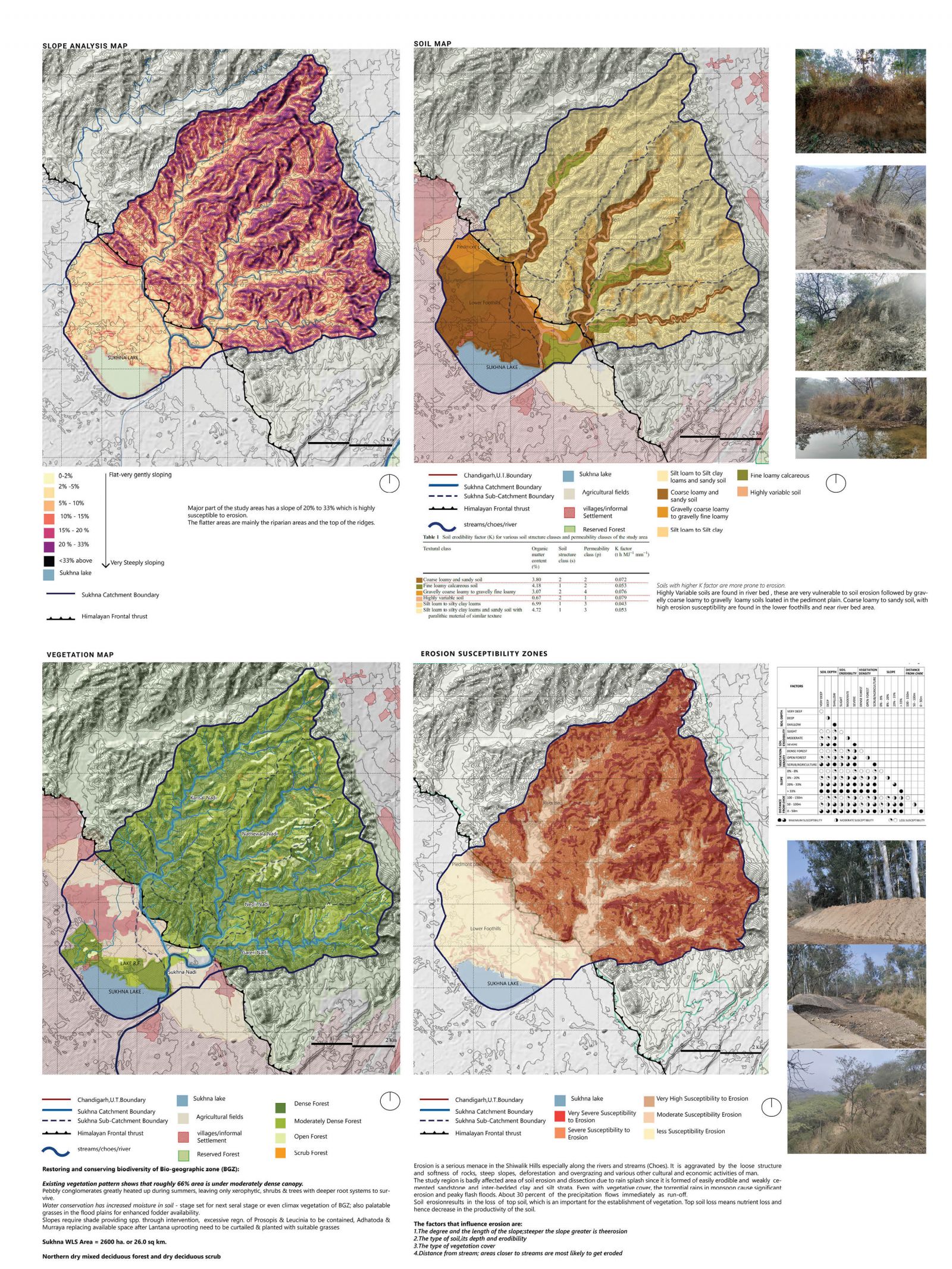
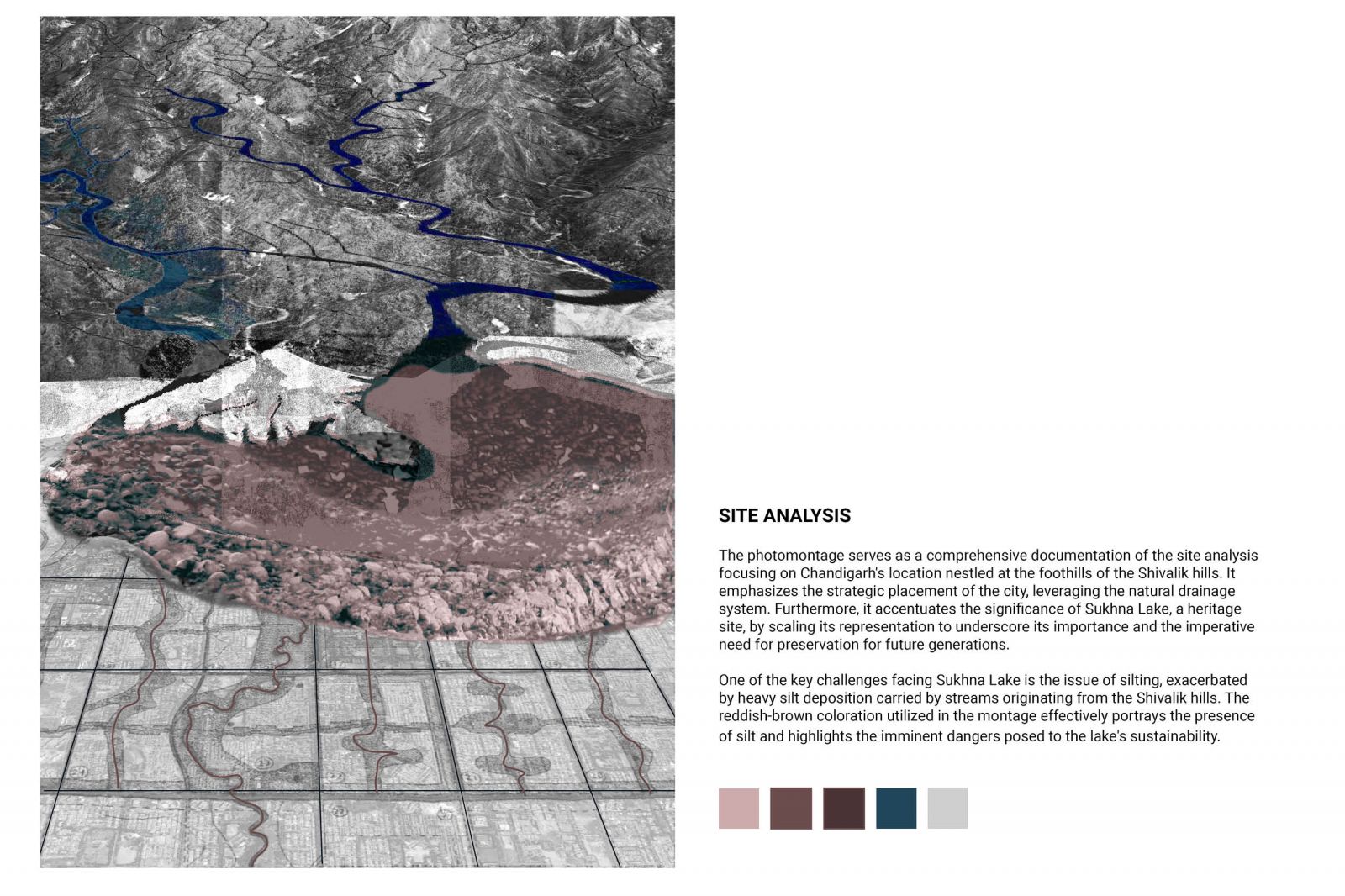
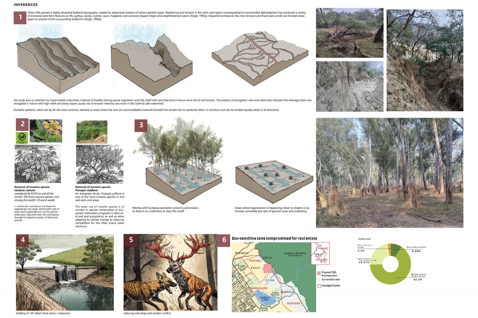
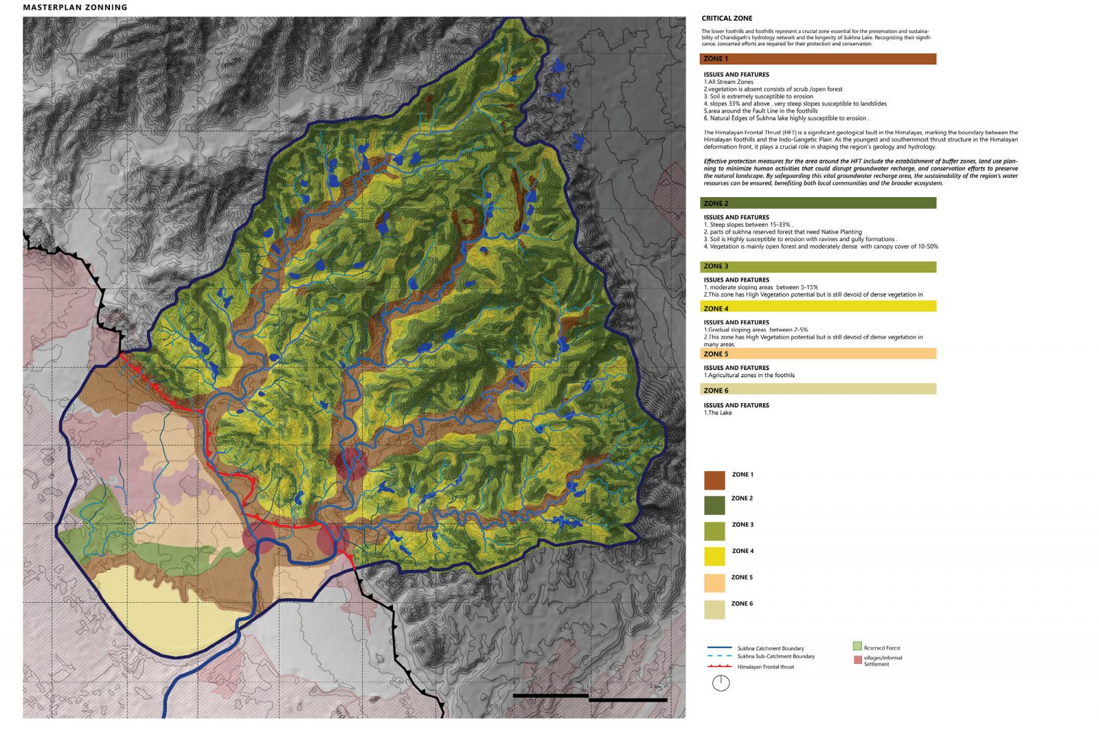
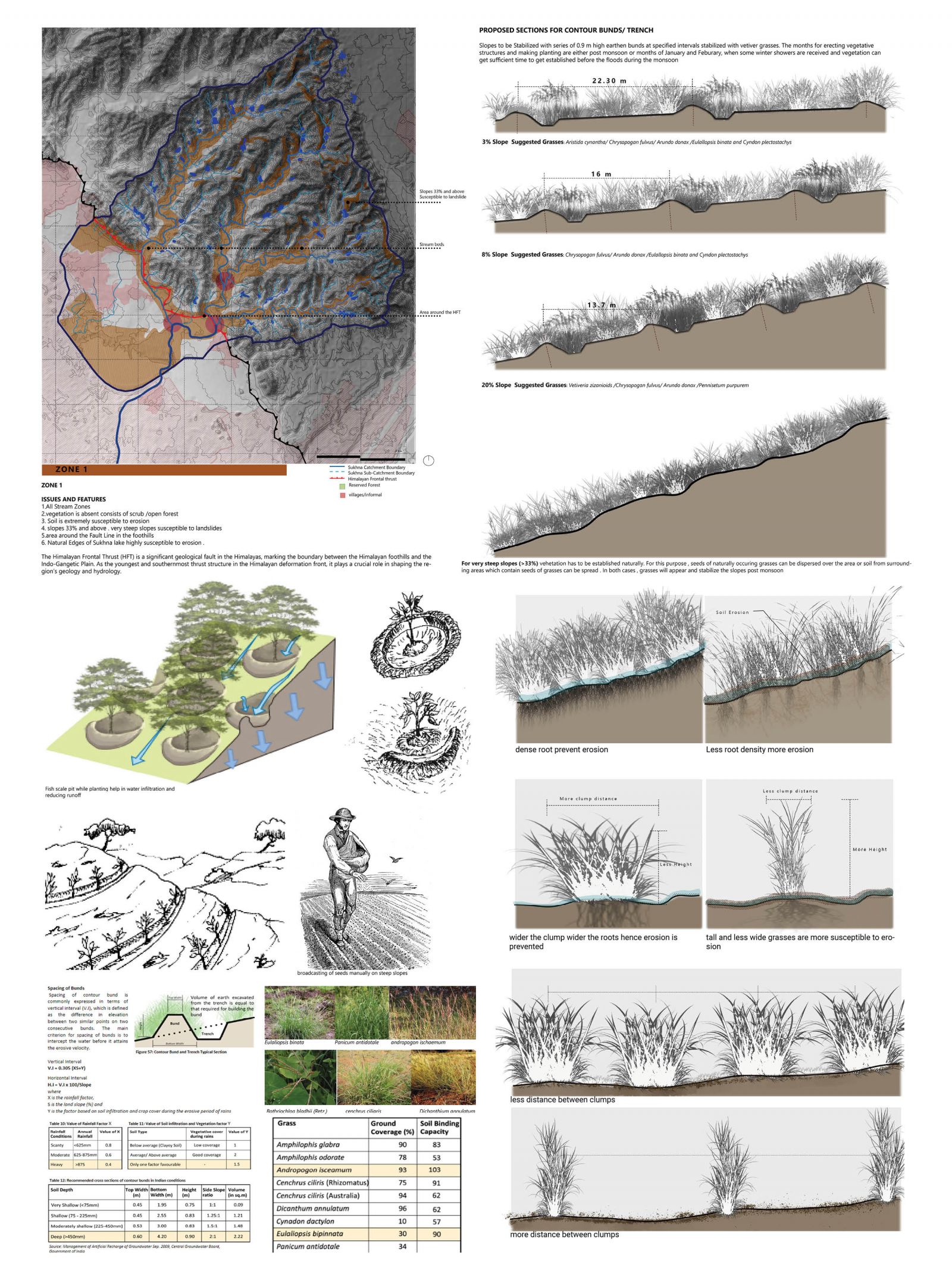
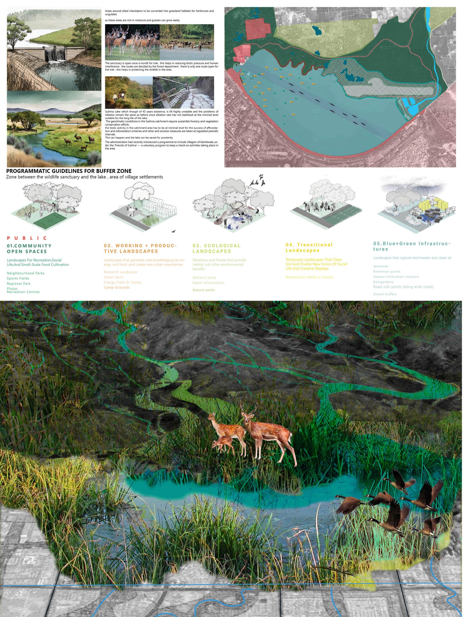
Resilient Restoration: Conservation of Sukhna Lake and its catchment. Overview: Between 1966 and 1991, a study was conducted on the forests of Chandigarh and Morni Hills, revealing a prevalence of ‘badland’ topography, leading to high water-soil erosion rates. This erosion altered stream profiles, causing frequent flooding. Similarly, the Chandigarh Siwalik Hills (CSHs) witnessed significant environmental changes due to developmental activities, resulting in substantial soil loss. Sukhna Lake Development: Sukhna Lake, created in 1958 by obstructing the Sukhna Choe’s flow, has faced siltation issues over the years. This project examines the lake’s geographical location, water spread, storage capacity changes, vegetation, siltation patterns, and remedial actions taken over 43 years. Drainage Ecosystem: The Sukhna and its catchment areas are part of the Semi Natural Drainage Ecosystem (SNDE), reliant on the Natural Hilly Ecosystem (NHE) of CSHs. Drainage lines originating from NHE sustain SNDE, crucial for the lake’s balance. Any disruption in NHE and SNDE functionality, resulting in increased water run-off and silt load, affects the lake’s sustainability. Siltation Issues: The rugged terrain, steep slopes, and vulnerable soils of the catchment area facilitate significant soil erosion, leading to heavy siltation in the lake. Approximately 50% of rainfall in Siwalik results in run-off, exacerbating erosion. Consequently, sedimentation reduces the lake’s storage capacity, depth, and water spread area annually, impacting its sustainability. Conclusion: The study highlights the critical interdependence between natural ecosystems and man-made developments, emphasizing the urgent need for holistic environmental management strategies to ensure the long-term sustainability of Sukhna Lake and its surrounding ecosystem.