Your browser is out-of-date!
For a richer surfing experience on our website, please update your browser. Update my browser now!
For a richer surfing experience on our website, please update your browser. Update my browser now!
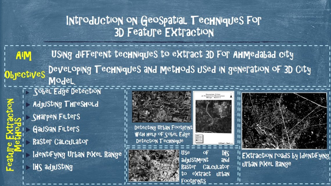
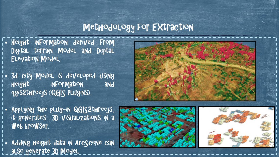
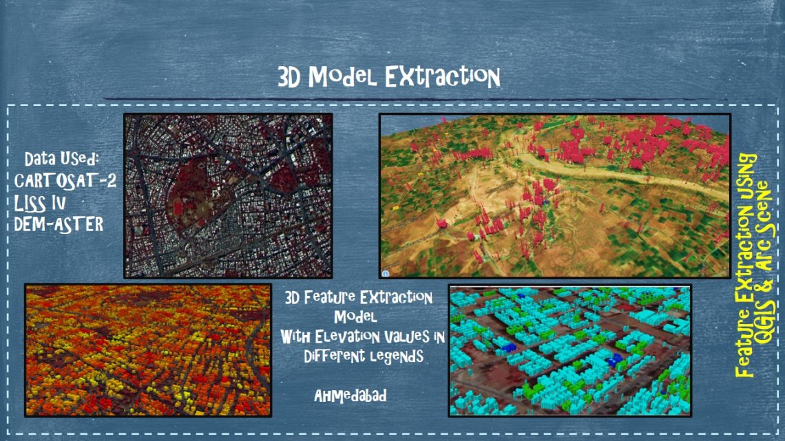
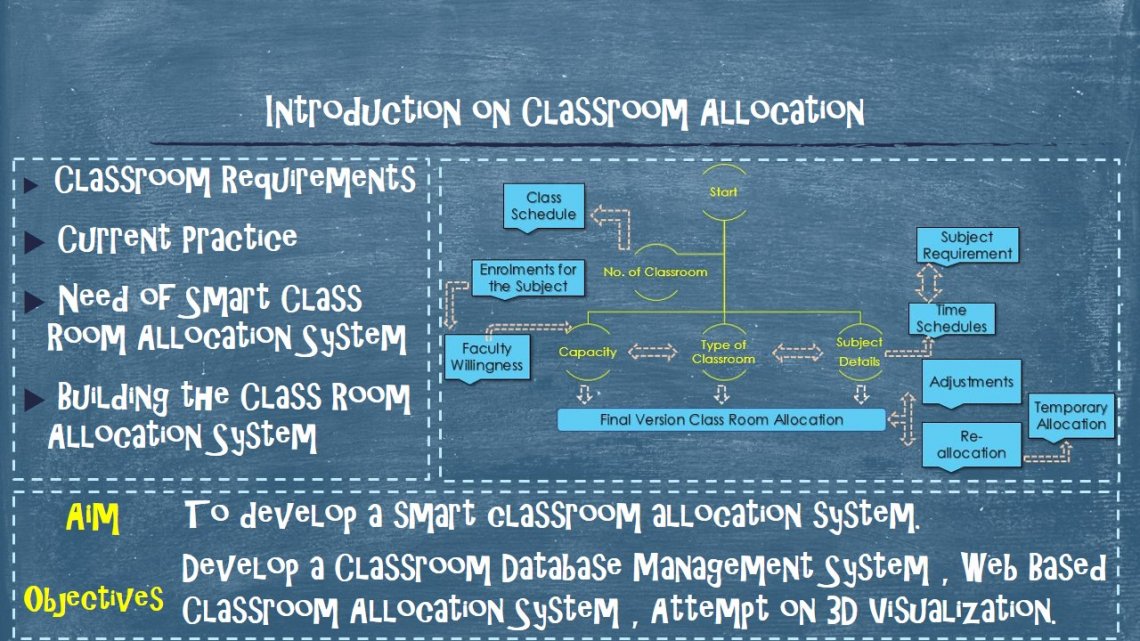
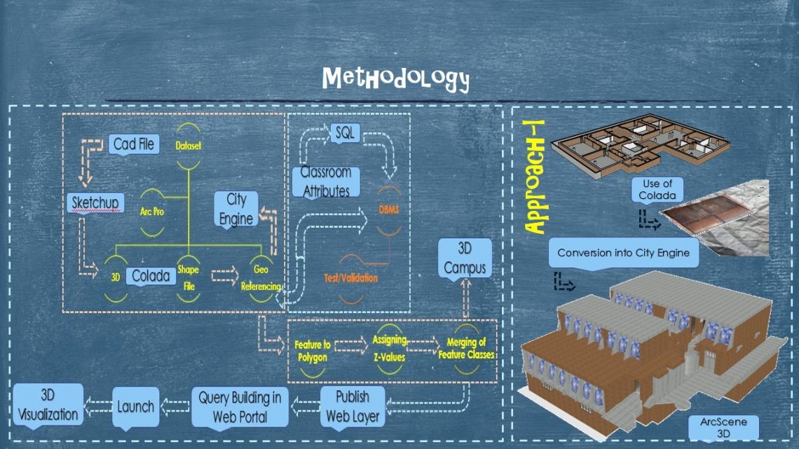
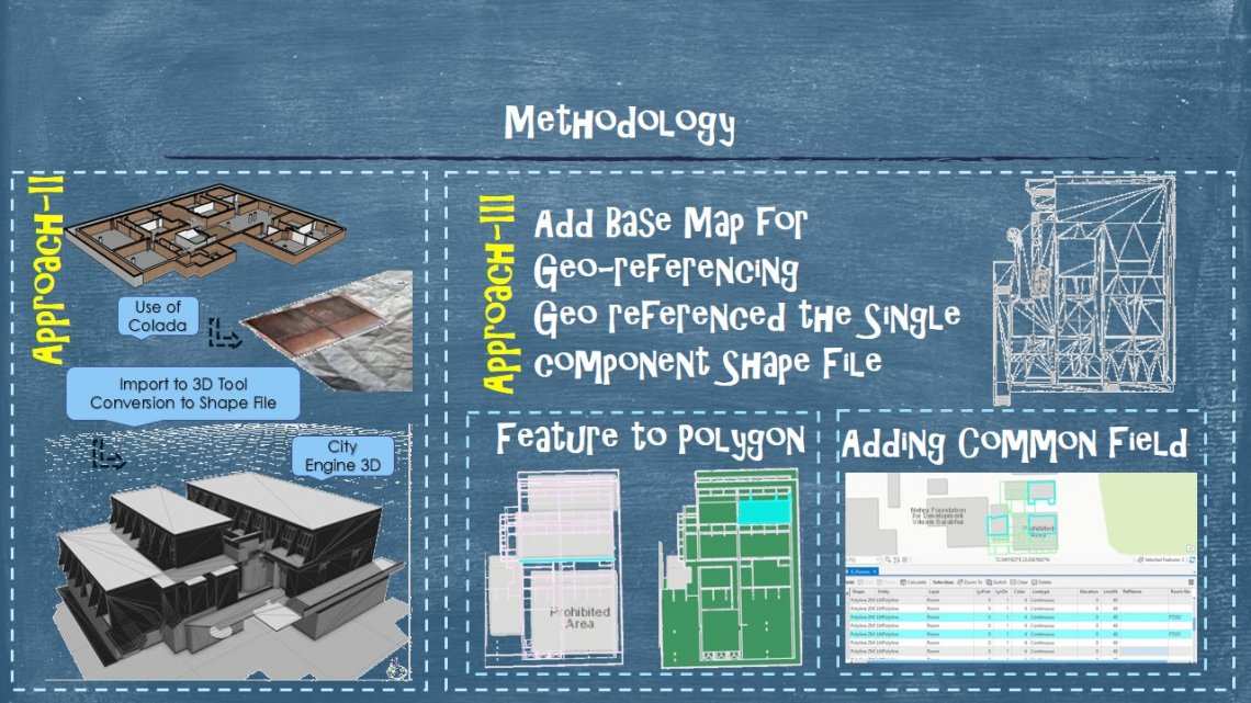
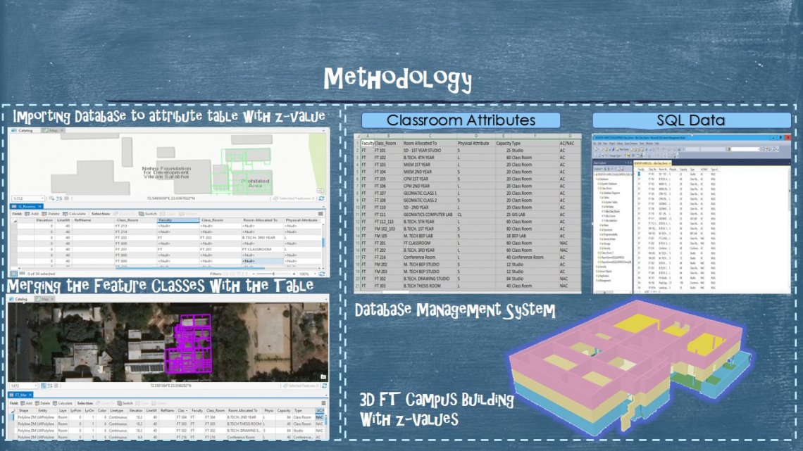
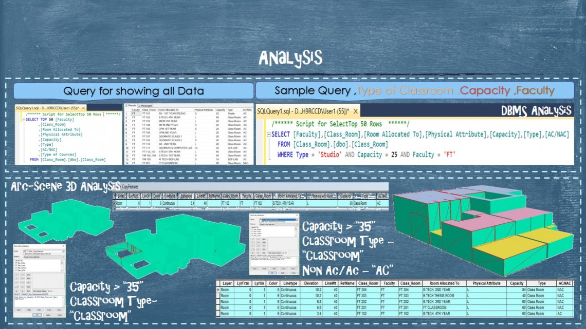
The Studio was divided into two parts.Firstly , to Create 3D City Model by Extracting Urban feature from Satellite Images.Secondly, to Create an application that can aid in making CEPT campus a Smart Campus.
https://cep.maps.arcgis.com/apps/webappviewer/index.html?id=383fcb3e2cbf405ea3a3cf4374cd2251