Patel Gaurang Mahendrabhai

5692

GEO - SPATIAL TECHNOLOGY STUDIO

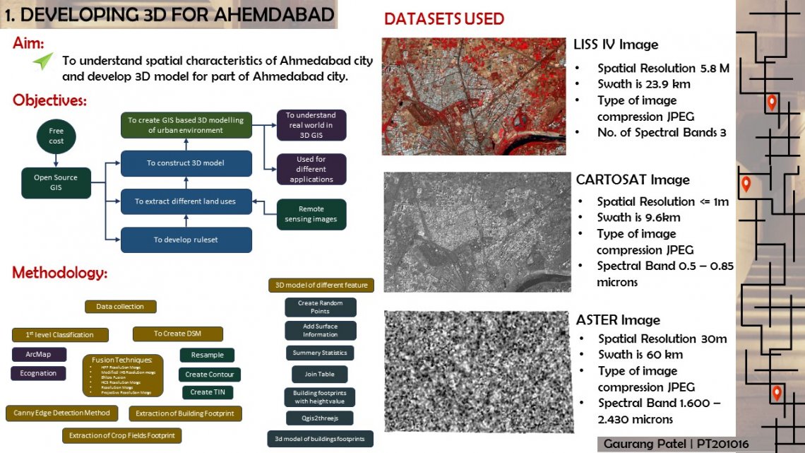
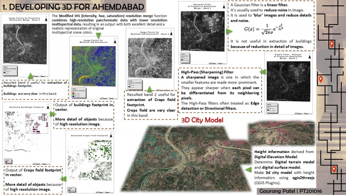
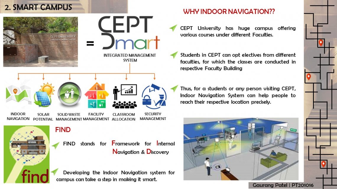
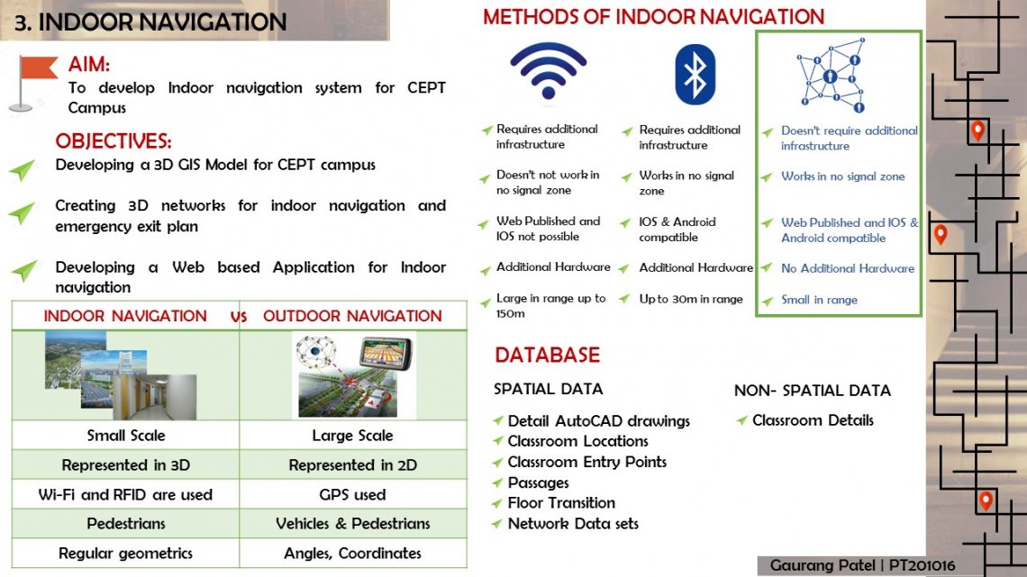
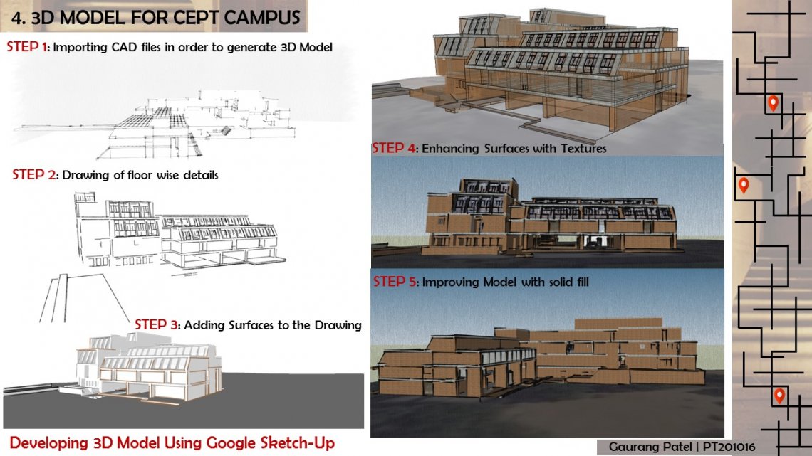
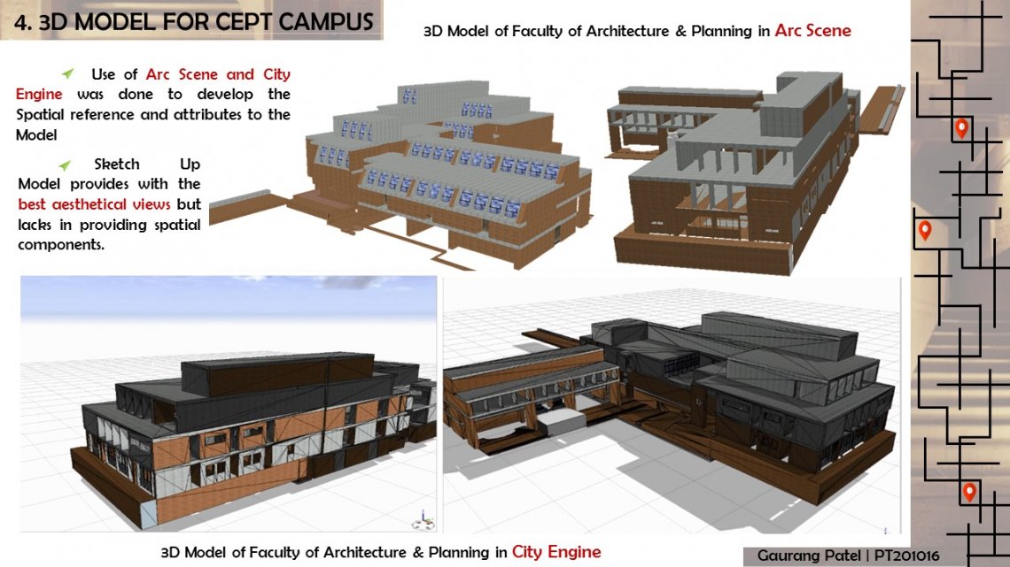
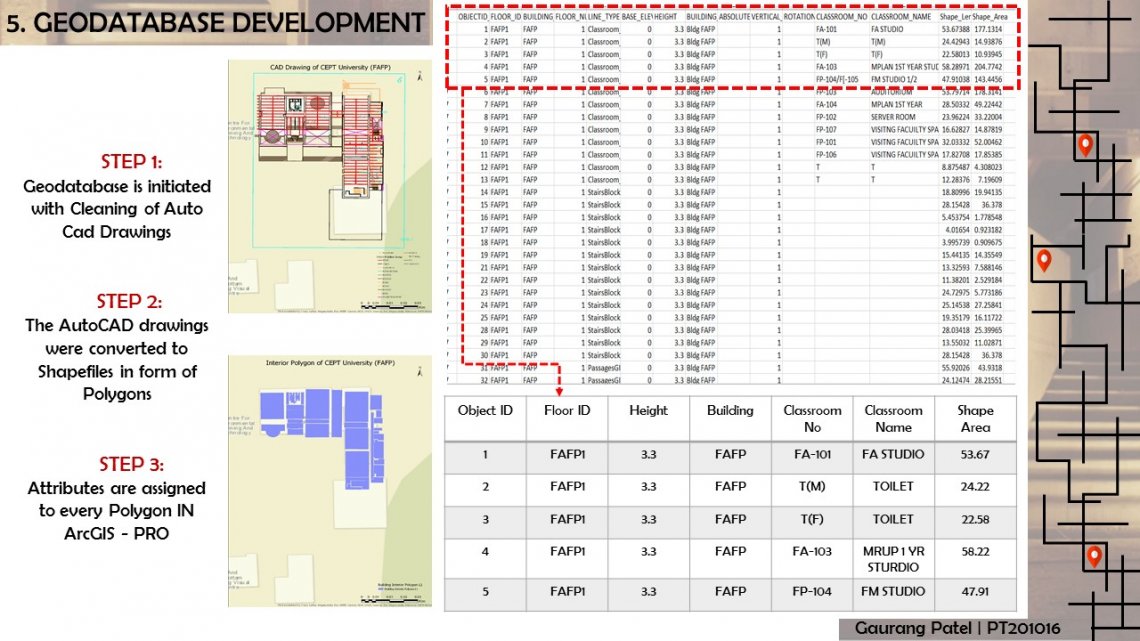
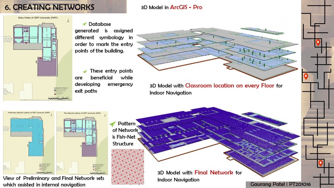
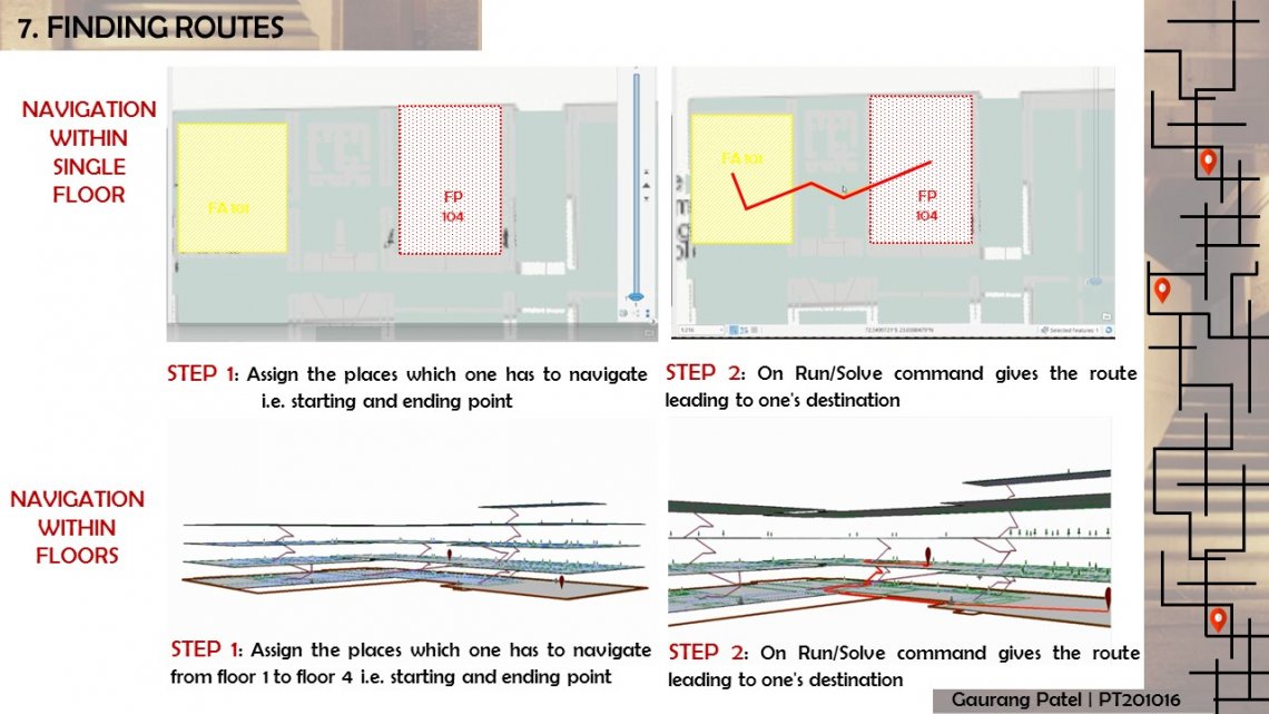
Extracting features from high resolution satellite image and developing smart CEPT Campus with help of Geo spatial technologies like Indoor Navigtation.


Report Content

Introduction to feature Extraction with help of Satellite Images.

Development of Algorithms for Urban Feature Extraction and generating 3D Model for part of Ahmedabad City.

Introduction to Smart Campus and Indoor Navigation.

Methods for Indoor Navigation and usefulness of Indoor Navigation over Outdoor Navigation.

Developing 3D Model for CEPT Campus.

3D models of CEPT Campus in Arc Scene & City Engine.

Creating Data Sets.

Generating Network Lattices for Indoor Navigation.

Indoor Navigation within single floor and Indoor Navigation in 3D. Simply putting your known location and room number it will find you closest path from where user can get to the place.

End result achieved is in form of Web Application. Web Application provides Outdoor as well as Indoor Navigation for CEPT University campus. Capability of this application is that it can navigate a person to CEPT University from anywhere. One of the most important output of this Application is it can give Distance, Time required to reach the Destination.