Your browser is out-of-date!
For a richer surfing experience on our website, please update your browser. Update my browser now!
For a richer surfing experience on our website, please update your browser. Update my browser now!
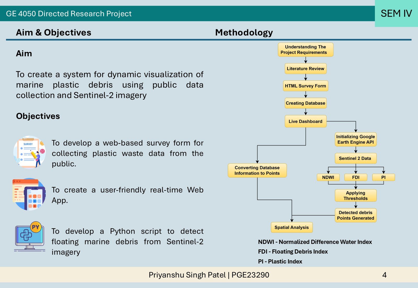
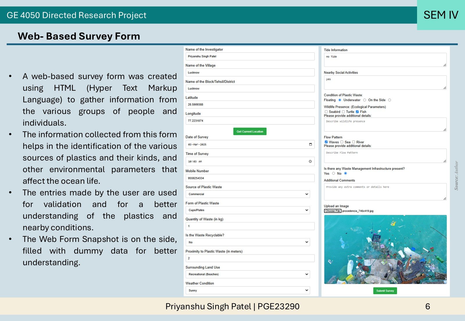
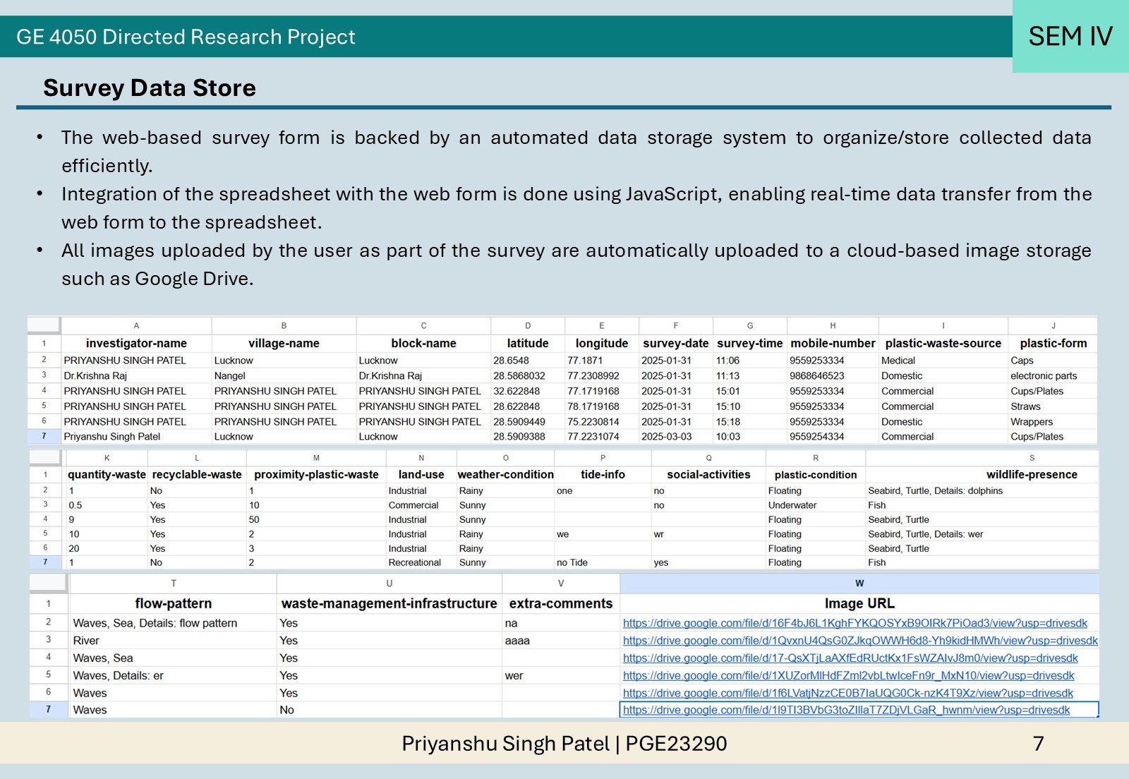
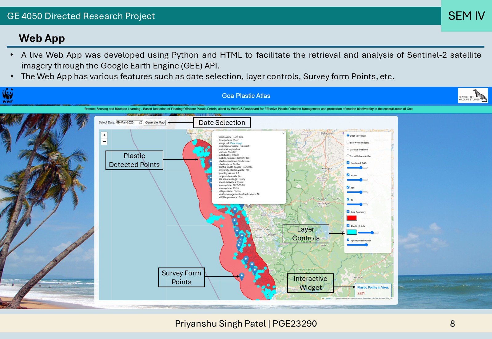
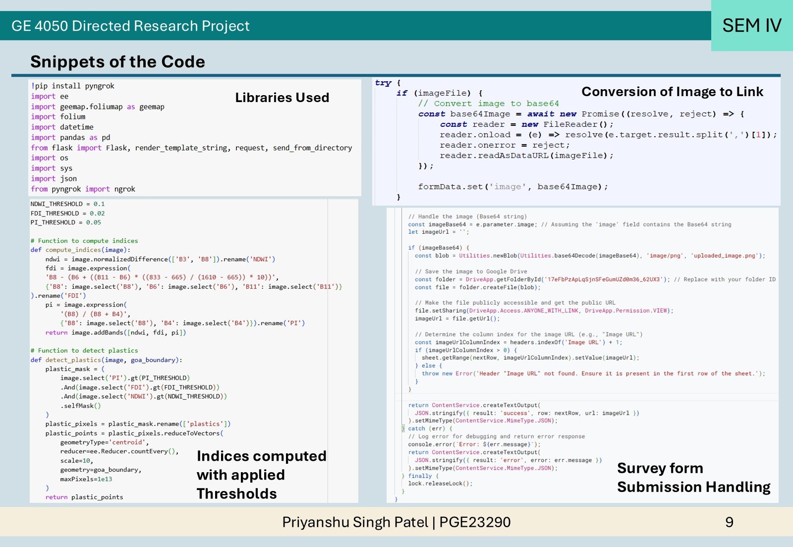
This project integrates remote sensing, community data, and GIS tools to monitor coastal plastic pollution. Using Sentinel-2 imagery and indices like NDWI, FDI, and PI on Google Earth Engine API, it identifies plastic hotspots. A web survey collects local waste data, while an interactive app enables real-time visualization and analysis. This system supports timely, informed decisions for better coastal waste management and environmental protection.