Your browser is out-of-date!
For a richer surfing experience on our website, please update your browser. Update my browser now!
For a richer surfing experience on our website, please update your browser. Update my browser now!
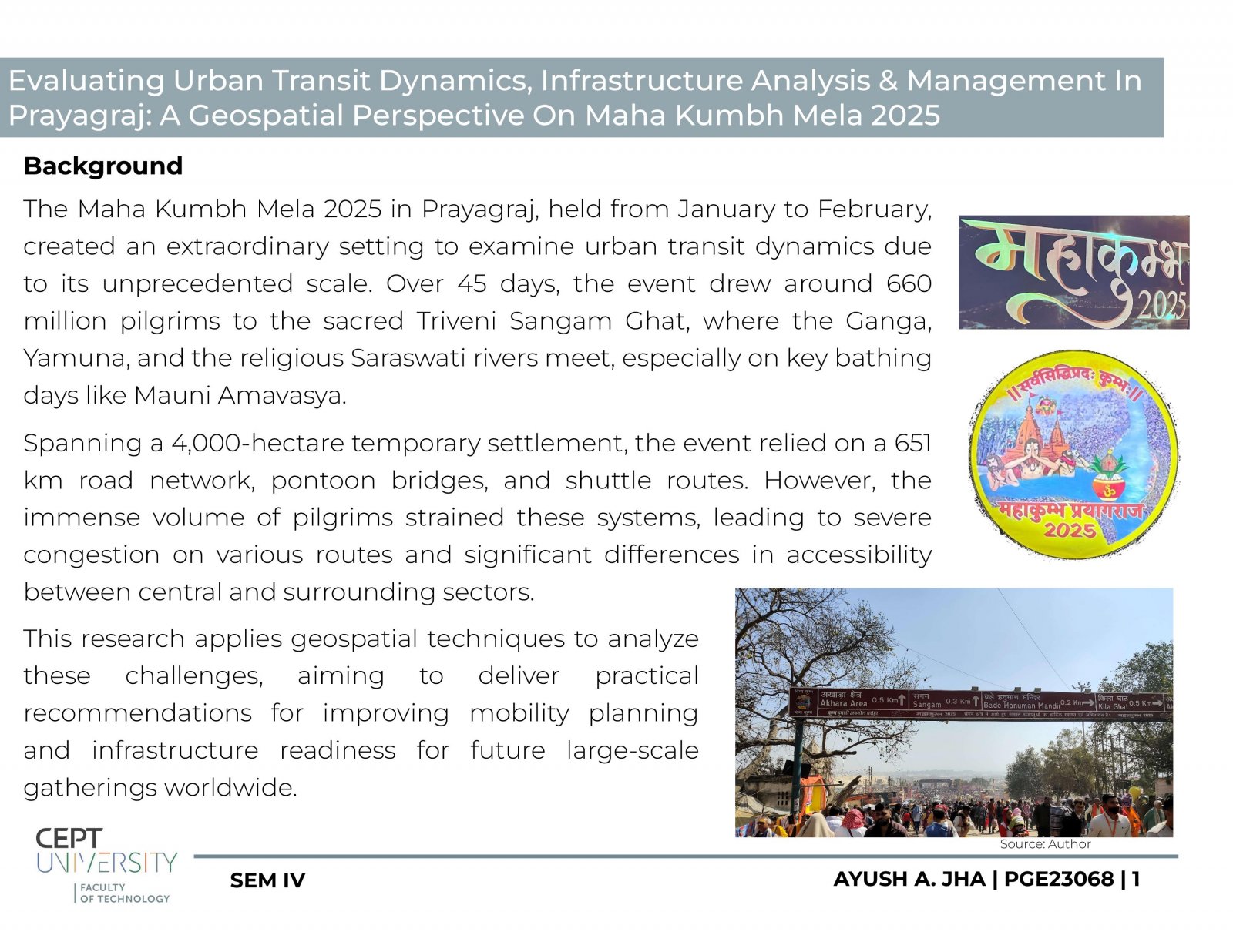
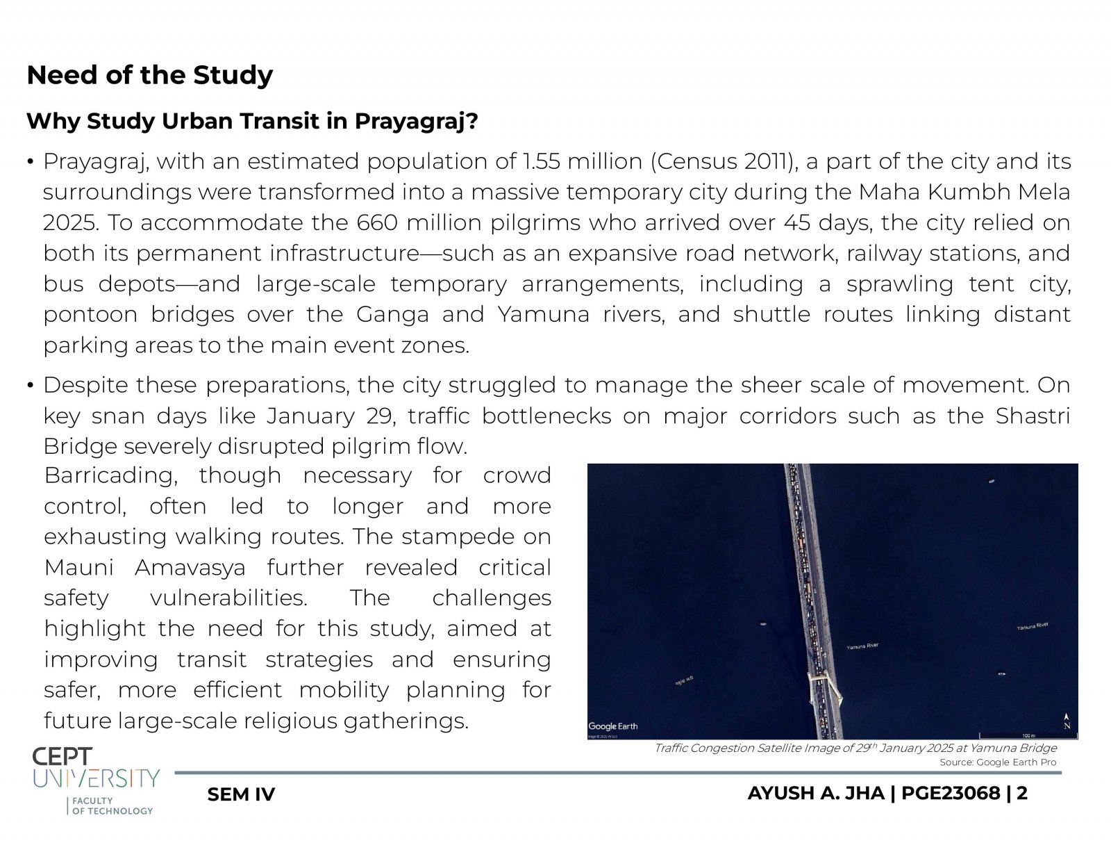
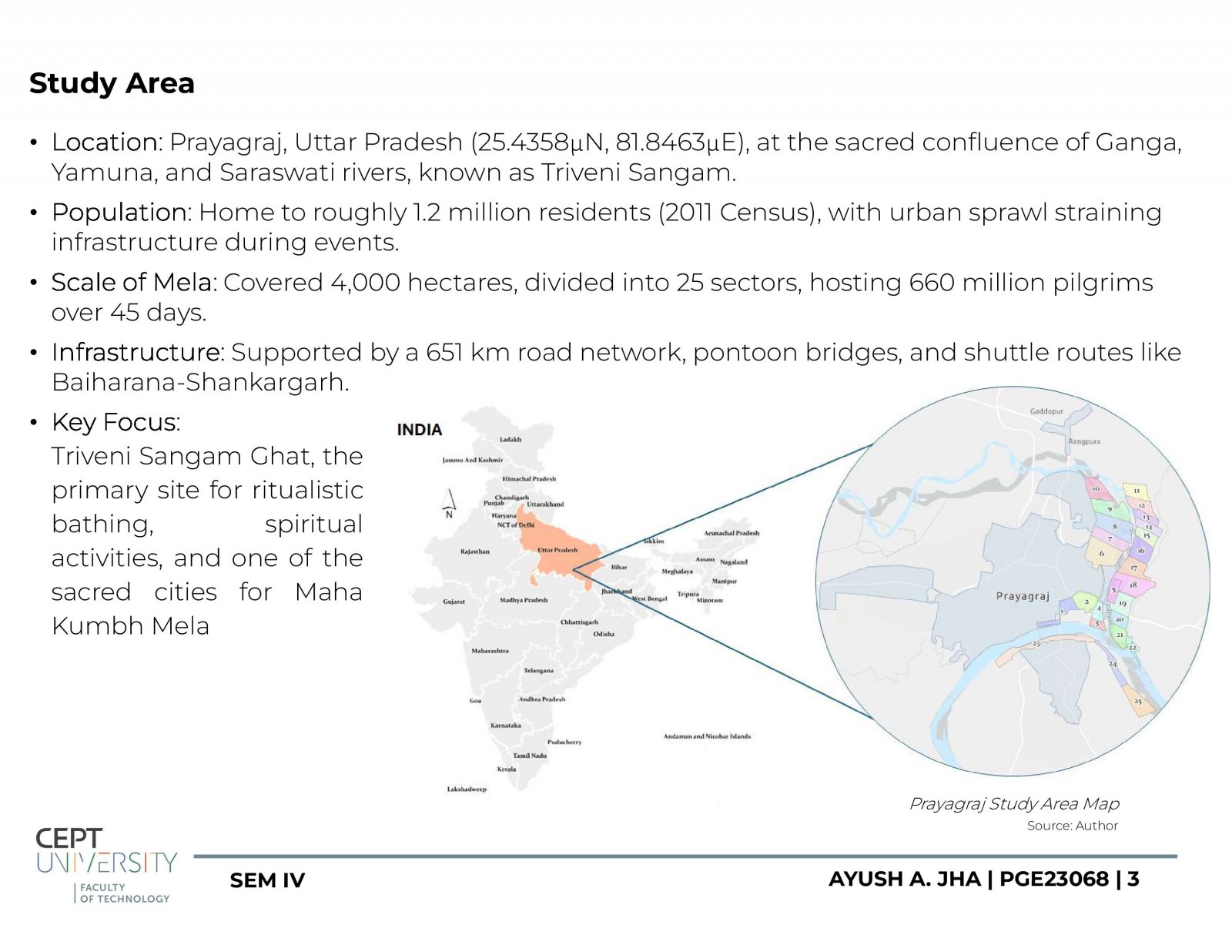
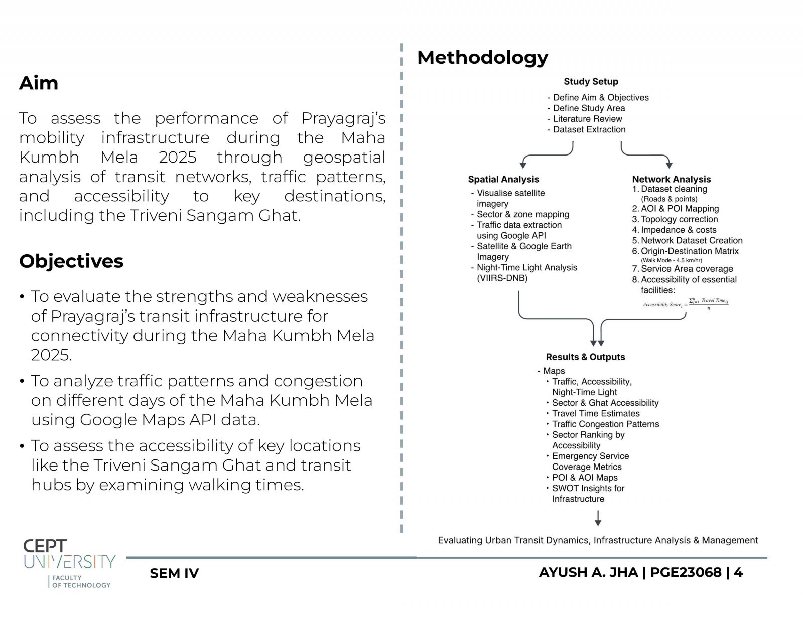
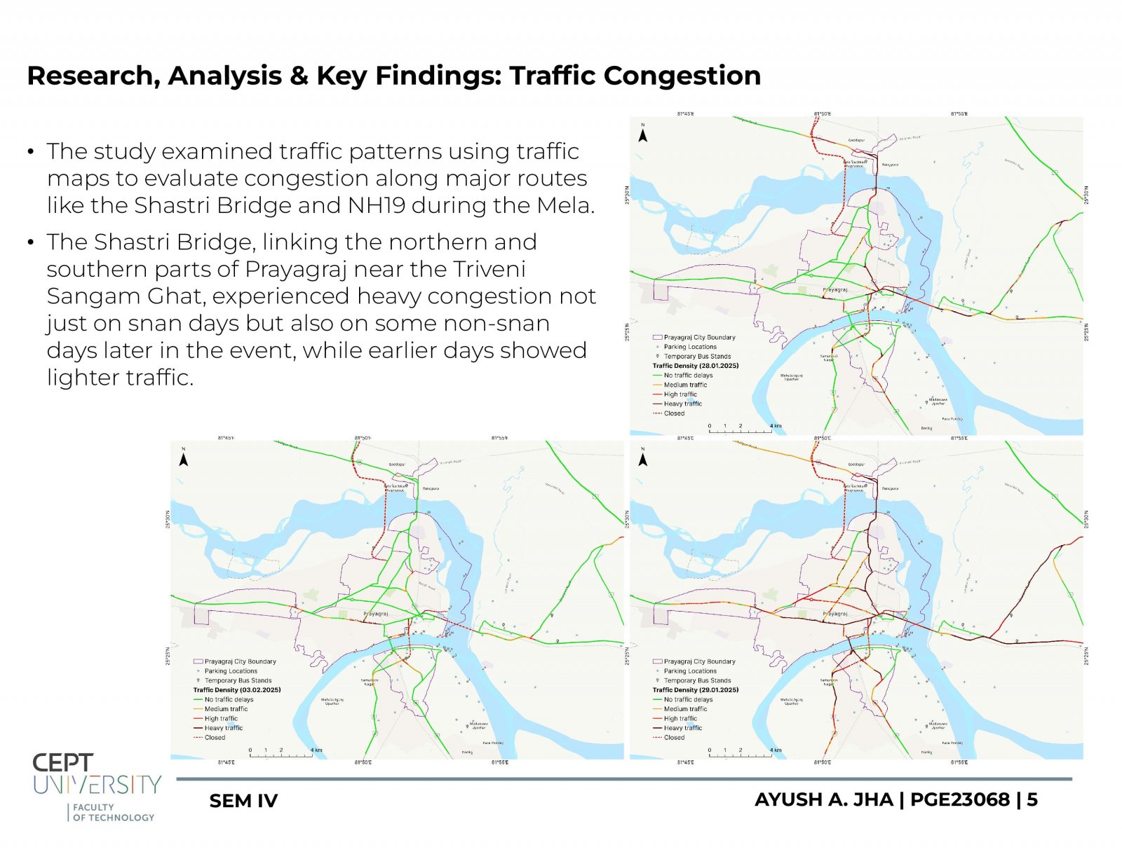
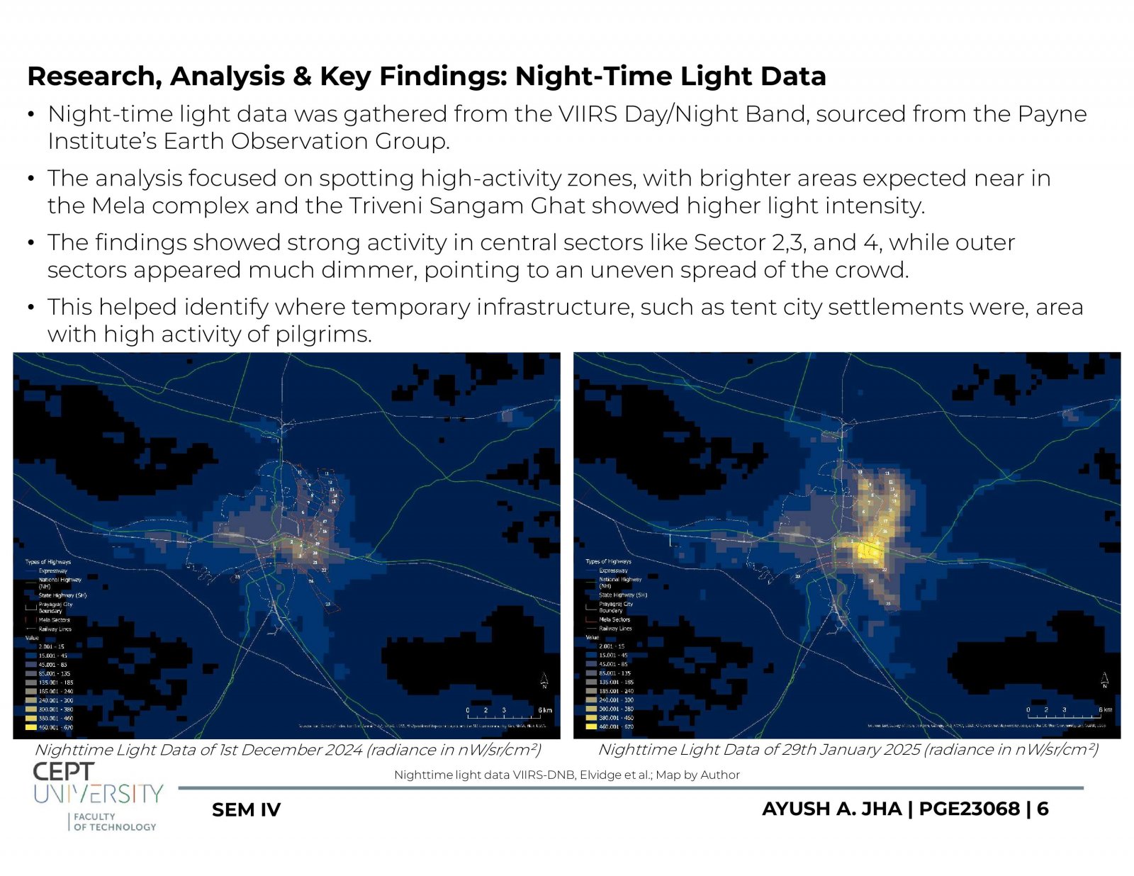
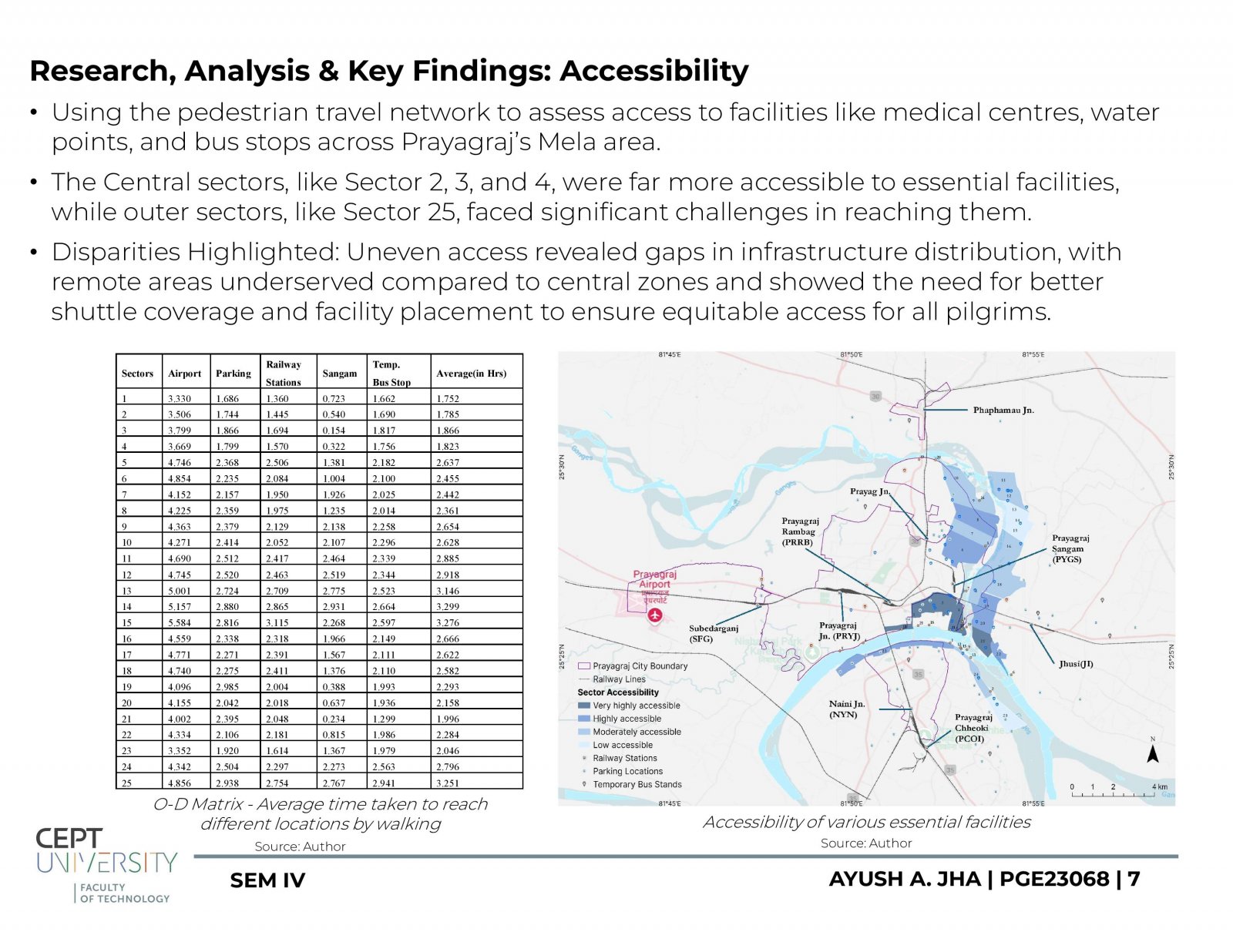
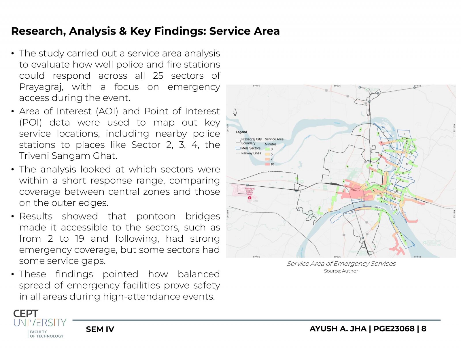
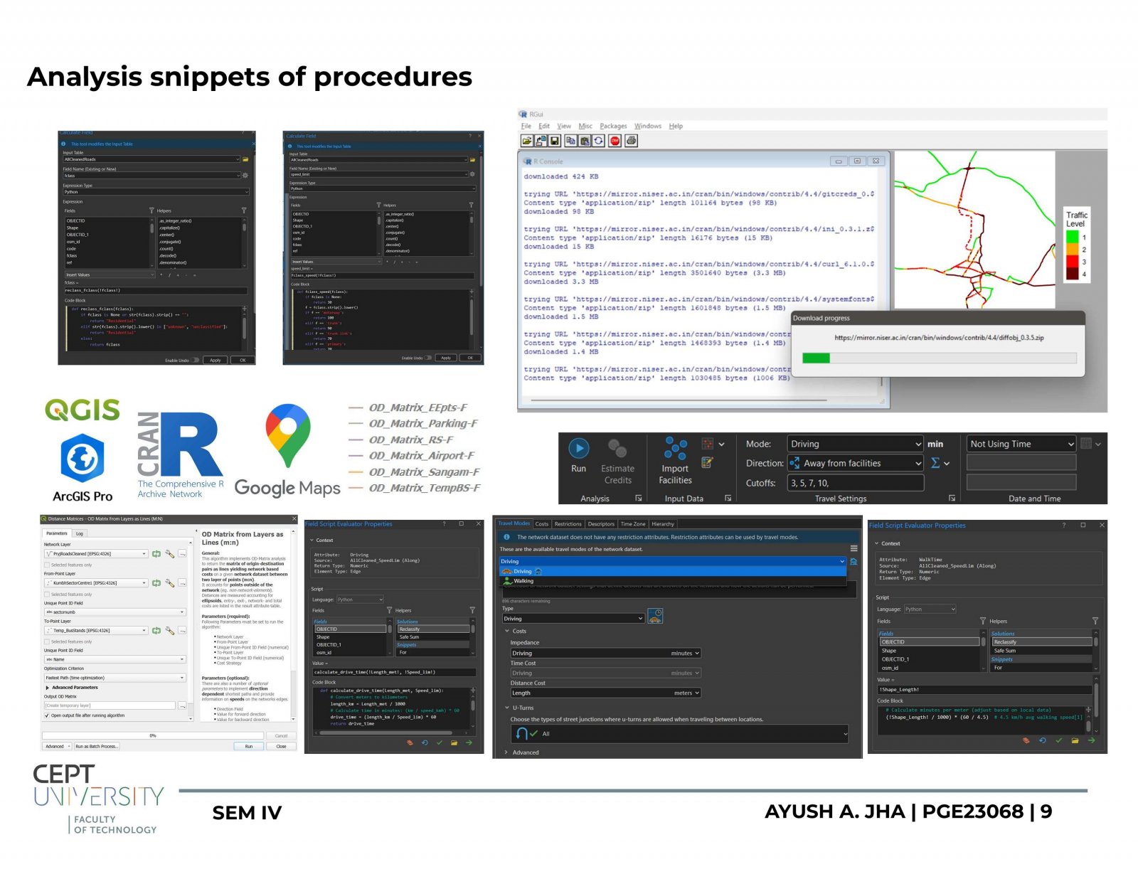
The project titled "Evaluating Urban Transit Dynamics, Infrastructure Analysis & Management in Prayagraj: A Geospatial Perspective on Maha Kumbh Mela 2025" focuses on the complex transit issues that surfaced during one of the world’s largest religious congregations, which drew approximately 660 million pilgrims to Prayagraj. Through the use of geospatial tools, such as night-time light imagery and traffic flow mapping, the study investigates patterns of congestion, uneven access across sectors, and the role of temporary infrastructure like pontoon bridges. A key observation is the impact of barricading for crowd control, which often forced pilgrims to take longer, more indirect routes. These insights highlight the urgent need for real-time transit management and flexible planning approaches to ensure safer, more efficient mobility during future mass events.