Your browser is out-of-date!
For a richer surfing experience on our website, please update your browser. Update my browser now!
For a richer surfing experience on our website, please update your browser. Update my browser now!
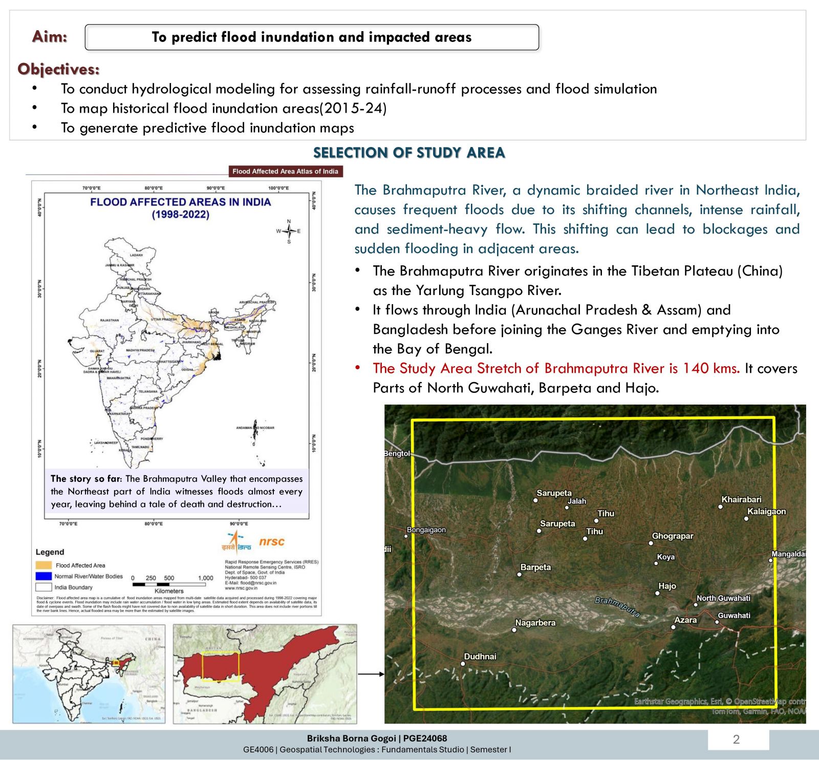
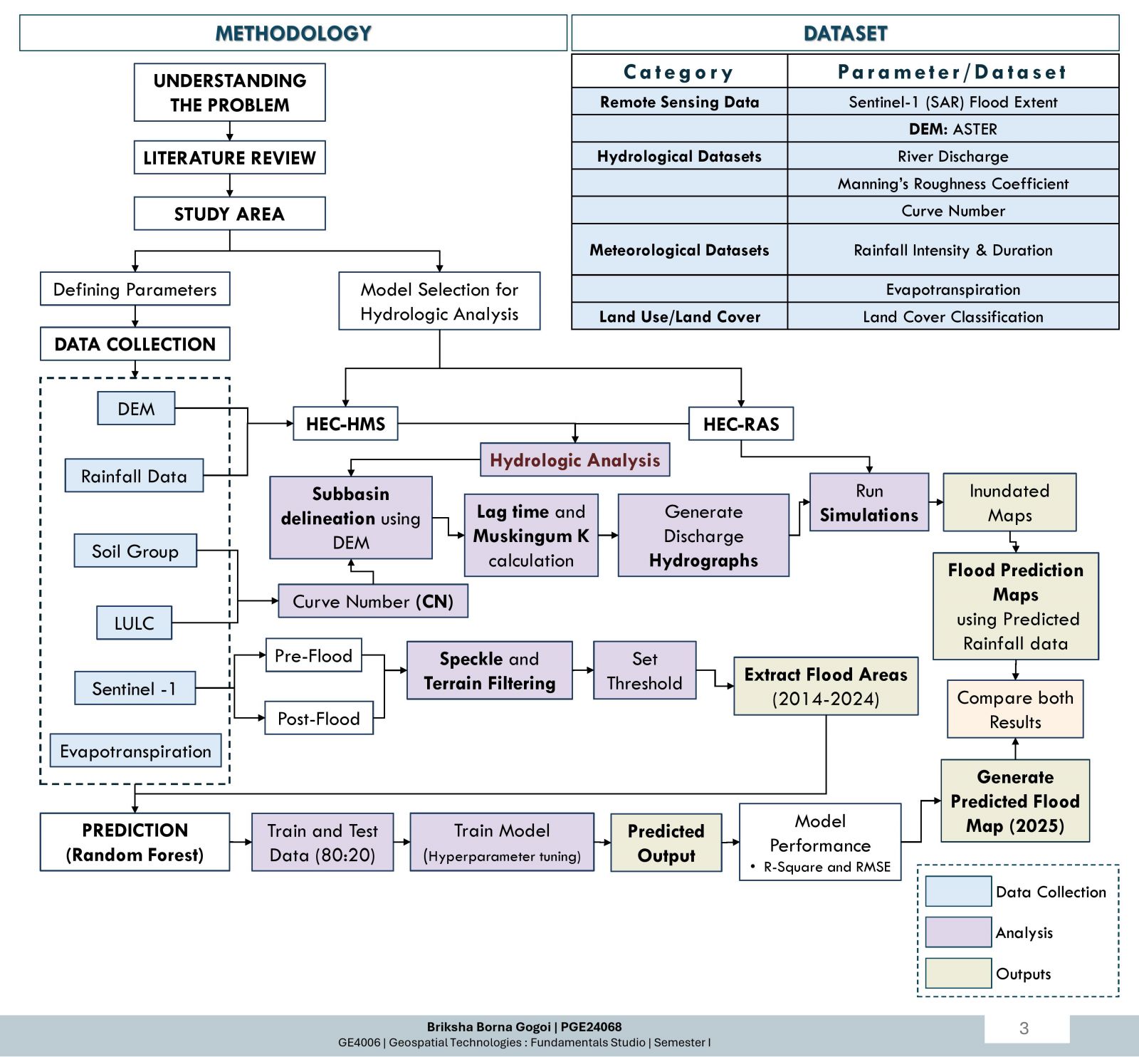
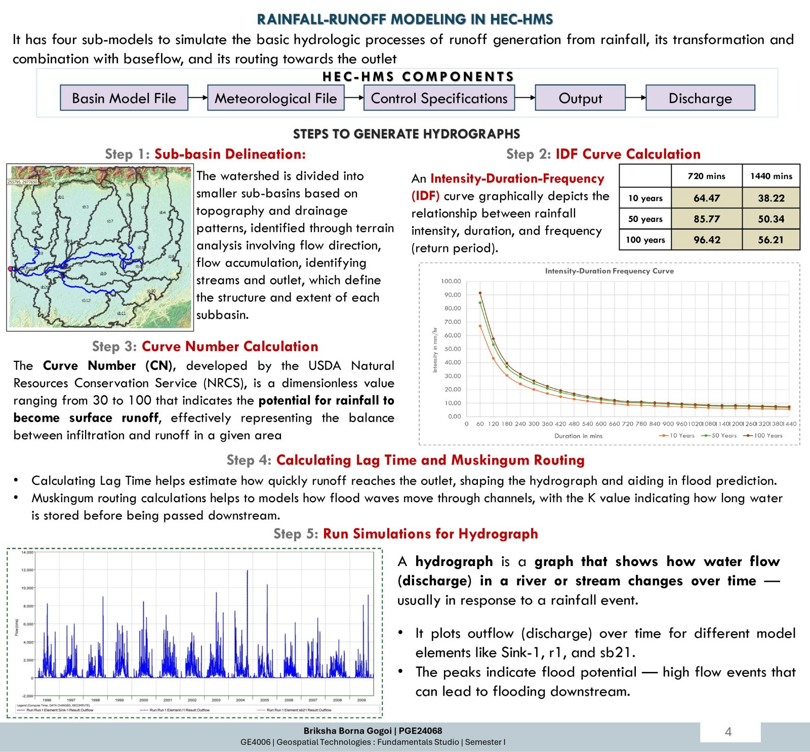
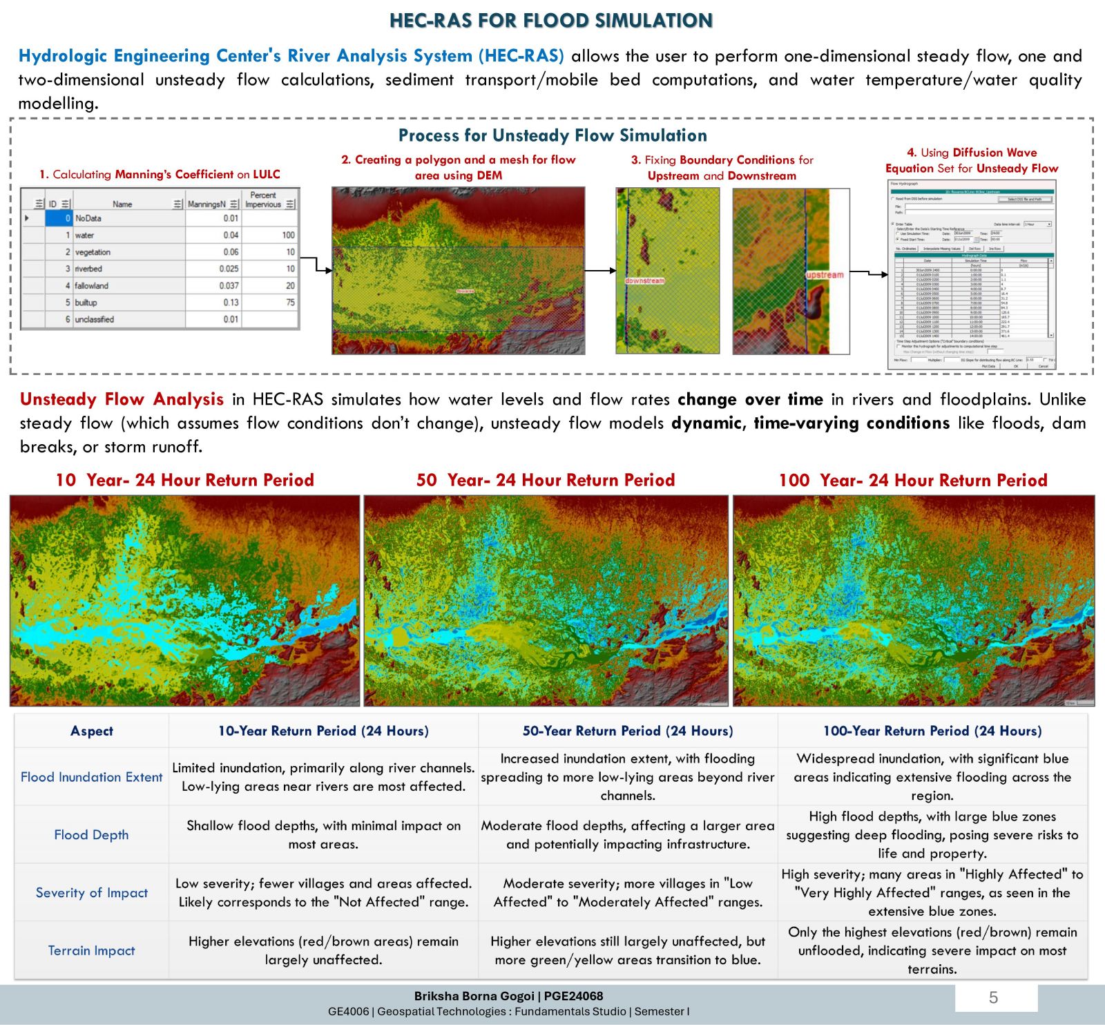
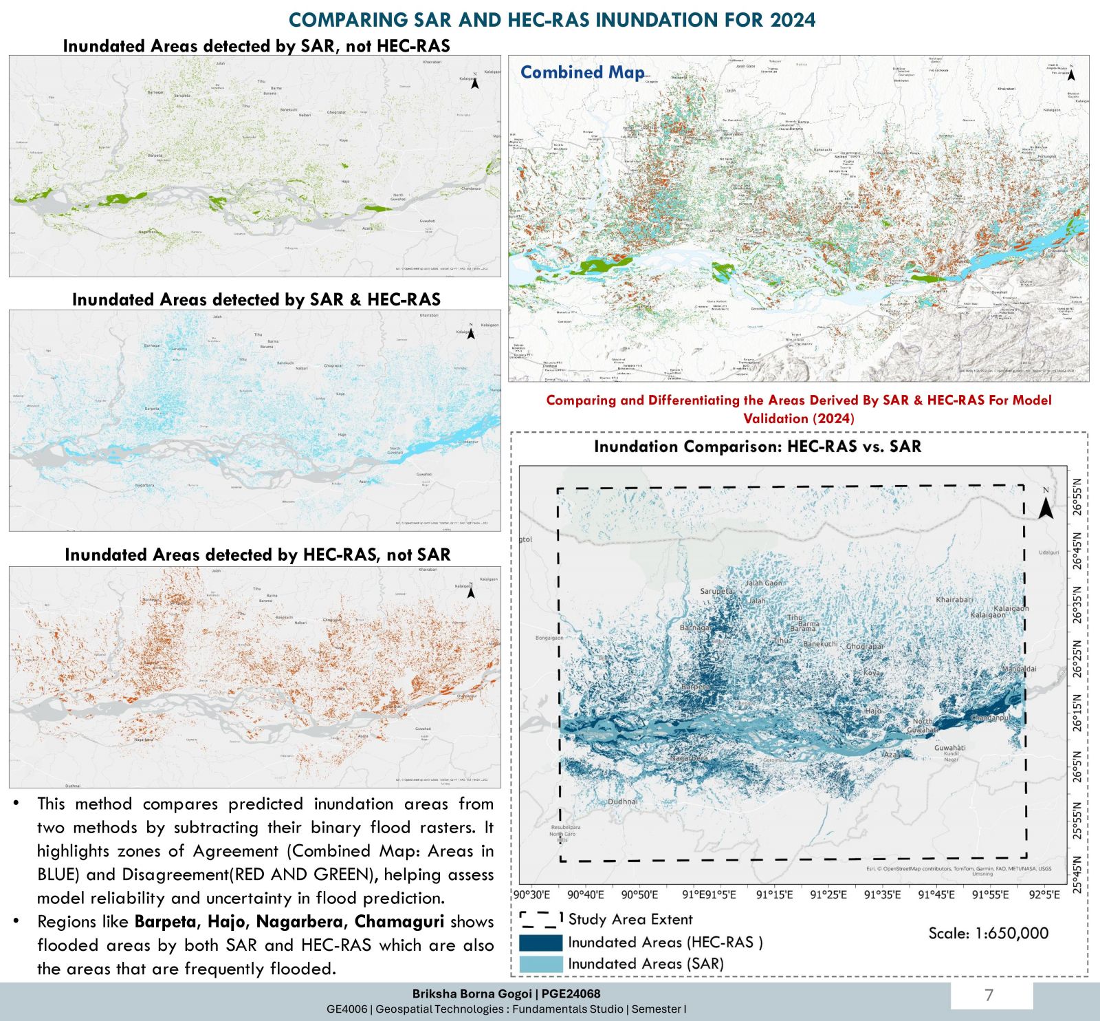
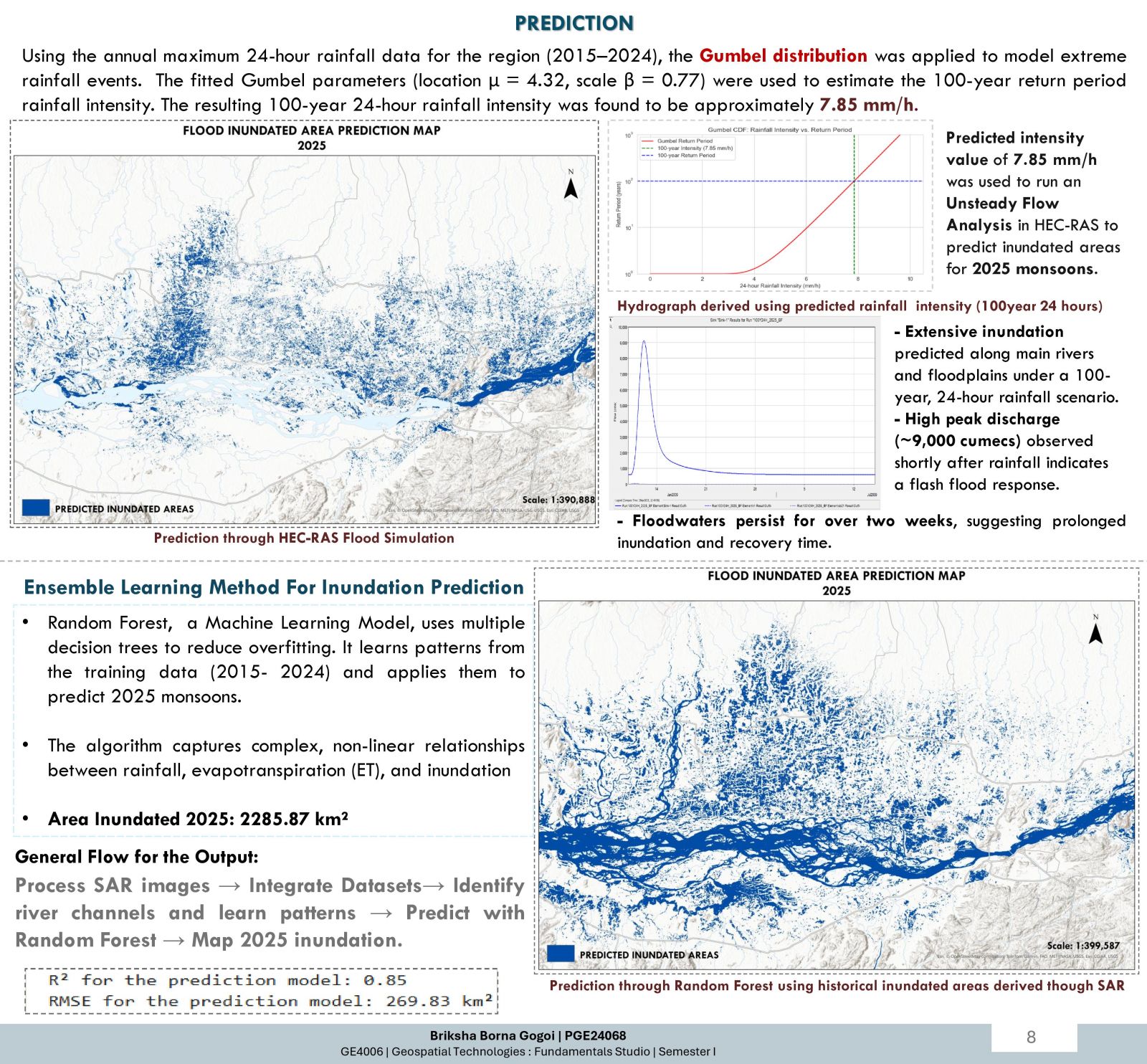
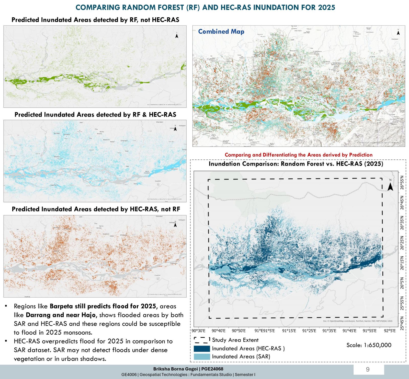
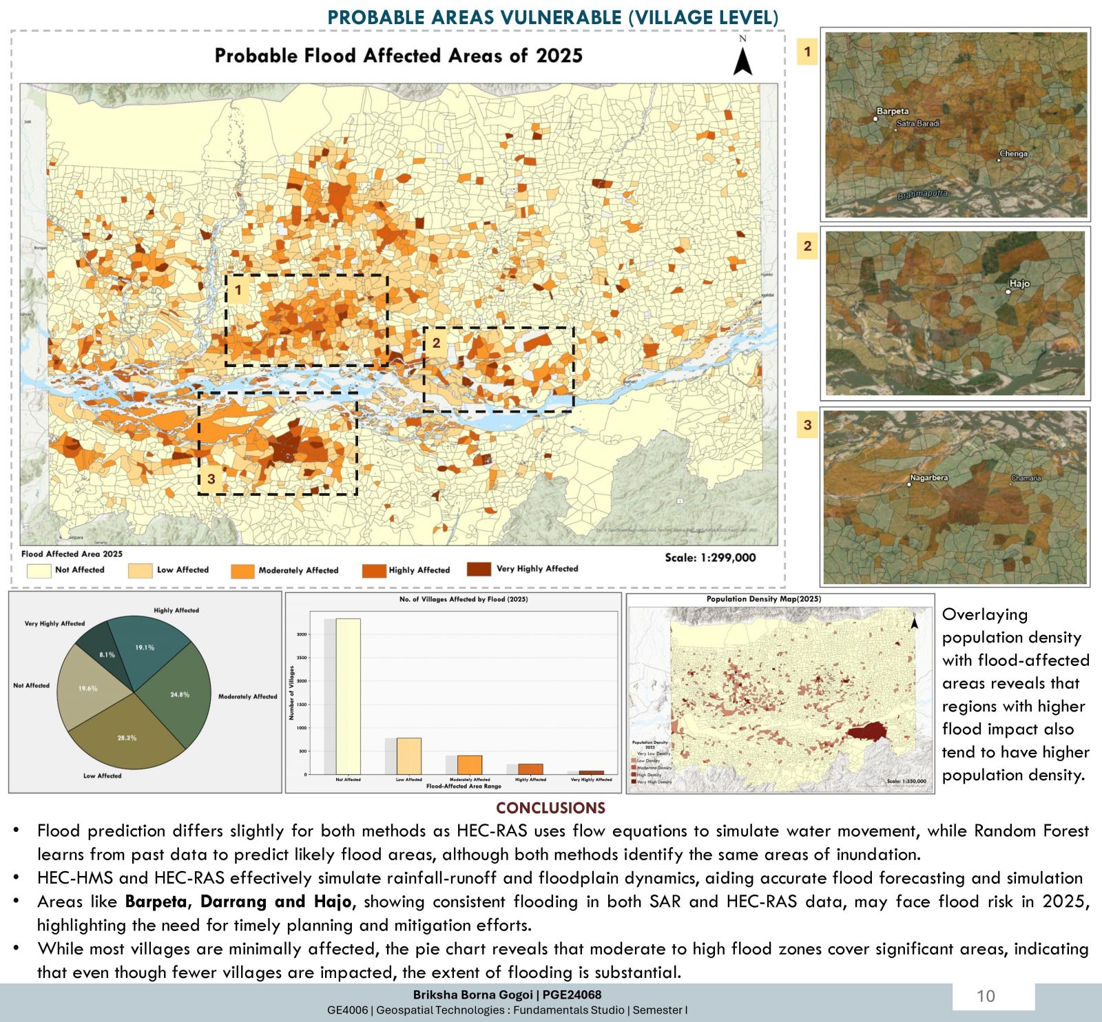
This project aims to predict flood and it's extent of inundation in the Brahmaputra River's floodplains, focusing on a 140-km stretch in Assam, India. Utilizing HEC-HMS for rainfall-runoff modeling and HEC-RAS for Unsteady Flow Simulations, it maps simulation for different Return Periods and intensity, understanding historical flood patterns (2015-2024) using Sentinel-1 SAR imagery and predicts 2025 inundation with Random Forest ensemble learning. The model estimates a 100-year rainfall intensity of 7.85 mm/h (2025), forecasting extensive flooding affecting 2285.87 km². By comparing SAR and HEC-RAS outputs, the project identifies vulnerable villages, enhancing disaster preparedness and supporting sustainable development in flood-prone regions.