Your browser is out-of-date!
For a richer surfing experience on our website, please update your browser. Update my browser now!
For a richer surfing experience on our website, please update your browser. Update my browser now!
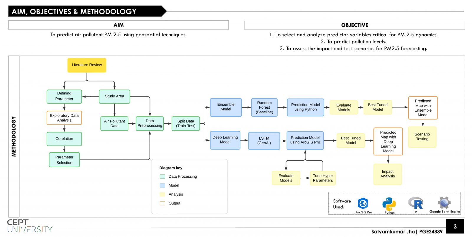
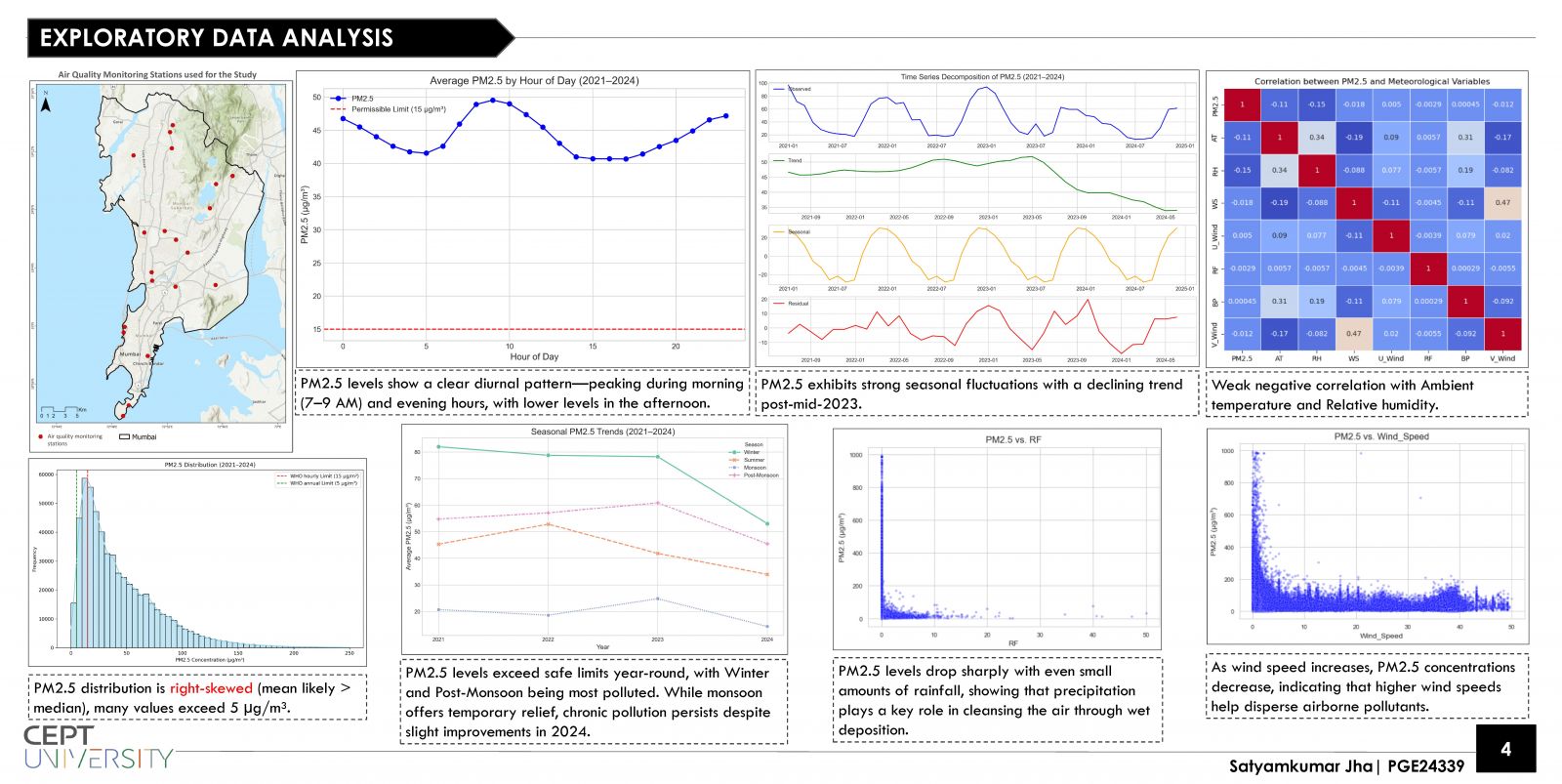
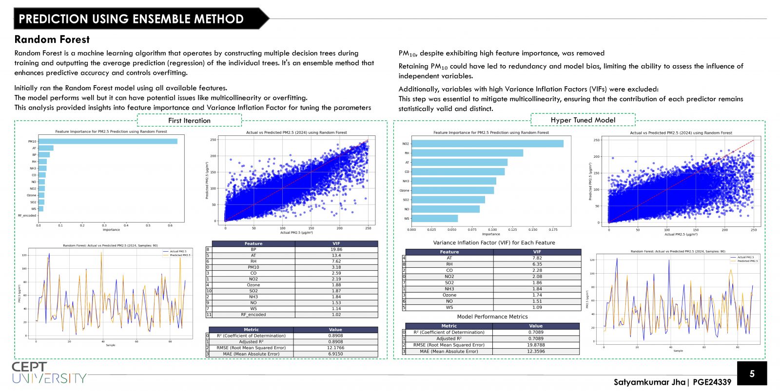
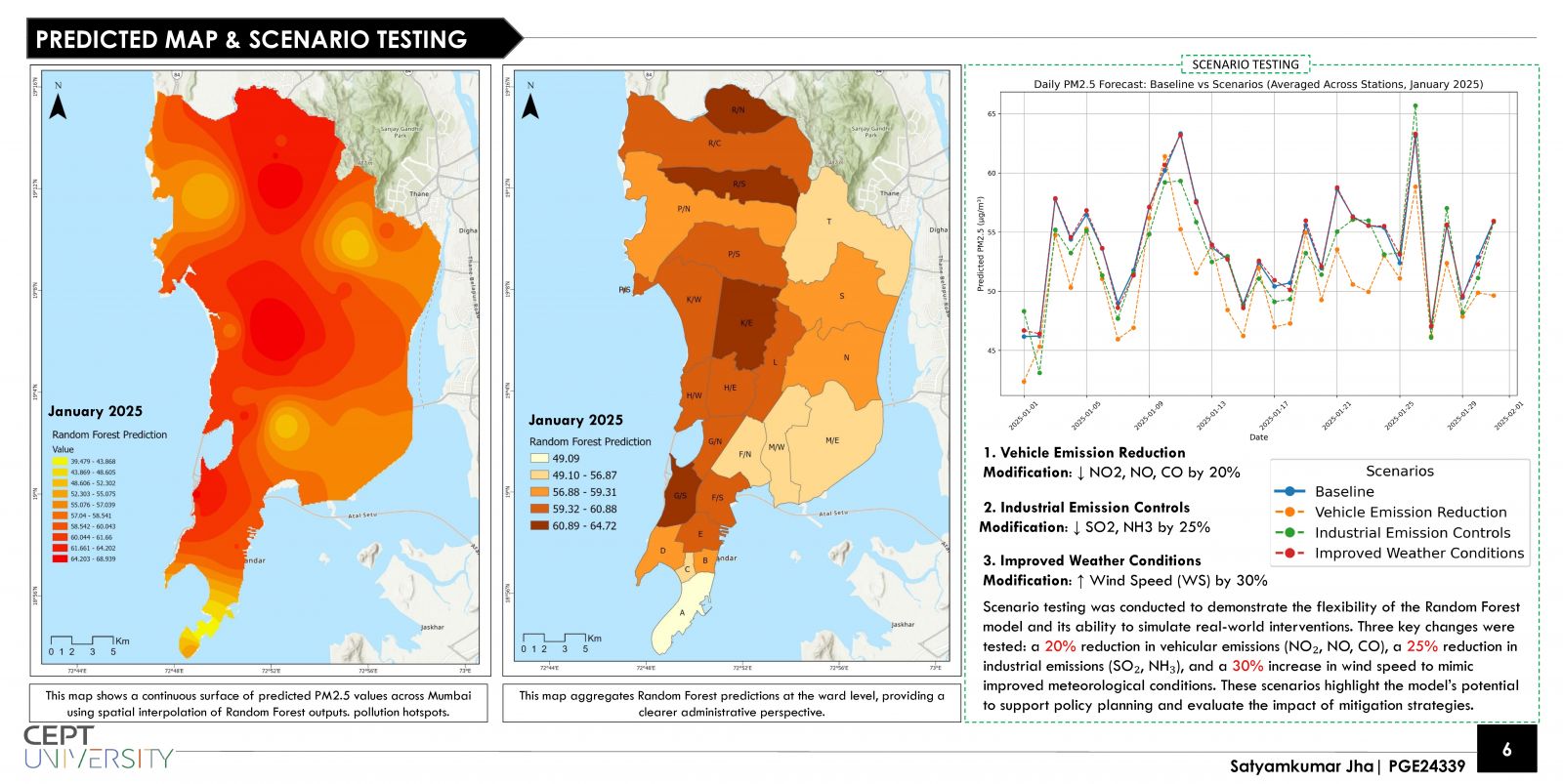
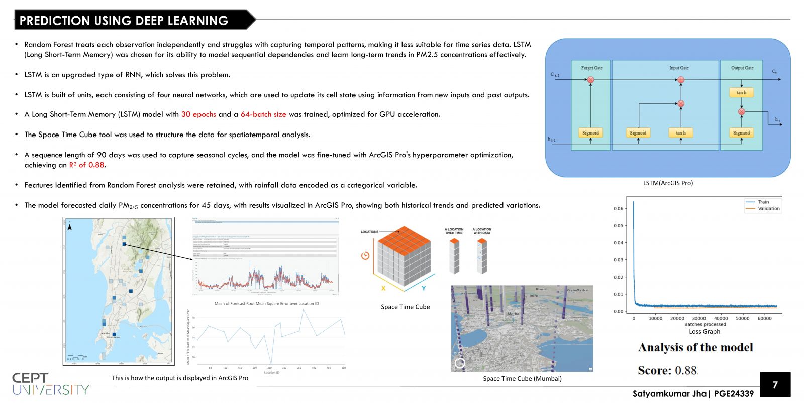
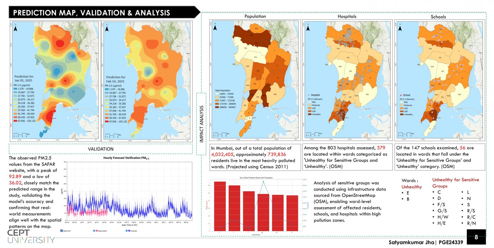
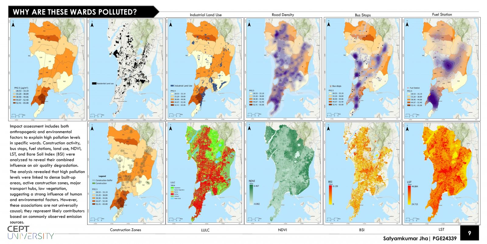
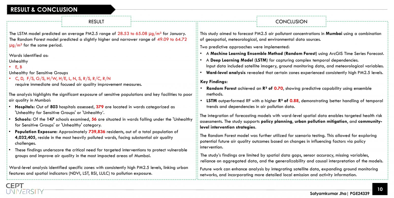
This study forecasts PM2.5 air pollution in Mumbai using Random Forest and LSTM models, trained on hourly data from 2021 to 2024 and validated with observations from the SAFAR portal. Data from 20 air quality monitoring stations across Mumbai was used to capture spatial and temporal variations. The LSTM model achieved high accuracy (R² = 0.88). Scenario testing showed that a 20% reduction in vehicular emissions can significantly improve air quality. Ward-level analysis revealed 739,836 residents, 379 of 803 hospitals, and 56 of 147 schools are in high-risk zones, highlighting the need for targeted urban interventions.
View Additional Work