Your browser is out-of-date!
For a richer surfing experience on our website, please update your browser. Update my browser now!
For a richer surfing experience on our website, please update your browser. Update my browser now!
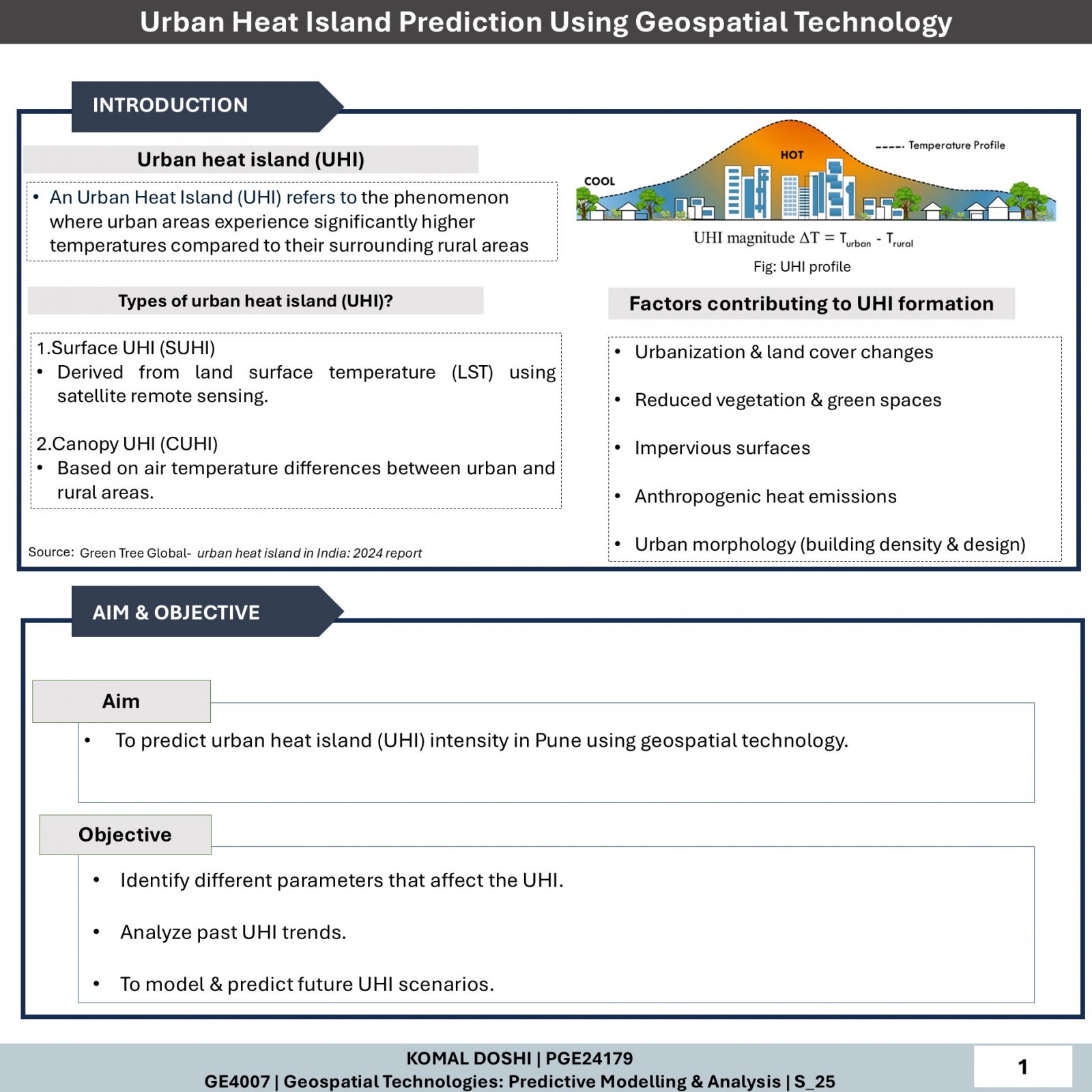
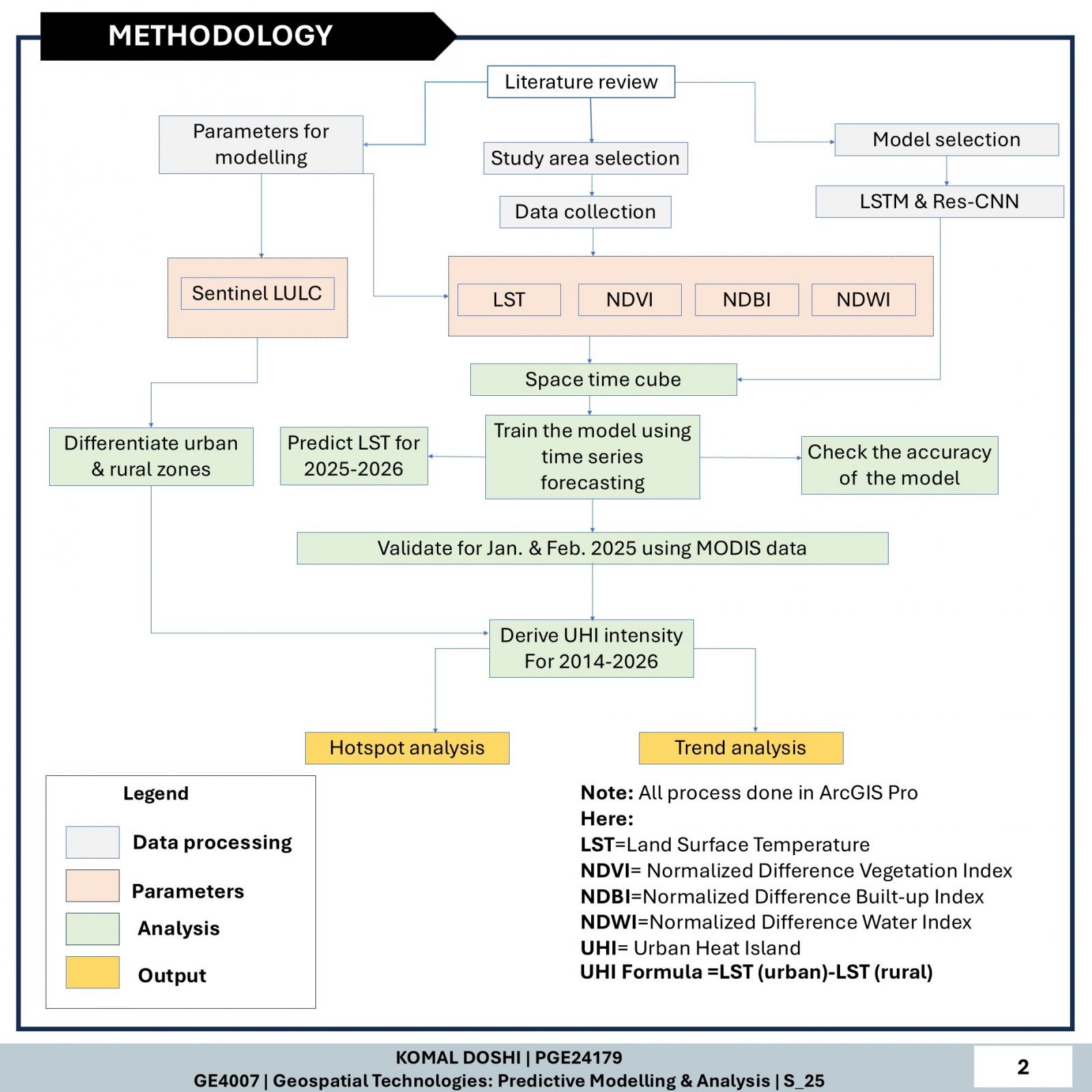
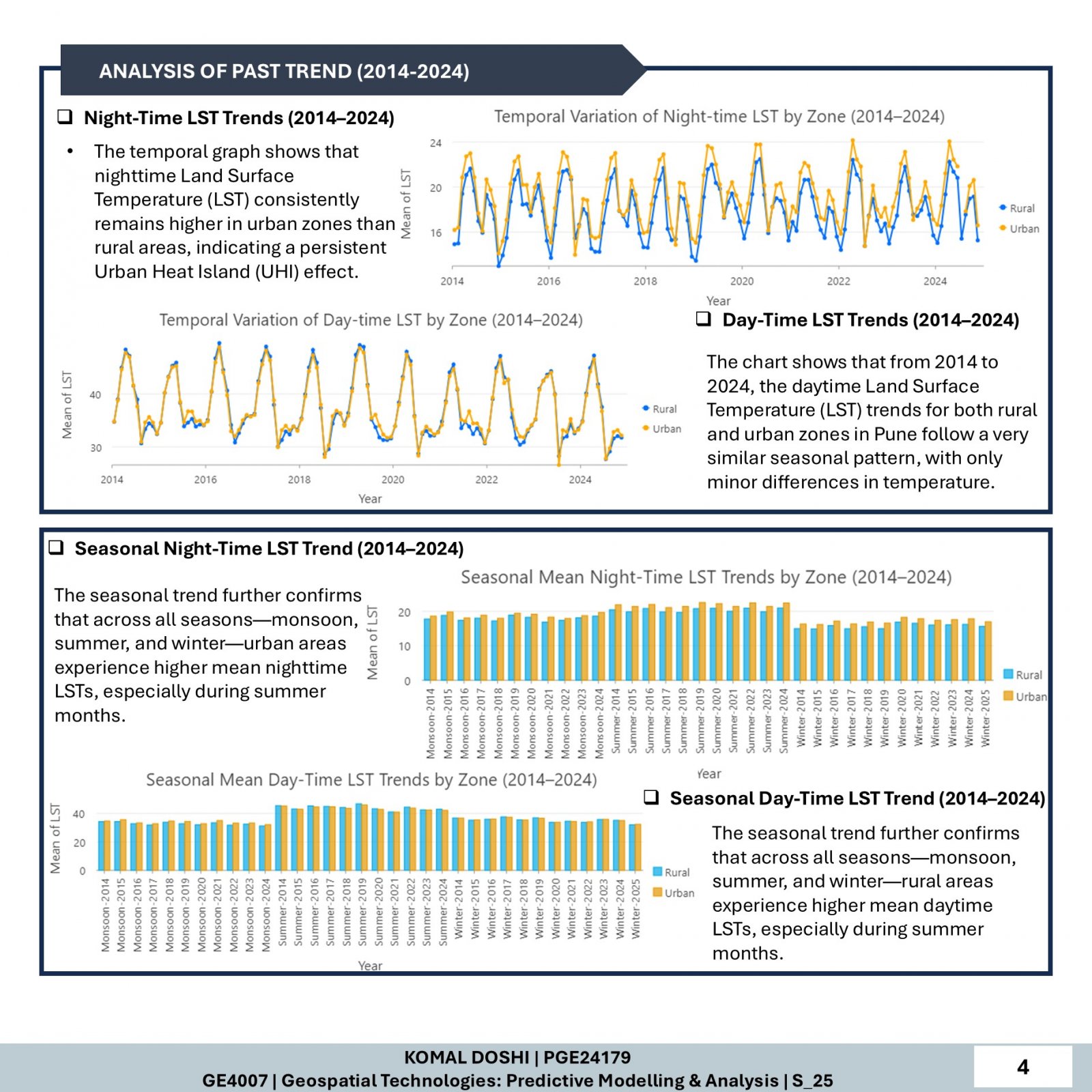
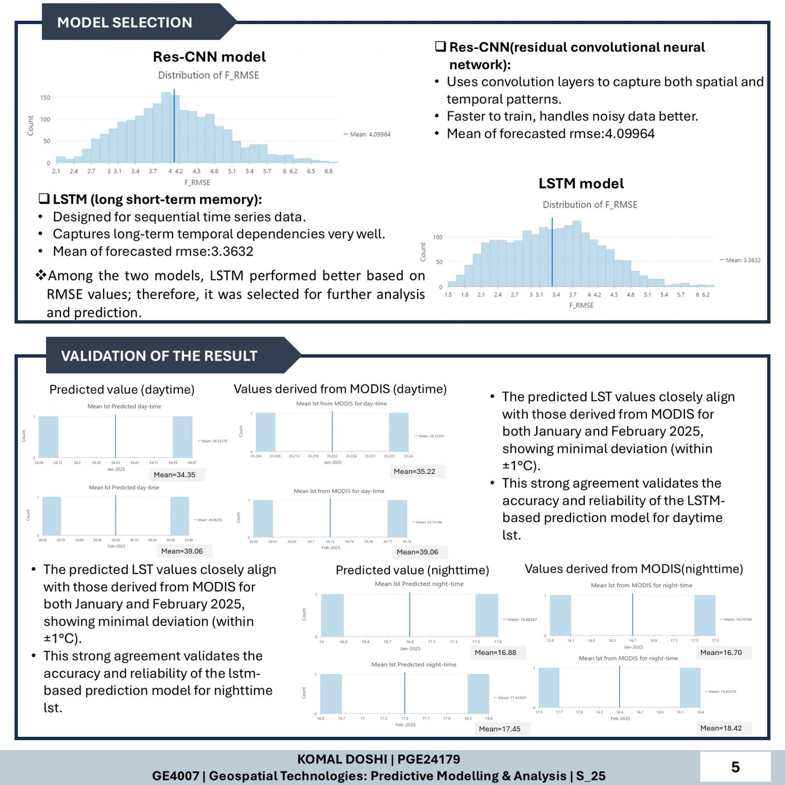
This study predicts Urban Heat Island (UHI) intensity in Pune for the years 2025–2026 using time-series modeling. Key indicators such as LST, NDVI, NDBI, and NDWI were used for analysis. The LSTM model, selected for its superior performance , was applied to forecast Land Surface Temperature. Results showed that daytime UHI was weak or negative, with rural areas heating more due to bare land and croplands. In contrast, night-time UHI was strongly positive, with urban zones retaining more heat. Hotspot analysis and LULC data supported these findings, confirming persistent night-time heat stress in urban regions.