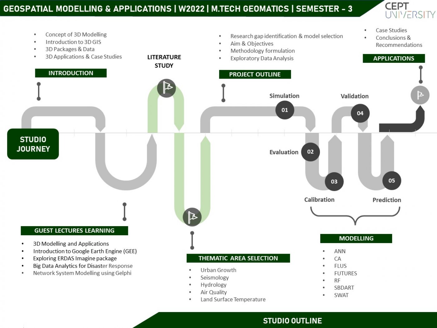
The Geospatial modeling and application studio is designed to develop and apply 3D mapping and modeling skills among students for solving real-world problems. GIS-based 3D models are widely used in a vast array of applications i.e disaster management, utility mapping, transportation, navigation, energy management, security, surveillance, etc. In the studio, students will explore different methods, techniques, and technologies to build a 3D model and work with different 3D data structures, tools, and algorithms to handle the third dimension aspect of the real world. All the data collection, creation, and application pertaining to 3D will be carried out in an urban environment to address real-world problems. Also, students will be working with open-source software/tools to interact with the 3D objects and customize the model as per the given application. The application and importance of the 3D model will be further explored in thematic areas in the GIS environment.